The Concord-Lake Sunapee Rail Trail is an ambitious work in progress. Segments between Bradford and Concord, New Hampshire are already open (no OHRV/ATVs or dirt bikes, please). I last visited the trail’s eastern terminus in Concord, New Hampshire in autumn of 2020. On the spur of the moment on a July day, I decided to return to see how the trail looks in summer.
I found a different kind of beauty, with flowers rather than foliage catching my eye. Varieties included milkweed, oxeye daisies, mullein, St. John’s wort, and others that I couldn’t identify. It was pollinator heaven, lining the trail along open space close to the trailhead at 25 Fisherville Road (US 3), less than four miles north of the State House.
Fleabane is one of many varieties of summer blossoms to be found along the edges of NH’s rail trails.This and other photos in this post are by Ellen Kolb.
That trailhead had room for maybe half a dozen cars. Information about the trail was posted on a kiosk in the parking area. Close by were several rail-themed benches. The unpaved trail surface was smooth and pleasant.
The perfect rail-trail bench designA natural tunnel offers summer shade on the CLSRT
The trail passed open space for a few hundred yards before entering deep shade under mature trees. I walked for about a mile and a half, enjoying the shade on a muggy day, before deciding to turn around.
Uh-oh…the forecast had been for scattered afternoon pop-up showers, and one of them popped up as soon as I turned around. I wasn’t carrying rain gear on the 80-degree day, and I had a half-hour walk between me and my car. I shrugged and took the consequences as a hard rain began to fall. It was over in 15 minutes, which was long enough to leave me drenched. It was a reminder that even for short walks, carrying an inexpensive poncho is a good idea.
That wouldn’t have helped my shoes, of course. They should dry out within a few days. That’s a modest price to pay for a cool place to walk on a summer day.
This easternmost segment of the CLSRT is one of the many recreational assets in Concord for walkers and cyclists. Other completed segments are not yet continuous but are worth discovering if your travels take you to Hopkinton, Warner, or Bradford.
Among the treats of this season in southern New Hampshire have been community walks organized by municipal agencies. The Manchester Police Department and Goffstown Parks and Recreation have been leading popular events on local rail trails. I joined a few of them, and saw for myself how important the trails have become to local residents.
Both of these programs were free of charge when I attended, and both were held on weekday mornings,
Big turnout for Manchester Senior Walks
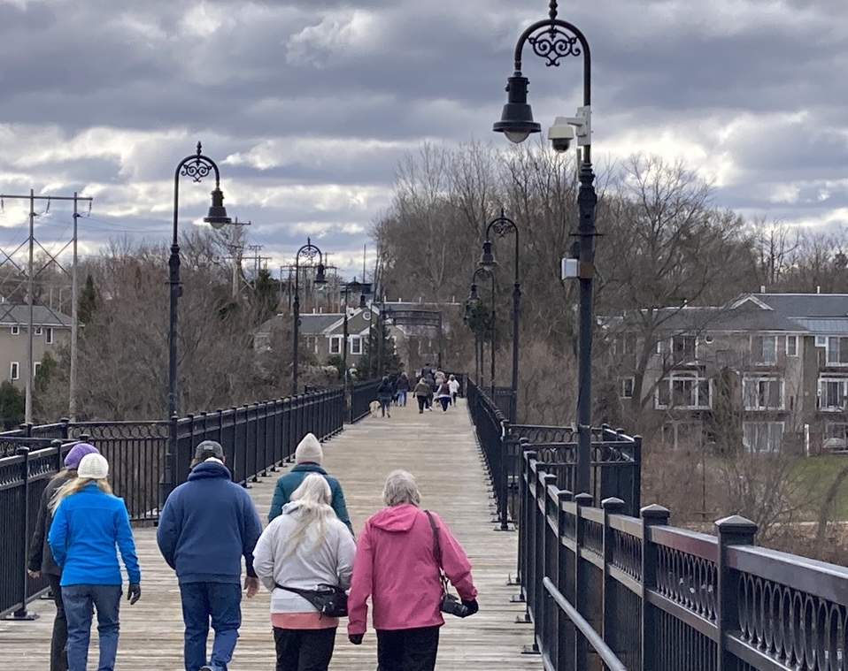
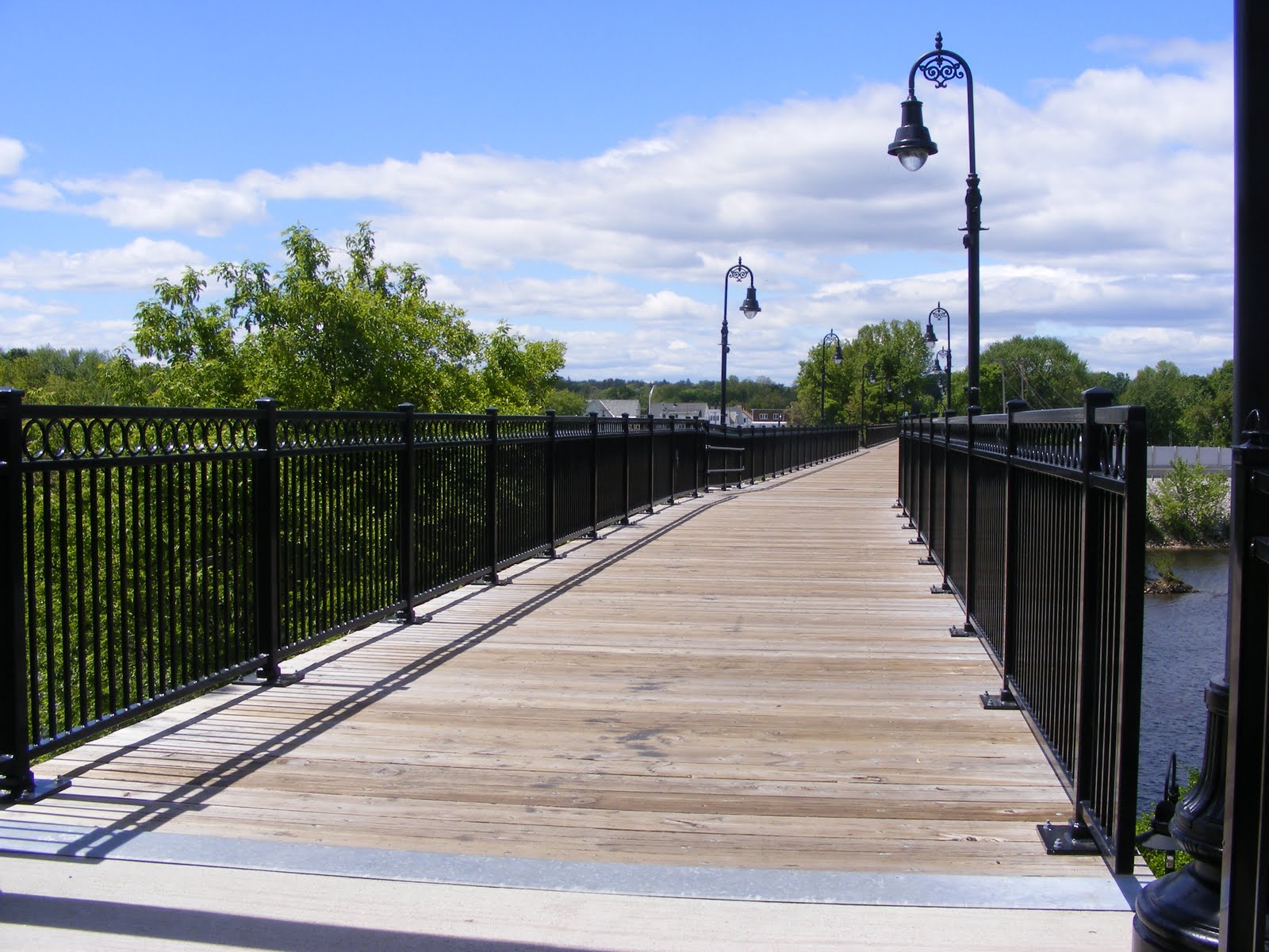
Senior walkers cross the Hands Across the Merrimack bridge in Manchester NH along the Piscataquog trail. All photos by Ellen Kolb.
I learned via social media about weekly springtime Senior Walks offered by the Manchester Police Department’s Community Affairs officers. When I showed up for one along the Piscataquog rail trail, I was surprised to find over a hundred people ready for the morning’s outing! The crowd was even larger for a walk later in the season on the Rockingham Recreational Trail.
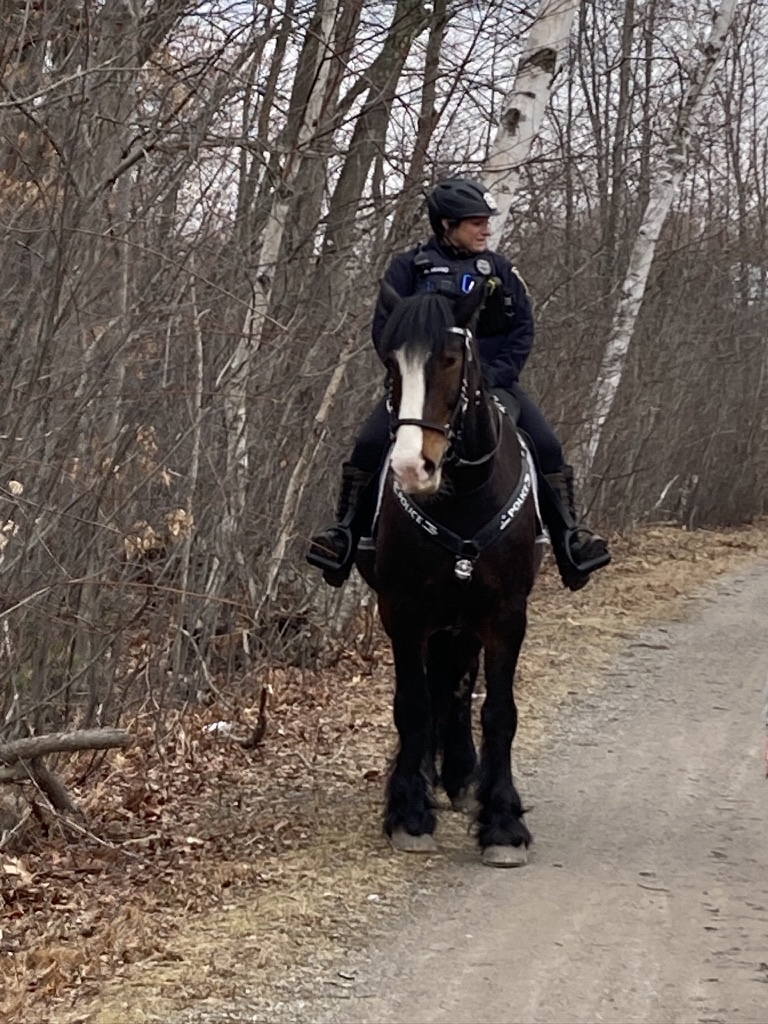
The Senior Walks program was new to me, but clearly it was well-known to many Queen City residents. Each walk lasted for an hour, with a 30-minute turn-around time. No rush: walkers were self-paced, and simply turned around at the 30-minute mark, no matter how far they’d gone. Traffic control at road crossings was excellent. The Department’s Mounted Division got into the act, too, with Officer Miano aboard the gentle-but-imposing (16 hands high!) General Stark. A bonus: each walk ended with refreshments provided by local businesses.
For my cross-state project, I wondered about the best way to cross Manchester. These Senior Walks showed me the way: Valley Street with its sidewalks and pedestrian crossing lights let me link the Piscataquog rail trail on the west side of the city and the Rockingham Rec trail on the east side, with just a little jog along side streets at each end.
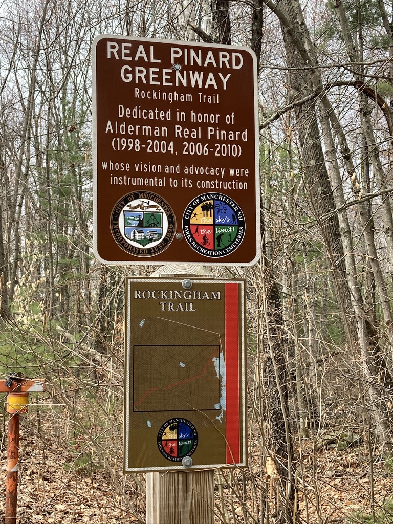
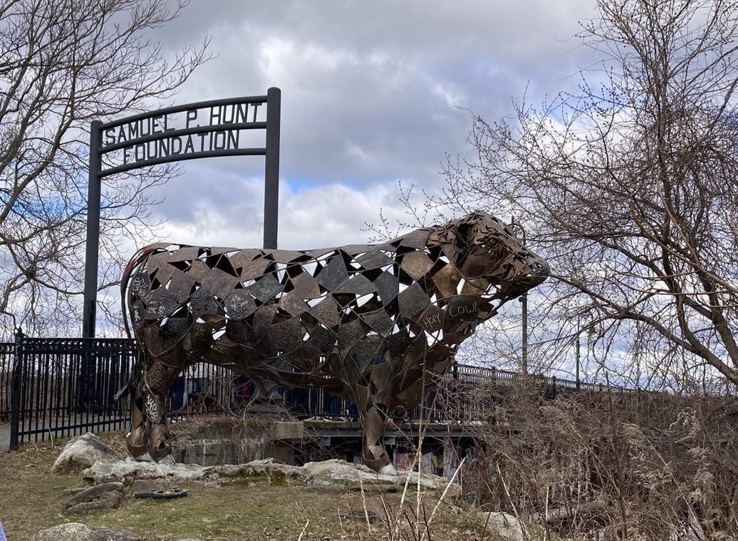
Near the east end of Manchester’s segment of the Rockingham Recreational Trail, a sign honors former Alderman Pinard, a trail supporter.Accompanying Senior walk participants was an MPD Mounted Unit team: Officer Miano and General Stark.A unique work of art adorns the east end of the Piscataquog Trail, paying tribute to the workers at the meatpacking plant that once stood near the site.
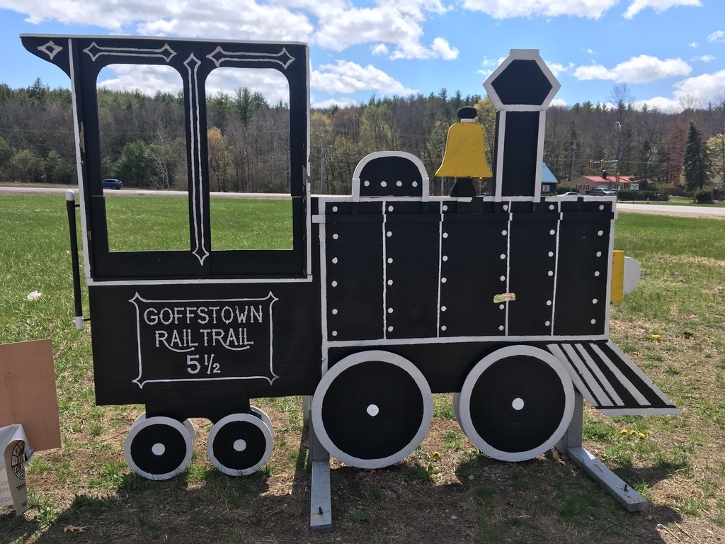
A warm welcome in Goffstown
I’m always happy to get out to the well-maintained five-mile-long Goffstown rail trail. The Parks and Recreation department in town has been offering weekly guided walks of varying distances on the trail, and as soon I heard about that, I resolved to join one as soon as my schedule allowed.
When I arrived at the Parks and Rec office on the morning of my chosen walk (the trailheads vary each week), I was welcomed by a small friendly group led by a Parks and Rec staffer. The trail includes two signaled crossings of busy NH Route 114, and I’m always nervous about getting across that road, but the fear factor went down to zero with a dozen people crossing together. (Kind of like being a pedestrian in Boston, now that I think about it.)
Our walk that day was pretty much in the middle segment of the trail. When our group returned to the office, I decided to keep going. I seldom get to the westernmost end of the trail. I was delighted to find that since I was last there, signage has been upgraded significantly for both trail navigation and parking. As I stood at the western end of the trail and looked out at the Piscataquog River and town center, I tried to imagine how the rail line must have looked with its covered rail bridge there once upon a time. The rail bridge is long gone. We’re left with a rail trail that extends all the way to Manchester’s Piscataquog trail, linking the state’s biggest city with its quieter neighbor.
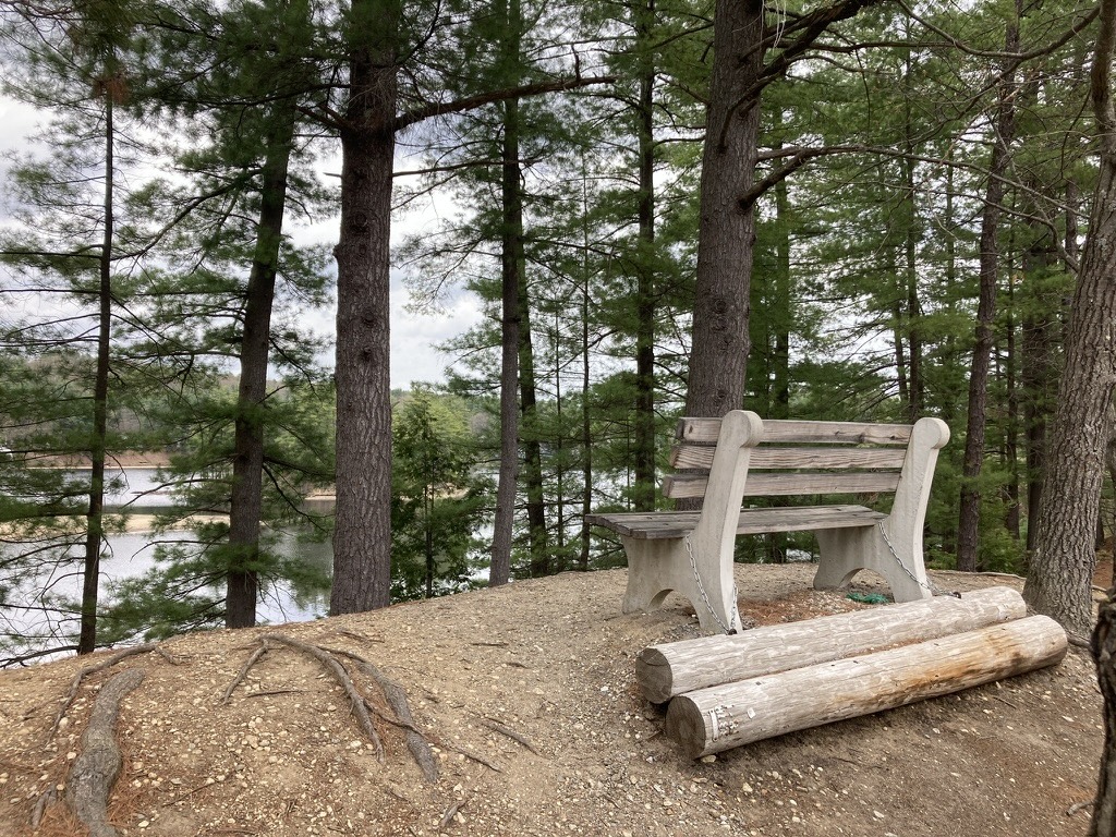
A bench along the Goffstown trail overlooks Namaske Lake.
Goffstown Rail Trail has plenty of signage to guide users.
The west end of the Goffstown Rail Trail offers a view of the town center and the Piscataquog River.
I hope you enjoy this post! You can search this blog for 20 years of essays and trip reports about New Hampshire trails. I welcome your support to get to the next trailhead.
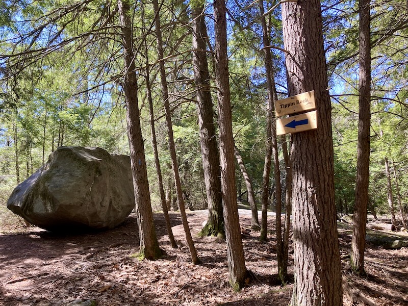
Swanzey, New Hampshire is perhaps best known for its covered bridges, each with its unique appearance and history. (I’m partial to the Thompson Bridge with its sidewalk.) The town has more to offer, though, including several short trails worth exploring. I recently discovered Hewes Hill and Tippin Rock, with the help of a Cheshire Walkers hike sponsored by the Monadnock Conservancy, a regional land trust.
Is it Tippin’ or Tippin? The apostrophe is optional, but either way, it’s an apt name for the glacial erratic boulder perched on a ledge in the woods on the way to Hewes Hill’s summit ridge. If you lean against it at just the right place, it’ll rock back and forth a little bit. A couple of my hiking companions kept pushing on different locations on the boulder until it yielded ever so slightly. It’s fun to see, even if it’s a little unnerving to see a 40-ton boulder moving like that!
There’s Tippin Rock, resting in the woods, just waiting for the next hiker to try to rock it. Ellen Kolb photo.
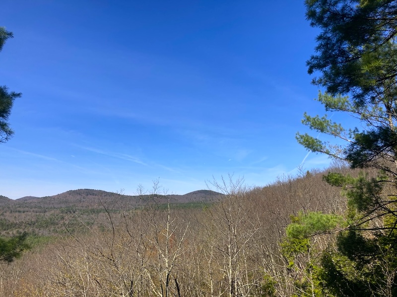
We continued up the trail after inspecting Tippin Rock. Hewes Hill is forested, with a bit of exposed ledge on the summit ridge that gave us a pleasant western view on a sunny spring day. I was glad to rest and catch my breath after the uphill hike. The hike is about 1.8 miles round trip, with an elevation gain of a little over 300 feet.
Western view from Hewes Hill on a blue-sky day, trees ready to leaf out for spring.Ellen Kolb photo.
A printable trail map is available on the Monadnock Conservancy website. Limited parking is available on Warmac Road in Swanzey, about a half mile west of NH Route 32.
The trail is on private land with an easement to the Conservancy, and as is written on the Conservancy’s map, “respectful hikers, snowshoers, and cross-country skiers are welcome on Hewes Hill.” Daytime use only; carry out what you carry in; no facilities at the trailhead.
Generous landowners keep many New Hampshire trails open to the public. I was lucky that one of my hiking companions to Tippin Rock was the property owner whose land we were crossing, so I could give her a proper face-to-face thank-you.
My cross-state plan hits a bump
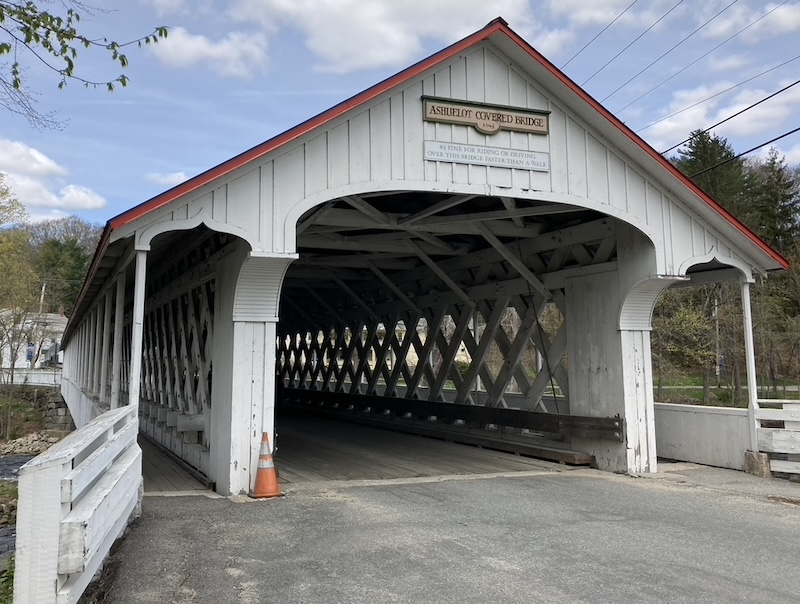
The Tippin Rock hike was a bonus for me on a challenging day. I spent time on the limited section of the Ashuelot rail trail that’s open in Swanzey; much of the trail in town is closed for reconstruction. Once I hit the trail detour, I thought maybe I could cross the town on local roads as part of my cross-state effort. It didn’t take me long to realize that wasn’t a good idea. Those narrow curving roads with tiny shoulders were not pedestrian-friendly.
So…there will be long breaks in my route across southern New Hampshire this year. I’ll connect trails where I can. Along the way, I know I’ll find unexpected fun, such as that hike to Tippin Rock.
Note for Ashuelot trail hikers and cyclists: be sure to respect the 2026 trail closure north of the southern Holbrook Road crossing. Heading south on the trail from there is fine. There’s room enough at that crossing for a car to park off the road while staying clear of the trail gate.
Visiting Swanzey
The Town of Swanzey has a good website with information on local trails and covered bridges. Check it out when you’re ready to plan an itinerary for a trip to the area.
If you happen to be in Swanzey on Old Home Day (usually in July), enjoy the parade! Also, Swanzey is home to the Cheshire Fair every summer.
Your support will help me get to the next trailhead. Thanks!
This year’s sweet spot for spring hiking, after the mud and before the bugs and pollen, has lasted longer than usual in southern New Hampshire. It’s an auspicious beginning to a project I’ve started: walking across the southern tier of the state along as many familiar trails as I can, from the Connecticut River to the Atlantic Ocean.
My situation rules out doing the whole thing with one long push. Instead, I’ll do a series of dayhikes as my schedule permits, each one out-and-back, and not strictly in west-to-east order. I recently headed to New Hampshire’s southwestern corner to get started.
Two rivers and a covered bridge
I took advantage of the recent benign weather to spend two fine days on the Fort Hill and Ashuelot Rail Trails in the towns of Hinsdale and Winchester. My private little ceremony to launch the cross-state walk consisted of taking the Fort Hill rail trail to a boat launch where I scooped up a little vial of Connecticut River water. I’ll empty it into the Atlantic when I reach the Seacoast, some weeks hence.
This just might be my favorite spot in Hinsdale, where the Connecticut River meets a boat launch and the Fort Hill Rail Trail.All photos by Ellen Kolb.
My route included town roads as well as the unpaved rail trails. From the Fort Hill trail, I walked into central Hinsdale via quiet Prospect Street. Once I reached Main Street (NH Route 119), I walked a short distance east to Depot Street, where I picked up the Ashuelot trail eastbound.
Before long I came to a spot that appeared to be recently repaired from a washout. Based on information on the state parks website, the Pisgah Mountain Trail Riders are responsible for that restoration. The Ashuelot trail took a violent hit from flooding in July 2023, and perhaps this was where some of the damage had occurred. In fact, the trail’s Swanzey section is still closed as of April 2026, awaiting repair of the three northernmost washouts.
(By the way – snowmobile clubs like the Trail Riders provide an outsized amount of rail trail maintenance. I’ve made modest donations to a club that maintains a trail close to home, even though I’m not a snowmobiler. I encourage other walkers and cyclists to do likewise.)
Where I walked, both trails were in remarkably good shape. I wondered if I’d find mud – and if I had, I would have swallowed hard and shifted over to NH 119 – but the trail surfaces were firm and well-drained. A few ruts on the Ashuelot trail showed that at least one local cyclist hadn’t been able to resist riding during mud season, but the trail scars were minimal. Vegetation was just waking up from winter, and no grasses or ground covers encroached on the wide paths.
While I had company on the Fort Hill trail, I experienced unexpected solitude on the Ashuelot trail. I was there midweek; would a weekend have been different?
I turned around at the Ashuelot covered bridge and walked back to Hinsdale where I’d left my car. It was a decent workout, even at my easygoing pace.
“Need a ride?”
The next day, I parked downtown near Winchester’s town offices. “Downtown” seems a grand word to use about a municipality with 4200 residents, but the area had two traffic lights as well as commercial and municipal buildings, so downtown it is.
The Ashuelot trail north of the town center feels different from the section closer to Hinsdale. It’s more open in spots, sandier but still well-surfaced. It’s closer to homes. It criss-crosses Old Westport Road, and I hopscotched between trail and road to stay close to the river with its pleasant views. Traffic on nearby NH Route 10 could be heard but for the most part not seen. I turned around before the trail crossed NH 10; further on is Swanzey, a destination for another day.
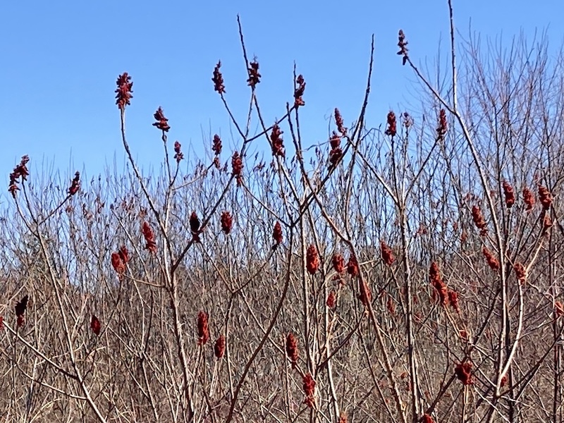
The red fruits of staghorn sumac shrubs were the brightest things in sight amid so much leafless vegetation. Spring will soon have every plant in sight bursting with fresh growth.
Staghorn sumac in early spring. Fresh leaves will be along shortly.
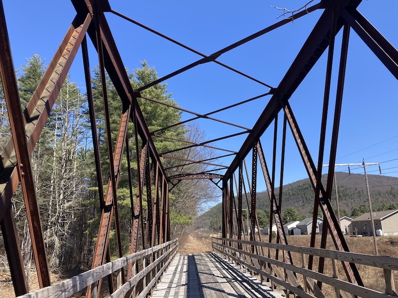
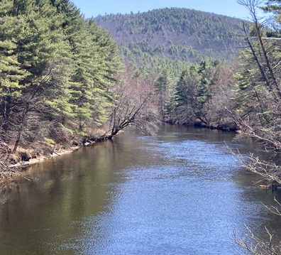
I took a break at a snowmobile bridge carrying the trail across the slow-flowing Ashuelot River, enjoying a serene view along with my snack. A lone bicyclist was the only other trail user in sight.
Snowmobile bridge in Winchester, a fine lunch spot……with a view of the Ashuelot River, which was in a quiet mood this day.
At one point as I walked along Old Westport Road, I heard a car behind me slowing down. I turned around to see what was up, and the car stopped beside me, with a worried-looking driver at the wheel. Was I okay? Did I need a ride? I assured him that I did not, as I wondered how awful I must have looked to elicit such concern. “I had to check,” he said with a look of relief. “If I didn’t, my mom would kick my butt.” I realized then that it was only my age, shouted to the world by my silver hair, that made him stop. God bless him.
I love living and walking where people care enough to check up on each other. At the same time, we need more baby boomers on the loose in the great outdoors, so our younger neighbors won’t be so surprised to see us. I’m doing my part.
About the area
An excellent map and guide to rail trails in southwestern New Hampshire is available from the Monadnock Rail Trail Collaborative. Their website includes an online map. Contact that agency directly about availability of printed maps.
Parking is limited along the Fort Hill and Ashuelot trails. Along the sections I visited on this trip, I found parking in Hinsdale at the boat launch on Prospect Street and Millstream Riverfront Park on Main Street (NH 119). In Winchester, I parked in the town hall lot, a block or so away from the trail via Elm Street.
Public restrooms were scarce on this route, and I didn’t find (or expect) portajohns along the way. Facilities are available in Walmart (north end of Hinsdale, almost at the Vermont border) and at a gas station/Dunkins at the southern NH 10/119 intersection in Winchester.
There are restaurants and convenience stores in the town centers.
I’ll use “Across NH 2026” as a tag on this and future posts about my across-state project, so interested readers can search the blog quickly.
I usually hike solo. The solitude and pace suit me. Sometimes, though, those of us who enjoy non-motorized travel on trails need to speak out together. We’re gentle folk, really, but when we’re provoked, we can get a mite testy.
A pair of recent provocations in the Granite State got us going. People listened. Way to go, team.
The Derry Tunnel
The I-93 exit 4-A project in Derry has been talked about forever, and when construction finally began, sighs of relief were heard up and down the highway corridor. The original plan called for the Derry Rail Trail to be routed through the area via a tunnel. Straightforward, safe, good for all users.
Then, a few years ago, the plan on paper was suddenly changed, without input from trail-user groups. A “spaghetti” route – the good folks at the state Department of Transportation probably hated that term, but that’s what it was – replaced the original plan. On paper, the revised route would have brought the rail trail up and around a curve to an at-grade crossing of a six-lane town road, followed by a descent back to the old rail right-of-way. The New Hampshire Rail Trails Coalition published a summary of the situation in April 2025, with a link to a New Hampshire Union Leader article.
Groups representing trail users pushed back politely, then more firmly, and heard “no” a lot before finally resorting to litigation against NHDOT and the Federal Highway Administration.
Today, eighteen months later, there’s a Union Leader headline: “Settlement paves way for Derry Rail Trail tunnel.” I love that word “settlement.” This was never about one side needing to beat the other. It was about reaching consensus on a sound plan for a project that will benefit the area for years to come.
The Committee to Save the Derry Rail Trail Tunnel didn’t exist before the spaghetti route sprang up. The Committee came about when trail groups realized they had to band together and speak with one voice in favor of a plan that would optimize safety for everyone traveling near exit 4-A. I’m proud to have served once upon a time on the board of NHRTC, which was a driving force behind the effort to restore the tunnel plan.
Once the exit 4-A project and the rail trail tunnel are complete, the Derry Rail Trail will join up with the Londonderry, Windham, and Salem rail trails to create a continuous path from the state line to the Manchester airport. Eventually, this will all be part of a Granite State Rail Trail that will connect southern New Hampshire with the existing Northern Rail Trail, all the way to Lebanon.
Summer along the Derry Rail Trail: milkweed in bloom. Ellen Kolb photo.
The Bike Fee
Meanwhile in Concord, where state legislators labor, a proposal to impose a $50 annual bicycle registration fee seems to be going down in flames. A formal House vote hasn’t been scheduled, but the Transportation committee got an earful during the January 27 hearing on HB 1703.
Not only did people show up at the bill’s hearing, but over 14,000 people signed in online in opposition. For about two solid weeks before the hearing, I couldn’t check my email or open a social media feed without being hit with a blast from people urging opposition to the bill. It was beautiful, spontaneous, perfectly civil resistance to an ill-considered proposal.
The bill’s sponsor paid attention. As reported by WMUR, he said “We’re not going to be moving forward with this…please don’t beat up on the Transportation Committee anymore.”
The bill’s text indicated that its purpose was to raise funds for bike paths and trails. I agree with the sponsor that New Hampshire needs to come up with better ways to fund trails, but telling families to cough up fifty bucks per bike per year is a tough sell. The kicker was that the bill’s fiscal note said there would be no effect on municipal expenditures. Tell that to the cops who would have been expected to write up tickets for noncompliance.
Many voices delivering one message derailed HB 1703.
A place at the table
Many conversations loom ahead about funding and placement of trails and paths for walkers and cyclists. There’s always another highway project just around the corner. There are always questions about how to allocate limited state resources to trail maintenance. Where’s the money coming from? What are the best ways to align the interests of motorized and non-motorized trail users?
The two recent situations serve as a reminder that whenever such discussions are happening, non-motorized trail users belong at the table, working with all other interested parties.
Judging from this year’s traffic on Granite State Walker, there’s been a surge of interest in the Piscataquog trail in Manchester. That’s fitting for a trail that’s conveniently located in New Hampshire’s largest city. The two-mile-long path crosses the city’s West Side, with interesting features along the way.
What do you need to know to appreciate this urban trail?
It’s a rail trail
The Piscataquog trail was built on an old rail line, one of many in New Hampshire converted to recreational use thanks to the vision and commitment of community members. As you travel along the path, watch for markers honoring some of the people who were instrumental in the trail’s development.
It features a pair of notable bridges
The trail is only a couple of miles long, but it features a pair of bridges that would be standouts on any longer path. At the east end near Delta Dental stadium where the New Hampshire Fisher Cats play baseball, the Hands Across the Merrimack bridge spans the Merrimack River, offering a fine view of Manchester’s mills and downtown towers. A bridge at the western end, near the West Side ice arena, crosses the Piscataquog River.
The Hands Across the Merrimack bridge, where the Piscataquog Trail crosses the Merrimack River in Manchester NH.Photos by Ellen Kolb.
Both bridges are closed to motorized vehicles apart from e-bikes, providing cyclists and pedestrians a safer alternative to busy nearby streets.
Stay right
This is an urban trail, and it’s a busy one. Good trail etiquette promotes safety for everyone. Stay to the right side of the trail. Cyclists, yield to walkers and runners. That goes double for people on e-bikes, where speed and power can quickly lead to dangerous conflicts with other trail users.
Most of the Piscataquog trail’s road crossings are in quiet neighborhoods. Main Street on the West Side is in a class by itself, busy at all hours. Fortunately, there’s a pedestrian crossing beacon there that can be activated with the push of a button, triggering flashing lights to warn drivers of activity in the crosswalk.
Cross the city limit and you’re still on a trail
If you’d like to add miles or time to your outing, you’re in luck if you’re headed west. Just west of the Piscataquog River bridge, the trail changes from pavement to a neatly-maintained unpaved surface as it crosses the town line into Goffstown. Same old rail line, different town! The Goffstown Rail Trail extends west for five miles, all the way to the town center.
The Piscataquog trail bridge over the Piscataquog River…with the Goffstown Rail Trail just ahead.
Birdwatchers, bring your binoculars
The trail’s proximity to rivers and wooded neighborhoods mean it’s a fine route for spotting waterfowl and songbirds. If you’re lucky while you’re on the Hands Across the Merrimack bridge, you might even see a bald eagle! Eagles have nested not far downstream, and they like to feast on the river’s bounty.
Other connections: maybe someday
Perhaps in a few years the South Manchester trail will connect with the Piscataquog. For now, there’s a gap between the Delta Dental Stadium and South Willow Street near where the South Manchester trail begins. It’s hidden behind the shopping centers, and it continues south to Perimeter Road near the Manchester airport. That trail features a beautiful trestle bridge crossing Little Cohas Brook near the Perimeter Road end.
On the east side of the city, about two and a half miles from the stadium, the Rockingham Recreational Trail begins at Mammoth Road and continues east for more than 25 miles to the town of Newfields.
A note on trail safety
Whether you’re on an urban trail or miles away from the nearest town, the best practices for safety are the same: maintain situational awareness, and always let someone know where you’re going before you launch your adventure. Avoid anything that would prevent you from listening to (and watching for) what’s going on around you.
If you’re a Manchester resident and you enjoy using the Piscataquog trail, be sure to tell your representative on the Board of Aldermen. When local officials know that their neighbors support recreational trails, those trails are more likely to be maintained – with help from volunteers, of course.
The Granite State Walker blog will celebrate its 20th anniversary in 2026 – and more people have visited the blog in the past 12 months than ever before! With your support, GSW will keep highlighting some of the best non-motorized recreational opportunities in the Granite State, with an emphasis on southern New Hampshire.