The Concord-Lake Sunapee Rail Trail is an ambitious work in progress. Segments between Bradford and Concord, New Hampshire are already open (no OHRV/ATVs or dirt bikes, please). I last visited the trail’s eastern terminus in Concord, New Hampshire in autumn of 2020. On the spur of the moment on a July day, I decided to return to see how the trail looks in summer.
I found a different kind of beauty, with flowers rather than foliage catching my eye. Varieties included milkweed, oxeye daisies, mullein, St. John’s wort, and others that I couldn’t identify. It was pollinator heaven, lining the trail along open space close to the trailhead at 25 Fisherville Road (US 3), less than four miles north of the State House.
Fleabane is one of many varieties of summer blossoms to be found along the edges of NH’s rail trails.This and other photos in this post are by Ellen Kolb.
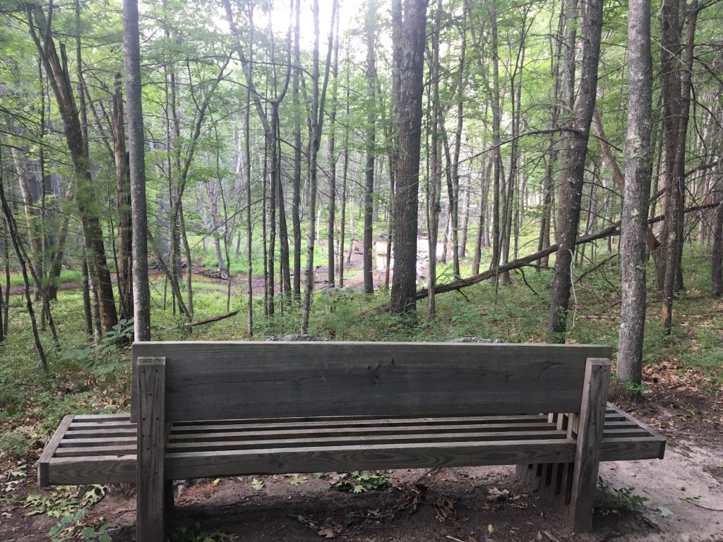
That trailhead had room for maybe half a dozen cars. Information about the trail was posted on a kiosk in the parking area. Close by were several rail-themed benches. The unpaved trail surface was smooth and pleasant.
The perfect rail-trail bench designA natural tunnel offers summer shade on the CLSRT
The trail passed open space for a few hundred yards before entering deep shade under mature trees. I walked for about a mile and a half, enjoying the shade on a muggy day, before deciding to turn around.
Uh-oh…the forecast had been for scattered afternoon pop-up showers, and one of them popped up as soon as I turned around. I wasn’t carrying rain gear on the 80-degree day, and I had a half-hour walk between me and my car. I shrugged and took the consequences as a hard rain began to fall. It was over in 15 minutes, which was long enough to leave me drenched. It was a reminder that even for short walks, carrying an inexpensive poncho is a good idea.
That wouldn’t have helped my shoes, of course. They should dry out within a few days. That’s a modest price to pay for a cool place to walk on a summer day.
This easternmost segment of the CLSRT is one of the many recreational assets in Concord for walkers and cyclists. Other completed segments are not yet continuous but are worth discovering if your travels take you to Hopkinton, Warner, or Bradford.
My last visit to Mt. Kearsarge in Warner, New Hampshire was a few years ago, as the fire tower was being rebuilt. I recently decided to go back for my first uphill walk since the virus-in-the-news laid me low earlier this year. From the upper end of the auto road in Rollins State Park, which is a treat in itself, I hiked the half-mile-long Rollins trail to the Kearsarge summit.
Mt. Kearsarge fire tower, Warner NH. Ellen Kolb photo.
It was a splendid morning at the end of August. A muggy summer heat wave had just broken, giving way to clear dry air and brisk breezes. As self-imposed rehab assignments go, this hike was unbeatable.
Summit cairn, Mt. Kearsarge. Ellen Kolb photo. Twin hills in far distance at left are the Uncanoonucs in Goffstown NH.
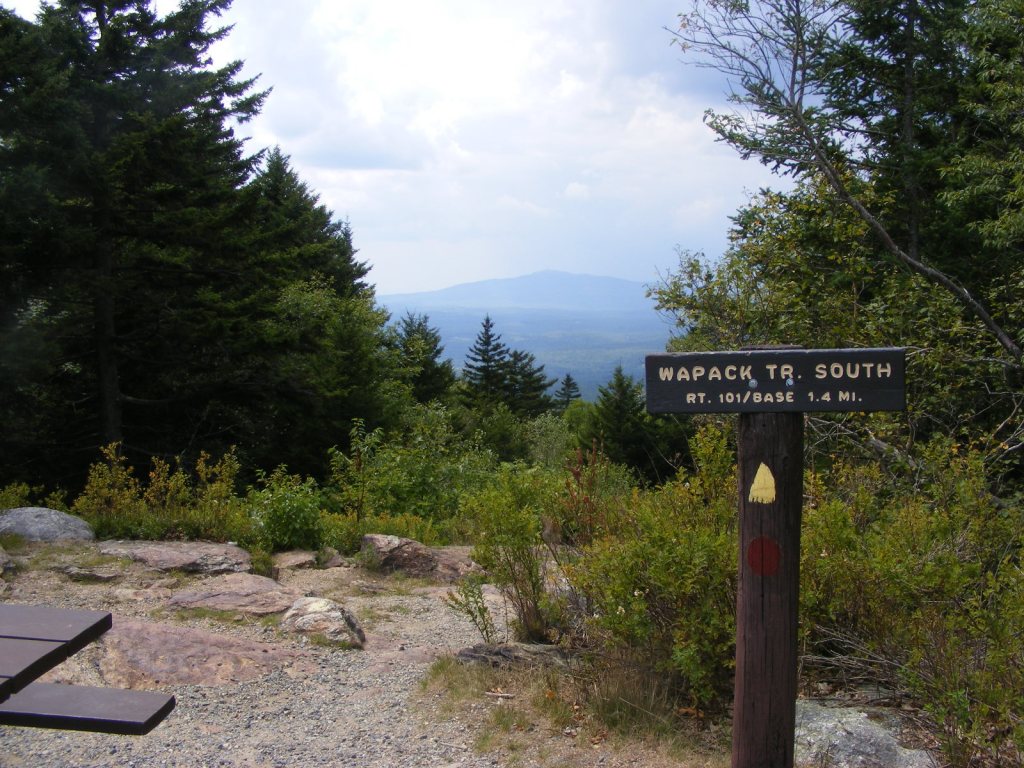
The hills and trails of southern New Hampshire spell home to me. I looked south from Kearsarge’s summit cairn and scanned the horizon: the Uncanoonucs in Goffstown, Joe English hill in New Boston, a view of the Wapack Range from the north – is that Crotched Mountain ski area nearby? – and aloof and stately Monadnock.
The ledgy summit features a 360 degree view, in case someone finds the view of the southern hills unsatisfactory. My advice is to soak it all in.
At $4, park admission is a bargain. See nhstateparks.org for up-to-date information on fees and maps for this and other state parks. Kearsarge is home to two of those parks. Rollins from the south features the auto road and a short hike; Winslow from the north offers longer trails. The Sunapee-Ragged-Kearsarge Greenway makes its way over the summit as well.
The auto road closes to motor-vehicle traffic in November and usually re-opens on Memorial Day weekend. I enjoy walking on the auto road in the off-season when the weather allows, sharing the road with other walkers and ambitious bicyclists. The summit is out of reach for the likes of me until the snow and ice are gone, but there are a few vistas along the auto road that make an uphill walk worthwhile.
While some New Hampshire recreational areas have been closed due to the too-much-love phenomenon (complicated by the no-sense-of-stewardship phenomenon), I am still getting out for good walks. August started out hot and hazy. It’s going out with hints of fall: fresh breezes, low humidity.
Pack Monadnock
On the one and only hilly hike I tried recently, Pack Monadnock via the Marion Davis Trail, I slipped on a bit of wet ledge and fell on my best-padded feature. I’ll have the bruise for another couple of weeks. It was worth it, just to be back on Pack. Even on a hazy day with a noisy storm approaching – which is what had me zipping downhill too quickly – Pack Monadnock is a nice hike.
The view of Monadnock from Pack Monadnock is unimpressive in summer haze.All photos by Ellen Kolb.
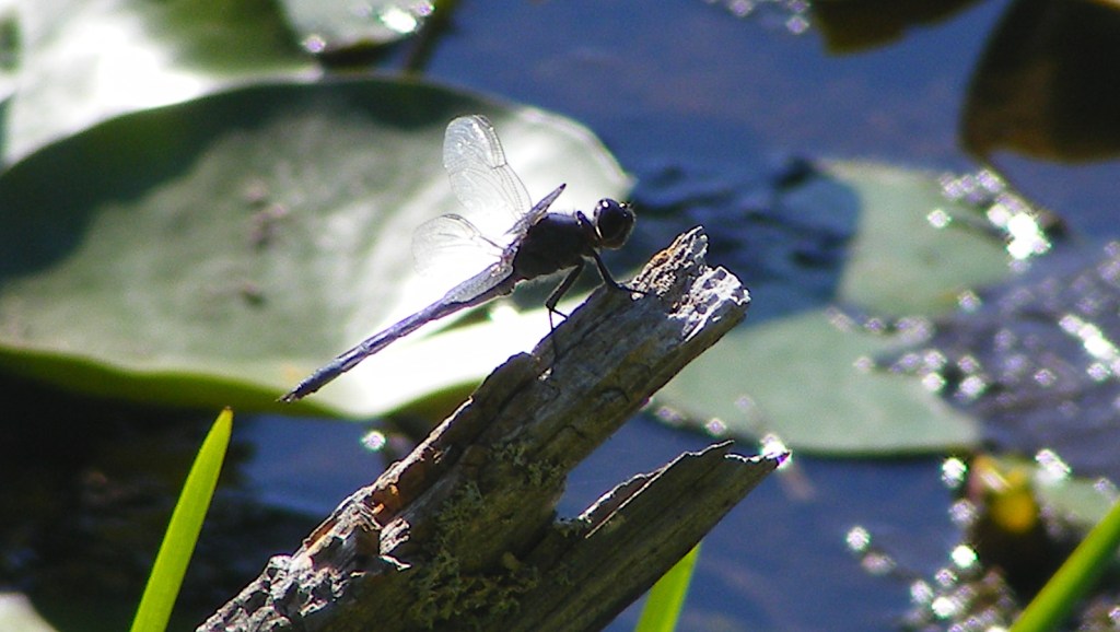
Closer to home, my favorite nature preserve in town has been a soothing refuge all summer. I recently discovered a little overlook that I somehow hadn’t known about, complete with bench, in a quiet part of the preserve. What does it overlook? A bone-dry stream-bed, that’s what. We’re in a drought. Birches in the preserve have shown their stress by dropping leaves early. The larger ponds and marshes in the preserve are at low water levels, but they’re still full of life.
I sat pondside to watch for herons, and got distracted by the dragonflies.
Beaver Brook, Hollis
I took my own advice and sought out a less-used trailhead at Beaver Brook, where the Jeff Smith Trail meets NH Route 130 in Hollis. I was rewarded with a couple of hours of near-solitude on surprisingly varied trails.
Maple tree hosting the day’s most dramatic-looking fungus
I loved coming across a meadow with an old cellar hole and a stone wall nearby, dead giveaways that there had once been a farm there. I found a trail that I hadn’t known about before, through a patch of woods dominated by white pines. Pine needles cushioned my every step.
The breeze in the trees there reminded me of growing up in south Florida, where fifty years ago long-needled Australian pines dominated every local park. Those trees were non-native and invasive, but I didn’t know it at the time; they were just normal trees to me. The memory of the sound of the wind through those long needles has stayed with me. The pines in New Hampshire with their shorter needles play a slightly different tune, just as soothing.
Less than an inch wide and only a few inches above ground, this wildflower caught my eye.
Queen Anne’s lace and goldenrod tried to get my attention, but a tiny pink wildflower beat them both. I don’t know what it’s called. Perhaps it’s something common, but it was new to me: a gift from August.
Recent walks and rides: Londonderry, Derry, and Windham. Each town has its own portion of New Hampshire rail trail on the old Manchester-Lawrence rail line. There are gaps, but the segments are being stitched together a bit at a time.
These are paved trails. They’re like boulevards without cars. They’re high-traffic compared with most of their unpaved cousins, but they’re off-road and therefore safer than hoofing it down any local street. I just stay to the right, pass with care when I need to pass, and keep my speed down. (I never have trouble keeping my speed down.)
Londonderry
No sooner was the Londonderry trail extended to Harvey Road in 2019 than an informal parking lot took shape near the trailhead, doubling as an observation point for watching the planes at Manchester’s airport. I love that kind of efficiency. (Update, 2026: since construction of a culvert under Harvey Road for Little Cohas Brook, parking at that trailhead is a problem. Try the trailheads across from North Londonderry Elementary on Sanborn Road or the Park and Ride on NH Route 28 near I-93’s exit 5.)
On my most recent visit on a hot summer day, I was surprised by a gentle fragrance as Little Cohas Brook came into sight. I gave the credit to the blooming water lilies. Loosestrife was in bloom as well: lovely purple color on what I’m told is a highly invasive plant.
Along Little Cohas Brook, Londonderry rail trail. All photos by Ellen Kolb.
Busy as the trail can be, I had no sense of being crowded on my midweek visit. There was room for everyone. I even had a bench to myself for a bit of birdwatching.
Benches are a bonus along rail trails.
I like seeing mile markers that have been restored or re-created. They keep me mindful of a trail’s history.
“L” for Lawrence MA, “M” for Manchester NH.
Four and a half paved miles extend from Harvey Road to the town line at NH Route 28. From the southern end, I could see across the road to a yet-undeveloped stretch of railbed in Derry. Its day will come.
I spent a good afternoon walking on Derry’s trail that links Hood Park with Windham Junction. That’s about 8 miles round trip, with refreshments available from businesses near each end. Parking is available at both ends.
Lest I forget about social distancing, someone painted a reminder.
Nothing but an embankment and a strip of trees separated me from I-93 on the southern part of the trail. Once the trail and highway diverged, the scenery changed to wetlands full of red-winged blackbirds. Proceeding north, I entered residential areas, then passed a ball field, and crossed busy NH Route 102 in the center of town.
Crossing 102 was easier than I expected. Traffic actually stopped for me as I entered the crosswalk. That is not something I take for granted in central business districts, even on a weekend.
My favorite part of the trail paid tribute to poet Robert Frost, who spent a few years teaching at nearby Pinkerton Academy. “The Road Not Taken” had been stenciled on the trail only a day or two before my walk. More artwork has since been added.
Frost’s “The Road Not Taken” is a Derry Rail Trail highlight.
I confess to a special liking for the Windham rail trail. Even on the hottest day, it’s cool and restful.
This Boston and Maine RR caboose is now a Windham Junction landmark.
Windham Junction, with its restored depot and caboose, has a good-sized parking lot. That makes it a good starting point for a ride or walk north into Derry or south into Salem. My recent trip was just to enjoy the Windham trail itself.
Roulston Road crossing (no parking here).
The trail looked practically freshly-pressed. Recent maintenance work has improved the trail’s surface and drainage.
New pavement, new drainage work, trimmed shrubs: welcome to Windham’s rail trail.
Job responsibilities prevented a backpacking trip for me this season. I settled for four days of dayhikes in Pittsburg, way north in Coos County, New Hampshire. (CO-ahhs, if you please, in case you’re new here. Welcome.)
Conditions: upper 80s, high humidity, overcast, with a low cloud ceiling that cut off views of nearly every peak in the area. On the other hand, I was there on quiet weekdays, and I had the solitude I craved on every road and trail.
Mount Magalloway (in cloud) and First Connecticut Lake. All photos in this post by Ellen Kolb.
Cohos Trail Segments
Covell Mountain really does not want to yield a trail this summer. There were signs of storm damage and logging. The mud made me glad I had shoes with a moisture-resistant lining. Grasses were growing high despite obvious efforts by trail adopters to keep them in check. Blazes were clear and plentiful, though, and I know I can thank those same trail volunteers for that.
There was a newly-fallen spruce across the trail, not far from a junction with a path marked Cattail Trail. The spruce refused to give way to the little knife I carried. All I got for my pains was a sappy blade.
Perhaps on a clearer and cooler day, I’d have kept going past Covell to Prospect Mountain, where on another trip I enjoyed a spectacular vista. This was not a week for great views, I thought, so I contented myself with an up-and-back hike on Covell.
As I returned to my car parked at the Ramblewood campground, I caught sight of Mt. Magalloway and a sliver of First Connecticut Lake. The summit was obscured by cloud and the lake reflected the gray sky: a striking monochrome landscape offered up by Covell Mountain, as if to thank me for putting up with its messy trail.
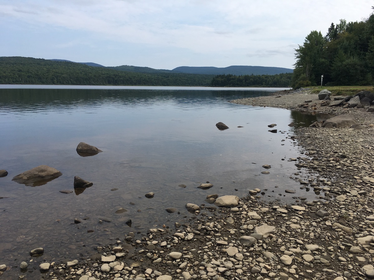
Second Connecticut Lake, at a low late-summer level.
Peaceful Second Connecticut Lake never disappoints, however short the visit. This time, I parked at the dam alongside U.S. 3 and followed the Cohos Trail north.
The trail soon intersected Idlewilde Road, and I turned for the five-minute detour to the Idlewilde boat ramp. On a hazy late-summer afternoon, I stood at the ramp on the lake’s shore all by myself, with a loon’s call the only sound I could hear.
Back on the trail, I took up the Chaput segment. It’s named for a couple I’ve never met who are famous to Cohos Trail veterans for their years of trail work. The segment is parallel to and very close to U.S. 3, but it gets hikers off the pavement. I’m a fan. I hiked the northern section of the Cohos Trail in 2009, and at that time the last ten miles of trail to the Canadian border were on the highway. Thanks to the efforts of many volunteers, that’s no longer the case.
“Lainie’s Lair,” on the Cohos Trail.
Along the Chaput segment, I found the little rocky overhang nicknamed Lainie’s Lair. That’s a fun tribute to another legendary Cohos Trail volunteer. Lainie brought me with her for a memorable day of trail work during my 2009 hike. I had a lot of enthusiasm for the task, but zero skill. Lainie patiently coached me on things like how to use tools without hurting anyone and how not to freak out at the sight of bear scat. She could have accomplished a lot more that day in 2009 without me, but she was happy to be my guide. Nine years later, I smiled at the whimsical salute to her at the “lair.”
Sophie’s Lane is part of snowmobile corridor #5, and the Cohos Trail follows it beginning just south of Deer Mountain State Park. After being in the woods on a hot day, Sophie’s Lane was a relief. It was wide and open enough to catch a breeze that kept insects at bay. The lane leads to a spur to the site of an old fire tower on Deer Mountain (no cab or platform remains), which is a side trip I didn’t take.
I liked the short spur to Moose Flowage, which is part of the Connecticut River south of Third Lake. It was a good spot for a break and a snack. It was a tempting place for a campsite as well, but signs sternly warned against any such notion. Deer Mountain state park’s campground, accessible from U.S. 3, is just across the Flowage.
Sophie’s Lane trail kiosk
The lane gradually narrowed the further north I walked. I stopped well short of the Canadian border, avoiding a walk through a long weedy stretch of trail. I passed a clearing with one boulder covered in street art. That jarred me. That painted rock somehow bothered me more than the relatively new cell tower at the north end of First Lake. It poked a big hole in the sense of isolation I expected in August on a snowmobile trail three miles from Quebec.
What I didn’t see along the way – not on Sophie’s Lane, and not anywhere else – was a moose. No bear or deer, either. I saw moose tracks in one muddy spot, but as for the beasts themselves, nada. Perhaps the heat kept them in hiding. Maybe I’m such a noisy hiker that I scare off everything larger than a mosquito. My presence didn’t bother the birds, though. It was a good week for seeing heron, hawks, and turkeys.
Pittsburg: the Village and Happy Corner
Broadband has come to Pittsburg, or at least parts of it. I stayed in the village – downtown Pittsburg, more or less – in a comfortable little cabin with WiFi and cell service.
The snowmobile crowds are a few months away, people are buttoning up their camps for the season, and the summertime ATV vacationers have mostly returned to work and school. The town roads were thus quiet and inviting during my recent visit. As always in Pittsburg, the people I encountered were friendly and hospitable, ready to answer my questions and point me to interesting places.
A three-mile loop walk from my cabin at day’s end took me to Murphy Dam, Lake Francis, and Cedar Stream Road. A tranquil route, from start to finish. Had I moved east on Cedar Stream Road rather than west towards town, I’d have picked up a Cohos Trail segment leading to the east side of Lake Francis.
Lake Francis seen from Murphy Dam
Six miles north of the village, the crossroads known as Happy Corner makes a good base for a few Cohos Trail dayhikes and for exploration of town roads. I loved rambling with no schedule and no fixed route.
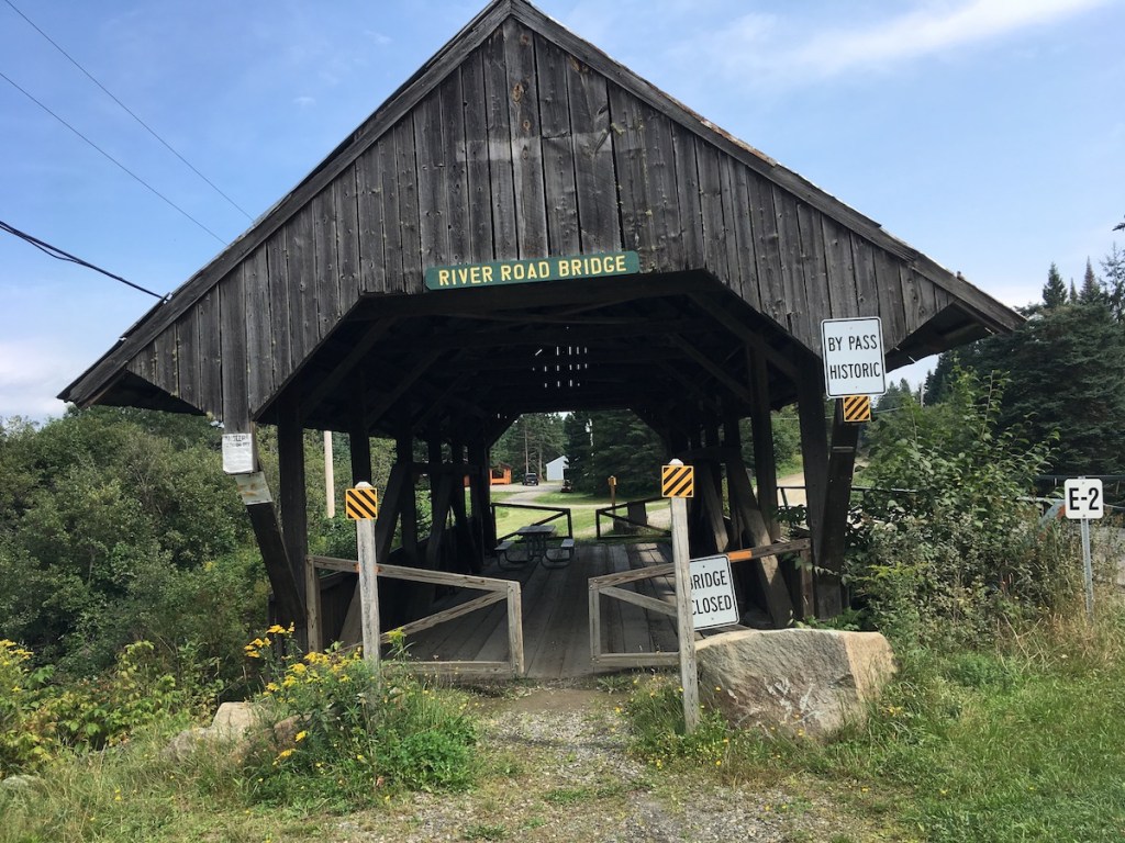
The Happy Corner bridge is still open to automobiles, although none were in sight when I was there.The old covered bridge on River Road has been bypassed, but visitors are welcome to take a break at the picnic table inside.I found this along Hill-Danforth Road, and left it for the next person to enjoy.Perry Stream at the River Road bridge.
Road Tripping
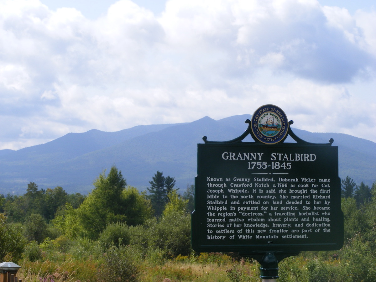
I only get up this way once a year or so, and I try to make the most of the long drive. I drove a circuitous route on the way north in order to photograph a slew of North Country historical markers. Interesting sites, interesting history!
On a cloudy morning, the Cog Railway track seemed to disappear into Mount Washington.That’s Cherry Mountain behind the Granny Stalbird marker in Jefferson.The city of Berlin on the Androscoggin River boasts four markers, each featuring a different aspect of the city’s heritage.
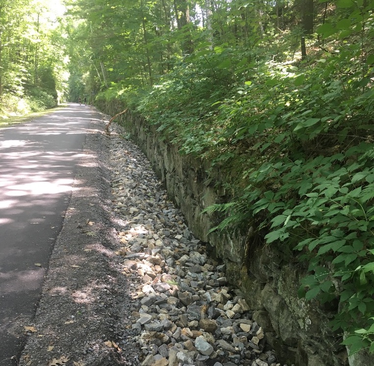
New Hampshire is having its annual heat wave. My car’s thermometer registered 104° today. It’s hot enough to make me forget for a few days that icy driveways are only a few months away. It’s even hot enough to make an indoor treadmill look appealing. But I found a good place for a half-hour walk today: a rail trail under a shady canopy of trees.
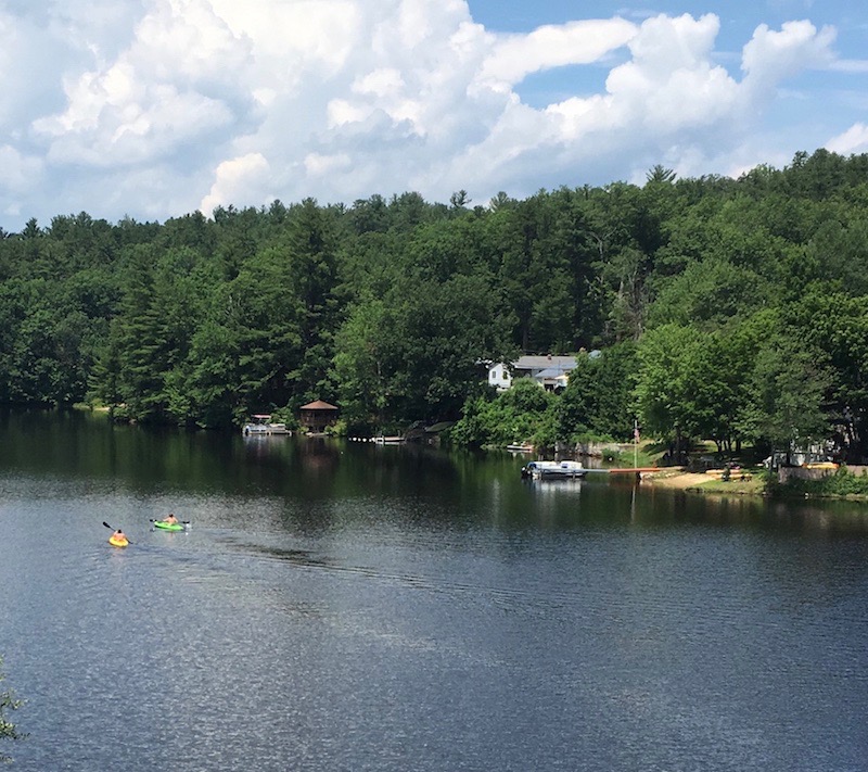
The Goffstown rail trail was my destination today. You might have a shady refuge just like it near you. Packed stone dust underfoot, trees overhead, river nearby. All was restful and cool, until the trail crossed a power line cut and the shade disappeared for a hundred yards or so.
From the trail’s bridge over the Piscataquog River, I could see a couple of kayakers who were no doubt in for a whopping case of sunburn. Still, the river was their refuge from the heat, so good for them.
As I turned around at the bridge to return to my car, a smiling bicyclist flew past me. She called back to me over her shoulder, “isn’t this a glorious day?”