“Today, you hike… I go because I want to and also because I can. I go because life doesn’t end once you’ve done enough. It keeps unfolding. And I intend to meet it with open eyes and sturdy shoes.”
That’s from the Blissful Hiker podcast by Alison Young. After my recent journeys recounted on this blog, her message resonates with me. I heartily recommend this nine-minute episode called “Aliveness”, for inspiration and encouragement.
Open eyes and sturdy shoes: I’ve been working on that here at Granite State Walker for nearly two decades now. It’s always good to meet fellow hikers similarly equipped. Walk on!
My Substack newsletter Braided Trails will soon include excerpts from Granite State Walker as well as original material inspired by New Hampshire trails. I hope you’ll subscribe.
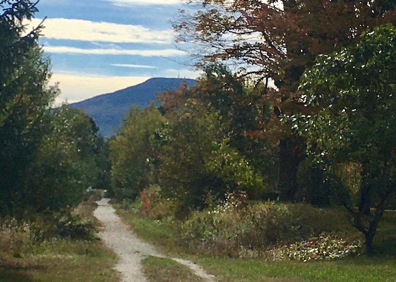
Mt. Kearsarge seen from the Northern Rail Trail, Wilmot
So why the addition? Here’s an excerpt from my intro to Braided Trails:
Readers have been curious or kind enough to follow me down various paths through the years. New Hampshire hikers have kept Granite State Walker going. At Leaven for the Loaf, I’ve reported on pro-life projects and legislation at the state level. My eponymous blog has been a promotional portfolio where I’ve also explored aspects of my Catholic faith.
But omigosh, what if the hikers don’t like my politics or my State House readers don’t care about my hiking or somebody somewhere is put off by a portfolio from a Catholic scribbler? I’ve tried to keep you all a secret from each other.
Enough already. Welcome to Braided Trails.
“Braid” is a nod to the three distinct blogs I’ve launched since 2006. This Substack is a place where each theme can get its due, in context with the others: braided, not fused. It’s about time I found a space big enough to bring the whole blessed lot of us together. It’s big enough for new readers, too.
Intrigued? Then I welcome you on board. Subscribing is free. And if you’d prefer to stick with this blog, plain and simple, that’s fine, too. I’m delighted to write for you in either case.
Thanks – and I’ll see you on the trails.
Spring is here, summer’s coming…and so is Braided Trails.
My favorite garden center opened for the season yesterday. I picked up one pot each of forced narcissus and hyacinths to put in my front window. No reason, really, except that I want something colorful to look at while the hickory and elm trees outside are still looking drab.
A few more weeks and the drab of winter will be past. Buds are swelling. I walked in Concord today on a trail along the Merrimack River. Around me were bare shrubs, bare trees, and fields of corn stubble. But something further away caught my eye: an island in the middle of the meandering river, with trees adorned with cloud-like pale-red streaks. Maples, of course, flowering earlier than all the other trees. Delightful.
Early April, Merrimack River: looks like spring is coaxing the maples along. Ellen Kolb photo.
The trail was in good shape, with very little mud. That’s not the case everywhere in southern New Hampshire, and mud season makes it challenging for me to pick good places to walk. The bugs aren’t out in force yet, though, which is a plus.
Soon I won’t have to look past my yard for flowering trees and unfolding leaves. That means my spring allergies will soon flare up. Worth it, though.
For now, I like being on the cusp of spring. The tom turkeys in my neighborhood are mightily displaying their plumage in an attempt to impress the hens. My neighbor on the sunnier side of the street is tending to the gorgeous little patch of crocuses blooming in her yard. The herons are back at their rookery. And of course the peepers are out now – the tiny tree frogs whose springtime call sounds like a chorus of little bells.
If the Danbury Country Store were a human being, it would be my new best friend. This and other treats awaited me as I set out on a long walk on central New Hampshire’s Northern Rail Trail.
Fifteen miles is a big stretch for me, especially after losing fitness and energy to post-Covid problems earlier this year. I had to crawl, figuratively, before I could walk far again. I’ve added a few more miles each week. This week, I decided to go big. I walked on the trail from Potter Place in Andover to the Danbury Country Store and back. I figured that was one way to evaluate how I’m doing.
I’m doing fine. Sore, yes, but fine.
Sights
I’d seen Potter Place before, but its charm catches me by surprise every time. The restored depot in Andover close to the US 4/NH 11 junction is a tribute to the people who care about the rail trail and the railroad’s history. The Northern Rail Trail is in fact well-loved and well-maintained throughout its fifty-plus miles. A big park-and-ride lot just down Depot Street from Potter Place is an ideal spot from which to launch a walk or ride along the trail.
Potter Place: restored depot and an old Central Vermont Railway car.All photos by Ellen Kolb.
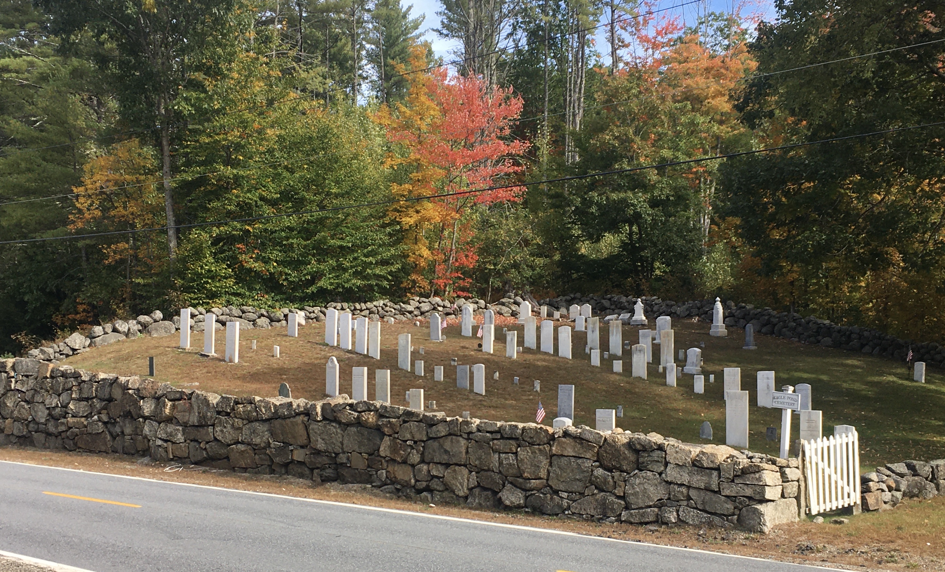
Coming upon an old cemetery is no surprise on any of my walks. In Wilmot, I came upon one that looks beautifully tended. From a distance the markers looks unweathered. They’re all upright. The stone wall around the cemetery is a work of art, albeit with some interesting items (read: “trash”) tucked between some of the stones.
Eagle Pond Cemetery, Wilmot
I even got a glimpse of Mt. Kearsarge. I took a photo that came out fuzzy, but even so one can barely discern the cell tower on the summit, with the fire tower just to its right.
Mt. Kearsarge seen from Northern Rail Trail
Foliage
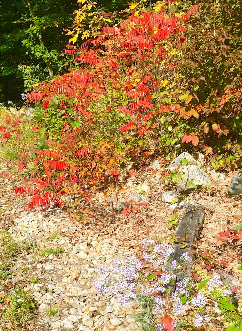
Fall is my favorite time to take walks, and even the weeks before peak foliage can be splendid. I found plenty of leaves underfoot this week. Remaining foliage in the central New Hampshire area I visited is still a week or two away from full color. Icy blue asters, a last reminder of summer, persist all along the trail, contrasting nicely with the changing leaves.
Tiny blue flowers in the foreground contrast nicely with the changing leaves.
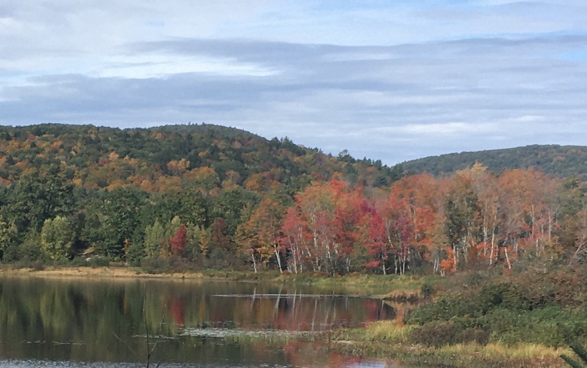
Eagle Pond in Wilmot
Lunchtime
My turnaround spot was the Danbury Country Store. It’s a must for anyone traveling along the NRT. I figured I’d sit on one of the porch seats there and nibble on a Clif bar from my pack. That was before the store’s deli crew set out two fresh hot pizzas. Game, set, match, and the Clif bar retreated to its pocket.
Also at the store: an air pump for cyclists, a huge assortment of beverages, the usual country-store inventory, and a deli where you can have any sandwich made to order. Enjoy. I sure did.
As I write this the day after my walk, I’m nursing a few aches, but they’re good aches. The kind that don’t herald injuries; the kind that whisper please don’t try this two days in a row. Best fifteen miles of the year, and that’s good to write three months after I needed my husband’s help to get around the block.
Fall isn’t winter’s knock on the door. Instead, winter is the price I pay for fall hiking. Fair exchange, in my view.
New Hampshire’s mud season is here, thanks to a month that has brought days of snow alternating with days of 50 degrees. I went to the forest trails in one of my favorite Concord parks the other day, and I turned around after about a hundred yards. Squishy ground is not ideal for hiking. Turns out hiking isn’t ideal for squishy ground, either. Ask any trail maintainer. I’m switching to pavement for the time being.
March 2022: Nashua River Rail Trail, Dunstable MA. Clear pavement, muddy edges.Ellen Kolb photo.
While I’m putting in the miles on roads and paved trails, I’ll be giving some thought to the maintenance work and spring cleanup that will be going on as the weather gets warmer and the mud dries up. This is a good time for trip planning, too.
I serve on my town’s conservation commission, on a subcommittee dedicated to one of the town’s nature preserves. We’ve been keeping an eye on some areas being taken over by invasive plants that are crowding out native species. In consultation with an expert from the local university’s extension program, we’re coming up with a management plan to tackle the invasives later in the year. Planning now will pay off later.
My favorite local paved trail, the Nashua River Rail Trail, has obviously seen recent work from volunteers who have already made the most of mud season. While the side paths in the woods are still muddy and soft, working on the pavement is easy. Between my last two visits to the northern section of the trail, a crew or crews had been through to clear away fallen branches and pick up trash.
I’m gathering trail information this month for a multi-day hike later in the year on the rail trails in the southwestern part of New Hampshire. I don’t feel quite so stuck during mud season when I know there’s a trip ahead to plan and train for.
Mud season might give you time to learn more about the trails in your area, even if they’re temporarily off limits until things dry up a bit. Is a trail owned or managed by your town? Check with the Parks and Recreation department or the municipal Conservation Commission to find out if there are opportunities for you to volunteer for upcoming events. Are you fond of a certain rail trail? The New Hampshire Rail Trails Coalition website contains links to many local trail clubs, each with its own projects and schedule. Don’t dismiss Facebook; it’s still a great way to find groups organized around a specific trail or park. Those Facebook groups are often the best source of information on up-to-date trail conditions and maintenance needs.
Avoiding the trails for another couple of weeks will be good for them. Using the time for planning ahead will be good for me.
I wrote last October about a layered trail: ice, mud, and leaves underfoot. That’s pretty much what I’ve found in January in southern New Hampshire, minus the leaves. Things are pleasantly messy, as long as I have some traction on my shoes. Yes, even for the flat paths: slipping on an icy flat trail in Mine Falls Park left me with a concussion a few years ago. That’s one winter adventure I don’t care to repeat.
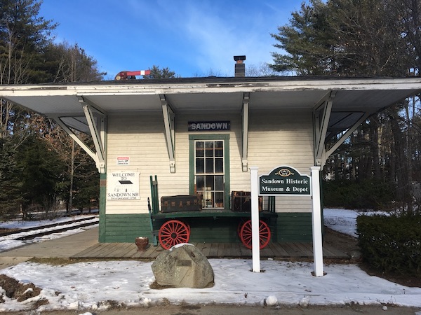
Rockingham Recreational Trail in Sandown; Sandown Depot. Photos by Ellen Kolb.
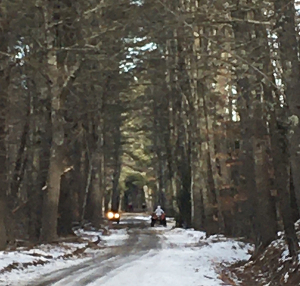
I was in Sandown the other day, sharing a trail with some polite ATVers. The trail wasn’t so much layered as patchy: ice here, slush there, frozen tire tracks in the shade, and lots of mud down the middle. I accidentally hit on the best time of day to be a walker there, mid-afternoon, after most of the ATVers had finished for the day. Not every multi-use trail works out so well for me.
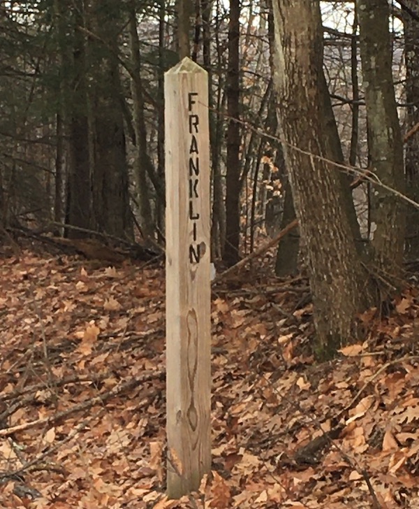
Not every trail gives me town line markers. I like it when the markers agree with my GPS.
A short drive north: the Northern Rail Trail follows the Merrimack River in Boscawen and part of Franklin. On New Year’s Day there, I was surprised to see an osprey. I didn’t think ospreys were winter residents in this area. An unexpected sighting like that is always a treat.
I have many miles yet to discover along the NRT, which is one of the most popular trails in central New Hampshire. I’ve walked on each end, so to speak – Lebanon and Enfield at one end, Boscawen at the other – and there are about 40 more miles to go.
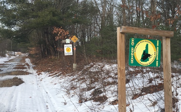
Where the work of one snowmobile club ends, another’s begins.
While we’re on the subject of walking in January, let’s thank the snowmobile clubs that groom so many of the trails I enjoy. It’s not all snow grooming: when a club takes responsibility for a trail, the members also do things like clear away fallen trees and make sure the trail’s full width gets attention.
I haven’t neglected my town’s conservation areas. I spent a brisk hour on a big loop route starting in Grater Woods, connecting with an adjacent neighborhood with which I was unfamiliar, returning on busy Baboosic Lake Road. I’m not a fan of being a pedestrian on one of our town roads with little shoulder and no sidewalk, but sometimes that’s where a path takes me. As for Horse Hill, I’ve never had a bad day there. No matter how many cars are in the parking lot, the trail network is extensive enough to keep us out of each other’s way.
Do you have resolutions about walks you want to take this year? I always start the year with a list of destinations, more for inspiration than anything else. I don’t want to waste time wondering where to go, if I find myself with a free afternoon. I just dip into The List, which I admit is heavy on rail trails. I also keep a map of New Hampshire on my wall, with outlines of each town, and after I walk in a new town I color in its spot on the map. I get a silly amount of satisfaction out of that little visual record.