I needed a hill climb as a mental palate-cleanser the other day. Not a big hill, just one with a view. Brookline (the New Hampshire version) is not-too-terribly far away, so I scooted down Route 13 to the Andres Institute of Art with its hilltop view of the Wapack Range.
A new driveway is now a stone’s throw north of the former entrance. Look for the address 106 Rt. 13. There’s plenty of parking. Even first-time visitors will have no trouble following the signs into the AIA’s property.
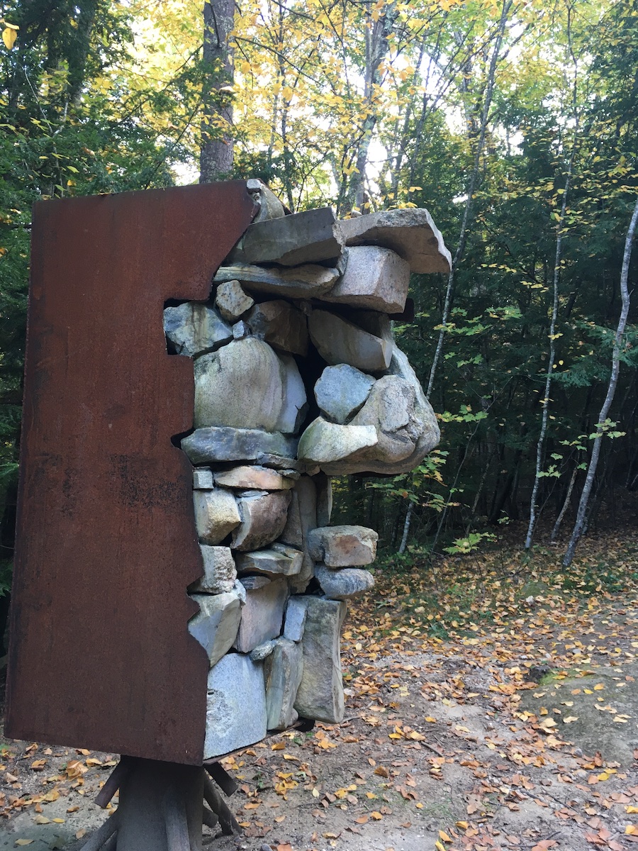
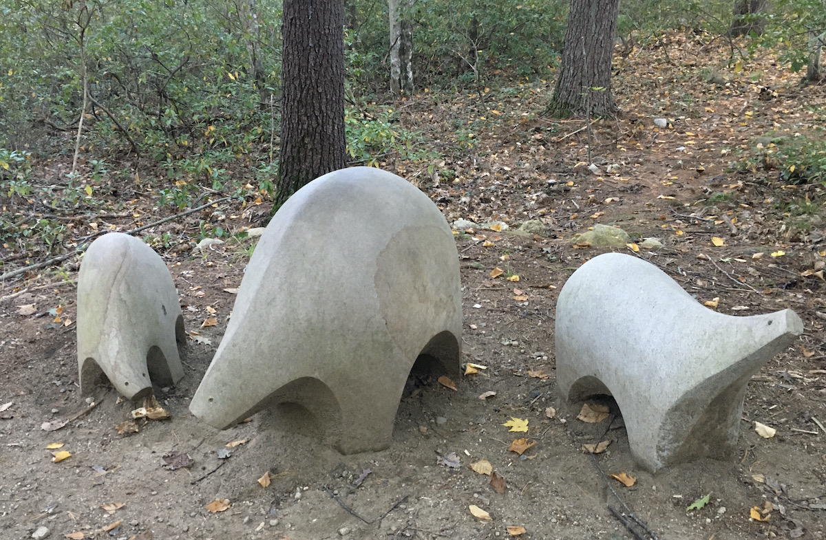
The property was once a tiny ski area (rope tows, not gondolas) on a little hill in Brookline. The ski area is long gone. The current owner is a patron of the arts with a passion for sculpture created by artists from all over the world who come to New Hampshire to work in granite. Their work adorns a network of trails winding around the hill.
At the summit is the payoff: a view of the Wapack Range, complete with seating. A striking sculpture entitled Phoenix is in the foreground of the vista. For a short walk uphill (a generous half-mile or so), it’s a pleasant experience.
Wapack Range from Andres Institute of Art summit: Kidder, Monadnock (pointed summit), Temple Mountain ridge
Late-day haze dulled the view a bit. The silhouette of the range was clear enough, though, and I even caught a glimpse of Mount Monadnock playing peek-a-boo behind Kidder Mountain.
On the October day I was there, the paths had a golden glow. Beech and aspen leaves are turning. Flashes of crimson from maples are hinting at the peak foliage that will be on display on a couple of weeks.
The AIA trails can be very popular, but my late-day midweek autumn visit was delightfully quiet. A mental palate cleanser, indeed.
“Phoenix” by Janis Karlovs, Latvia, 1999, Andres Institute of Art“Old Man in the Mountains New Home” by Alak Roy, Bangladesh, 2014, Andres Institute of Art“Rebirth” by Evrim Kilic, Turkey, 2019, on display at Andres Institute of Art, Brookline NH“Animals” by Tony Jimenez, Costa Rica, 2017, Andres Institute of Art. Pure whimsy!
After a Covid-influenced year of curtailing my activities, things are picking up. After an upstate errand, I had just enough spare time to sample the Winnipesaukee River Trail in Tilton. Another day, during a Seacoast trip, I enjoyed a tripleheader of varied paths. A more routine errand to the Manchester Airport gave me an excuse to see how the Londonderry Trail looks in spring.
Winnipesaukee River, Tilton. Ellen Kolb photos.
Winnipesaukee River Trail
This is not to be confused with the Winni Trail, where the “Winni” stands for “Winnisquam.” The Winnipesaukee River Trail may someday connect with Winni if several links are developed. Like Winni, the Tilton segment is rail-with-trail.
The Winnipesaukee River Trail goes from Franklin to Tilton via Northfield, with a little bit of road walking included. I recently visited the easternmost mile. Parallel to U.S. 3, the path is surprisingly quiet, shielded by a row of buildings from some of the traffic noise. The river was pretty but quiet due to lack of rainfall; a depth indicator painted on a bridge abutment was well above the current water level.
A lengthier visit extending to Franklin would have been more rewarding, but my time was limited. I enjoyed a peaceful half-hour along the river. My turnaround point was startling, after the quiet walk: the commercial cluster by exit 20 on I-93. Had I wanted a snack, that would have been a place to consider, with the trail’s terminus flanked by fast-food places. My starting point had some options as well, with U.S. 3 serving as Tilton’s Main Street.
The Winnipesaukee River joins the Pemigewasset River in Franklin to form the Merrimack, the waterway that defines south-central New Hampshire.
Rail-with-trail in Tilton. Ellen Kolb photo.
Rochester and Dover
I rarely get to Strafford County. When I did recently, I visited three very different trails.
The Farmington Rail Trail extends from the town of Farmington to the city of Rochester near Spaulding High School, roughly paralleling NH Route 11. I had been warned that it was sandy enough to leave even fat-tire bicyclists in despair. Being a walker, I dismissed that concern. Silly me. It was like walking on a beach, giving my legs more of a workout than I’d bargained for. I probably needed that anyway.
Next stop: the Lilac City Greenway, short and sweet. The northern portion of it runs along Rochester’s main drag, serving as a sidewalk. It’s paved, nicely landscaped for spring, and adorned with abstract sculptures. I benefited from a combination of Charles Martin’s guidebook and Google Maps, which warned me that the municipal parking lot close to the greenway is accessible only to northbound traffic on Route 125. That was a very helpful bit of information.
Lilac City Greenway, Rochester NH. Photo by Ellen Kolb.
Then, south to Dover. Without realizing it, I’d saved the best for last. The Dover Community Trail was wide and quietly scenic. I parked at the western end, at the Watson Road trailhead. The fairly large parking lot (room for about 20 cars) was nearly full when I arrived at midday on a workday. Even so, there was no sense of crowding on the wide, well-packed trail that extends about three miles to the center of Dover.
The Cocheco River flowed alongside the trail, and several anglers in hip waders were trying their luck. I was passed by a few lunch-hour runners, and in turn I passed a few easygoing dog walkers. My map told me that offices for county government and a large insurance company were nearby, but they were completely out of sight and sound, built on higher ground.
Cocheco River beside Dover Community Trail. Ellen Kolb photo.
I’m sure the downtown end of the trail has a much livelier character. I wasn’t looking for lively that day. The Watson Road trailhead was the right place for me to start my walk.
Londonderry
Here’s a familiar destination for me: Londonderry Rail Trail from the Harvey Road/Airport trailhead. (Update, 2026: Construction of a culvert in the area has made parking a challenge. Try the trailheads across from North Elementary School on Sanborn Road and at the Park & Ride on Route 28 near I-93 exit 5.)
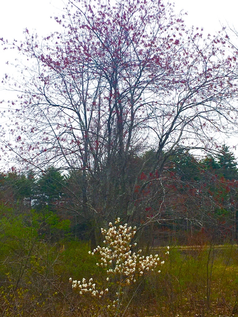
What did it look like on a drizzly spring morning? Delightful. A film of pollen glazed portions of Cohas Brook reservoir, but the trees in flower looked so good that I didn’t mind all the allergens floating around.
There are plenty of “destination” trails in New Hampshire worth a full day’s exploration, but I value quick trail stops, too. They can give a busy day a special kind of spark.
Springtime on Londonderry Rail Trail, at Little Cohas Brook Reservoir. Ellen Kolb photo.
I drove down Depot Road in East Candia a little slowly, wondering if I’d be able to find the parking lot where the Rockingham Rail Trail crosses the street. I needn’t have worried; the nearly-full lot was impossible to miss. I tucked my car into one of the few open spots.
No depot building here, but a sign marks the spot where a depot once stood. All photos by Ellen Kolb.
The lot was a busy place. Couples and singles and families were taking bikes off car racks or putting them back on. Hikers were setting out, many sporting seasonal blaze orange vests. It was as warm a day as November ever brings, and everyone wanted to take advantage.
Pick a direction: should I go east into Raymond, or west through Candia? Seeing several parties setting off to the east, I wished them well, and then turned my back to them to walk west.
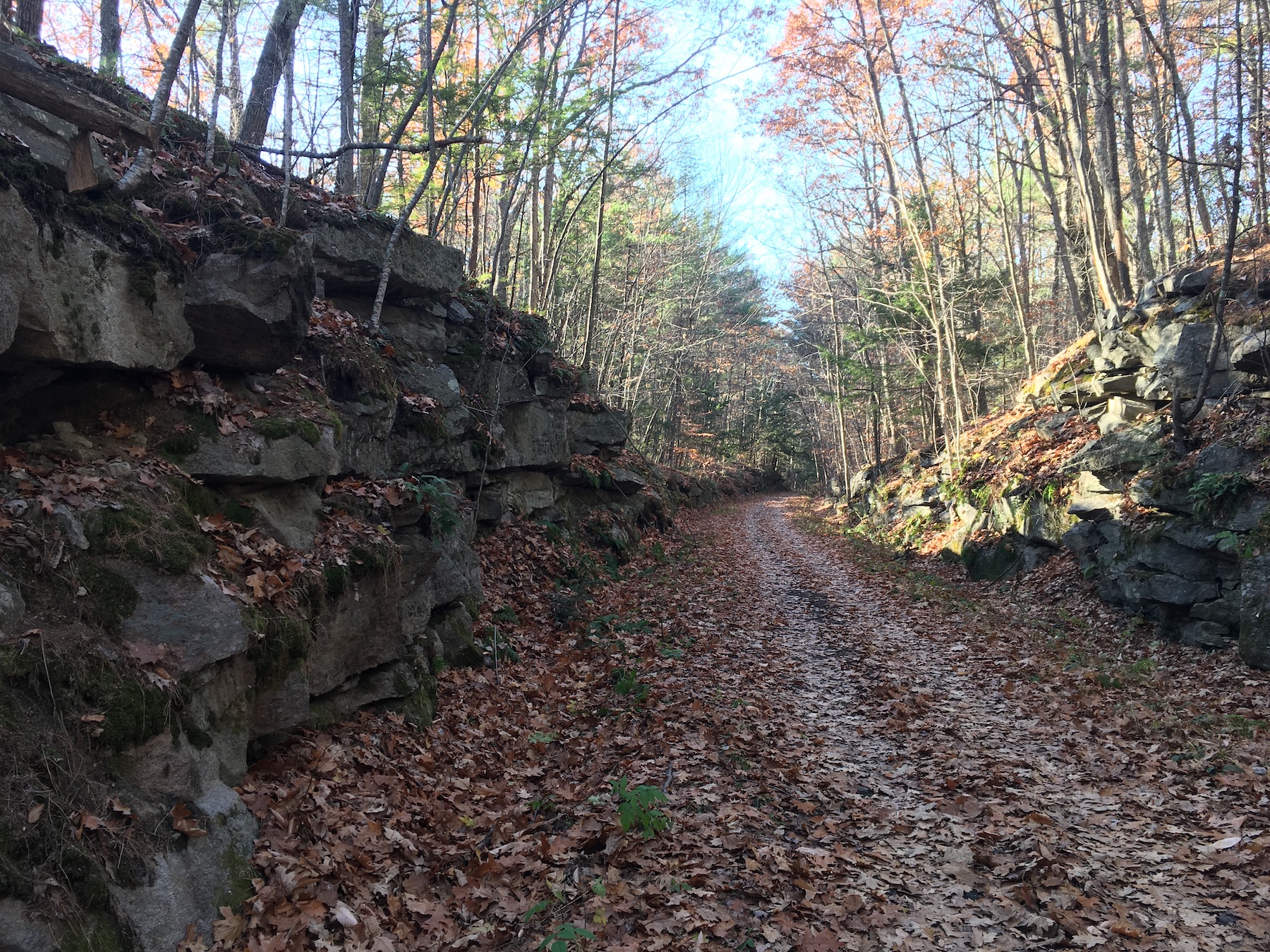
Rock cut along Rockingham Rail Trail, East Candia NH.
The Rockingham Rail Trail between Manchester and Newfields is more than 20 miles long, making it one of the longer New Hampshire rail trails. It’s a piece-at-a-time endeavor for a walker. I picked a winner of a day to amble out-and-back on a three-mile segment in Candia.
Temp in the 60s: what kind of November is this? Sunshine, few clouds, air as dry as could be.
There were more bicyclists than walkers on the trail. That didn’t mean walkers were overwhelmed; traffic was light to moderate. The few walkers kept their cheerful distance as we passed each other with smiles and nods – you stay on your side and I’ll stay on mine, we seemed to be saying.
Where houses were visible as I approached Main Street, the sounds and smells of a sunny late-autumn weekend took over: raking, leaf-blowing, the last round of mowing for the season, a carefully-tended fire to burn the clippings.
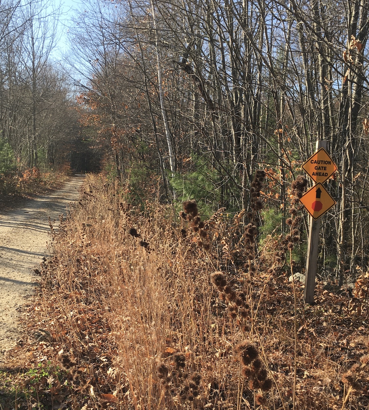
A sign along the way hints at the winter traffic to come.
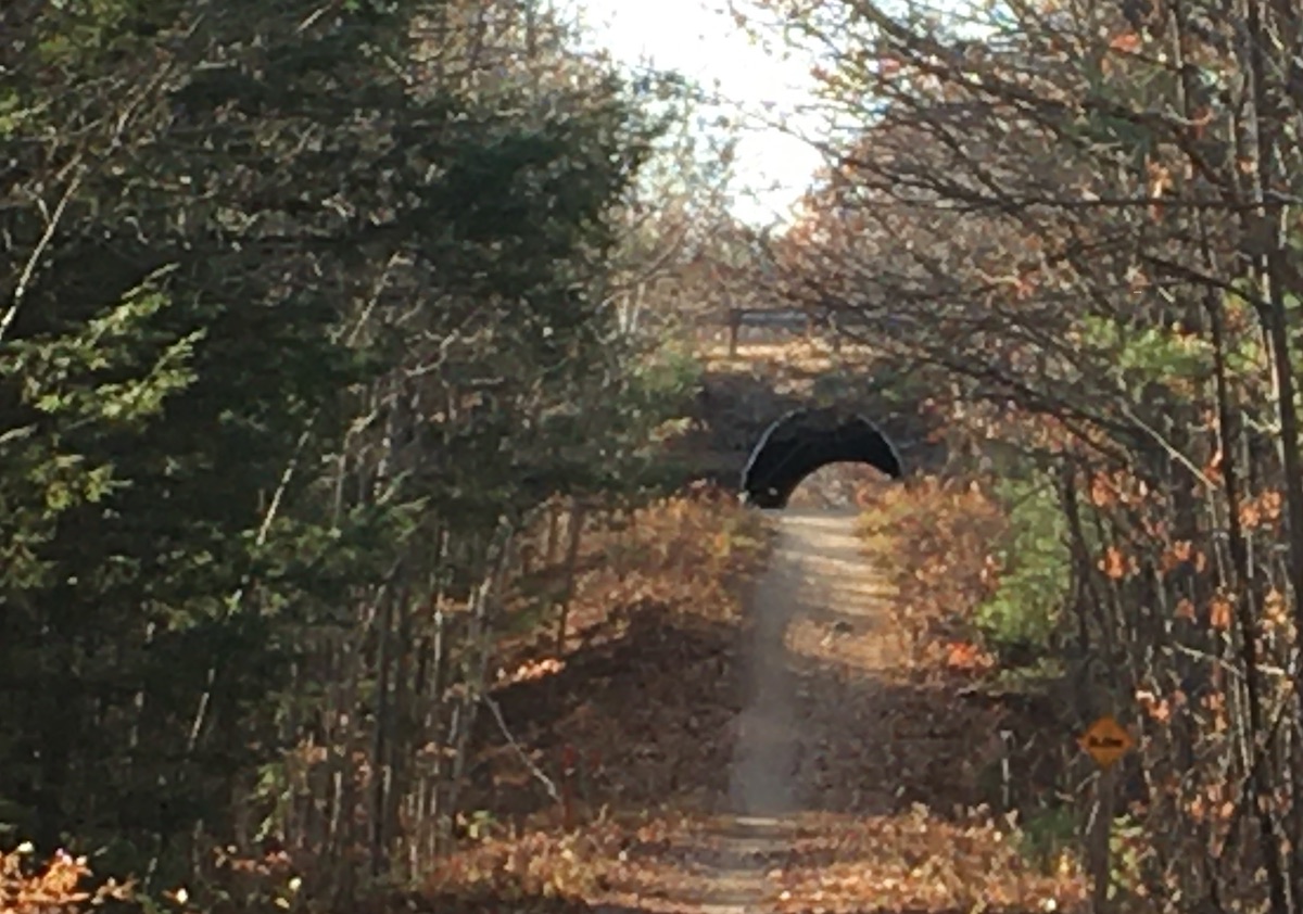
My turnaround point was Route 43, or more precisely the tunnel under the ramp linking 43 with Route 101. The parking lot in East Candia was nearly deserted when I returned. I decided to spend a little time walking toward Raymond, but I was racing the sunset: after half a mile, I returned to my car.
I think I saw the trail at its most inviting for walkers. Once the snow flies and piles up, the Rockingham Rail Trail will become a snowmobile corridor. Until then, all you need there is your bike or your walking shoes.
My turnaround point. West of Candia, the trail continues through Auburn into Manchester.
I needed a walk with no cars in sight. I headed to Mine Falls Park in Nashua. I found leaves over patchy ice over mud: not my favorite trail surface, but that’s what the end of October is dishing up in my area.
Mine Falls Park, Nashua, NH: late afternoon, end of October. Ellen Kolb photo.
A scant inch of snow fell yesterday along with the leaves. Everything froze overnight, and then the sun came up and promptly warmed things up to about forty degrees. That left me with the layered trail. It wasn’t too bad, and it was certainly better than pavement. The bridges over canal and river were still a bit slippery from the snow.
The park was quiet. Weekends are usually busier. Even adjacent Lincoln Park, where I left my car, was nearly empty. No complaints. I was a bit out of sorts, and solitude suited me.
I usually see mallards in the canal. This day, I saw them in the Nashua River instead. About three dozen were together midstream. The river was sluggish, and the ducks paddled upstream effortlessly. That left the cove for about 20 Canada geese, most of them napping in the late afternoon.
I needed my sunglasses as I returned to my car, with the sun low in the western sky. That reminded me that I was walking during the last day of Daylight Savings Time. November will bring the sense of dislocation I feel every fall until I mentally reconcile what the clock says with what the sun does.
Update, 2026: Since this 2020 post, the CLSRT has been extended in Concord, improved in Warner, and begun in Newbury. The segments are slowly coming together. Best ways to get updates are on the CLSRT website and Facebook page.
Some of my favorite short after-work hikes have been in Concord, New Hampshire. The trails on Oak Hill and in Winant Park stand out. Now there’s a new trail – new to me, anyway – on the north side of town, where I recently walked for a fine hour and a half.
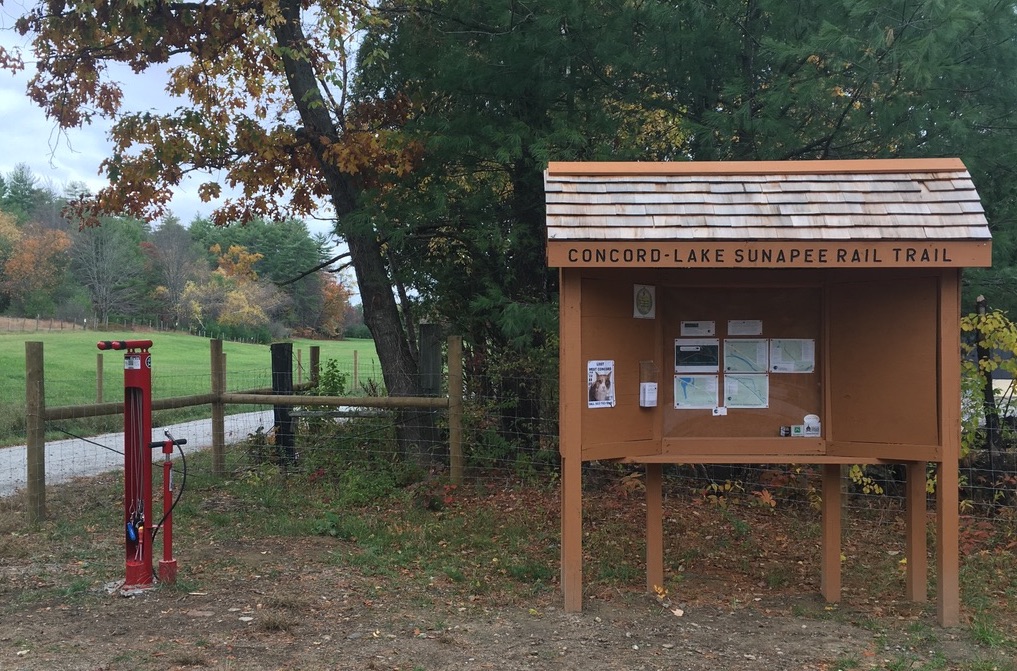
The two-and-a-half-mile long trail is a segment of the Concord-Lake Sunapee Rail Trail (CLSRT). This long-abandoned old rail line will someday be an uninterrupted upgraded rail trail linking Concord and Lake Sunapee. For now, it’s a disjointed thing, with a little piece open for use in Warner, another in Bradford, and now another in Concord.
I was there on an overcast, comfortably cool day. I had the parking lot to myself at the trailhead, at 25 Fisherville Road (U.S. 3). I found there an information kiosk and a bike-service stand.
Trailhead in Concord, on U.S. 3.Photos by Ellen Kolb.
The first section of trail had a surface of smooth well-packed stone dust. The trail was flanked by businesses on one side and a wide open field on the other.
Peak color was past, but autumn conditions were pleasant along the trail.
Before long, the trail entered the woods, becoming a little rougher but still wide and well-defined. Most of the more-vividly-colored leaves had dropped. What was left created a glowing golden tunnel. Granite markers recalled the days of the old active line, when C stood for Concord and CJ stood for Claremont Junction.
The trail stayed close to U.S. 3 before veering west to parallel Bog Road. Traffic noise was not intrusive. One dog’s barking certainly was; more about that later. The noisiest moment I had was when I flushed what must have been a grouse concealed in the leaves just off the trail. The bird’s explosive takeoff startled me half out of my wits.
What’s now a formal piece of rail trail has apparently served as a snowmobile trail, or so I conclude based on one well-signed junction. For the most part, though, I was on a path freshly improved for walkers and bikers alike. Runners, too. I was passed by a few who were probably delighted not to have to get their miles in on the nearby roads.
A signed junction along the way.
The trail passes through a residential area, with trees providing some buffer. I had a refreshing five-mile round trip walk. I owe that to amazing work by many volunteers and donors who built up this section. Together, they have created another fine trail in Concord.
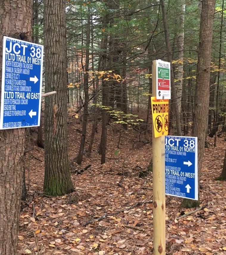
Recent walks and rides: Londonderry, Derry, and Windham. Each town has its own portion of New Hampshire rail trail on the old Manchester-Lawrence rail line. There are gaps, but the segments are being stitched together a bit at a time.
These are paved trails. They’re like boulevards without cars. They’re high-traffic compared with most of their unpaved cousins, but they’re off-road and therefore safer than hoofing it down any local street. I just stay to the right, pass with care when I need to pass, and keep my speed down. (I never have trouble keeping my speed down.)
Londonderry
No sooner was the Londonderry trail extended to Harvey Road in 2019 than an informal parking lot took shape near the trailhead, doubling as an observation point for watching the planes at Manchester’s airport. I love that kind of efficiency. (Update, 2026: since construction of a culvert under Harvey Road for Little Cohas Brook, parking at that trailhead is a problem. Try the trailheads across from North Londonderry Elementary on Sanborn Road or the Park and Ride on NH Route 28 near I-93’s exit 5.)
On my most recent visit on a hot summer day, I was surprised by a gentle fragrance as Little Cohas Brook came into sight. I gave the credit to the blooming water lilies. Loosestrife was in bloom as well: lovely purple color on what I’m told is a highly invasive plant.
Along Little Cohas Brook, Londonderry rail trail. All photos by Ellen Kolb.
Busy as the trail can be, I had no sense of being crowded on my midweek visit. There was room for everyone. I even had a bench to myself for a bit of birdwatching.
Benches are a bonus along rail trails.
I like seeing mile markers that have been restored or re-created. They keep me mindful of a trail’s history.
“L” for Lawrence MA, “M” for Manchester NH.
Four and a half paved miles extend from Harvey Road to the town line at NH Route 28. From the southern end, I could see across the road to a yet-undeveloped stretch of railbed in Derry. Its day will come.
I spent a good afternoon walking on Derry’s trail that links Hood Park with Windham Junction. That’s about 8 miles round trip, with refreshments available from businesses near each end. Parking is available at both ends.
Lest I forget about social distancing, someone painted a reminder.
Nothing but an embankment and a strip of trees separated me from I-93 on the southern part of the trail. Once the trail and highway diverged, the scenery changed to wetlands full of red-winged blackbirds. Proceeding north, I entered residential areas, then passed a ball field, and crossed busy NH Route 102 in the center of town.
Crossing 102 was easier than I expected. Traffic actually stopped for me as I entered the crosswalk. That is not something I take for granted in central business districts, even on a weekend.
My favorite part of the trail paid tribute to poet Robert Frost, who spent a few years teaching at nearby Pinkerton Academy. “The Road Not Taken” had been stenciled on the trail only a day or two before my walk. More artwork has since been added.
Frost’s “The Road Not Taken” is a Derry Rail Trail highlight.
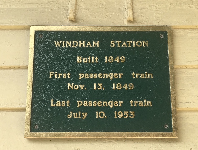
I confess to a special liking for the Windham rail trail. Even on the hottest day, it’s cool and restful.
This Boston and Maine RR caboose is now a Windham Junction landmark.
Windham Junction, with its restored depot and caboose, has a good-sized parking lot. That makes it a good starting point for a ride or walk north into Derry or south into Salem. My recent trip was just to enjoy the Windham trail itself.
Roulston Road crossing (no parking here).
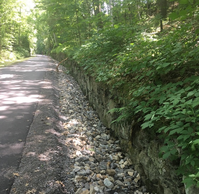
The trail looked practically freshly-pressed. Recent maintenance work has improved the trail’s surface and drainage.
New pavement, new drainage work, trimmed shrubs: welcome to Windham’s rail trail.