The thermometer is topping 90 degrees, and it’s not even July yet. What’s a walker to do? Air conditioning is a wonderful thing, but the trails beckon. I recommend shady ones. Here are a few favorites of mine, with photos I’ve taken along the way.
Odiorne Point State Park, on the Seacoast in Rye (Rt. 1-A). If there’s an onshore breeze, this is heaven on a hot day. Take a walk along the rocky shore, or take one of the paths through the woods. The sharp contrast between adjacent environments is surprising. Bonus: the wild roses are in bloom this time of year. There’s a modest admission fee.
Wild roses at Odiorne Point. All photos by Ellen Kolb.
Mine Falls Park in Nashua is accessible from exits 5E, 5W, and 6 on the Everett Turnpike. It’s a favorite of mine in all seasons. If you only have time for a quick lunchtime walk this summer, try the trail that runs along the mill pond, between Stellos Stadium and Nashua South high school. Bonus: if you have a kayak, you can launch it onto the pond via the ramp near Conway Ice Arena. Keep an eye out for muskrats, herons, eagles, and turtles. Free.
Miles of trails in Mine Falls Park include single track as well as wide paths like this one.
Massabesic Audubon Center is in Auburn off of the Londonderry Turnpike/NH Route 28Bypass, just a few minutes from Manchester. 130 acres, several miles of wooded trails, shoreline on Lake Massabesic. Free admission, but donations are accepted and encouraged.
Lake Massabesic from Battery Point
Madame Sherri Forest, in quiet Chesterfield. Sure, you could hike uphill from here to explore Mt. Wantastiquet. On a hot day, though, a low shady path is better. Parking for this Forest Society property is available on Gulf Road; be careful not to park on nearby private property. Check out the ruins of “Madame Sherri’s castle,” visit Indian Pond, and then stroll down Gulf Road at your leisure. Free.
Madame Sherri’s castle
Pawtuckaway State Park, Nottingham (take exit 5 from NH 101 and follow the signs). This is another year-round treat. Hike the flat shady trails, or pick a hill (one has a fire tower), or enjoy the beach on Pawtuckaway Lake. Bonus: camping and boat rentals. A small admission fee is charged, and on busy weekends and holidays, an advance reservation for parking is essential. See the state park website for more information. This is one of my favorite state parks just because of its sheer variety of recreational opportunities
Cooling off on Pawtuckaway Lake
Do you have any favorite summer spots for a dayhike? Drop a comment below!
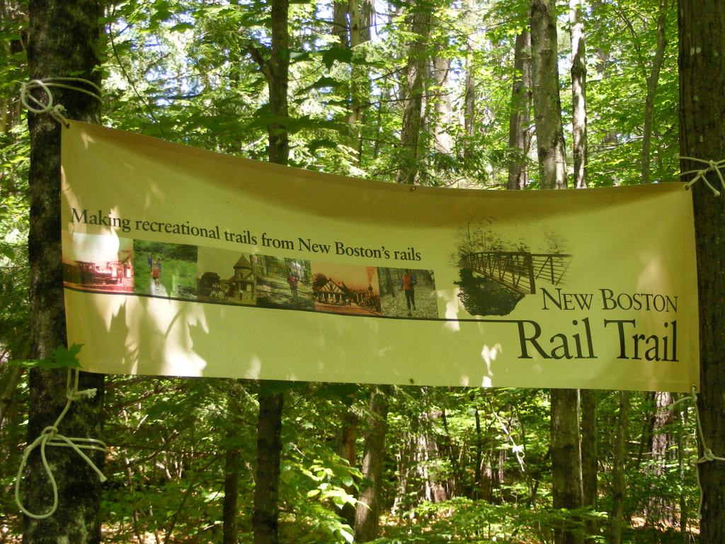
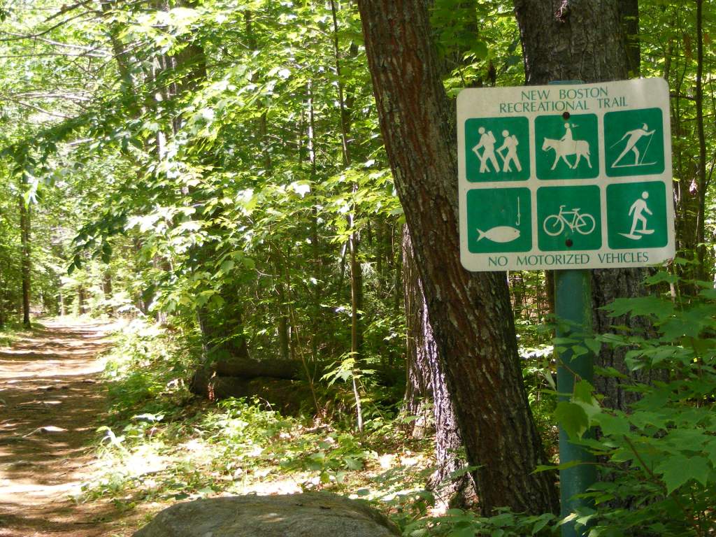
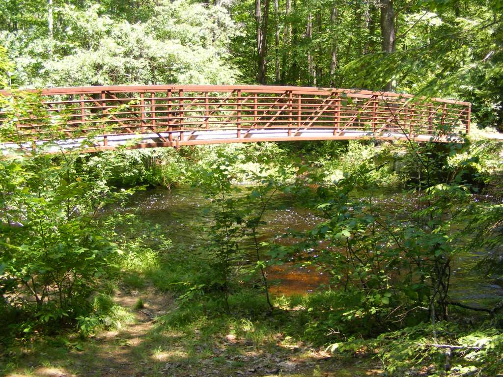
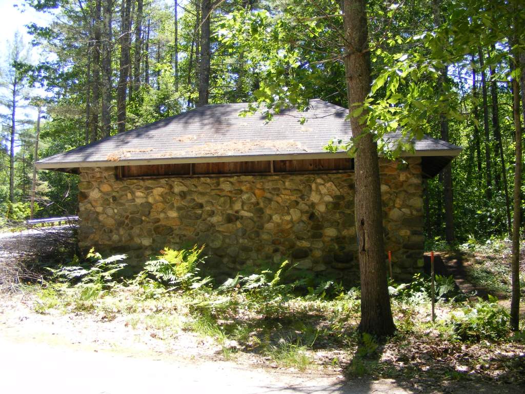
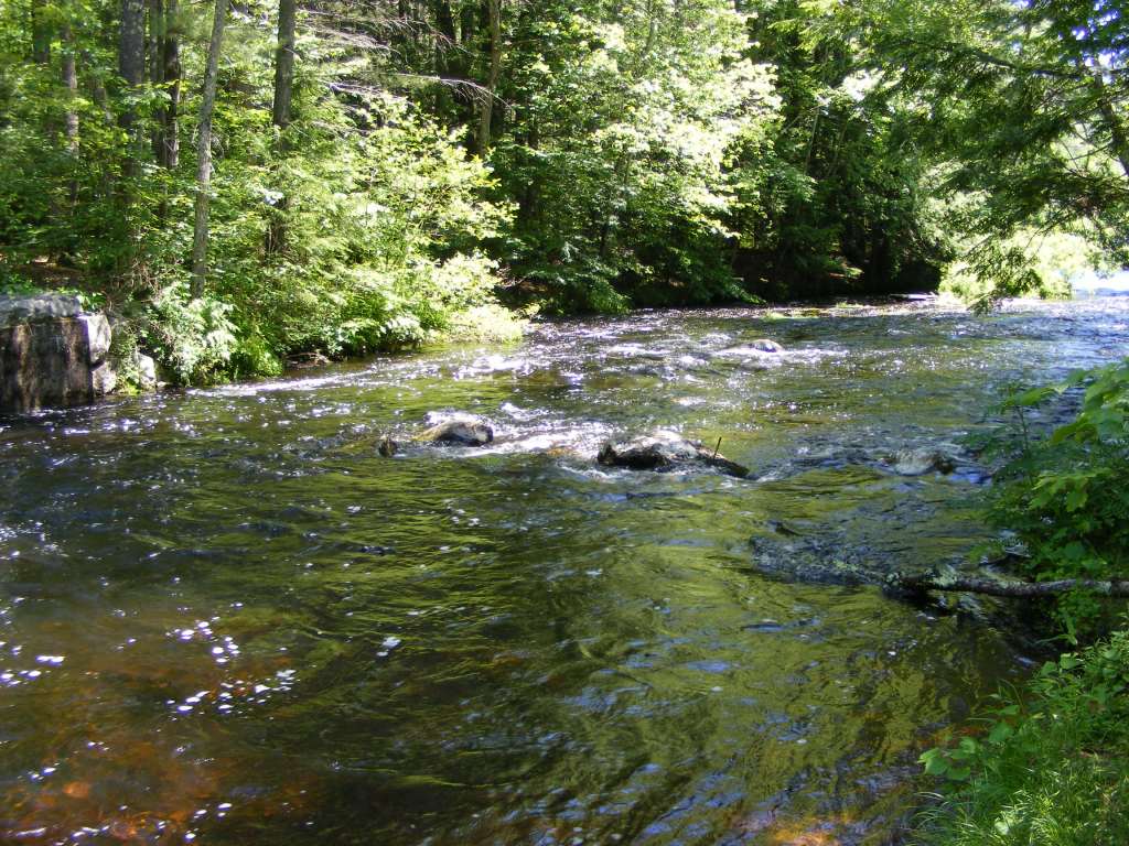
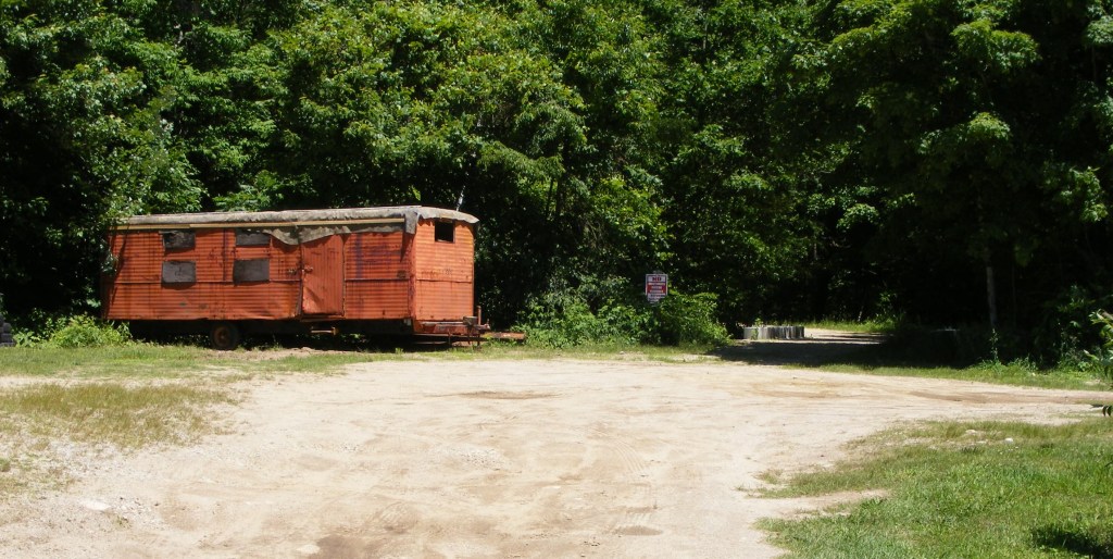
I love this banner at the trailhead.Piscataquog River, South Branch; bridge at entrance to 4-H FairgroundsThe trail’s OK for bikes that can handle rough ground with lots of tree roots.No motorized traffic here. Fishing’s OK.New Boston Rail Trail: footbridge over Middle Branch of the Piscataquog River, just off Gregg Mill Road.Lang Station, a small building on the trail at Gregg Mill Road; once an actual stop for trains on the Boston & Maine line.Middle Branch runs fairly high in late spring; I saw kayakers on South Branch today.New Boston town common. The rail trail’s trailhead at the 4-H fairgrounds is only a 10-minute walk north of here, off Rt. 13.Don’t be put off by this beat-up trailer on the fairgrounds; the trailhead is here, with adjacent parking.
Update: since this 2013 post, the New Boston Rail Trail has been extended north to the Goffstown line, with a small parking area at the northern terminus on Riverside Drive (off Parker Road). The trail enjoys strong support from town officials and enthusiastic volunteers. It’s well-maintained, closed to motorized traffic, and easily accessible from New Hampshire’s largest cities.Web links below are up to date as of February 2026.
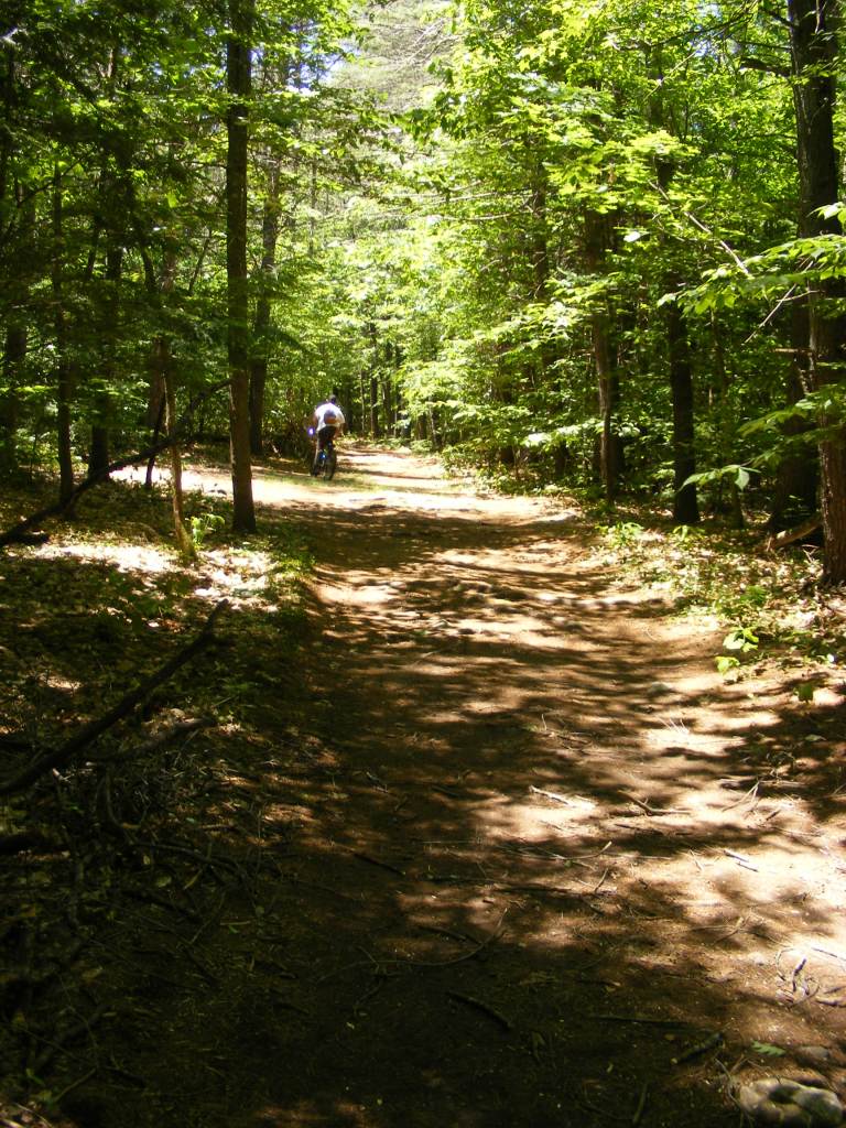
The New Boston rail trail follows the Piscataquog River and NH Route 13 through town. The river’s gentle sounds and a canopy of trees over the trail muffle sounds from the highway.
This is actually a remnant of the same rail line that gave rise to the Goffstown and Piscataquog (Manchester, NH) trails. This leafy and cool trail is perfect on a summer day, as long as you carry bug repellent. This is a dirt trail, which means it’s occasionally muddy, and it’s open to horses, which means watch your step.
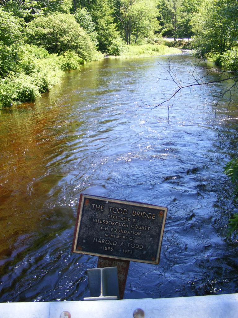
My favorite feature of the trail is the footbridge over the Middle Branch of the Piscataquog River. It’s a simple but lovely piece of work.
Parking is available at several locations off NH Route 13 north of New Boston’s town center: the 4-H Fairgrounds (Hilldale Lane), Lang Station (Gregg Mill Road), and Parker Road. See the rail trail website for further information.
With no formal vacation in sight, I can improvise. Just give me 24 hours and a car. Good hiking territory is essential, but so is a pleasant drive. Earlier this week, that meant heading up I-93 to Coos County.
Third Connecticut Lake area
Lone hiker, five miles from Canada
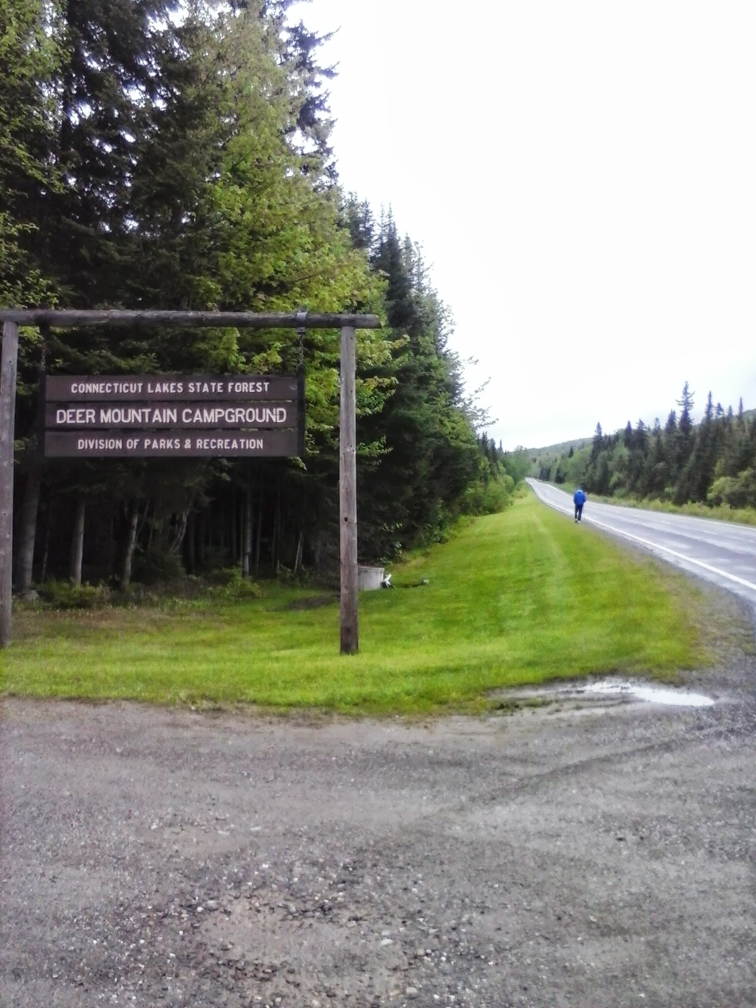
Site 28 at Deer Mountain State Park
This trip was inspired by a planned work project on the Cohos Trail, cutting a spur to the summit of Deer Mountain in the town of Pittsburg near the Canadian border. Unfavorable weather forced postponement of the trail work, leaving me free to wander familiar trails alone for a few hours. Very quiet overcast morning: no logging in the area this week, only two campsites occupied at Deer Mountain State Park, only one other hiker in sight. No hills on this trip, given my limited time in the area. US route 3 was nearly deserted. Snowmobile trail #5, on which the Cohos Trail piggybacks in this area, had a few mud puddles, but nothing dramatic. I enjoyed miles of walking the highway and the trail.
When I hiked through this area on a backpacking trip in ’09, the segment of trail now shared with the snowmobile trail was not yet on line. I was on pavement in 90 degree weather from Happy Corner to the Canadian border. I loved that trip, but I can tell you that cool drizzle is fine, too.
Stark
OK, I’m cheating here: I didn’t hike in Stark. I broke up the long drive to Pittsburg by stopping for a night at the Stark Village Inn, owned and operated by a member of the Cohos Trail Association board. The inn was homey and affordable. Nancy, the owner, is the soul of hospitality. She knows the trails in the area, and she’s been known to provide limited shuttle service.
View from Stark Village Inn
If I did decide to hike in Stark, I’d probably head up the Nash Stream Road from NH Route 110. Or maybe I’d head south of 110 toward the Kilkenny Ridge trail. Maybe I’d just walk along 110 and enjoy the sound and sight of the Upper Ammonoosuc River.
Colebrook and Columbia
I like Colebrook. It’s bustling, but it’s a tiny town nonetheless. Here, US 3 meets NH Route 26, which leads to Dixville Notch. Another day, I would have gone to the Notch for a short but lung-busting climb to Table Rock. No time on this trip, though. “Later,” I promised silently as I drove past NH 26, not weakening even when I drove past Le Rendez-Vous. That’s a bakery with amazing stuff, including irresistible chocolate croissants. (Update: Alas, since the publication of this post, Le Rendez-Vous has closed down.)
On NH 145 northeast of the center of town – a fun road, by the way – is Beaver Brook wayside area. It’s a feast for the eyes. There are short trails near the falls, especially nice in the summer when the spray from the falls is soothing on hot days. Pack a picnic.
Beaver Brook wayside area, Colebrook NH
I stopped in Columbia on my way home, just south of Colebrook, at the Shrine of Our Lady of Grace. It didn’t take long to walk the grounds. There are days when the shrine is thronged with pilgrims & tourists. I was there a few years ago during the annual Blessing of the Motorcycles, with hundreds of cheerful bilingual bikers. This week, I was alone. Different feeling altogether. For me, it was a place of prayer.
(Update: the Shrine closed in 2014. Part of the property has become the Tillotson Center, a community heritage, visual, and performing arts center.)
Shrine of Our Lady of Grace
The ride back to southern New Hampshire on US 3 went past some of my favorite hiking spots, including Weeks State Park. The pesky clock was ticking, though, and I kept driving. Once I was halfway home, the sun came out and the temperature went up 15 degrees. If I couldn’t have that weather for hiking, it was at least nice to have it for driving. No complaints, though. Those were twenty-four good hours.
A view from Boston Common. All photos by Ellen Kolb.
I try to manage my infrequent trips to Boston so as to catch good weather. Yesterday was Memorial Day, perfectly clear, with a high temp of around 70. Perhaps ten days a year have conditions so perfect for pounding the pavement as a camera-toting tourist.
“That’s not a trail,” you’re sniffing. My reply: “Is, too.” As someone who Will Not Drive In Boston, I’m an urban walker, and Huntington Ave. just happened to be my trail of choice to kick off the sightseeing. I knew the T, Boston’s extensive mass transit system, would back me up if my energy flagged.
Yesterday’s trip was inspired by two things, in the wake of the atrocious bombings at the Boston Marathon last month. First, I wanted to make my own quiet, private statement that no terrorist is going to bomb me into being scared of the city. Second, I wanted to take advantage of the free admission offered by the Museum of Fine Arts during the holiday weekend. I gladly plunked down $22 for a Boston Express bus ride from southern New Hampshire to Boston’s South Station.
When I got to the MFA, I found a very long line of people waiting to get in. That’s a great testament to the Museum and to the city’s low fear-factor. I wasn’t in town to wait in line, though, so I moved on. Boston has lots to see, even when plan A doesn’t work.
Memorial Day flags on Boston Common.
For Memorial Day, Boston honored Massachusetts’ war dead with a simple but moving display of over 30,000 American flags on Boston Common. That’s one flag for each Massachusetts resident who has died in military service to the nation, from the Revolution onward.
Boston Common was interesting, as always. Buskers, tourists with cameras & kids, clusters of teens with the day off from school, and locals going about their business all plied the paths, watched over by mounted police. The Freedom Trail starts on the Common, unless you consider the start to be in Charlestown, at the other end of the trail. The Massachusetts State House is across the street from one corner of the Common. Augustus Saint-Gaudens’ magnificent sculpture of the 54th Massachusetts Regiment faces the State House. Conveniences on the Common include a playground, food vendors, and the Park Street T station. Squirrels and birds abound, and they’re all fat little beggars, completely habituated to throngs of people. (That does not mean “tame.”)
Swan boat, Boston Public Garden
I had to see the Public Garden, home of the swan boats, just west of the Common. I last rode in one of the swan boats back in the mid-1960s on a family trip. Yesterday, for a mere $3 (one of Boston’s great bargains), I couldn’t resist another ride. The oversized paddle boats – for that’s what the swan boats are – were piloted by sturdy young people, so our short trip around the pond wasn’t marred by the sound of half a dozen internal combustion engines putt-putting through the water.
Boston is full of museums, and the Museum of Fine Arts is high on my list of favorites. As I mentioned, though, the line outside the MFA yesterday was too much for me. A walk along a promenade on the east side of the MFA building led me to the Fenway (that’s a street, not a building; Fenway Park is actually a few blocks away). I crossed a pedestrian bridge to the Back Bay Fens, part of the city’s “Emerald Necklace” of parks. I would have missed it altogether if I had been in the museum instead.
War memorial, Back Bay Fens, Boston
That park included a war memorial that was getting far less attention on this Memorial Day than the temporary one on the Common. It’s a striking monument to Massachusetts soldiers and sailors who died in World War II, Korea, and Vietnam.
Nearby in the Fens was the Kelleher Rose Garden, a little fenced-in nook that I’d have overlooked if there hadn’t been a sign. I found an astounding variety of roses, only weeks away from what I’m sure will be glorious bloom. A community garden was nearby, where spring blossoms abounded.
I found Boylston Street and Back Bay. Any other day I might have stopped at Prudential Center for some window-shopping. Instead, my destination was Copley Square.
In Copley Square, mementos from people all around the world paid tribute to the victims of the Marathon bombing.
There, mere blocks from the Marathon bombings, a makeshift memorial to the victims, survivors, and the city itself left me stunned. Countless handwritten messages of sorrow and encouragement covered children’s drawings, baseball caps, banners, and items of clothing. There was a large pile of stuffed animals, sent from who knows how many places. The site has become such a popular place for both tourists and area residents that volunteers are on site as guides for all who come to pay their respects.
Nearby, the sites where the bombs went off have been cleaned up and are in the process of reconstruction. I liked seeing that. I walked the rest of the way to South Station feeling good about the city.
I reflected as I rode the bus back to New Hampshire that while my planned MFA visit hadn’t worked out, all the discoveries I hadn’t planned for had made the day extraordinary. Flags, roses, a heap of stuffed animals, a ten-minute cruise in the Public Garden’s pond, the Back Bay Fens: sometimes, unexpected things make for the best walks.
“Altissimo” rose in the Kelleher Rose Garden
If you enjoyed this post, please consider supporting Granite State Walker at Buy Me a Coffee. Thank you.
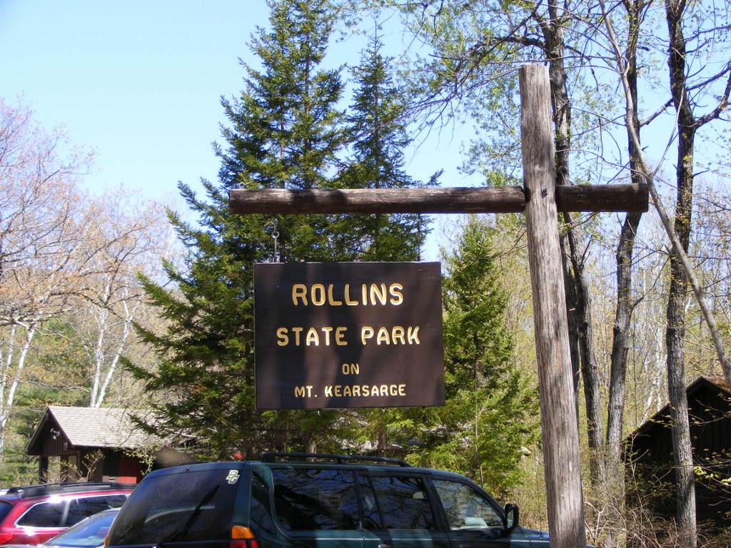
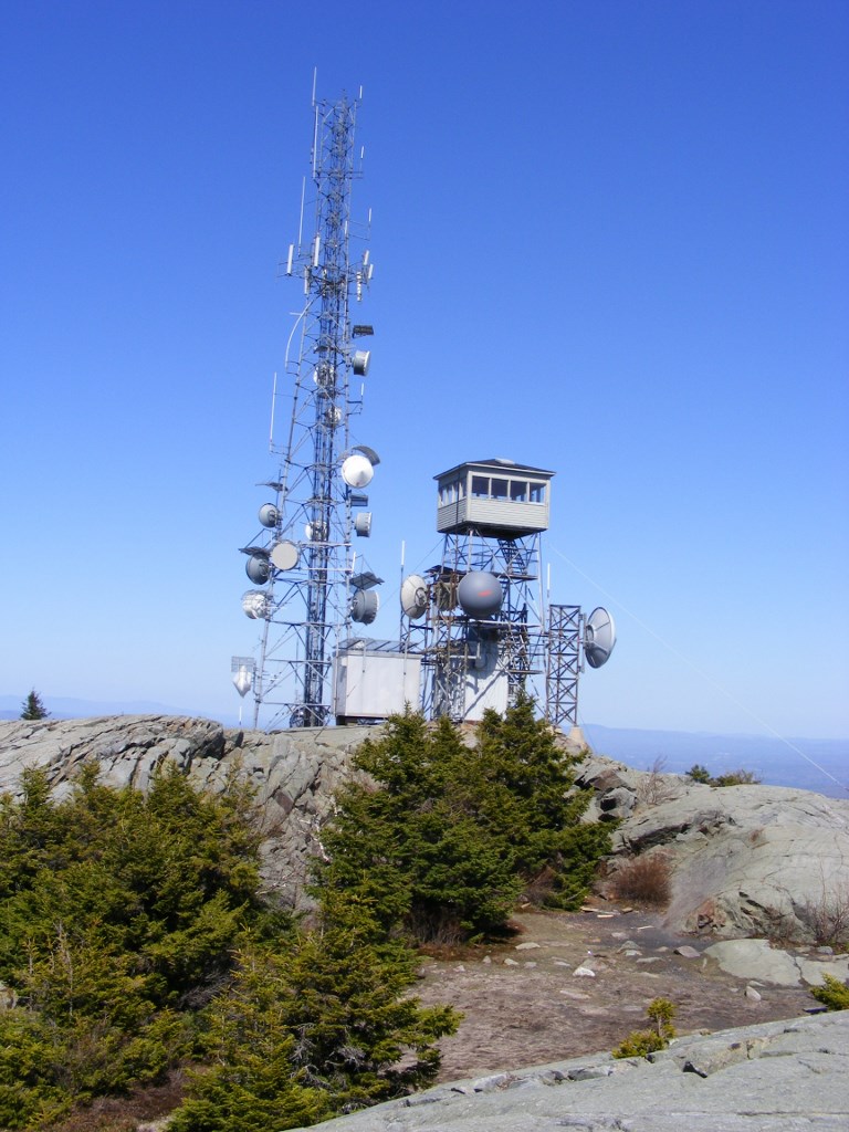
The auto road up Mt. Kearsarge in Rollins State Park in Warner, New Hampshire, is gated shut and will probably stay that way until Memorial Day approaches. See the Rollins page on the New Hampshire State Parks web site for updated information. That doesn’t block pedestrians and bicyclists, though. If you’re ready for a three-and-a-half-mile uphill walk on a paved road, followed by a half-mile hike on a ledgy trail (total elevation gain from park gate: roughly 1700′), this is the place. Download a map from the State Parks website and enjoy the trip.
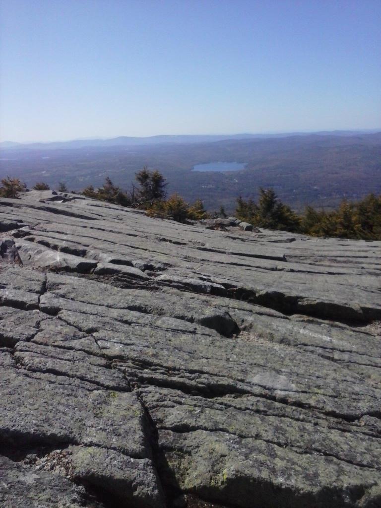
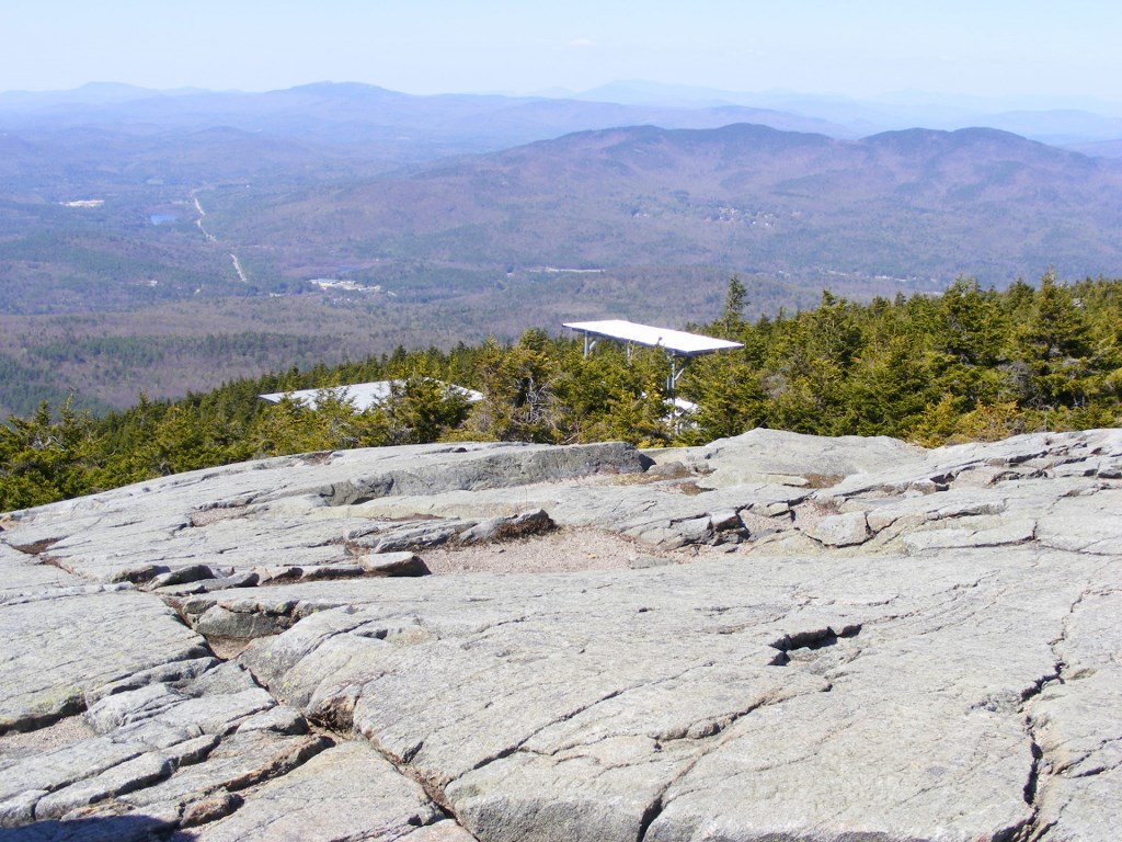
Yesterday, armed with plenty of sunscreen, I took the walk and reaped the views. For a plodder like me, it was two hours each way, plus time on the summit. Time well spent, indeed.
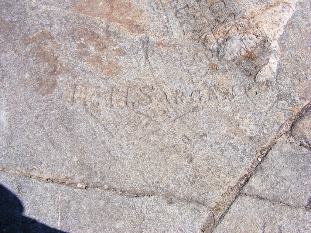
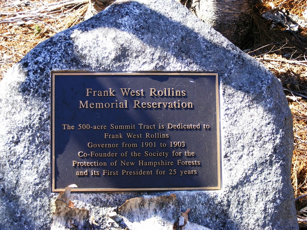
Rollins State Parklooking west from Summitview of Mt. Cardigan & Ragged MountainMt. Kearsarge, Winslow & Rollins State Parks. Probably the prizewinner for number of communication dishes on a NH fire tower.A name & crossed swords carved into the granite ledgePlaque honoring Gov. Rollins
I didn’t pack bug repellent, and I should have. Lesson learned.
While there were eight other cars parked outside the gate when I arrived, I encountered other people on the road only occasionally. I was passed by an ambitious bicyclist, twice. At one of the pullouts about halfway up the road, I stopped to watch some turkey vultures gliding aloft. They’re quite beautiful when in flight, however homely they are close up. The only sounds along the way were the breeze through the trees and a rustle of leaves from some nearby critter. I haven’t been anyplace so peaceful since my last trip to Second Connecticut Lake.
A few details: there was a pit toilet along the auto road not far from the park gate, which is always good to know before setting off for a few hours of walking. There’s an admission fee to the park ($4, subject to change), and when the park gate is closed in the off-season, there’s an iron ranger (donation box) where you can place your fee on an honor-system basis. At the upper end of the auto road, if the last half-mile hike is not to your liking, there’s a parking lot and picnic area with views to enjoy, though not the panorama seen from the summit.
Note: This Mt. Kearsarge is not to be confused with a remote peak of the same name in northern New Hampshire.
Getting to Rollins State Park: Take I-89 to exit 8; follow signs to NH 103 toward Warner. In town, turn onto Kearsarge Mountain Road; look for brown signs pointing to Rollins State Park. After several miles, the town road ends at the Rollins gate.
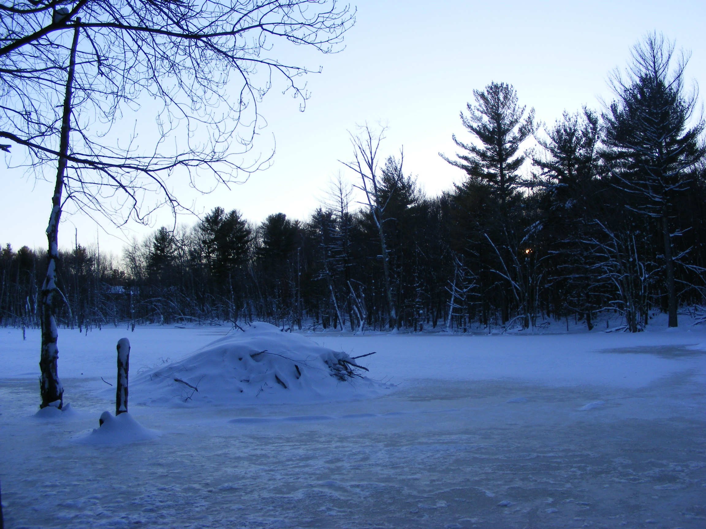
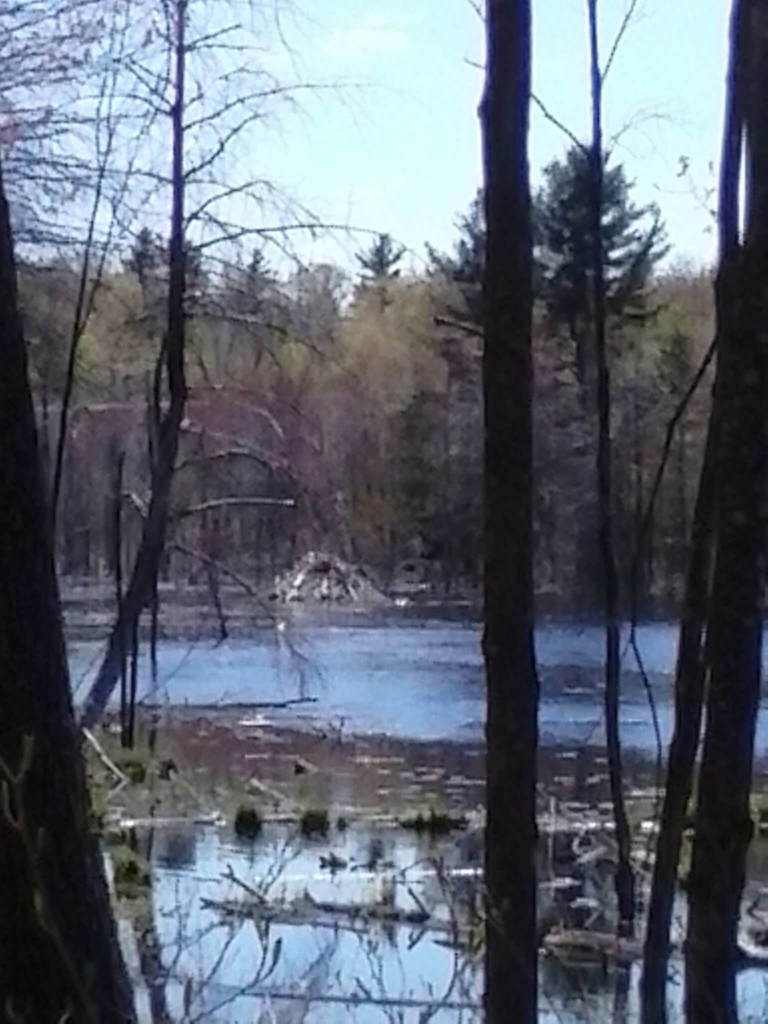
After a walk through Horse Hill Nature Preserve in Merrimack, New Hampshire, last December, I posted this photo of a snow-covered beaver lodge. Nothing dramatic. That was winter…
…and now, it’s spring. Today, I smiled at the sight of the same lodge, this time in spring sunshine.
A few moments later, as I looked across the pond, I caught sight of a MUCH bigger lodge, which I do not recall seeing before. I think the older lodge must now be the servants’ quarters. Amazing what these creatures can build.