My polling place is at a nearby school, adjacent to the Grater Woods conservation area. I was scheduled to work on Election Day as a ballot clerk. I had a long wait to vote, then a short time before my shift began; what to do?
Go to the Grater Woods trails, of course.
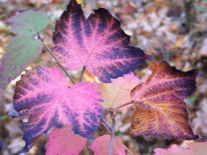
Grater Woods, Merrimack NH.
The trails were nearly deserted. The day was chilly, breezy, and sunny. I lingered for a few minutes at a little pond that’s usually a busy spot. This day, it was all mine.
I was ten minutes away from a polling station where the line of voters wrapped around the building, and I felt like I was in another world. A mental reset: that’s the power of a short walk in the woods, even on Election Day.
I needed a walk with no cars in sight. I headed to Mine Falls Park in Nashua. I found leaves over patchy ice over mud: not my favorite trail surface, but that’s what the end of October is dishing up in my area.
Mine Falls Park, Nashua, NH: late afternoon, end of October. Ellen Kolb photo.
A scant inch of snow fell yesterday along with the leaves. Everything froze overnight, and then the sun came up and promptly warmed things up to about forty degrees. That left me with the layered trail. It wasn’t too bad, and it was certainly better than pavement. The bridges over canal and river were still a bit slippery from the snow.
The park was quiet. Weekends are usually busier. Even adjacent Lincoln Park, where I left my car, was nearly empty. No complaints. I was a bit out of sorts, and solitude suited me.
I usually see mallards in the canal. This day, I saw them in the Nashua River instead. About three dozen were together midstream. The river was sluggish, and the ducks paddled upstream effortlessly. That left the cove for about 20 Canada geese, most of them napping in the late afternoon.
I needed my sunglasses as I returned to my car, with the sun low in the western sky. That reminded me that I was walking during the last day of Daylight Savings Time. November will bring the sense of dislocation I feel every fall until I mentally reconcile what the clock says with what the sun does.
Update, 2026: Since this 2020 post, the CLSRT has been extended in Concord, improved in Warner, and begun in Newbury. The segments are slowly coming together. Best ways to get updates are on the CLSRT website and Facebook page.
Some of my favorite short after-work hikes have been in Concord, New Hampshire. The trails on Oak Hill and in Winant Park stand out. Now there’s a new trail – new to me, anyway – on the north side of town, where I recently walked for a fine hour and a half.
The two-and-a-half-mile long trail is a segment of the Concord-Lake Sunapee Rail Trail (CLSRT). This long-abandoned old rail line will someday be an uninterrupted upgraded rail trail linking Concord and Lake Sunapee. For now, it’s a disjointed thing, with a little piece open for use in Warner, another in Bradford, and now another in Concord.
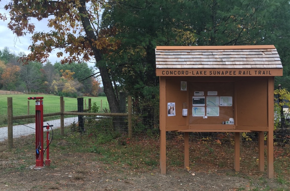
I was there on an overcast, comfortably cool day. I had the parking lot to myself at the trailhead, at 25 Fisherville Road (U.S. 3). I found there an information kiosk and a bike-service stand.
Trailhead in Concord, on U.S. 3.Photos by Ellen Kolb.
The first section of trail had a surface of smooth well-packed stone dust. The trail was flanked by businesses on one side and a wide open field on the other.
Peak color was past, but autumn conditions were pleasant along the trail.
Before long, the trail entered the woods, becoming a little rougher but still wide and well-defined. Most of the more-vividly-colored leaves had dropped. What was left created a glowing golden tunnel. Granite markers recalled the days of the old active line, when C stood for Concord and CJ stood for Claremont Junction.
The trail stayed close to U.S. 3 before veering west to parallel Bog Road. Traffic noise was not intrusive. One dog’s barking certainly was; more about that later. The noisiest moment I had was when I flushed what must have been a grouse concealed in the leaves just off the trail. The bird’s explosive takeoff startled me half out of my wits.
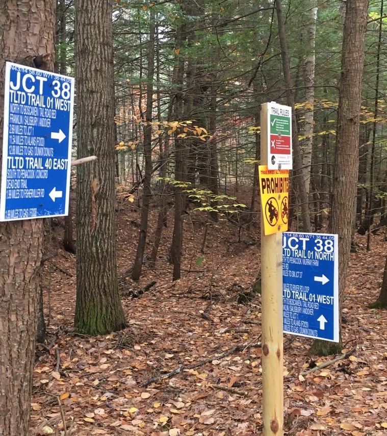
What’s now a formal piece of rail trail has apparently served as a snowmobile trail, or so I conclude based on one well-signed junction. For the most part, though, I was on a path freshly improved for walkers and bikers alike. Runners, too. I was passed by a few who were probably delighted not to have to get their miles in on the nearby roads.
A signed junction along the way.
The trail passes through a residential area, with trees providing some buffer. I had a refreshing five-mile round trip walk. I owe that to amazing work by many volunteers and donors who built up this section. Together, they have created another fine trail in Concord.
Four years, folks. That’s how long it’s been since I plunged into the Forest Society’s Forest Reservation Challenge. Visit 33 of the Society’s New Hampshire properties & get a patch, they said. Piece of cake, I said.
It took me four years to consume that particular piece of cake, I just got my patch.
The Granite State Walker meets a challenge.
A few favorites
The project sent me to easy hikes and challenging ones, wetlands and high granite ledges, near home and darn near Canada. A few of the properties made deeper impressions than others.
Christine Lake, Kauffmann Forest, Stark NH
Kauffmann Forest, Stark. Christine Lake with its view of Victor Head and the Percy Peaks is a worthy destination in itself.
Dame Forest, Durham. When my daughter was a UNH student, I didn’t know this beautiful wetlands jewel was only a few miles away from campus. A long easy trail leads to Great Bay, and shorter trails are available. I had the place to myself for an unhurried visit when I was there a couple of years ago. I’m told that since COVID, it has become much more popular. I recommend a midweek visit.
Morse Preserve, Alton, with the summit of Pine Mountain. After seeing the wonderful view of Lake Winnipesaukee from there, and sharing the trail with only three other people, I may never visit Mount Major again.
Moose Mountains Reservation, Middleton/Brookfield. The view from Phoebe’s Nable turned my brown-bag lunch into a special event.
That’s not to mention the lime kilns, and the roads with whimsical names like Faraway and Local Ox Team, and autumn on Silver Mountain. Then there are a few spots suffering these days from too-much-love syndrome, and I’ll let you figure those out for yourself.
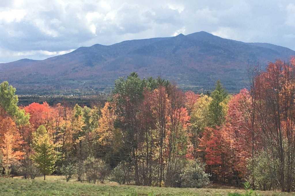
Autumn on Silver Mountain, Lempster NH
How I did it
Pre-Covid, I had a job that sent me all over the state for various projects. I fit in Forest Society reservations where I could: a stop in Bethlehem on the way home from business in Littleton, a trail in Sandwich on my way to a presentation in Ossipee. A couple of times, I took one-day road trips with two or three reservations on the itinerary.
Bretzfelder Park, a Forest Society property in Bethlehem NH
The Kingsbury-Chippewa property in Haverhill was particularly elusive. I finally got there as my husband and I returned from a weekend upstate, determined to avoid I-93. I said, “There’s this Forest Society reservation over in Haverhill…” and I may have mentioned something about the patch. Actually I’m sure I did. “Let’s go,” said my traveling companion. And so we did.
As is often the case, the journey – in this case journeys – mattered more than the arrival. The arrival took the form of a little embroidered patch. Every time I look at it, I’ll recall one of those journeys, and I’ll be smiling.
Exploring Forest Society properties
The Forest Society has some excellent resources. Check out the Outdoor Spatial app for a mobile-friendly guide to select reservations. Enjoy the annual 5 Hikes Challenge. Follow the Forest Society’s Facebook page for videos including virtual field trips to various properties.
My husband and I drove to northern New Hampshire for a hastily-planned weekend trip for some hiking and biking, past the peak autumn foliage and the oppressive crowds driving to see it. The cloudy weather got cloudier. Traffic got lighter. When we stopped at a little inn on U.S. 2, we were exactly where we wanted to be.
You can call it “past peak.” I call it just fine.
It was not a weekend for grand vistas or clear night skies. Low clouds were the rule. My favorite lookout spot on the Weeks State Park Auto Road, which usually features a showstopping view of the Presidential Range, featured nothing but a wall of fog.
So instead of looking at things miles away, I spent more time looking at things like the carpet of red maple leaves under my feet. I liked walking for miles in the cool conditions. Segments of the Presidential Rail Trail were ideal.
The only noisy mile of trail was one I shared with ATVs in Gorham when I wanted to get a look at the Androscoggin River from a trail bridge. Once I’d done that, I scooted back west to where the trail was closed to motorized traffic. Once I was on that stretch, I saw a grand total of three other people in five miles of walking.
Androscoggin River, Gorham NH: low in October after a dry summer. Ellen Kolb photo.
At one point during the weekend, the clouds lifted enough to reveal nearby Cherry Mountain, which for once wasn’t just a visual foil to all the other peaks in the area. I was lucky enough to be walking on the Presidential Trail in the Pondicherry area (trailheads on Airport Road in Whitefield and NH Route 115-A in Jefferson) when the sun came out and the view opened up.
When 2020 kicked off, I had never heard of Zoom. Since March, thanks to COVID, I’ve had online meetings on the Zoom platform several times a week. (And still, I’m apt to forget to unmute myself when I’m called upon to speak.) When I’m lucky, as I’ve been this month, I get to Zoom about trails.
My thanks go out to the New Hampshire Rail Trails Coalition board members, who welcomed me to a recent online meeting to talk about our mutual interests. I learned more than I shared!
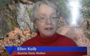
I’m likewise grateful to Jeanine Notter, who welcomed me and former New Hampshire Rep. Lenette Peterson to her “Chattin’ With Jeanine” show on Merrimack Community TV for a half-hour conversation about our favorite places to hike in the Granite State. Even the TV show was a Zoom event, with everyone logging in from home while an MCTV tech whiz put it all together.
Screenshot courtesy Merrimack Community TV/Chattin’ With Jeanine
I love sharing trail stories with fellow Granite State walkers. We learn from each other. If you’re a program host and you’d like to shine a light on southern New Hampshire’s trails, please let me know if I can be part of your conversation.