Autumn afternoon on Pack Monadnock

As a pedestrian, I like to take advantage of the auto road up Pack Monadnock in New Hampshire’s Miller State Park during off-hours, when the gate is closed to auto traffic. Sometimes I’d just rather reach the summit on smooth pavement instead of using the trails in the woods. I recently made the trip as late afternoon was shading into evening.

Miller State Park auto road (Pack Monadnock), late October. Photos by Ellen Kolb.

The road’s uphill grade gave me a bit of a workout, even at my easy pace. I’m discovering that a pair of trekking poles can be helpful to me no matter how smooth the terrain. My poles and I made it to the picnic area at the summit about 35 minutes after leaving the parking lot, covering a bit under a mile and a half of road with 700 feet of elevation gain.

Mount Monadnock seen from Pack Monadnock

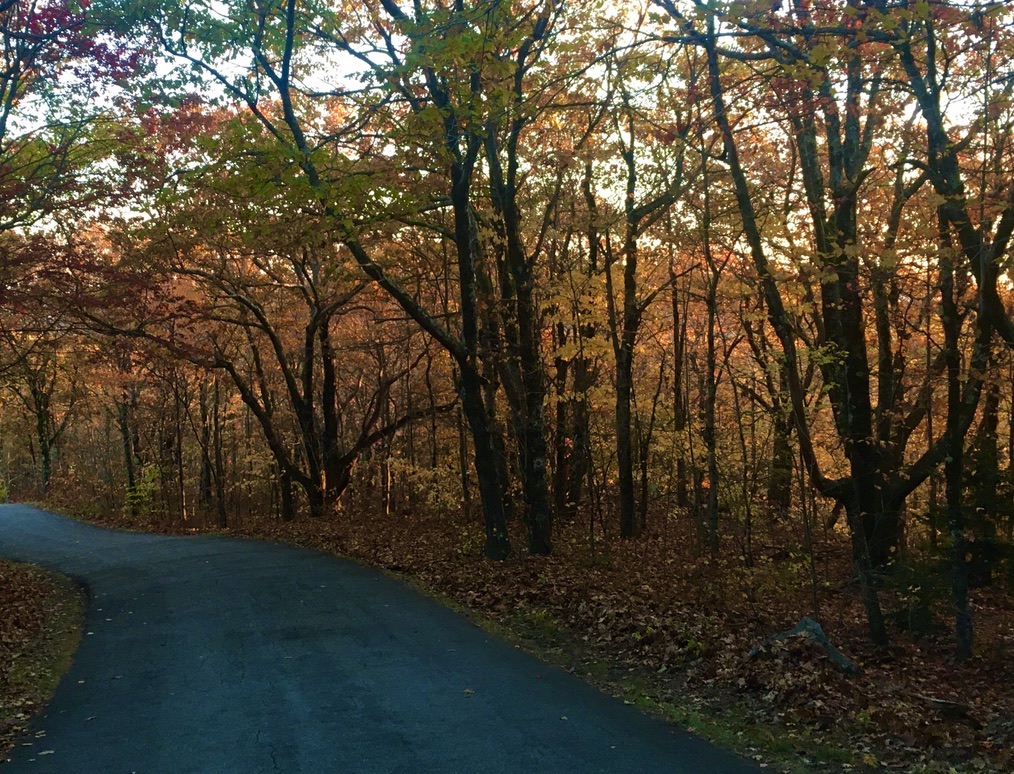
Gold and bronze leaves caught the setting sun and made the woods glow.

The Boston skyline was lost in haze, except for one of the Back Bay skyscrapers situated at just the right angle to reflect the sun’s rays. It was probably the glassy Hancock building, which I know has a different name now – but it will always be the Hancock building to me.

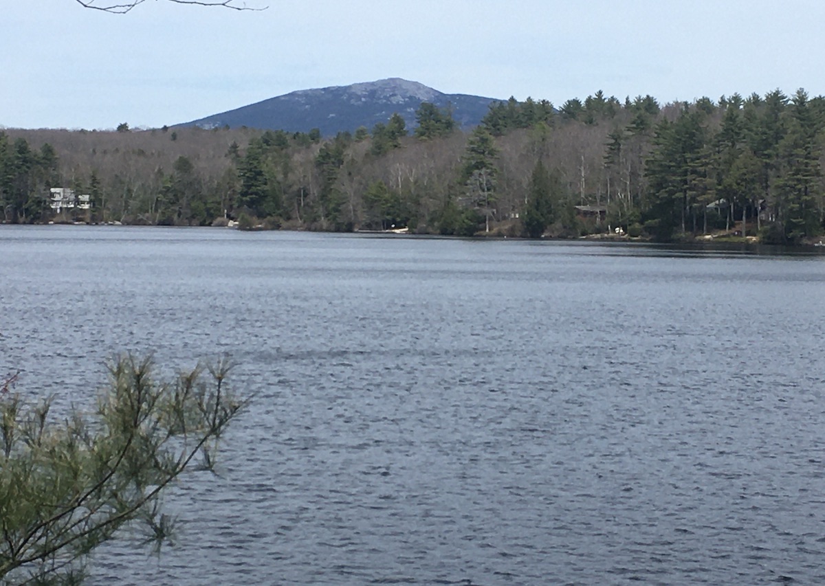
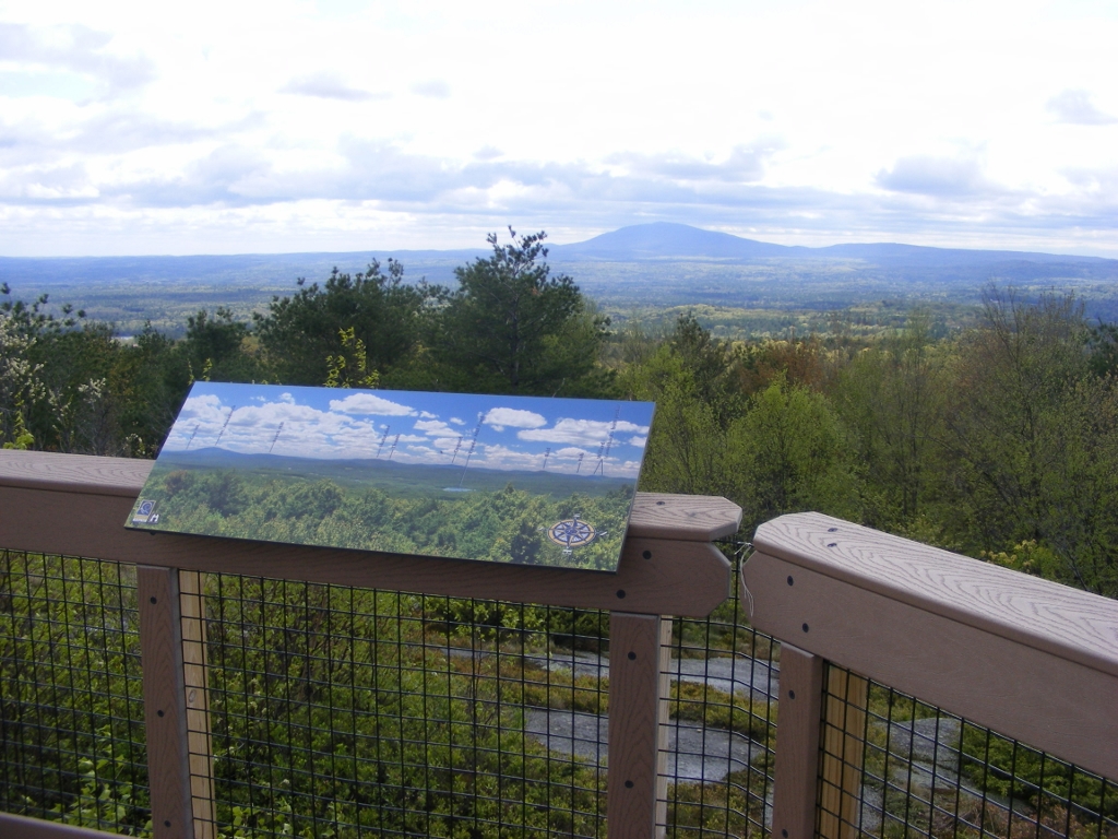
Mount Monadnock – the Grand Monadnock – is only a few miles away. The view of it from the picnic area at the summit of Pack Monadnock is almost clichéd; everyone takes a photo from the same spot. I’m no exception. The colors of the sky vary with the season and the time of day. Sometimes the view is hazy and sometimes it’s crystal clear. However many pictures I’ve taken there, no two are identical.

New Hampshire historical marker number 270, Miller State Park, Pack Monadnock summit

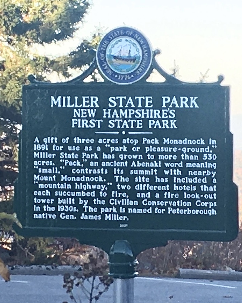
I love finding historical markers on my walks, and there’s a new one atop Pack Monadnock in honor of Miller State Park. Almost all of the New Hampshire markers are placed along state highways, but this one rated a special spot. Route 101 gets you to the park, but you’ll have to drive or hike to the summit to see the marker.

I got to the park too late in the day to join the autumn raptor migration count that takes place on Pack Monadnock daily, sponsored by New Hampshire Audubon and the Harris Center in Hancock. It’s a fascinating event that’s definitely worth checking out if you’re in the area this time of year. Bring the kids!

The park’s $4 admission fee is a bargain. I put my donation in an envelope and dropped it in the iron ranger, which is a donation box visitors can use when there’s no attendant on duty. For visits during the park’s regular hours, I advise checking the New Hampshire State Parks website first; reservations might be advisable on busy days. The park entrance to the auto road is located on NH Route 101 in Peterborough.

Several of the state parks have auto roads to featured vistas, and they each make for a pleasant drive. My favorite way to enjoy those roads, though, is on foot in the early morning or late afternoon, when the gate is closed and there are no cars around. Autumn with its moderate weather is prime time for a visit.

Spring on Cheshire County NH roads and trails

Cheshire County, New Hampshire is best known to outdoors enthusiasts for its most dramatic geological feature, Mount Monadnock. I have nothing against the mountain, except that I can’t seem to get to the summit and back without an injury of one sort or another. That’s not a problem. The Monadnock region offers plenty of options that have nothing to do with hiking uphill.

Rockwood Pond in Fitzwilliam , New Hampshire, with Mount Monadnock in the background.
Seen from the Cheshire Rail Trail in Fitzwilliam: Rockwood Pond with Mount Monadnock nearby. Photos by Ellen Kolb.

As part of the New Hampshire Rail Trails Challenge, I’ve been exploring rail trails all over the state – but I’ve barely touched southwestern New Hampshire, aside from a few miles in the town of Troy. This is the year I’ll get busy out in that direction. I got off to a modest start recently on a short segment of the Cheshire Rail Trail in Fitzwilliam.

What a day! Weather was pleasant. The flying insects were not yet out in force (but alas, the same couldn’t be said for ticks; I came prepared with permethrin-treated clothing). Deciduous trees hadn’t yet leafed out. That left the hemlocks and pines to shade me, and as a bonus, the breeze through their boughs was like music.

Parking along long trails like the Cheshire can be a problem. Not every road crossing has room nearby for cars to pull over. I decided to begin my walk at Rhododendron State Park, a mile away from the trail. No trouble parking there. The park’s signature rhododendrons won’t be in bloom until July, but spring wildflowers abounded in the park’s grove and along its trails.

daffodils and violets, flowers

Spring flowers at Rhododendron State Park

From there – pull out your maps app now – it’s a mile along unpaved Rockwood Road to the the intersection with rail trail along Rockwood Pond. Rhododendron Road provides a shorter but less interesting link.

The scenic highlight of the day was the view of Monadnock seen from the shores of Rockwood Pond. Pine trees tried to obscure the view, but I found my way through them.

From the pond, I headed south. The trail was unpaved, wide, and shaded. It’s a snowmobile trail when there’s snow cover, but motorized vehicles are supposed to stay off the rest of the year. Wide ruts in some soft sections of the trail told me that an ATV driver or two had ignored the restriction. Aside from that, the trail was in good condition between the pond and state road 119. South of there, the trail was full of roots and rocks, looking like a typical New Hampshire woods walk. I got as far as Royalston Road before turning around.

Midweek on Old Toll Road, Mount Monadnock

When the Forest Society announced its challenge last year, offering a patch for anyone visiting 33 specified Forest Society properties, I jumped on board immediately. Since then, I’ve had fun discovering some new trails. Others, like those on Mount Monadnock, are already familiar. The Forest Society has a reservation on the mountain that blends seamlessly with Monadnock State Park.

On my most recent visit to Monadnock, my indifferent level of fitness ruled out a summit hike. I settled for an easy walk to the Halfway House clearing via the Old Toll Road, featuring a wonderful view to the south with Gap Mountain foremost.

Gap from Halfway House_Monadnock
The view south from Mt. Monadnock’s Halfway House clearing. Photos by Ellen Kolb.

The Old Toll Road begins at the well-marked state park parking lot on NH Route 124 on the south side of the mountain. (Post-Covid update: the state park now charges a $15 parking fee, which covers a driver and up to five passengers. Reservations can be made online. See the Monadnock State Park web page for current information.)

The Old Toll Road has a packed crushed-gravel surface, well-drained, and wide as a boulevard. It’s an uphill path for sure, but easy going until it ends at the White Arrow Trail. I walked up the Road, picked up White Arrow for a short distance, and soon I reached my destination: the Halfway House clearing, named for an inn that once stood there.

Old Toll Road, Spring
Old Toll Road on Mount Monadnock, mid-spring

I looked up to the summit and saw no hikers. That’s unusual. Normally, the summit seen from that distance looks like an anthill.

DSCF1650 - Copy
A peek at Monadnock’s summit from the Halfway House clearing

A cool breeze kept the bugs away on the overcast day. I knew I was likely to be rained on any minute. I didn’t care. A midday midweek visit to New Hampshire’s most-climbed mountain rewarded me with solitude, and solitude on Monadnock is meant to be savored.

From Monadnock: my favorite bad photo

When my daughter gave me a digital camera a few years ago and consigned my little plastic 35mm Polaroid to the junk drawer, I soon discovered my favorite aspect of digital cameras: the delete button. No more paying to develop film with 24 exposures but only one picture worth keeping.

Even the bad pictures can bring back good memories, though. This is one of my favorites, taken at Bald Rock on Mount Monadnock.

 boulder with inscription on a forested mountainside
Bald Rock, Monadnock State Park, NH. Photo by Ellen Kolb.

Overexposed, lousy lighting, hard to see the intriguing and unexplained inscription on the rock: I didn’t get much right with this shot, except capture a special spot on what is so far the best day I’ve ever spent on Monadnock.

This was the day I realized that I could go to the mountain and not feel like a failure for skipping the summit. I sat by this rock and ate my lunch in regal solitude. I felt absolutely no need to join the crowd I saw on the peak above me. With a breeze and a view and a PB&J, I had everything I needed.

Trips to Monadnock don’t always work out that way for me. Last time I went, I kept moving up the Pumpelly trail despite a sore knee. The pain finally got so bad I had to turn around, hobbling slowly downhill, not getting to my car until well after sundown. On another day, a beautiful December afternoon, I dawdled on the summit and figured I’d make up some time on the descent. Bad move. I lost my footing, fell down hard, and slid on my back headfirst, certain that I was going to crack my skull on a rock. Instead, my backpack took the hit, which was more luck than I deserved.

I’ve had good days to offset those misadventures. The day at Bald Rock beats them all.


A New Year’s Day visit to Mount Monadnock

I decided to bring in 2014 by heading to Jaffrey, New Hampshire and Mount Monadnock for a First Day Hike sponsored by the good folks at Monadnock State Park. Two routes were offered. I chose a nature hike along the low and flat Parker Trail, accompanied by guides from the park and from the Forest Society.

Yours truly celebrating New Year's Day on Mt. Monadnock
Celebrating New Year’s Day on Mt. Monadnock

I left my snowshoes in the car and strapped traction aids to my boots when I saw how icy the trails were. The temperature was about 15º, and I can tell you now what happens when you carry granola bars in your backpack on a 15º day: the bars freeze solid. (Next time, I’ll carry them in an inside coat pocket.) Lots of sunshine, though.

We were led by Meredith and Brenda of the park staff, along with a specialist in land conservation from the Forest Society. I soaked as much as I could as they talked about forest management, wildlife habitat, and the history of the mountain. We walked at a very leisurely pace along the quiet Parker Trail. Half the fun was watching the kids in our group. A few of them appeared to be veterans of the trails. Others were wide-eyed and full of questions, walking a little unsteadily as they adjusted to having microspikes on their boots.

When I arrived at the headquarters entrance, the main parking lot was full and I had to proceed to the overflow lot. When I met Sue, the new park director, I asked her about that. “Oh, yes. We’re open year-round. Even on days like this, we get between 200 and 400 visitors.”

This is the third year that First Day Hikes have been held at New Hampshire state parks. I’ll look forward to future events.

A path to take another day: Lost Farm trail.

Gregg Trail, Greenfield NH: Wheelchair-Friendly, Good Views for All

Update, 2026: the former Crotched Mountain Rehabilitation Center is now the Crotched Mountain School. The Gregg Trail is still maintained, with a parking area and map kiosk at the trailhead.

The Crotched Mountain Rehabilitation Center in Greenfield, New Hampshire features two trails on its property that are designed to be accessible for all, including people whose mobility is limited. One of the trails is a short loop around a wetland. I was there today for the longer trail: the Gregg Trail, just under a mile long, leading to a knoll with a view towards Mt. Monadnock. Other trails, rougher and more traditional, continue from there to the several summits of Crotched Mountain.

Gregg Trail is wide, with an average 5% grade. Bring the whole family and take your time along the way. There are blueberry bushes all over the place, which of course did me no good in early spring but should be perfect by July. Along the way, look east to the twin Uncanoonuc Mountains in Goffstown and the whaleback-shaped Joe English Hill in New Boston. As you approach the knoll, you’ll see North Pack Monadnock and Pack Monadnock to the south. Finally, as Monadnock comes into view, you’ll see all kinds of hills that will make you wonder what’s what – and fortunately, there’s an illustration nearby that names each peak.

No dogs allowed except for service animals. Sorry, Fido.

Head north out of Greenville center on route 31 and look for the blue Crotched Mountain sign at an intersection. Turn right and follow the road uphill about a mile and a half to the rehab facility, and you’ll see the trailhead on your left. There are picnic tables and a porta-john along with a map kiosk at the trailhead.