I spent this uncommonly warm April day driving upstate to Bethlehem, Littleton, and finally Lancaster. This is a blog about southern New Hampshire trails, but today’s trip was pleasant enough to rate a mention.
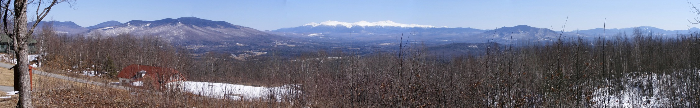
I found my way to the auto road up Mt. Prospect at Weeks State Park. The road is closed to auto traffic until sometime later this spring, but pedestrians may leave their cars at the base of the road and walk to the top. A pullout with a view of the Presidential Range makes walking even halfway up the road well worth the effort.
Looking east from the Weeks State Park auto road, Lancaster NH: the Presidential Range, snowcapped in April. Ellen Kolb photos.
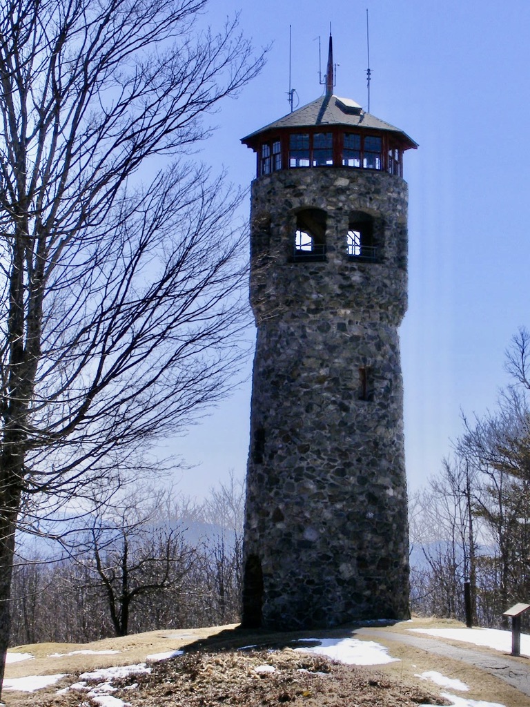
I didn’t walk all the way to Mt. Prospect’s summit on this trip, but I encourage readers to do so if they get a chance. The summit’s fire tower is unique. Instead of the usual metal skeleton, this one is a flagstone tower. This is an active firespotting station, and if you’re lucky, you’ll be there on a day when it’s staffed & the cab is open to the public. As you’d expect, the views are outstanding.
The entrance to Weeks State Park is on U.S. 3 in Lancaster, about 2 miles north of the Whitefield town line. Details are available at nhstateparks.org.
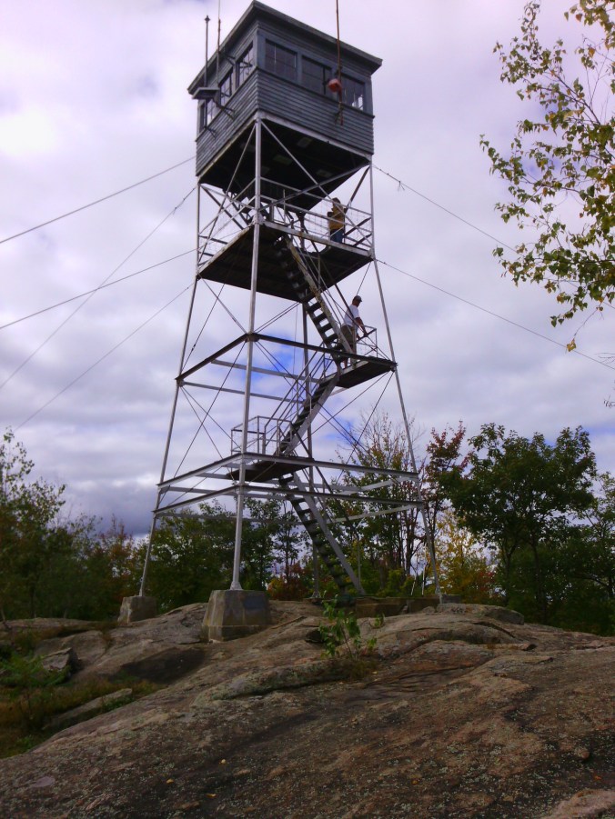
I spent a couple of hours at Pawtuckaway State Park in Raymond yesterday, still waiting on southern New Hampshire’s first snowfall of the season. Great time for a visit! I came in the “back” way, via Reservation Road in Deerfield, parking at the Round Pond Trailhead alongside a couple of other vehicles. I had no company on my walk to Tower Road and the fire tower. I’d never been to the tower without finding dozens of other hikers there, and I rather liked having the view to myself.
I enjoyed the sunny December day, but there was too much haze for me to catch sight of the Boston skyline.
(Update: Pawtuckaway State Park’s popularity skyrocketed during the Covid pandemic, prompting the state of New Hampshire to institute a reservation system for parking and beach use. The system has outlived the pandemic. Especially on weekends and holidays, check the park’s website for reservation information.)
Fire tower at Pawtuckaway State Park, 2010. It has since been rebuilt.
The Oak Hill trails in Concord, New Hampshire branch out from a parking area on Shaker Road, where ten cars (maybe a dozen, in a pinch) can fit comfortably. From NH Route 132 in the northeast part of town, turn onto Shaker Road and continue for about 2.4 miles. Watch for a sign on the right with a parking area.
The forested hill is laced with trails, with good vistas here and there. The fire tower at the summit, on the Concord-Loudon line, is a bonus, and you can get there by following Tower Trail, which is about two miles long and has signage along the way. Print out your map from the City of Concord’s website so you can find your way around the trail network.
My trail report from a visit on December 18, 2010:
Tower Trail is free of obstructions. The few bridges are intact. Oak Hill is still snowless, and the trail itself is ice-free except for a few small areas in the last few hundred yards leading to the tower. The frozen ground is covered with leaves that can be a bit slippery, and the surface is a bit uneven with rocks and roots. In other words, this is a typical woods walk.
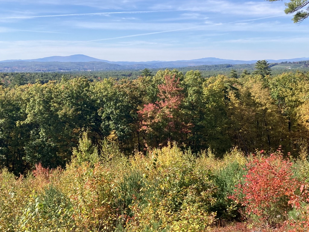
The last quarter-mile or so follows a power line straight to the fire tower, which is dwarfed by a pair of cell towers. The cab is unstaffed and locked this time of year. I was able to climb to the platform just below the cab, stopping at each landing to wonder just what the fire warden was supposed to survey. I had to get to the platform before the view and the breeze really opened up. Warner’s Mt. Kearsarge dominated the view to the west-northwest. There are hills in all directions, none of them snowcapped yet, though my view was limited by distant haze.
It’s about 500 feet of vertical rise from the trailhead to the tower, with a gentle grade. The hike took me 50 minutes each way, and a more fit walker could undoubtedly cut that time considerably. The full trail network on the hill covers about 7 miles, so a hiker could easily spend a day exploring the area. There are no toilet facilities at the trailhead.
The trailhead is less than 15 minutes’ drive from the State House, and the trail is in great shape. I’ll be back.
Looking west from the Oak Hill fire tower in Concord NH, the next active fire tower is on Mount Kearsarge (at left) in Warner.