Third in a series of posts about my 2009 hike on the northern section of the Cohos Trail.
(Update, 2026: Fortunately, Lake Francis State Park hasn’t changed much. It still has tent platforms set apart from RV sites. If you visit there, take time to rent a kayak and explore Lake Francis.)
Yesterday was not fun. It stopped short of being miserable, but I’m still glad to be past it. I now have even more respect than before for the folks who set out in June to through-hike the CT and were stopped within days by that month’s relentless downpours. I started whining to myself after only a few hours of rain. Not even thunderstorms, mind you — just rain. Gotta toughen up a bit.
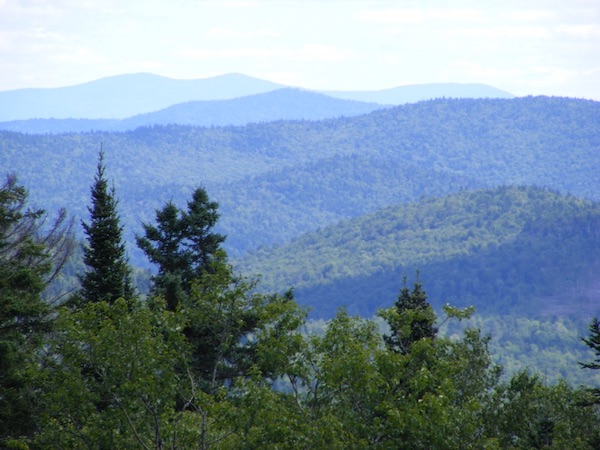
I started the day feeling fine after a very good night’s sleep. A day-long hike is a great sleep-inducer. My first sight as I looked out the window this morning was a loon on Clarksville Pond, silently wishing me good morning.
I might have covered anywhere from 13 to 15 miles today, but it’s impossible for me to tell since the CT map doesn’t reflect the recent re-route through the Deadwater area. I was on the trail 8 hours, including stops for snacks & navigation & one maddening half-hour lost at a confusing intersection. The compass was handy.
I have blisters now. Oh, do I have blisters. I chose not to pack light shoes for camp in order to save space & weight. Bad move.
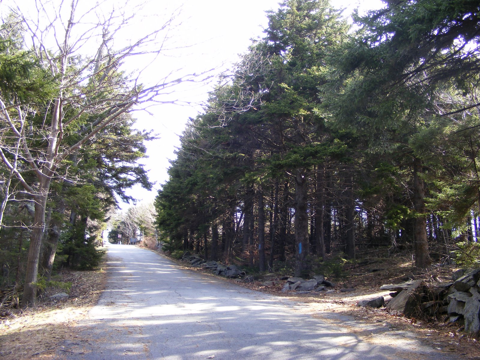
At least the rain held off for the first 3 hours or so of the day’s hike. Let me state firmly that I hate snowmobile corridor 21, on which the CT now travels for a few miles. Finding it was a cinch. Walking on it was a real pain. There are very few CT blazes, since the trail is “so easy to follow,” according to the CT website. Hmmm.
First big intersection: well-worn dirt road to left. Smaller trail to right. Little CT sign pointing (not facing northbound traffic, by the way) down the smaller trail. I stopped & brought out the compass, knowing that I ought to be heading north. Great: north was precisely between the two trails. I decided to pick one, walk 10 minutes, and if I found no CT sign, back up & try the other trail. Ten minutes brought me to one snowmobile sign, but no CT sign. I backtracked & walked down the larger road, which led to a logging yard & a gate. At least that only took 6 minutes (one way) to ascertain. OK, back to the smaller trail, corridor 21.
I couldn’t expect blazes on trees, with ditches on both sides of the trail. I hoped for a little brown CT sign, though. No such luck. The trail narrowed and became quite overgrown. I was heading in a northerly direction, there were no junctions, & the ridge running parallel to the trail to the east corresponded to a ridge on the map. Corridor 21 was really the only game in town.
Further on, still more weeds, & OUCH! I was hit by two simultaneous sudden attacks – a bee sting on my finger, and a sting or bite on my leg, clear through my sock, that I think must have come from a surprised & angry little garter snake. Are-we-there-yet came to mind, and not for the last time.
At last, Deadwater Loop Road. Go right or left – about 7 miles to the east end of Lake Francis in either case. I went left, hoping to hit Cedar Stream Road along the lake’s south shore within a couple of miles. Five minutes later, the rain started. I had packed most of my items within the backpack in sealed plastic bags, and that proved to be the smartest bit of preparation I’ve done. Neither a poncho nor a plastic garbage bag proved adequate today for covering me and my pack.
Cedar Stream Road is wide & flat, but views of the lake are mostly obstructed by trees & camps. There was no place to rest other than the ground. Rain continued off and on.
There was a little CT sign at the junction where the CT goes off Cedar Stream Road & picks up the Lake Francis Trail. I knew from the CT website that this boggy & soggy trail had been weed-whacked just a week ago, and I thank the trail volunteers for that much! A pox on any & all ATVers who have come through, turning every little brook & drainage into a quagmire. [2026 update: my attitude towards ATVers has mellowed to some degree. An upgraded network of ATV trails has made ATV tourism an important factor in the North Country economy.] At one point, the inevitable happened: one mud puddle couldn’t be skirted, & it was deeper than my boots. Boots, socks, feet – all wet. (No gaiters.) I knew then that blisters would form & intensify within minutes. Sun was out by then, although I was under such a thick canopy of trees on this trail that rain might not have been a problem.
The CT databook I carried said “keep left @ all junctions.” Junctions? The only one I saw was a signed snowmobile intersection, where I obediently went left. Are-we-there-yet was absolutely consuming me. The wobbly knees were back by this time. The sweetest sound of the day: an internal combustion engine somewhere ahead of me, confirming that there was a road nearby. (I knew that I was parallel to River Road, but bushwhacking wouldn’t have helped – the Connecticut River was in the way.)
At last! A road, a bridge, & a left turn put me on River Road. I’d have kissed the ground, but that would have meant getting up with the pack dragging me down.
Straight shot, about a mile, and I was at Lake Francis State Park & my little tent platform. I checked in & found my spot. Clouds were building again, so I pitched my tent right away, improvising long guy lines to accommodate the tent platform. Then, in order: ice cream from the park store, a shower, & a load of laundry. While the laundry was in the dryer, I used the pay phone to call home & check in. My husband knows not to worry, but my teenagers made clear to me before I left home that I was to call whenever I could. Now they know how I feel when they’re out somewhere! Good to hear their voices, as always.
There’s a loon calling nearby as I write this. My campsite is just a few trees away from the lake, away from the RVs, & I have civilized neighbors – a tranquil setting.
Rain resumed early in the evening, by which time I had everything buttoned up for the night. A neighbor came by with his dog to invite me to wait out the rain with his family under their screened canopy. Nice people. I declined, though, & I was in my sleeping bag moments later for what turned out to be 12 straight hours of sleep. My inexpensive little tent did NOT leak.
There’s that loon again. I’ll always associate that eerie cry with tranquility.