Kiosk at Mountain Road parking area near town waterworks gate. No take-along maps available; download one before you go.
Western view towards the Monadnocks from North Uncanoonuc. The haze is typical.
My boots had cobwebs in them when I picked them up for this afternoon’s hike in Goffstown. It’s been too long since the last hike. The Uncanoonuc hills are close by, have easy trails, and offer fairly good views, so that’s where I went. Not a bad little local jaunt.
On this clear day with temperatures in the 40s, the little parking area on Mountain Road at the town waterworks was almost full. (“Full” means about eight cars.) I headed for North Uncanoonuc’s summit via the snowmobile trail marked as a class VI road. (Download the map here.) The slippery leaves & loose rocks made made me watch my step, but this is an easy hike overall. At a casual pace, I got to the summit in just over half an hour.
People brought their kids and dogs today. Most, like me, were taking it easy. A few ambitious souls ran a big loop beginning on the trail I took, then over the summit to the White Dot trail (not to be confused with the famous one on Monadnock) and back to Mountain Road. Must be nice to be so fit.
While the south peak boasts a decent view of Manchester, North Uncanoonuc offers views west to the Wapack Range and north to Mt. Kearsarge. (The Kearsarge vista is a few hundred yards down from the summit on the White Dot trail.) The ledgy summit pokes just far enough up from forest & shrubs to reward hikers with some pleasant sights. It’s a great picnic spot, too.
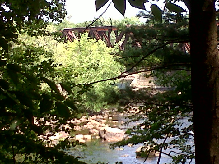
View of Merrimack River from the Bedford Heritage Trail
The Heritage Trail in Bedford, New Hampshire doesn’t demand a lot of time from the casual visitor, although you could go on a slow mile-long birdwatching walk if you were so inclined. I decided to head there for a quick lunch-hour visit.
I found the trailhead on Moore’s Crossing Road off of US 3 (South River Road). From the parking area, I walked north and quickly found a picnic area overlooking the Merrimack River and the Moore’s Crossing railroad bridge.
Eagles have nested along the river, though I didn’t spot one this day. The herons made up for that. The rail bridge is somehow not ugly from this vantage point, despite the graffiti on it. Perhaps all the trees around me softened the view. The river is low today, reflecting the recent lack of rain.
I work near the trail, and today’s picnic beat having lunch at my desk. Employment is great, but my current job is making long hikes impossible for now. I’ll get out to good spots like this when I can, even for twenty minutes at a time.
Among New Hampshire Audubon’s many properties is a little one in Amherst, New Hampshire, tucked away alongside a residential neighborhood yet not far from busy route 101-A. Ponemah Bog is what’s left of a kettle-hole pond formed long ago by the retreat of glaciers. The pond itself covers only about three acres, and it’s surrounded by a sphagnum peat bog that sustains flora unlike what can be found in most of New Hampshire. I visited today for the first time in quite awhile, and I had the place to myself on this sultry day.
To get there from Nashua, take 101-A west into Merrimack. Turn right onto Boston Post Road, just past Home Depot. In about two miles, turn left onto Stearns Road. In 0.3 mile, turn left onto Rhodora Drive; there is a small sign at this intersection pointing to the bog. Where Rhodora Drive curves right, drive straight into the gravel parking lot.
Ponemah Bog. What you can’t see in the photo are the birds & muskrats that were out & about. Ellen Kolb photo.
Take a few minutes to look at the information kiosk, where you’ll find information about the rich variety of birds and unusual plants that favor the bog. A loop path begins from the parking lot, with the two ends a short distance apart. I prefer starting on the left and going clockwise through the property, but either direction will do. The mulched path in the woods eventually gives way to a boardwalk as you make your way onto the mat of peat.
Watch your step, and watch your kids. Stay on the boardwalk for your own safety. That boardwalk also protects the bog itself from undue disturbance. You could walk the length of the boardwalk, including the spur trails, in fifteen minutes or less. Don’t be in such a hurry, unless you’re with small children, as I often was in years past. Taking your time, stopping at the benches scattered around the property, is the only way to get a good look at the birds that scatter at the sound of footsteps on the boards.
When my youngest son (now grown) was little, I used to love to bring him here. The bog is home to several varieties of carnivorous plants, and he used to scoot ahead of me, keeping an eye out for pitcher plants. Whenever he found one, he grinned as though he’d won the lottery – and then he’d move on and look for more.
Today, pitcher plants were blossoming, and so was a tiny purple orchid that only blooms around Independence Day each year. The bog supports larch & pitch pine, with mixed hardwoods in the parking lot, but the bog’s most interesting plants are the flowering shrubs no higher than my waist. Pitcher plants, bladderworts, and sundews are very low-growing. No wonder my son liked finding them.
Today, in hot and dry weather, I wore sandals and had no trouble. After heavy rains, sections of the boardwalk can be underwater. In the winter, even if there’s little snow, the boards can be icy and treacherous. Choose your footwear accordingly.
Before visiting Odiorne Point State Park on a holiday or weekend, be sure to consult the state park’s website for information on day-use reservations.
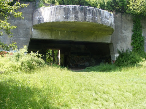
This is the best piece of New Hampshire’s eighteen-or-so miles of Atlantic coastline. With a rocky shore, it’s not a big sunbathing destination. Instead there are trails, a boat launch, a salt marsh, dense woods, a science museum (separate admission), and a few World War II-era gun emplacements. Check out the New Hampshire State Parks web page here for more information.
Located on Route 1-A in Rye, just south of Portsmouth & New Castle, Odiorne Point State Park has a modest admission fee whenever there’s an attendant on duty, as on this Memorial Day weekend. Children 5 and under, and New Hampshire residents 65 and older, get in free. Pack a lunch & enjoy the view to the Isles of Shoals from the picnic area. Bring bikes & strollers, since most of the paths are smooth & flat. The boat launch is a short distance north on Route 1-A from the main park entrance, if you want to bring your kayak. You’ll want a camera as well, especially if you’re a birdwatcher.
Somewhat hobbled by a tweaked knee today, I walked a slow circuit from the main parking area out to Frost Point, then past one of the concrete gun emplacements to the bike path along 1-A, which led me back to the parking lot. Lots of families were out & about, but there was no sense of being crowded. I was probably the slowest person in the park, and no one seemed to mind.
To get a sense of the different environments in this one small area, take an oceanside walk to feel the breeze & smell the salt air. Then walk away from the shore into the woods – and in just a minute, no more salt air. The fragrance of the woods is completely different. The shade will catch you by surprise, and so will the mosquitoes, unless you pack some bug repellent.
Flowers both wild & cultivated are everywhere. I’m fond of the wild roses that were blooming along the shore path. Clumps of iris stood near markers paying tribute to the park’s history. They’re not for picking, of course, but I have to admit I was tempted.
Jetty at Odiorne Point State Park, Rye NH. All photos by Ellen Kolb.Wild roses on the Atlantic shore.A woods trail at Odiorne Point State Park, only steps from the sea.A relic of World War 2 coastal defenses is preserved at Odiorne Point State Park.
Update, 2026: the former Crotched Mountain Rehabilitation Center is now the Crotched Mountain School. The Gregg Trail is still maintained, with a parking area and map kiosk at the trailhead.
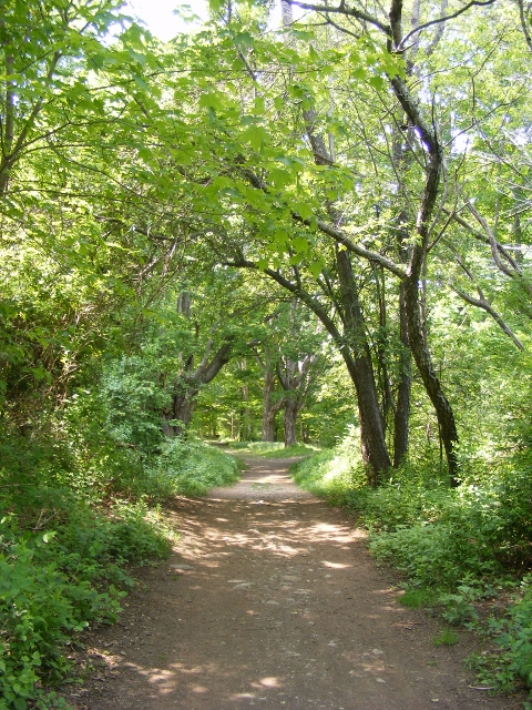
The Crotched Mountain Rehabilitation Center in Greenfield, New Hampshire features two trails on its property that are designed to be accessible for all, including people whose mobility is limited. One of the trails is a short loop around a wetland. I was there today for the longer trail: the Gregg Trail, just under a mile long, leading to a knoll with a view towards Mt. Monadnock. Other trails, rougher and more traditional, continue from there to the several summits of Crotched Mountain.
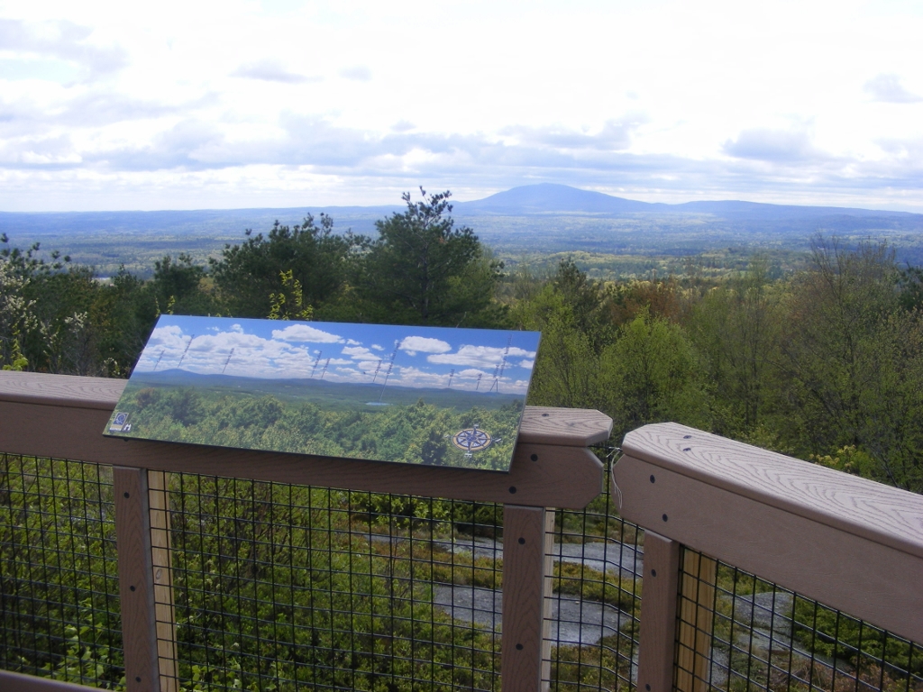
Gregg Trail is wide, with an average 5% grade. Bring the whole family and take your time along the way. There are blueberry bushes all over the place, which of course did me no good in early spring but should be perfect by July. Along the way, look east to the twin Uncanoonuc Mountains in Goffstown and the whaleback-shaped Joe English Hill in New Boston. As you approach the knoll, you’ll see North Pack Monadnock and Pack Monadnock to the south. Finally, as Monadnock comes into view, you’ll see all kinds of hills that will make you wonder what’s what – and fortunately, there’s an illustration nearby that names each peak.
No dogs allowed except for service animals. Sorry, Fido.
From the Gregg Trail in Greenfield, I could see the multiple peaks of Crotched Mountain.A viewing platform on Gregg Trail provides a panoramic map for identifying distant peaks, including Mount Monadnock (seen here, center).
Head north out of Greenville center on route 31 and look for the blue Crotched Mountain sign at an intersection. Turn right and follow the road uphill about a mile and a half to the rehab facility, and you’ll see the trailhead on your left. There are picnic tables and a porta-john along with a map kiosk at the trailhead.
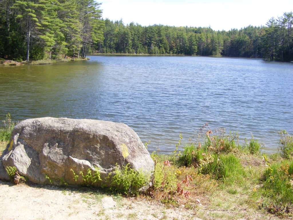
This is one of the newer state parks, and its wide & flat main trail was originally developed to be suitable for wheelchair users. The walk from the parking lot to Meadow Lake, this park’s little jewel, takes only about ten or fifteen minutes at an easy pace.