When 2020 kicked off, I had never heard of Zoom. Since March, thanks to COVID, I’ve had online meetings on the Zoom platform several times a week. (And still, I’m apt to forget to unmute myself when I’m called upon to speak.) When I’m lucky, as I’ve been this month, I get to Zoom about trails.
My thanks go out to the New Hampshire Rail Trails Coalition board members, who welcomed me to a recent online meeting to talk about our mutual interests. I learned more than I shared!
I’m likewise grateful to Jeanine Notter, who welcomed me and former New Hampshire Rep. Lenette Peterson to her “Chattin’ With Jeanine” show on Merrimack Community TV for a half-hour conversation about our favorite places to hike in the Granite State. Even the TV show was a Zoom event, with everyone logging in from home while an MCTV tech whiz put it all together.
Screenshot courtesy Merrimack Community TV/Chattin’ With Jeanine
I love sharing trail stories with fellow Granite State walkers. We learn from each other. If you’re a program host and you’d like to shine a light on southern New Hampshire’s trails, please let me know if I can be part of your conversation.
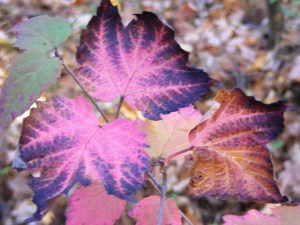
A ten-dollar view for a two-dollar hike: that’s how a way-more-experienced hiker once described an easy scenic hike for me. Not a literal description, of course. The hike was free. The view was out of all proportion to the effort I’d put into getting there.
And so it was on a recent stop in Alton, when I visited the Forest Society’s Morse Preserve.
From Pine Mountain, Morse Preserve, Alton NH: Lake Winnipesaukee and Alton Bay. Photos by Ellen Kolb.
Alton’s Pine Mountain
A short uphill hike led me to the modest summit of Pine Mountain, where I was treated to a vista that included Lake Winnipesaukee and summits near and far.
Nearby was Mount Major, Alton’s principal crowd magnet, famed for the views from its summit. I once went there with a friend. The trail was mobbed from top to bottom. The parking lot was overflowing. And that was before Covid. I didn’t even make it to Major’s summit. Not a bad day, but too much company for my hiking taste.
If only I’d known about Morse Preserve. At the summit of the preserve’s Pine Mountain, I enjoyed the vista with three other people and a well-behaved dog. Hawks caught thermals overhead. Patchy hints of autumn flared here and there. An interpretive sign from the Forest Society identified the various peaks in the distance. Blueberry bushes were all over the place, resting up after what must have been a bountiful July.
No views to the south, but that’s just nitpicking, and I ought to be ashamed of myself for even mentioning that.
The Belknap Range offers an extensive trail network.
Gilford
Later the same afternoon, Gilford played Miss Congeniality to Alton’s flashy prizewinner. The entrance to another Forest Society property, Weeks Forest, is located across Route 11-A from Gilford’s municipal government complex. Weeks has a couple of miles of flat trails, lined in September with late-summer wildflowers. Getting there requires a nerve-wracking walk, or trot, across Route 11-A (parking is in the municipal complex lot).
I entered Weeks Forest through an archway of sorts.
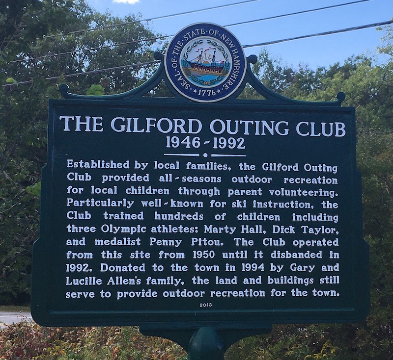
Gilford also has a couple of historical markers. I stalk those like they’re big game. I reward myself with a photo and a brief history lesson at each marker. The day’s catch: something old (a story of how Gilford was named for a North Carolina Revolutionary War battle, if you please) and something relatively new (a tribute to the town’s Outing Club).
The Gilford Outing Club marker sits at the base of what must be a fine sledding hill in winter
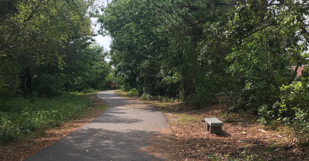
An hour’s free time let me string together a Mine Falls path with the Nashua Heritage Rail Trail to make a pleasant loop for an afternoon walk.
A Heritage Trail sign gives the story behind the trail, for those who stop to read closely. Photos by Ellen Kolb.
Once upon a time, the railroad line that’s now the Heritage Trail was on the same line that became the Nashua River Rail Trail. It’s not likely that the two trails will ever connect again, what with the Everett Turnpike and a few decades of real estate development in the way.
Today, the paved Heritage Trail parallels West Hollis Street from City Hall to just short of Simon Street. There are numerous road crossings and congestion through the Tree Streets behind City Hall. To the west, the trail is quieter. There’s a sign along the way indicating where to veer off to get to the 7th Street entrance to Mine Falls Park.
Nashua Heritage Rail Trail, near western terminus.
Mine Falls Park, as ever, was a beautiful place to visit. The cove’s water level in this drought-stricken season was lower than I’ve ever seen it. Even so, the park’s woods and waterside plants were irrepressibly lush.
Whipple Street access bridge from Mine Falls Park.
How To: A bit of road walking was involved in the loop. I parked on Whipple Street, walked up Simon Street to Will Street – watching out for the tractor-trailers on their way to the nearby UPS depot – and then picked up the Heritage Trail on the sidewalk. When I got to the sign on the trail pointing me to Mine Falls’ 7th Street entrance, I turned onto 7th Street and followed it across Ledge Street to the park entrance. I turned left at the canal and kept walking back to the Whipple Street entrance. A little shy of 3 miles, all told.
While some New Hampshire recreational areas have been closed due to the too-much-love phenomenon (complicated by the no-sense-of-stewardship phenomenon), I am still getting out for good walks. August started out hot and hazy. It’s going out with hints of fall: fresh breezes, low humidity.
Pack Monadnock
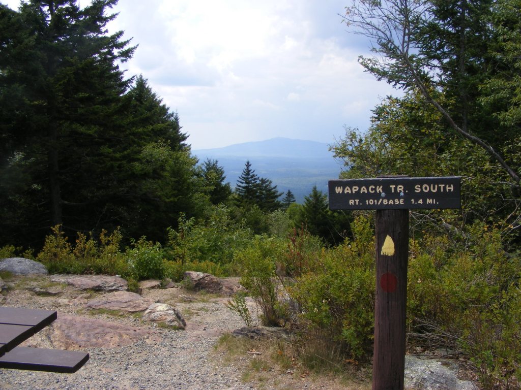
On the one and only hilly hike I tried recently, Pack Monadnock via the Marion Davis Trail, I slipped on a bit of wet ledge and fell on my best-padded feature. I’ll have the bruise for another couple of weeks. It was worth it, just to be back on Pack. Even on a hazy day with a noisy storm approaching – which is what had me zipping downhill too quickly – Pack Monadnock is a nice hike.
The view of Monadnock from Pack Monadnock is unimpressive in summer haze.All photos by Ellen Kolb.
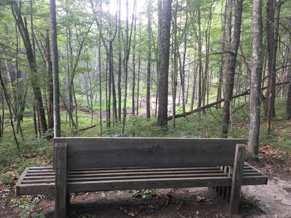
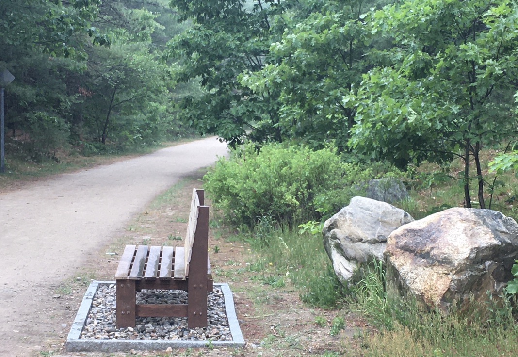
Closer to home, my favorite nature preserve in town has been a soothing refuge all summer. I recently discovered a little overlook that I somehow hadn’t known about, complete with bench, in a quiet part of the preserve. What does it overlook? A bone-dry stream-bed, that’s what. We’re in a drought. Birches in the preserve have shown their stress by dropping leaves early. The larger ponds and marshes in the preserve are at low water levels, but they’re still full of life.
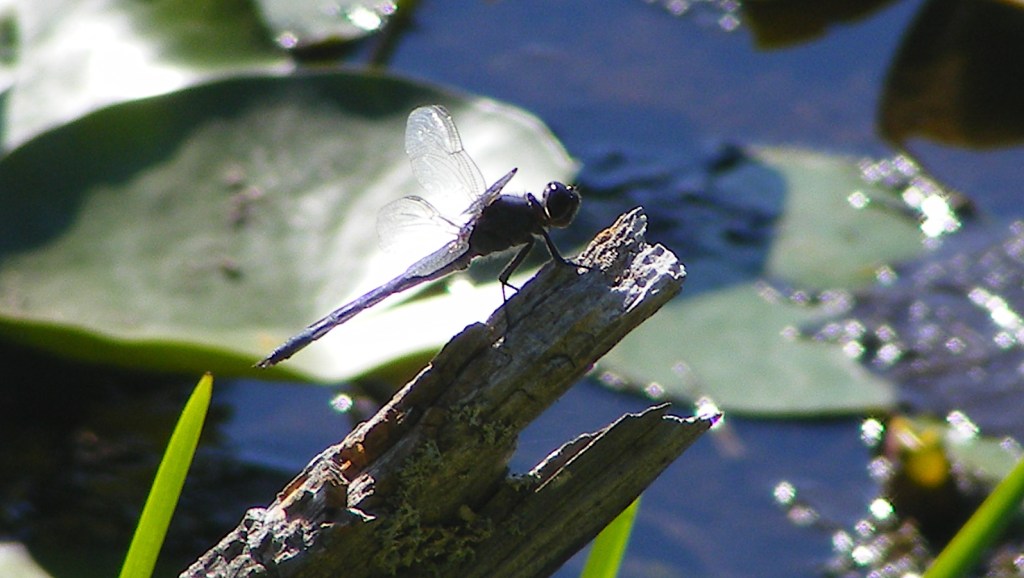
I sat pondside to watch for herons, and got distracted by the dragonflies.
Beaver Brook, Hollis
I took my own advice and sought out a less-used trailhead at Beaver Brook, where the Jeff Smith Trail meets NH Route 130 in Hollis. I was rewarded with a couple of hours of near-solitude on surprisingly varied trails.
Maple tree hosting the day’s most dramatic-looking fungus
I loved coming across a meadow with an old cellar hole and a stone wall nearby, dead giveaways that there had once been a farm there. I found a trail that I hadn’t known about before, through a patch of woods dominated by white pines. Pine needles cushioned my every step.
The breeze in the trees there reminded me of growing up in south Florida, where fifty years ago long-needled Australian pines dominated every local park. Those trees were non-native and invasive, but I didn’t know it at the time; they were just normal trees to me. The memory of the sound of the wind through those long needles has stayed with me. The pines in New Hampshire with their shorter needles play a slightly different tune, just as soothing.
Less than an inch wide and only a few inches above ground, this wildflower caught my eye.
Queen Anne’s lace and goldenrod tried to get my attention, but a tiny pink wildflower beat them both. I don’t know what it’s called. Perhaps it’s something common, but it was new to me: a gift from August.
Recent walks and rides: Londonderry, Derry, and Windham. Each town has its own portion of New Hampshire rail trail on the old Manchester-Lawrence rail line. There are gaps, but the segments are being stitched together a bit at a time.
These are paved trails. They’re like boulevards without cars. They’re high-traffic compared with most of their unpaved cousins, but they’re off-road and therefore safer than hoofing it down any local street. I just stay to the right, pass with care when I need to pass, and keep my speed down. (I never have trouble keeping my speed down.)
Londonderry
No sooner was the Londonderry trail extended to Harvey Road in 2019 than an informal parking lot took shape near the trailhead, doubling as an observation point for watching the planes at Manchester’s airport. I love that kind of efficiency. (Update, 2026: since construction of a culvert under Harvey Road for Little Cohas Brook, parking at that trailhead is a problem. Try the trailheads across from North Londonderry Elementary on Sanborn Road or the Park and Ride on NH Route 28 near I-93’s exit 5.)
On my most recent visit on a hot summer day, I was surprised by a gentle fragrance as Little Cohas Brook came into sight. I gave the credit to the blooming water lilies. Loosestrife was in bloom as well: lovely purple color on what I’m told is a highly invasive plant.
Along Little Cohas Brook, Londonderry rail trail. All photos by Ellen Kolb.
Busy as the trail can be, I had no sense of being crowded on my midweek visit. There was room for everyone. I even had a bench to myself for a bit of birdwatching.
Benches are a bonus along rail trails.
I like seeing mile markers that have been restored or re-created. They keep me mindful of a trail’s history.
“L” for Lawrence MA, “M” for Manchester NH.
Four and a half paved miles extend from Harvey Road to the town line at NH Route 28. From the southern end, I could see across the road to a yet-undeveloped stretch of railbed in Derry. Its day will come.
I spent a good afternoon walking on Derry’s trail that links Hood Park with Windham Junction. That’s about 8 miles round trip, with refreshments available from businesses near each end. Parking is available at both ends.
Lest I forget about social distancing, someone painted a reminder.
Nothing but an embankment and a strip of trees separated me from I-93 on the southern part of the trail. Once the trail and highway diverged, the scenery changed to wetlands full of red-winged blackbirds. Proceeding north, I entered residential areas, then passed a ball field, and crossed busy NH Route 102 in the center of town.
Crossing 102 was easier than I expected. Traffic actually stopped for me as I entered the crosswalk. That is not something I take for granted in central business districts, even on a weekend.
My favorite part of the trail paid tribute to poet Robert Frost, who spent a few years teaching at nearby Pinkerton Academy. “The Road Not Taken” had been stenciled on the trail only a day or two before my walk. More artwork has since been added.
Frost’s “The Road Not Taken” is a Derry Rail Trail highlight.
I confess to a special liking for the Windham rail trail. Even on the hottest day, it’s cool and restful.
This Boston and Maine RR caboose is now a Windham Junction landmark.
Windham Junction, with its restored depot and caboose, has a good-sized parking lot. That makes it a good starting point for a ride or walk north into Derry or south into Salem. My recent trip was just to enjoy the Windham trail itself.
Roulston Road crossing (no parking here).
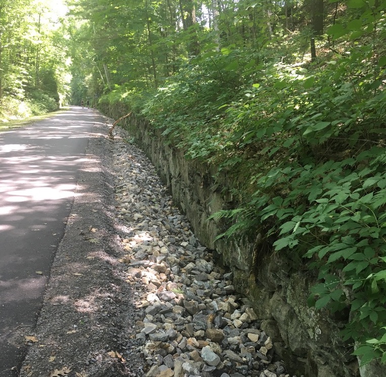
The trail looked practically freshly-pressed. Recent maintenance work has improved the trail’s surface and drainage.
New pavement, new drainage work, trimmed shrubs: welcome to Windham’s rail trail.
I can tell already that the Rail Trail challenge is going to figure into many future posts. I hope readers who are inspired by the challenge will share their own posts and photos so we can learn from each other.
I enjoyed a walk on the Goffstown rail trail a few days ago with Paula Bedard of the Bike-Walk Alliance of New Hampshire, of which the New Hampshire Rail Trails Coalition is an affiliate. If the Challenge has a prime mover and guiding spirit, she’s it. It was great to talk with her about our favorite trails and the shape they’re in.
Along Goffstown rail trail
She made an important point to me that makes me much more optimistic about earning that Challenge patch: participants must explore each trail, not travel every inch of every trail. Whew! OK, so I’m not just going to do a quarter-mile of the Northern Rail Trail and then check it off the Challenge list. But it’s good to know that an overgrown trail – northern stretch of Fort Hill, maybe? – won’t be a stopper.
The next day, at Paula’s urging, I picked up the second edition of Charles F. Martin’s book, Rail Trails of New Hampshire. The first edition has been my companion on many trips. With more trails developed and with conditions changing on existing ones, a new edition is timely.
Brookline, NH
Why go out of my way to check off anything from a trail list? In 2020, the only reason I need is that I am grateful for diversions from the challenges of COVID-19. I crave out-of-the-way places where no masks are required. Fresh air clears my head. A straight flat trail lends itself to prayer and reflection.
The Brookline rail trail is unpaved but wide and suitable for bikes. Ellen Kolb photos.
All of which brought me to the Potanipo rail trail in Brookline, NH. The little town already has a place in this blog thanks to the Andres Institute of Art with its trails and outdoor sculptures. The rail trail is nearby. It’s short, straight, shady, and ideal for a brief respite from routine.
I parked off of Bohannon Bridge Road, next to a ball field, just past the Nissitissit River. Finding the trailhead for the developed part of the old rail line was easy. A runner was just returning to her car. A gentleman was walking his dog ahead of me. Farther along I saw a pair of friends laughing and walking briskly together. The trail might have been new to me, but clearly the locals were familiar with it.
The Nissitissit river and the streams flowing into it are quiet in summer – but watch out during spring freshet.
The trail is about a mile long. The slow-moving river alongside is concealed this midsummer by heavy vegetation. The trail surface is unpaved but wide and smooth. There’s one road crossing. The trail peters out at NH Route 13, behind a gas station and a pizza restaurant. The parking there makes a convenient starting point for anyone who wants to go out-and-back along the trail from that direction.
After a hilly walk at the Andres Institute, the flat Brookline trail might be a good way to get the kinks out of those sore legs.


