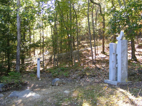
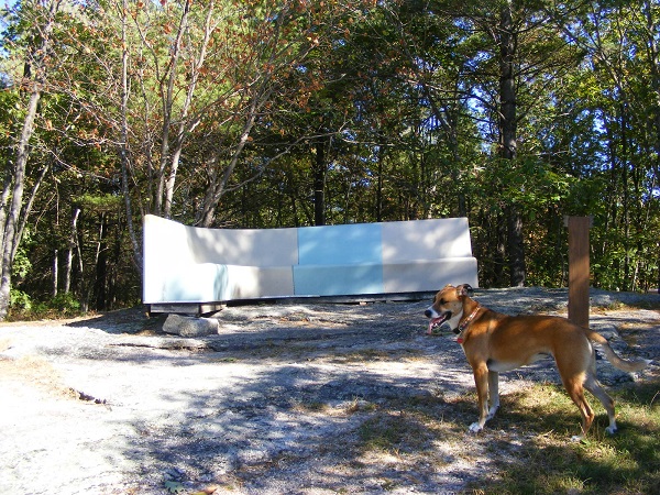
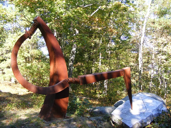
The Andres Institute of Art – “a sculpture park to delight the whole family,” as its website proclaims – occupies much of a hill alongside Route 13 in Brookline, New Hampshire. Over 70 sculptures are scattered around the property, which is laced with walking trails. The property is open dawn to dusk daily, and there’s no fee although donations are welcomed.
I spent an hour here on summer’s final weekend, and took these photos that show a sample of the artwork to be found along the Andres trails.
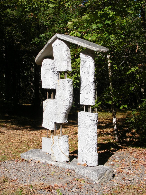
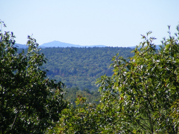
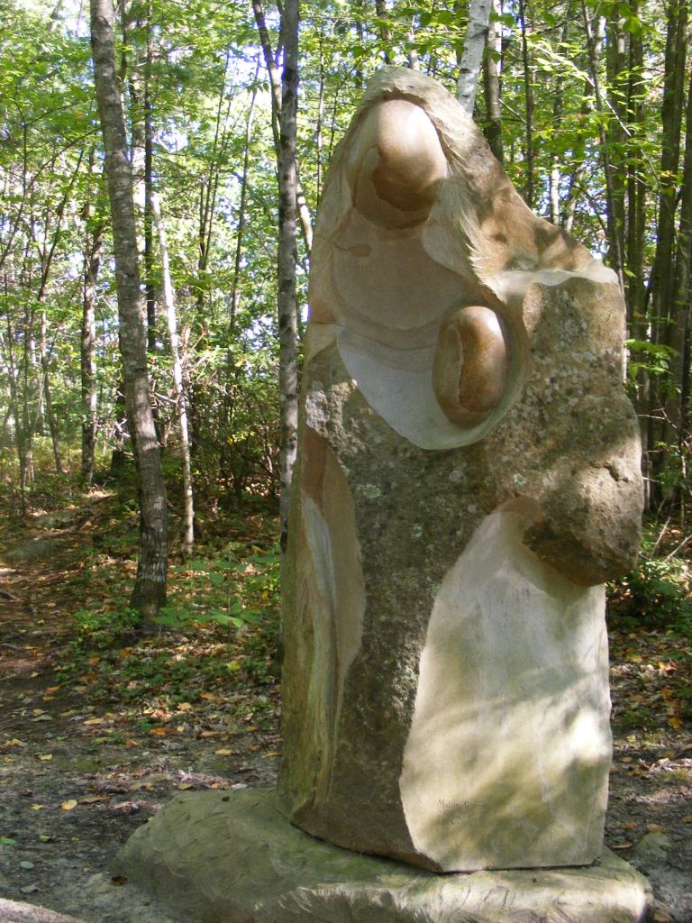
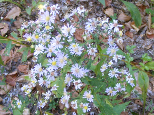
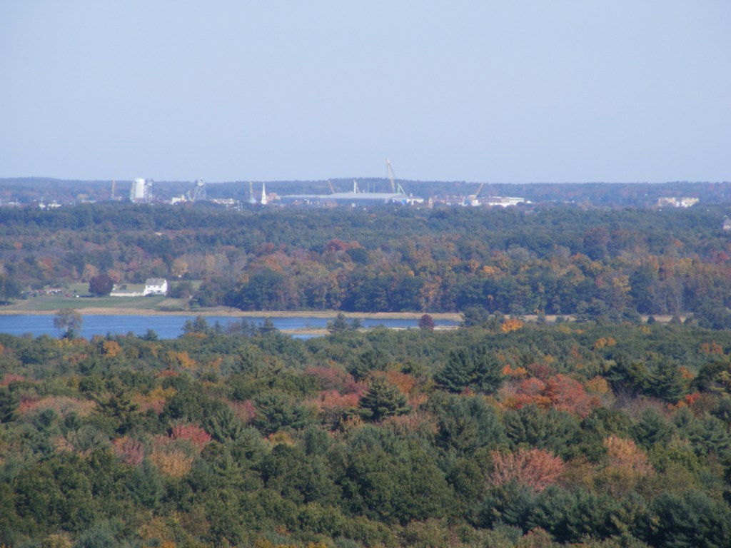
Mbari House by Geoffery Nwogu.Mount Monadnock, seen from the top of the hill at the Andres Institute.Alignment by Hoa Bich Dao. The path uphill cuts a diagonal line in the background.Of all the sculpture along my way, this was by far my favorite:Souls Of Peace by Gerard Montonri.At the top of the hill, a surprising seat from which to take in the view. (Yes, the seat’s from a bowling alley.)Plenty of trailside asters today.Drawing Sculpture/The Myth, by Satoru Takata.
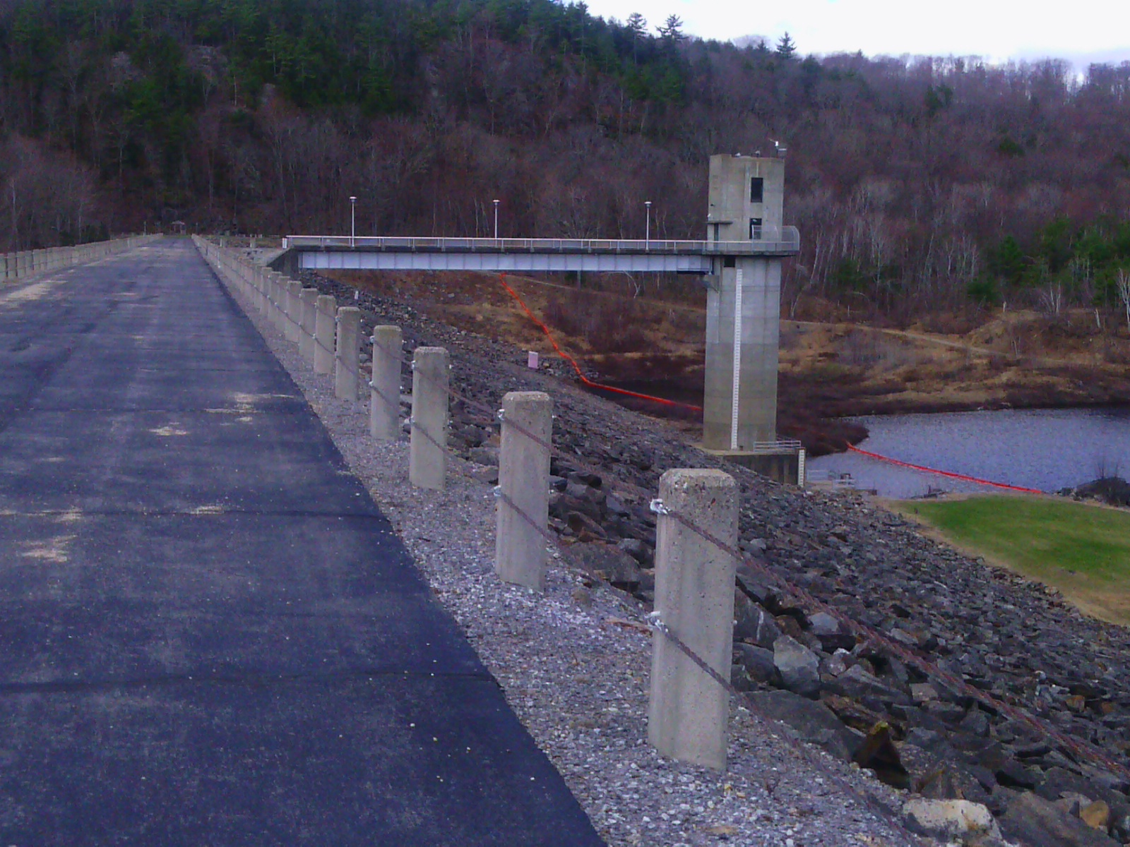
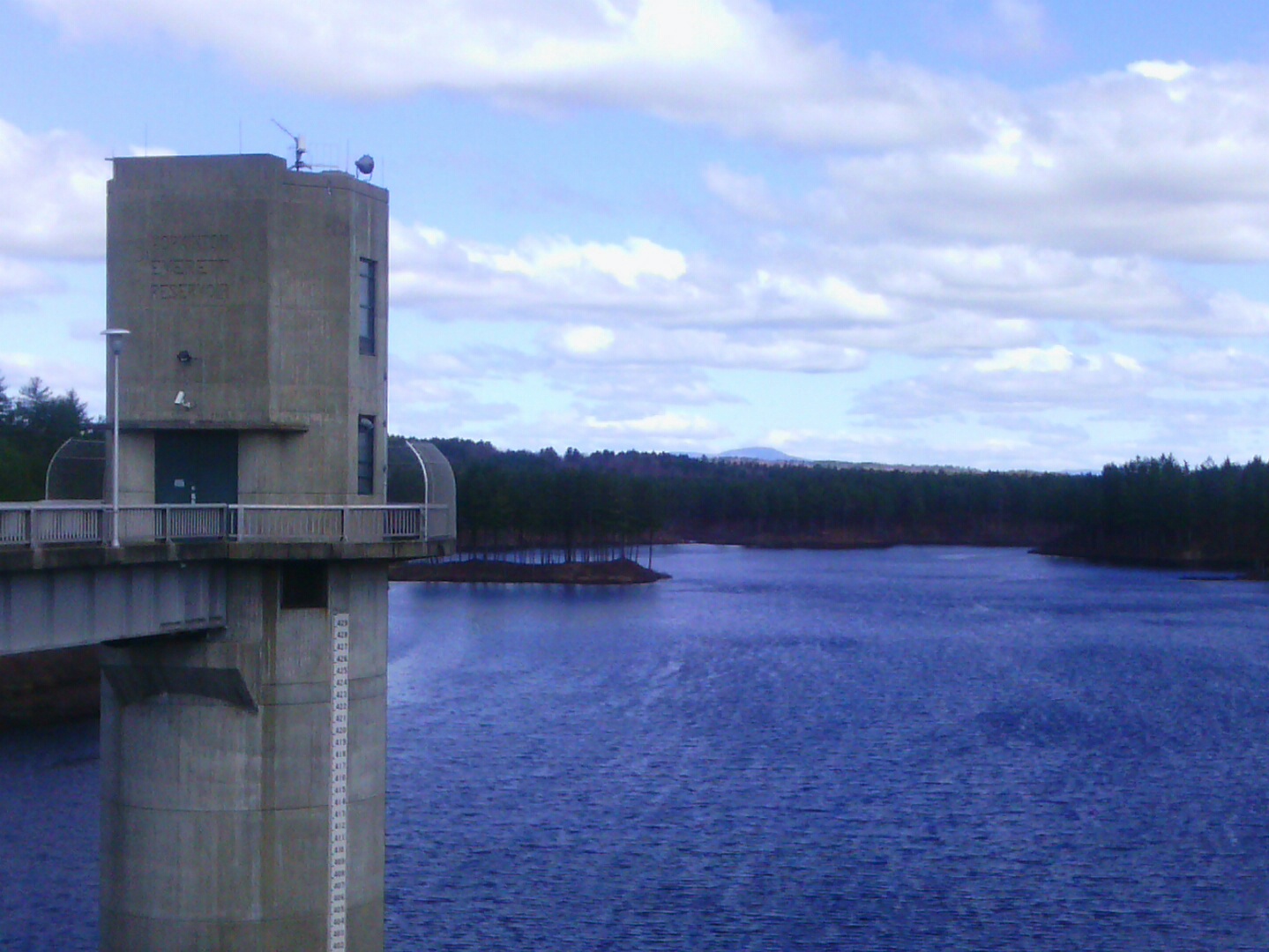
Clough State Park with its little beach on Everett Lake in Weare is still awaiting its opening day, but walkers are welcome on the nearby Everett Dam (operated by the Army Corps of Engineers). This would have been a mountaintop day if I’d had the time. The air was amazingly clear. I settled for a half-hour walk along the dam and the quiet roads nearby.
Both park and dam are on Clough Park Road in Weare. The park has a modest entrance fee. The dam has its own parking area a short distance south of the park, and it’s free.
View across the dam from the parking area on Clough Park Road. Photos by Ellen Kolb.
Everett Lake, with Mount Kearsarge in the distance.
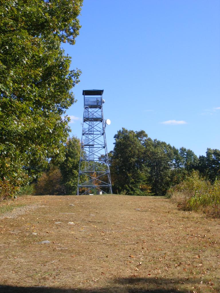
A decommissioned fire tower is a five-minute walk uphill from the parking lot at Stratham Hill Park on Route 33 in Stratham, New Hampshire. I paid it a quick visit on a sunny and clear fall afternoon.
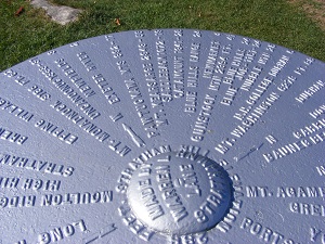
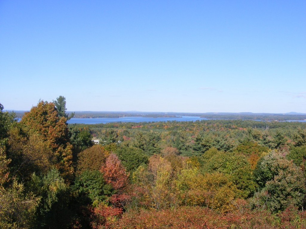
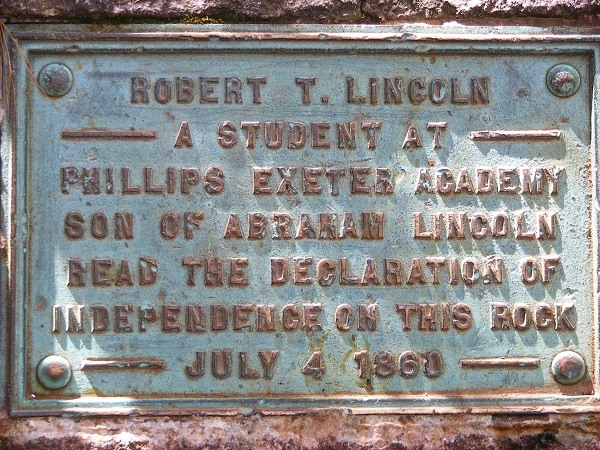
Stratham Hill tower can’r be seen from Route 33, but it’s only a short walk uphill from Stratham Hill Park’s parking lot.A lovely feature at the base of the tower: a guide to the features one can spot in the distance.Great Bay on the horizon.From the decommissioned tower at Stratham Park, looking towards Portsmouth and the NH coast.Spotted on the walk to the Stratham Hill tower: a note that Abe Lincoln’s son Robert was there one day.
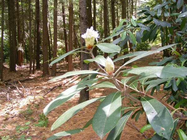
So few free weekends this summer! This was a mountaintop day, though, with clear dry air that guaranteed good views. I dropped everything and drove to Fitzwilliam to visit New Hampshire’s Rhododendron State Park and its trail to Little Monadnock.
In early July, Rhododendron State Park’s famous blooms are still a couple of weeks away.
Alas, the rhododendron grove is still a week or two from being in full bloom. The park’s loop trail makes for a pleasant shady walk nonetheless. The well-prepared visitor will bring bug repellent (and for once, I remembered to pack it). Then I headed uphill wearing sturdy shoes, following yellow blazes over rocks and roots to the summit ridge of Little Monadnock. Once I reached the ridge, I turned east-northeast and followed the Metacomet-Monadnock Trail a short distance to get a fine view of Grand Monadnock.
The trailhead at the state park’s parking area leads to a junction with the Little Monadnock trail.
Mt. Monadnock, seen from Little Monadnock’s summit ridge.
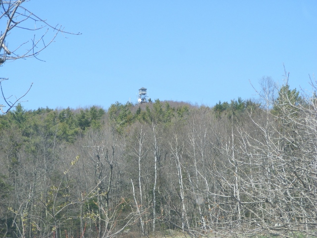
When was the last time I got to one of New Hampshire’s fire towers? It’s been awhile. The other day, everything came together for a tower expedition: perfect weather, access to a car, and an afternoon to myself. I took a beautiful drive to Stoddard for a visit to Pitcher Mountain. The walk from parking area to fire tower only takes me ten or fifteen minutes. The 360º views from the tower are splendid, and the drive is a treat. Dozens of miles on roads with no traffic signals and not a single Dunkin’ Donuts in sight: how’s that for a Sunday drive?
Pitcher Mountain fire tower, Stoddard NH. All photos by Ellen Kolb.
I couldn’t miss the small parking lot on Route 123 on Stoddard. There’s a sign, and a view of the tower from the road.
First peek at the tower, approaching from the east on Rt. 123.
The walk uphill from the parking lot through woods opens up to a field with a fine view of Monadnock to the south.
Mt. Monadnock in the distance, seen from the path to the Pitcher Mountain fire tower.
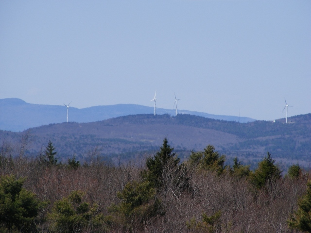
From the tower, there was a full panorama. Monadnock was the most prominent feature, but plenty of other peaks were visible as well. I had the second edition of Hiking the Monadnock Region (a fine guidebook by Joe Adamowicz) to help me identify some of them.
Wind farm in Lempster, seen from the fire tower
For more about New Hampshire fire towers:
One of the most interesting local publications in my collection is a little orange booklet called A Field Guide to New Hampshire Firetowers by Iris W. Baird and Chris Haartz (2002). Look for used copies online. The booklet includes a short history of all the currently operating towers in the state, along with notes on other towers that are still standing but have been decommissioned.
The New Hampshire Division of Forests and Lands has a web page that includes information on the Tower Quest program, with a patch available to anyone visiting at least five fire towers. I admit I have one of those patches myself.
I see no columbines yet on the Nashua River Rail Trail in Dunstable, Massachusetts, just over the New Hampshire border. I knew today was kind of early in the season, but I was eager for the year’s first visit to this old friend of a trail. I spotted a columbine along the way in this stretch about three years ago. The following year, a second plant sprang up a few feet away. Since then, I haven’t been able to spot them – pulled up? died? I don’t know, but I look for them anyway.
Tiny violets – harbingers of wildflower season
Blossoms were few this weekend – a dandelion, and a few of the tiny violets that I refuse to call weeds. The deciduous trees along the trail are just beginning to leaf out, and little pines are taking root in the shadow of big ones. The skunk cabbages down in the wetlands are the brightest green in sight. Spring cleanup has already been done by some wonderful volunteers who have moved the winter’s deadfall off the pavement.
Columbine: what I’m waiting for.
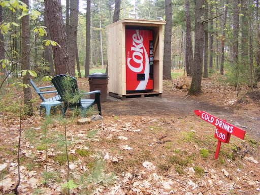
Most flowers are still a few weeks off, and I’m impatient for them. Still, I liked what I saw today – if not for its own sake, then for what it means for the coming season. Clumps of green grasses and ground cover are poking up through the dead leaves along the edge of the trail. The farm in Dunstable has sheets of white row-cover already out on one field, so something’s been planted – will it be pumpkins or butternut squash this year? The soda vending machine that one whimsical family sets up annually in their back yard adjacent to the trail is back, and the price per soda is unchanged at $1.
No plane from Skydive Pepperell. I’m not sure if that was due to the weather or the calendar. From late spring through fall, I’m accustomed to the every-20-minutes rhythm of the prop plane as it takes off from its airstrip near the trail, makes lazy circles up to what I’m told is 13,000 feet to let out the skydivers, then descends and returns.
From a good NRRT neighbor: the soda stand
Weekend traffic was far below summer levels. There were very few cyclists riding as though on a mission, zooming past everyone. This was a family day, featuring kids on training wheels or on very shiny bikes that were probably under the Christmas tree. One high-spirited six-year-old had a BMX-style helmet that probably cost more than his bike.
No helmet or bike for me this weekend, just sneakers and a hankering for wildflowers. They’re not out yet, but I’ll see them soon.