Gregg Trail, Greenfield NH: Wheelchair-Friendly, Good Views for All

Update, 2026: the former Crotched Mountain Rehabilitation Center is now the Crotched Mountain School. The Gregg Trail is still maintained, with a parking area and map kiosk at the trailhead.

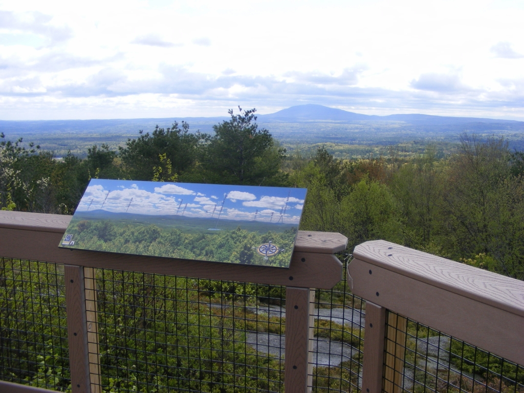
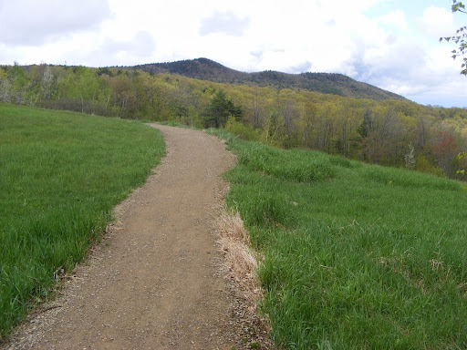
The Crotched Mountain Rehabilitation Center in Greenfield, New Hampshire features two trails on its property that are designed to be accessible for all, including people whose mobility is limited. One of the trails is a short loop around a wetland. I was there today for the longer trail: the Gregg Trail, just under a mile long, leading to a knoll with a view towards Mt. Monadnock. Other trails, rougher and more traditional, continue from there to the several summits of Crotched Mountain.

Gregg Trail is wide, with an average 5% grade. Bring the whole family and take your time along the way. There are blueberry bushes all over the place, which of course did me no good in early spring but should be perfect by July. Along the way, look east to the twin Uncanoonuc Mountains in Goffstown and the whaleback-shaped Joe English Hill in New Boston. As you approach the knoll, you’ll see North Pack Monadnock and Pack Monadnock to the south. Finally, as Monadnock comes into view, you’ll see all kinds of hills that will make you wonder what’s what – and fortunately, there’s an illustration nearby that names each peak.

No dogs allowed except for service animals. Sorry, Fido.
Head north out of Greenville center on route 31 and look for the blue Crotched Mountain sign at an intersection. Turn right and follow the road uphill about a mile and a half to the rehab facility, and you’ll see the trailhead on your left. There are picnic tables and a porta-john along with a map kiosk at the trailhead.

Northwood Meadows State Park, Northwood, NH

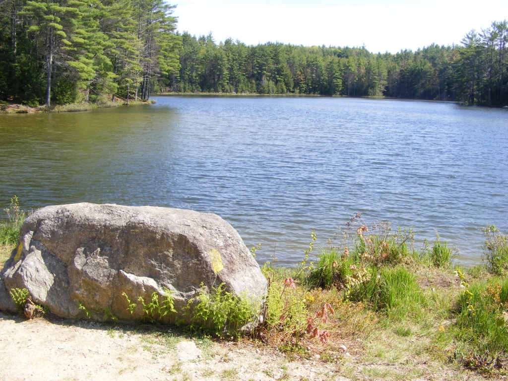
pond in Northwood Meadows State Park NH on a sunny day
Meadow Lake, Northwood Meadows State Park, Northwood NH. Ellen Kolb photo.

On US 4 in Northwood, New Hampshire, about halfway between Concord and Durham, there’s a quiet state park that had flown under my radar until recently. Northwood Meadows State Park has accessible trails throughout its 600+ acres. The main trail from the parking area is the north end of a 5-mile network of trails leading to Meadow Lake and linking the park with other parcels of public land. Print out a trail map in case the map box in the parking lot is empty: https://www.nhstateparks.org/getmedia/62d97940-2bfd-4862-aa14-82a9bc023805/Northwood-Area-Land-Management-Collaborative-Trail-Map.aspx

This is one of the newer state parks, and its wide & flat main trail was originally developed to be suitable for wheelchair users. The walk from the parking lot to Meadow Lake, this park’s little jewel, takes only about ten or fifteen minutes at an easy pace.

Mid-spring on the Nashua River Rail Trail

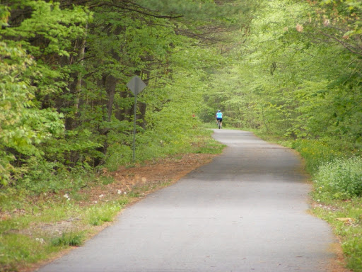
Back to the Nashua River Rail Trail today. This is still one of my favorite places, in all seasons. After a dry winter & early spring, recent rains have brought out the wildflowers along the trail, including the columbines that I know will be gone before my next visit. Today’s walk was from Gilson Road in Nashua, New Hampshire to Rt. 113 in Pepperell, Massachusetts.

Forest Society Conservation Area, Concord NH

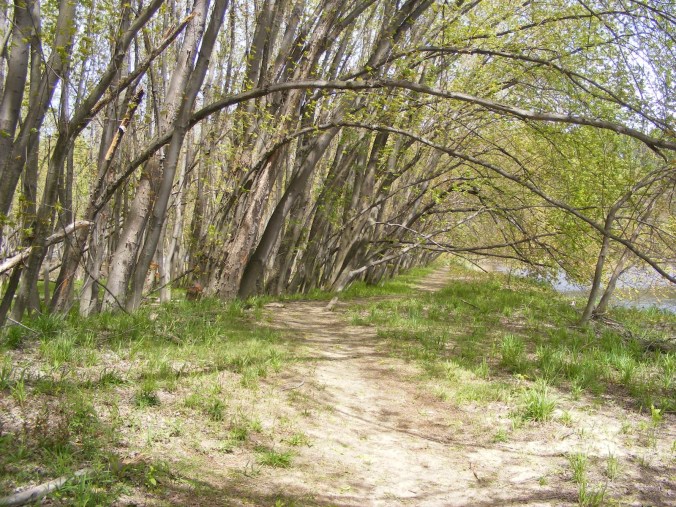
silver maple trees bent by the wind
Silver maples bend over the trail at the Forest Society’s Merrimack River Education and Conservation Area, Concord NH. Ellen Kolb photo.

The Society for the Protection of New Hampshire Forests headquarters is in Concord, off of I-93’s exit 16. Follow signs for “conservation center”, and you’ll find the headquarters on Portsmouth Street.  

The Forest Society trail network at this property runs along the Merrimack River and includes a pine plantation, a silver maple forest, floodplain, and a river cove with a canoe landing. The traffic sounds from nearby I-93 are easy to ignore. In this drought, the river is quiet, but the sharply-cut banks indicate how high the Merrimack can run in a rainy season.

I stayed here longer today than I had intended, stretching a quick lunchtime walk into an hour. The trail is flat & sandy; no boots required. The bugs are out, so bring your insect repellent. This is an undramatic, peaceful spot for a walk, and it’s open from dawn to dusk.

Mason, New Hampshire: Parker’s to Mason Rail Trail

I took my husband up on his invitation to join him and his running buddies in Mason, New Hampshire this morning. Beautiful day, lots of sun, 40 degrees or so at 8 a.m. We agreed to meet back in the Parker’s Maple Barn parking lot at 9:30, and I left the runners to follow their own paths. I walked toward the rail trail that runs through Mason from the Massachusetts border north to Wilton and then west to Greenville.

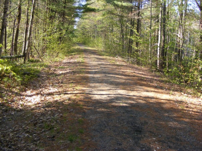
unpaved rail trail through a forested area
Mason (NH) rail trail. Ellen Kolb photo.

Mason has hills. Not steep hills, but hills nonetheless. Brookline Road heading northwest from Parker’s makes a steady climb up to County Road and continues fairly level to a sharp left turn. At that point, I went straight onto unpaved Scripps Road, a dead end with no-parking signs all along one side. Soon, I emerged onto the rail trail.

(Update, 2020: that access point is no longer a formal trailhead. Please respect private property. A trailhead with parking is at the trail crossing on Depot Road, less than a mile south of Scripps via Brookline Road. Parking for the trail is also available where it crosses Pratt Pond Road.)

This is a decently-maintained trail, wide as a boulevard, with unremarkable but pleasant woodland scenery. It must make a great snowmobile trail in winter.

I know from long-ago hikes on more northerly segments of the trail that I could have walked in peace all day if I’d had the time. I’m sorry I couldn’t stop today at Pratt Pond, probably the prettiest spot on the Mason trail.

Although close to town roads, the trail’s peace and quiet are remarkable. Aside from a plane passing far overhead, the only sounds were birdsong and wind in the trees.

I walked back to Parker’s Maple Barn and met up with my husband and friends for an excellent breakfast. As is usually the case with Parker’s on a Saturday morning, there was a short wait for a table. Believe me, it’s worth it. (Try stuffed French toast and a mug of maple coffee. Trust me.)

North Country views: Weeks State Park, Lancaster, New Hampshire

I spent this uncommonly warm April day driving upstate to Bethlehem, Littleton, and finally Lancaster. This is a blog about southern New Hampshire trails, but today’s trip was pleasant enough to rate a mention.

I found my way to the auto road up Mt. Prospect at Weeks State Park. The road is closed to auto traffic until sometime later this spring, but pedestrians may leave their cars at the base of the road and walk to the top. A pullout with a view of the Presidential Range makes walking even halfway up the road well worth the effort.

view of the Presidential Range in New Hampshire, with snow on summits
Looking east from the Weeks State Park auto road, Lancaster NH: the Presidential Range, snowcapped in April. Ellen Kolb photos.

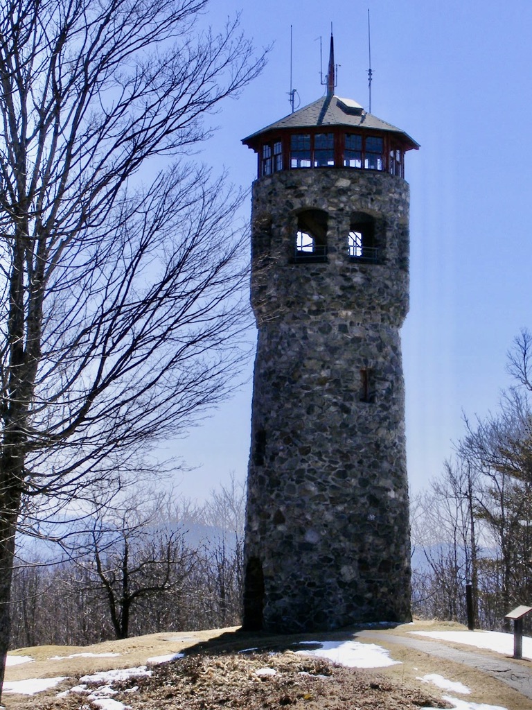
I didn’t walk all the way to Mt. Prospect’s summit on this trip, but I encourage readers to do so if they get a chance. The summit’s fire tower is unique. Instead of the usual metal skeleton, this one is a flagstone tower. This is an active firespotting station, and if you’re lucky, you’ll be there on a day when it’s staffed & the cab is open to the public. As you’d expect, the views are outstanding.

Fire tower built out of stone, Weeks State Park, New Hampshire

The entrance to Weeks State Park is on U.S. 3 in Lancaster, about 2 miles north of the Whitefield town line. Details are available at nhstateparks.org.