Horse Hill Nature Preserve gallery

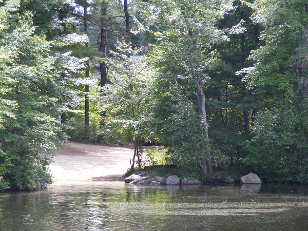
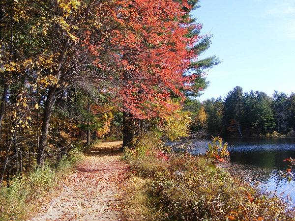
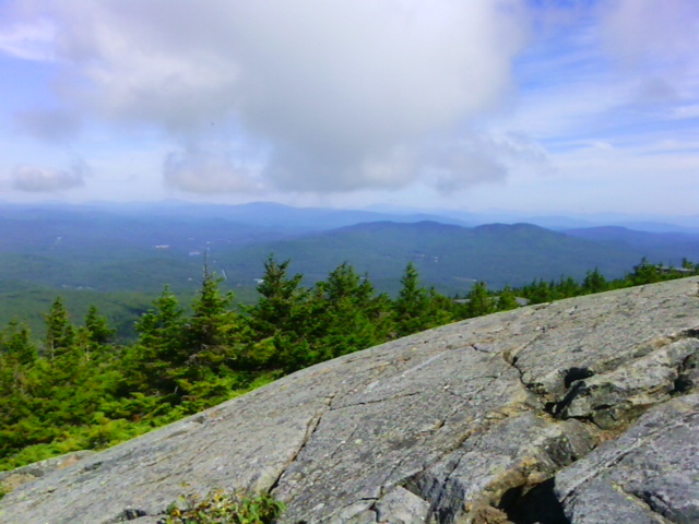
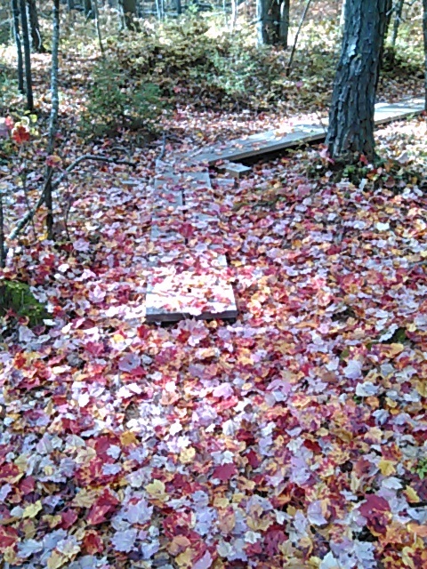
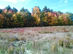
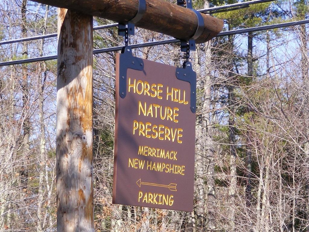
Among the places to which I’ve returned repeatedly since beginning this blog is Horse Hill Nature Preserve, one of my favorite southern New Hampshire destinations. Here are a few Horse Hill images.

sign for Horse Hill Nature Preserve in Merrimack, New Hampshire

When I moved to this area thirty years ago, what is now the preserve was just a big undeveloped area with a sandpit in the middle. There was once talk of building a housing development in there. The development never materialized, and in 2002, the town purchased the property for conservation. As a community, we made a wise decision.

The area needed a lot of cleanup before it was ready for prime time, and we resorted to some creative maneuvers to get the job done. I remember going there with my son’s Scout troop on a hike. In the sandpit area was debris from the area’s days as an informal target range. Each Scout gleefully stuffed his pockets full of shell casings and carried them out. I can only imagine how many forgotten little brass pieces found their way into washing machines that weekend.

golden light in an avenue of birch trees
My favorite season at Horse Hill. Photos by Ellen Kolb.

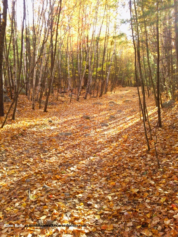
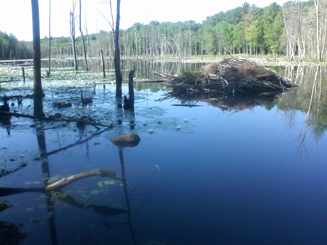
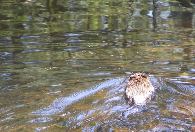
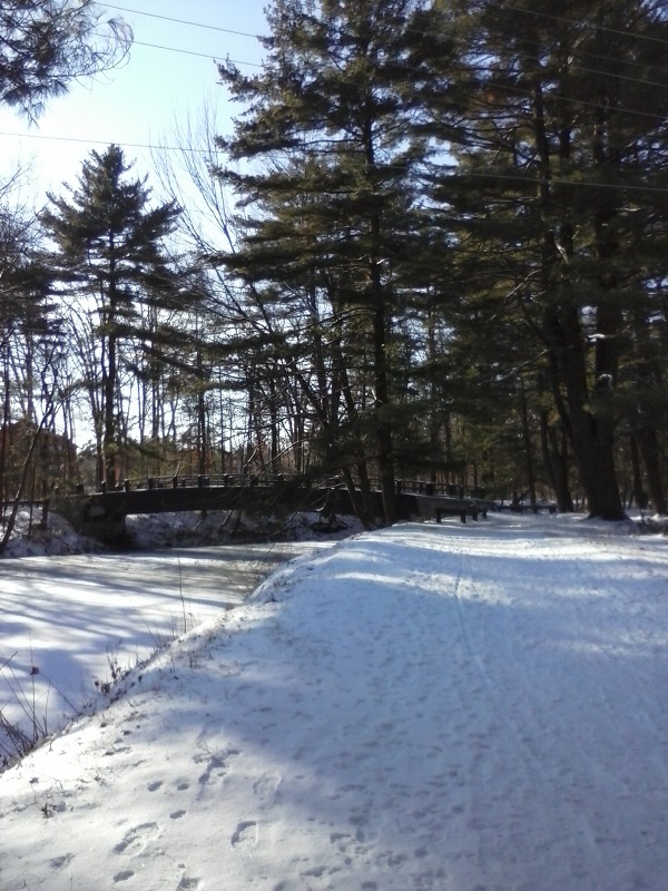
Now, Horse Hill is a year-round spot for walkers, runners, and off-road bicyclists. Horseback riding is allowed, too, for equestrians who don’t mind taking their chances sharing a trail with bikes. As for being a nature preserve, Horse Hill’s wetlands and trees provide habitat for a variety of wildlife.

Horse Hill is popular enough that the town just tripled the size of the parking area, yet it never seems crowded once I’m more than five minutes from my car. Plenty of trails branch off from the main loop, so hikers aren’t concentrated in one area.

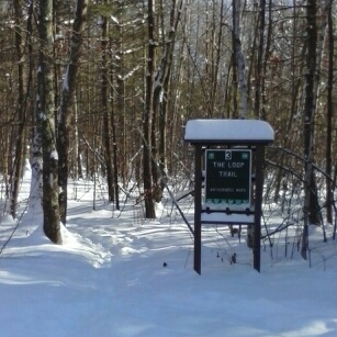
If you go, pick up a map first from the kiosk on Amherst Road, and then have fun.

Trails in winter are good for snowshoeing, cross-country skiing, and fat tire biking.


pond with beaver lodge
Lastowka Pond at Horse Hill Nature Preserve hosts a heron rookery and beaver lodge.

Re-collection: Piscataquog trail therapy

I walk for fun, to explore, to more-or-less exercise. I also walk to keep my head on straight. I wouldn’t have gotten through today without a couple of miles outside.

I’m a political critter, you see. I’ve been a campaign staffer, an activist, a blogger from the New Hampshire State House, to name a few pastimes. Yesterday was election day after the nastiest campaign year I’ve ever experienced. This has been a backed-up-sewer of a season.

Nothing will flush it out except time on the trails.

I had time today for a couple of local miles. Manchester’s Piscataquog rail trail came through for me. There were enough leaves left on the trees to serve as a canopy. The overcast sky suited me; bright sunlight would have left me with a slashing headache.

Forty good minutes: enough time to escape agitation. Time to block out the noise, turn away from the news feeds, take lots of deep breaths, recall what’s important.

A man biked past me. I recognized him as the unofficial adopter of the trail, picking up bags of trash, neatly hanging fresh plastic bags every hundred yards or so. Seeing him was oddly consoling and reassuring. He has a simple, selfless volunteer’s dedication to an unsung job that consists of keeping a public area pretty.

Beat that, candidates.

Decompression is going to take awhile. Today’s walk was a good start.

dscf3697-2
Piscataquog trail, in another season.


Mine Falls Park gallery

As the Granite State Walker blog turns 10 this month, I’m looking back at some of my favorite southern New Hampshire destinations. Today’s gallery:  Mine Falls Park in Nashua. This urban park is accessible from the Everett Turnpike (exit 5W, or 5E to Simon Street), Stellos Stadium, Lincoln Park, the Millyard downtown, or 7th Street off Ledge Street. If you live near Nashua and you haven’t explored this park yet, do yourself a favor and get out there!


boat launch on pond
Two boat launches serve the park, including this one outside Conway Arena. All photos by Ellen Kolb.
river flowing over a low dam, late afternoon
The dam at Mine Falls.
autumn foliage along an unpaved path
This path edges the millpond, home to heron and beaver.
A short history of the park.
muskrat swimming in a canal
Muskrats love the Mine Falls canal. The  canal, nearby Nashua River, and millyard cove are great areas for observing birds and wildlife.
snow-covered trail leading to a bridge over a canal
In the winter, I bring my snowshoes.
American flag on a tall flagpole with a memorial stone at base
A memorial to a fallen Nashua-area Marine SSGT Allen Soifert graces the walkway leading to the Mine Falls playing fields.

From Monadnock: my favorite bad photo

When my daughter gave me a digital camera a few years ago and consigned my little plastic 35mm Polaroid to the junk drawer, I soon discovered my favorite aspect of digital cameras: the delete button. No more paying to develop film with 24 exposures but only one picture worth keeping.

Even the bad pictures can bring back good memories, though. This is one of my favorites, taken at Bald Rock on Mount Monadnock.

 boulder with inscription on a forested mountainside
Bald Rock, Monadnock State Park, NH. Photo by Ellen Kolb.

Overexposed, lousy lighting, hard to see the intriguing and unexplained inscription on the rock: I didn’t get much right with this shot, except capture a special spot on what is so far the best day I’ve ever spent on Monadnock.

This was the day I realized that I could go to the mountain and not feel like a failure for skipping the summit. I sat by this rock and ate my lunch in regal solitude. I felt absolutely no need to join the crowd I saw on the peak above me. With a breeze and a view and a PB&J, I had everything I needed.

Trips to Monadnock don’t always work out that way for me. Last time I went, I kept moving up the Pumpelly trail despite a sore knee. The pain finally got so bad I had to turn around, hobbling slowly downhill, not getting to my car until well after sundown. On another day, a beautiful December afternoon, I dawdled on the summit and figured I’d make up some time on the descent. Bad move. I lost my footing, fell down hard, and slid on my back headfirst, certain that I was going to crack my skull on a rock. Instead, my backpack took the hit, which was more luck than I deserved.

I’ve had good days to offset those misadventures. The day at Bald Rock beats them all.


Finding New Hampshire Fire Towers

About ten years ago, I came across A Field Guide to New Hampshire Firetowers, a labor-of-love booklet by Iris W. Baird and Chris Haartz. It’s a gem of local history, and I used to take it with me whenever I headed out for a tower hike. (I just learned that Baird passed away earlier this year; may she rest in peace.) They worked to collect information on every New Hampshire fire tower and former fire tower site – more than ninety locations!

A newer resource that I’ve discovered is a must for all tower hunters: the NH Fire Towers Facebook group.

IMG_20150912_105821
View from the tower site on Mt. Kearsarge, Warner NH. Photos by Ellen Kolb.
6. Fire Tower
The Pitcher Mountain tower, Stoddard, NH, is a short and easy hike from the parking area on NH Route 123.
DSCF8392
View from the decommissioned tower at Stratham Park, looking towards Portsmouth and the NH coast.
DSCF8284
Loveliest fire tower to be found anywhere, in my opinion. Weeks State Park, Lancaster NH.
magalloway-tower
Northernmost active tower in New Hampshire, on Mt. Magalloway in Pittsburg, not far from the Canadian border. The view on a clear day extends beyond New Hampshire to Maine, Vermont, and Quebec.

Glimpses of fall, eastern New Hampshire

It’s fall, the prime time for Granite State walkers of all ages. Crisp air and fewer bugs make every trail more inviting. And then there’s fall foliage, which I thought would be a disappointment after our region’s drought. How wrong I was.

I have a map of New Hampshire that I’ve marked with sites of historical markers, Forest Society reservations, and state parks. It’s a great guide for daytrips. Last weekend, I consulted the map and headed east to scout some trailheads for future exploration. I meandered all over the place, just for fun. Here are a few of my discoveries.

Effingham

The drive to the Green Mountain trailhead at the end of High Watch Road was the stuff of travelogues. There’s a point on NH route 16 northbound from Rochester where I got to a rise in the road, and suddenly mountains were in view, swathed in colors.

autumn foliage, distant mountain, blue sky
View to the north from High Watch Road. I’m pretty sure that’s Mount Chocorua in the distance on the left. A hike for another day, perhaps. Photos by Ellen Kolb.

Once on the trail, I nearly threw away my watch. There was a fire tower up there, after all, and what views it promised! But this was a scouting trip, and I had a schedule to keep, so I contented myself with a short walk in the woods and a silent promise to come back someday.

New Durham

State Route 11 connects Rochester and Alton, with New Durham along the way. A 55-mph speed limit makes scanning for trailheads a bit tricky. I plugged the coordinates for Cooper Cedar Woods into my phone’s GPS and hoped for the best. It worked, which is always a pleasant surprise to someone who surrounds herself with low-grade electronics.

boardwalk trail covered with fallen autumn leaves
In Cooper Cedar Woods, New Durham, NH.

The wooded tract features a simple loop trail less than a mile long, and I had it all to myself. The fragrance in the air was amazing. It was some indescribable combination of trees and their fallen leaves, unique to that particular location. I could hear Route 11’s auto traffic nearby, and yet it seemed to be a world away.

Rochester

Champlin Forest, seen from Route 108 in Rochester, NH

Early in my road-trip day, I was one of the walkers bringing up the rear at the Foley Run in Rochester, a joyous 5k event in memory of photojournalist James Foley. Main Street’s trees were at their showiest, right on schedule for the visiting racers.

After a quick post-race snack of bagels and fruit, I drove south of town to a quiet parking area tucked across the road from the town’s airport. Here was the Champlin Forest, another Forest Society property, with about two miles of trails meandering through it.

I came home with many notes that will help me plan future trips, including return visits to these three places.