Do you have something to celebrate, but you’re not sure how? Walking works for me.
My original plan for this year was to celebrate my birthday with a flourish. I’d backpack on my favorite New Hampshire rail trails, maybe over five days or so, for a number of miles equal to my age.
Ultimately, the plan was modified in every respect except the number of miles I wanted to walk. Dayhiking instead of backpacking; eight days, not five; August, not the actual month of my birthday. I included roads and park paths as well as rail trails. I skipped around New Hampshire, and even crossed into Maine for a bit.
Mission accomplished. I’ll help myself to cake at the earliest opportunity.
Let me share some highlights. Maybe you’ll get ideas for your own celebrations. I’ll split this into three posts, so if you like this one, you can look forward to two more shortly. If you don’t like this one, you can tune in later to see if I’ve upped my game.
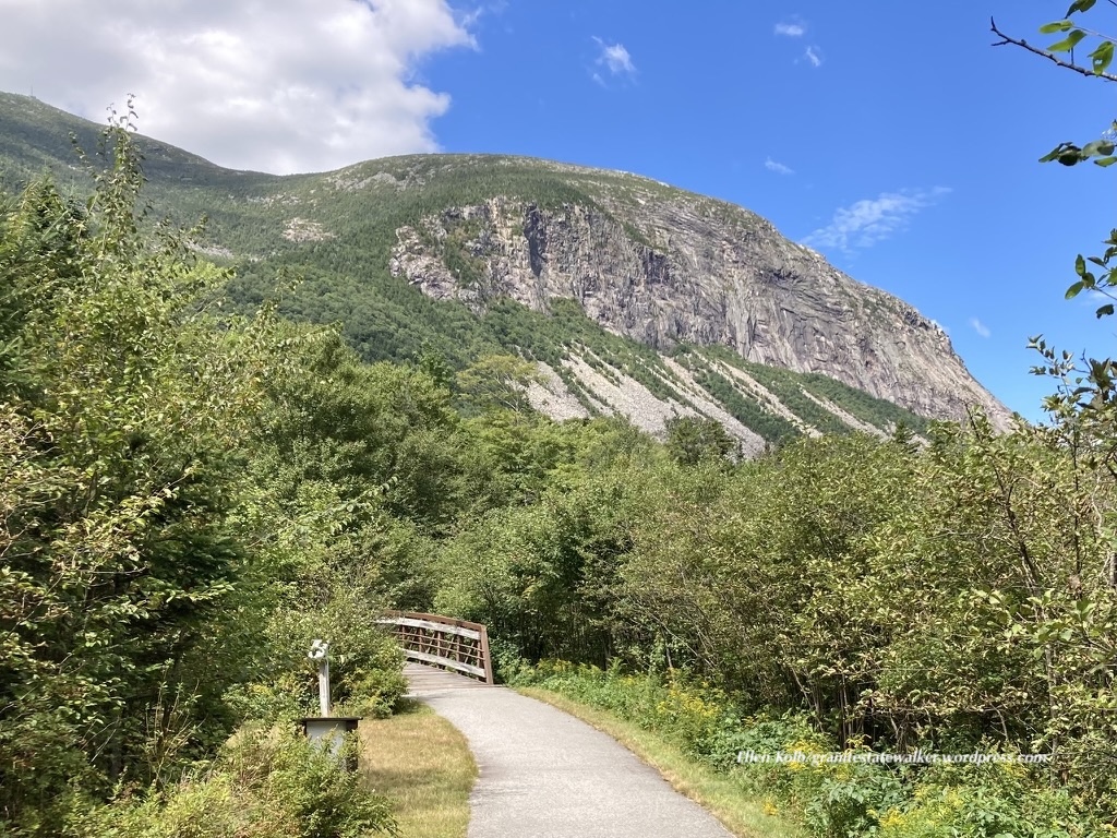
Franconia Notch State Park
I’ve driven on I-93 through the notch more times than I can count. Knowing that Franconia Notch State Park has a paved recreational trail 9 miles long, I thought it was about time for me to enjoy the area at walking speed.
The Basin in Franconia Notch State Park, NH. Dry summer, low water – and still a pleasant place to visit.Ellen Kolb photo.
The rec trail was a treat, once I came to terms with the cyclists sharing the path. There were more than a few e-bike renters who weren’t quite at home with their vehicles on the downhills. We gave each other space and cheerful greetings. I was there midweek, and I expect the experience might have been more hectic on a weekend.
I started at the Flume visitor center at the south end of the notch, and worked my way north. I stopped at the pretty Basin for a few minutes, and gave serious thought to joining a few people wading in the shallow Pemigewasset River just upstream. Warm day, cool water…but I kept going, knowing that up at Profile Plaza I’d find a place to enjoy my lunch with views of the surrounding mountains. The walk back to where I was parked was downhill, and I made sure to listen for speedy cyclists coming up behind me.
The Franconia Notch recreational trail and the cliffs of Cannon Mountain. Ellen Kolb photo.
Towards the southern end of the rec trail, I was on the Appalachian trail for about 30 feet. Maybe 20. We briefly shared a bridge, you see. AT hikers go through Franconia Notch the hard way. It wasn’t the last time I’d cross the AT on this trip.
I packed too much sweet stuff in my lunch bag. The rec trail goes through Lafayette Campground, where I found a nice little store stocked with Goldfish crackers. Pardon my crumbs.
If you head to the Notch and want to get oriented, the Flume visitor center at the south end of the park is the place to go. I used the nice clean bathroom there, knowing that facilities in the coming days were likely to be a bit more rustic.
Coming up in part II of the trip journal: two days and half of my miles were on the Presidential Rail Trail, which extends from Whitefield to Gorham. The first day was cloudy, the second brilliantly sunny, and each was splendid. Part III will cover the serene walk along Hogan Road, a unique section of the Cross New Hampshire Adventure Trail.
You can help Granite State Walker get to the next trailhead, simply by clicking on Buy Me a Coffee. Thank you!
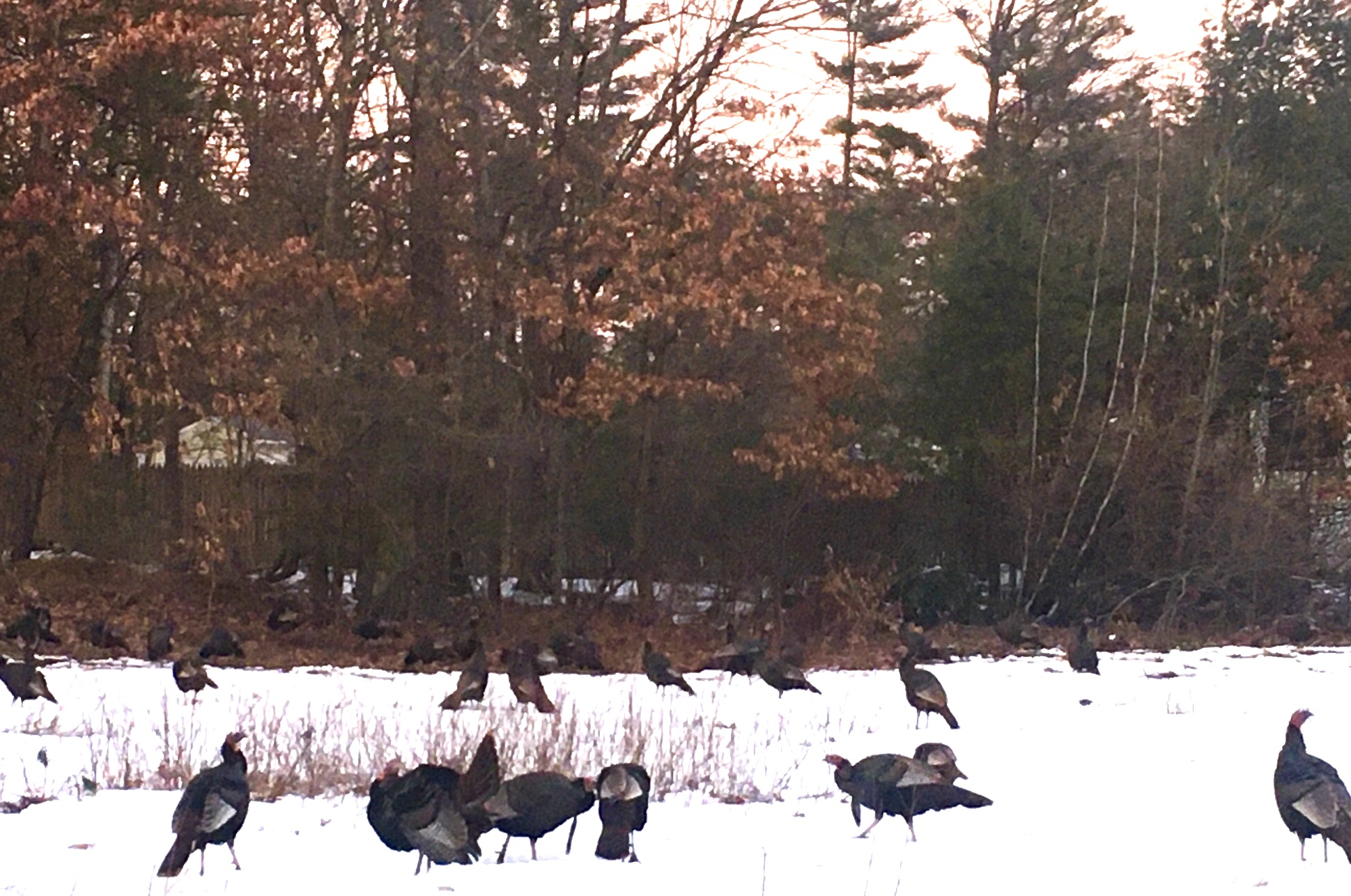
I seldom take sunset walks these days. Fresh into Daylight Savings Time, though, I find myself with daylight to work with even after I’m through with the dinner dishes. The lingering light lured me outside yesterday, long enough for a round-the-block stroll. I was well-rewarded: I saw and heard the local turkeys as they called it a day.
We share our suburban development with a flock of wild turkeys. My neighbors and I are accustomed to seeing them a few at a time in our yards throughout the year, patiently gobbling up spilled seed beneath bird feeders or checking out freshly-turned soil in our gardens. The flock has grown over the past several years, and I counted 57 turkeys a few weeks ago, pecking and scratching under nearby power lines for whatever food they could find. They’re habituated to us, but still wild.
Wild turkeys flocking together, late winter. Ellen Kolb photo.
I’m used to hearing gobbling and clucking, along with the occasional thumping whoosh as a turkey takes ungainly flight, usually at just the right altitude to match the grille of an oncoming car. On my recent sunset walk, I heard that whoosh, then another and another. Soon I came upon the cleared space under the power lines, and there they were: dozens of turkeys, taking flight one at a time, not to torment motorists but to head into the nearby pines to roost.
I’d never seen a flock at sunset. I stood fascinated, watching them ascend to their chosen spots. There were a few kerfuffles as some of the roosting birds objected to having their space invaded by later arrivals, but there was ample room in the stand of trees for all of them. Soon the clucking subsided to softer sounds, and the whooshes came to an end.
The timing was none of my doing. I just got lucky. Pretty good stuff, for a spur-of-the-moment walk.
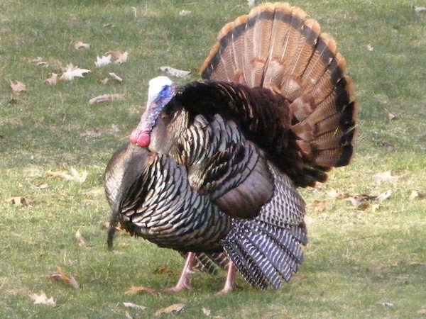
Male wild turkey, posing for his portrait. Ellen Kolb photo.
According to New Hampshire Fish and Game, wild turkeys were successfully re-introduced into New Hampshire in the 1970s, after more than a hundred years of absence due to habitat loss and overhunting. Since then, the turkeys have been thriving. Too thriving, it sometimes seems: I think every driver in the state has at one time or another had to stop for a bunch of turkeys crossing a road, always one bird at a time, moving at an infuriatingly leisurely pace.
I’ve grown a bit more patient with the big fowls as they’ve moved into the neighborhood. I’ve seen them throughout the year, courting and squabbling and caring for their young. Without meaning to, I’ve picked up a bit about the rhythm of their lives. They’re remarkable, even if they do act as though they own the roads.
The New Hampshire Rail Trails Coalition biennial conference went virtual this year, and the online environment didn’t get in the way of an informative event. I was invited by fellow NHRTC board members to talk for a few minutes about a walker’s view of the trails, and how even the slowest of users can become an enthusiastic advocate for rail trails. My presentation is now up on Vimeo, and I hope you’ll enjoy it.
For all of you who have suffered through videoconference indignities this year, you’ll sympathize with the post-slide-show Q&A here featuring my deer-in-the-headlights reaction to someone’s unintentionally muted mic. Once that problem was solved, our ace moderator kept the questions flowing.
You can find other presentations from the conference at The New Hampshire Rail Trails Coalition Vimeo page.
Job responsibilities prevented a backpacking trip for me this season. I settled for four days of dayhikes in Pittsburg, way north in Coos County, New Hampshire. (CO-ahhs, if you please, in case you’re new here. Welcome.)
Conditions: upper 80s, high humidity, overcast, with a low cloud ceiling that cut off views of nearly every peak in the area. On the other hand, I was there on quiet weekdays, and I had the solitude I craved on every road and trail.
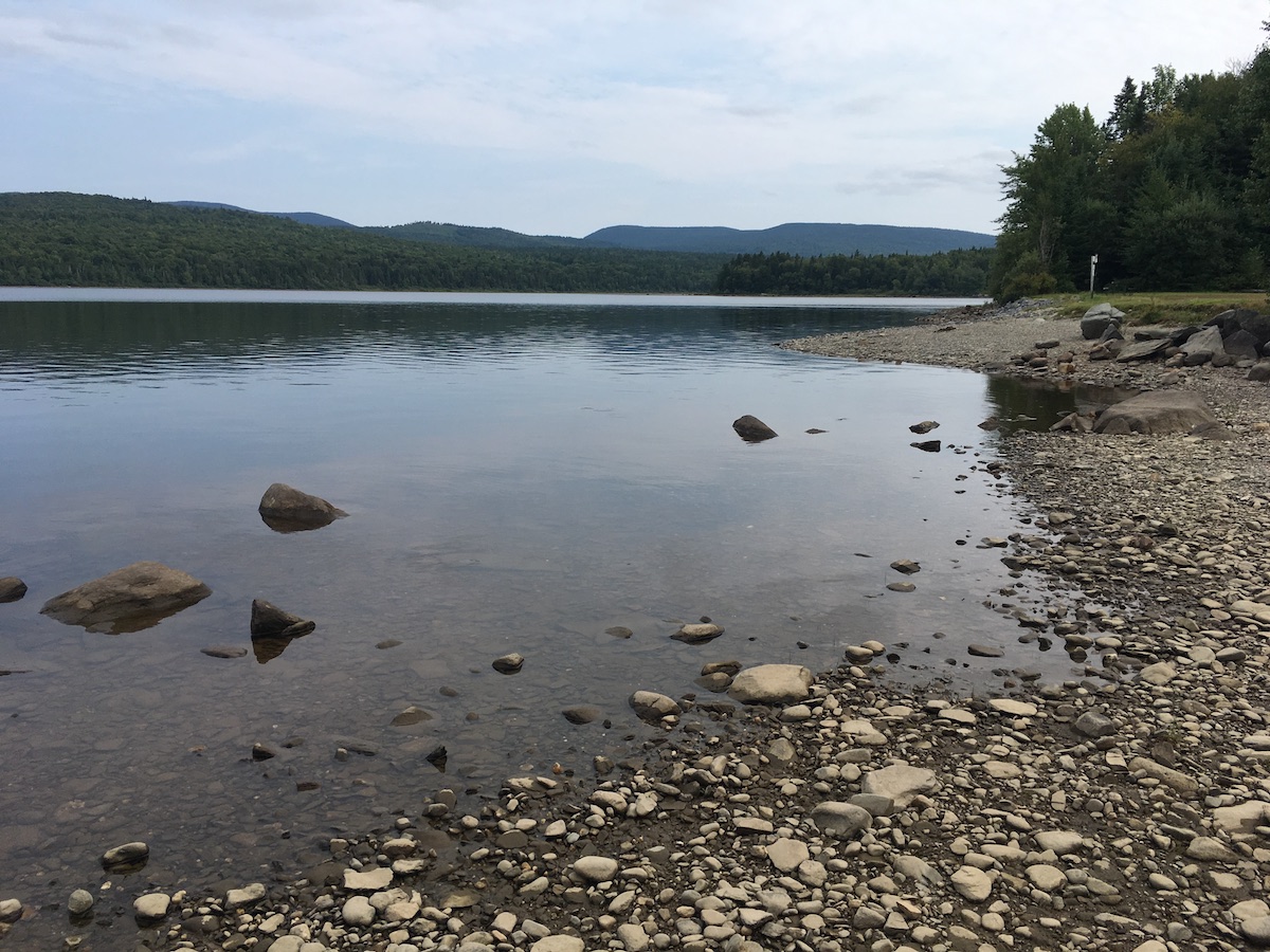
Mount Magalloway (in cloud) and First Connecticut Lake. All photos in this post by Ellen Kolb.
Cohos Trail Segments
Covell Mountain really does not want to yield a trail this summer. There were signs of storm damage and logging. The mud made me glad I had shoes with a moisture-resistant lining. Grasses were growing high despite obvious efforts by trail adopters to keep them in check. Blazes were clear and plentiful, though, and I know I can thank those same trail volunteers for that.
There was a newly-fallen spruce across the trail, not far from a junction with a path marked Cattail Trail. The spruce refused to give way to the little knife I carried. All I got for my pains was a sappy blade.
Perhaps on a clearer and cooler day, I’d have kept going past Covell to Prospect Mountain, where on another trip I enjoyed a spectacular vista. This was not a week for great views, I thought, so I contented myself with an up-and-back hike on Covell.
As I returned to my car parked at the Ramblewood campground, I caught sight of Mt. Magalloway and a sliver of First Connecticut Lake. The summit was obscured by cloud and the lake reflected the gray sky: a striking monochrome landscape offered up by Covell Mountain, as if to thank me for putting up with its messy trail.
Second Connecticut Lake, at a low late-summer level.
Peaceful Second Connecticut Lake never disappoints, however short the visit. This time, I parked at the dam alongside U.S. 3 and followed the Cohos Trail north.
The trail soon intersected Idlewilde Road, and I turned for the five-minute detour to the Idlewilde boat ramp. On a hazy late-summer afternoon, I stood at the ramp on the lake’s shore all by myself, with a loon’s call the only sound I could hear.
Back on the trail, I took up the Chaput segment. It’s named for a couple I’ve never met who are famous to Cohos Trail veterans for their years of trail work. The segment is parallel to and very close to U.S. 3, but it gets hikers off the pavement. I’m a fan. I hiked the northern section of the Cohos Trail in 2009, and at that time the last ten miles of trail to the Canadian border were on the highway. Thanks to the efforts of many volunteers, that’s no longer the case.
“Lainie’s Lair,” on the Cohos Trail.
Along the Chaput segment, I found the little rocky overhang nicknamed Lainie’s Lair. That’s a fun tribute to another legendary Cohos Trail volunteer. Lainie brought me with her for a memorable day of trail work during my 2009 hike. I had a lot of enthusiasm for the task, but zero skill. Lainie patiently coached me on things like how to use tools without hurting anyone and how not to freak out at the sight of bear scat. She could have accomplished a lot more that day in 2009 without me, but she was happy to be my guide. Nine years later, I smiled at the whimsical salute to her at the “lair.”
Sophie’s Lane is part of snowmobile corridor #5, and the Cohos Trail follows it beginning just south of Deer Mountain State Park. After being in the woods on a hot day, Sophie’s Lane was a relief. It was wide and open enough to catch a breeze that kept insects at bay. The lane leads to a spur to the site of an old fire tower on Deer Mountain (no cab or platform remains), which is a side trip I didn’t take.
I liked the short spur to Moose Flowage, which is part of the Connecticut River south of Third Lake. It was a good spot for a break and a snack. It was a tempting place for a campsite as well, but signs sternly warned against any such notion. Deer Mountain state park’s campground, accessible from U.S. 3, is just across the Flowage.
Sophie’s Lane trail kiosk
The lane gradually narrowed the further north I walked. I stopped well short of the Canadian border, avoiding a walk through a long weedy stretch of trail. I passed a clearing with one boulder covered in street art. That jarred me. That painted rock somehow bothered me more than the relatively new cell tower at the north end of First Lake. It poked a big hole in the sense of isolation I expected in August on a snowmobile trail three miles from Quebec.
What I didn’t see along the way – not on Sophie’s Lane, and not anywhere else – was a moose. No bear or deer, either. I saw moose tracks in one muddy spot, but as for the beasts themselves, nada. Perhaps the heat kept them in hiding. Maybe I’m such a noisy hiker that I scare off everything larger than a mosquito. My presence didn’t bother the birds, though. It was a good week for seeing heron, hawks, and turkeys.
Pittsburg: the Village and Happy Corner
Broadband has come to Pittsburg, or at least parts of it. I stayed in the village – downtown Pittsburg, more or less – in a comfortable little cabin with WiFi and cell service.
The snowmobile crowds are a few months away, people are buttoning up their camps for the season, and the summertime ATV vacationers have mostly returned to work and school. The town roads were thus quiet and inviting during my recent visit. As always in Pittsburg, the people I encountered were friendly and hospitable, ready to answer my questions and point me to interesting places.
A three-mile loop walk from my cabin at day’s end took me to Murphy Dam, Lake Francis, and Cedar Stream Road. A tranquil route, from start to finish. Had I moved east on Cedar Stream Road rather than west towards town, I’d have picked up a Cohos Trail segment leading to the east side of Lake Francis.
Lake Francis seen from Murphy Dam
Six miles north of the village, the crossroads known as Happy Corner makes a good base for a few Cohos Trail dayhikes and for exploration of town roads. I loved rambling with no schedule and no fixed route.
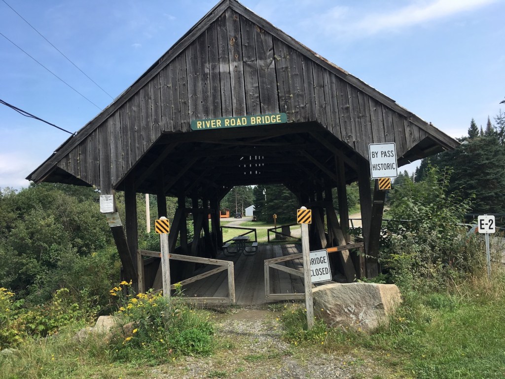
The Happy Corner bridge is still open to automobiles, although none were in sight when I was there.I found this along Hill-Danforth Road, and left it for the next person to enjoy.The old covered bridge on River Road has been bypassed, but visitors are welcome to take a break at the picnic table inside.Perry Stream at the River Road bridge.
Road Tripping
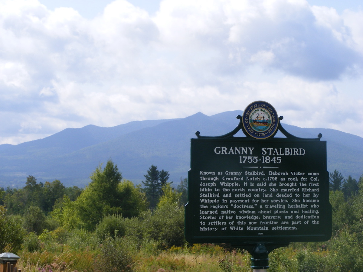
I only get up this way once a year or so, and I try to make the most of the long drive. I drove a circuitous route on the way north in order to photograph a slew of North Country historical markers. Interesting sites, interesting history!
On a cloudy morning, the Cog Railway track seemed to disappear into Mount Washington.That’s Cherry Mountain behind the Granny Stalbird marker in Jefferson.The city of Berlin on the Androscoggin River boasts four markers, each featuring a different aspect of the city’s heritage.
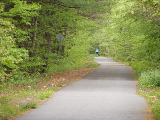
Look back over this blog’s decade of posts and one place gets mentioned in all seasons: the Nashua River Rail Trail. It extends twelve miles between Nashua, New Hampshire and Ayer, Massachusetts.
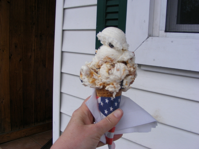
I love the seasonal changes on the trail. I like the sound of the skydiving plane overhead and the sight of the colorful chutes as the skydivers make their jumps. I like seeing what’s being planted at the farm in Dunstable. I am enchanted anew each time I see the soda machine that a trail-abutting family has set up. I like the ice cream stand in East Pepperell.
There are no bad seasons here.
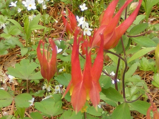
Pepperell’s Rail Trail Ice Cream Shop keeps me coming back.Columbines bloom in early summer along the trail.The Nashua River Rail Trail, mid-springAlong the Nashua River near the Pepperell/Groton line.
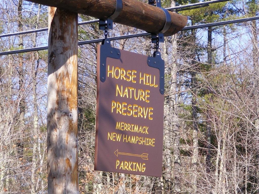
Among the places to which I’ve returned repeatedly since beginning this blog is Horse Hill Nature Preserve, one of my favorite southern New Hampshire destinations. Here are a few Horse Hill images.
When I moved to this area thirty years ago, what is now the preserve was just a big undeveloped area with a sandpit in the middle. There was once talk of building a housing development in there. The development never materialized, and in 2002, the town purchased the property for conservation. As a community, we made a wise decision.
The area needed a lot of cleanup before it was ready for prime time, and we resorted to some creative maneuvers to get the job done. I remember going there with my son’s Scout troop on a hike. In the sandpit area was debris from the area’s days as an informal target range. Each Scout gleefully stuffed his pockets full of shell casings and carried them out. I can only imagine how many forgotten little brass pieces found their way into washing machines that weekend.
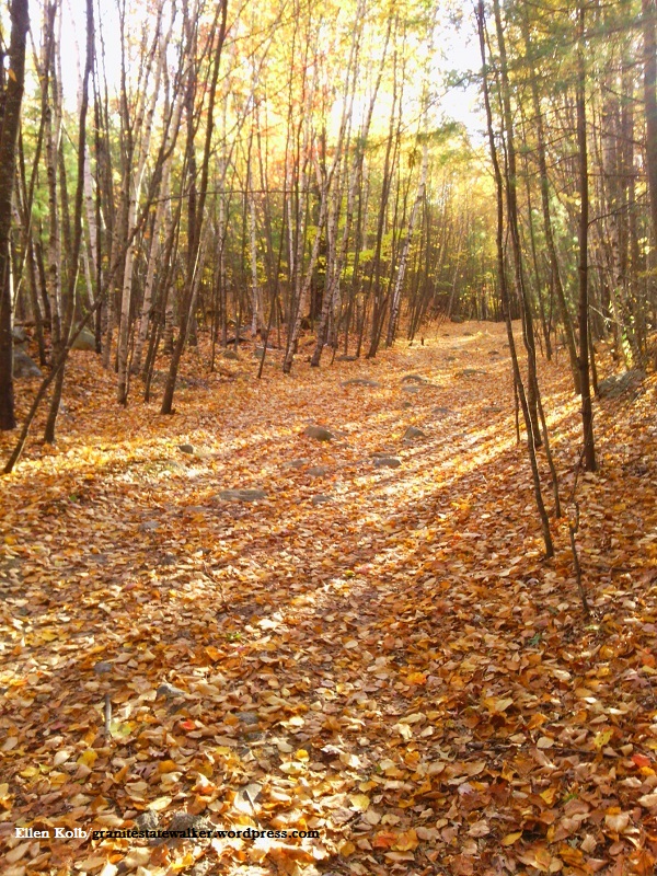
My favorite season at Horse Hill. Photos by Ellen Kolb.
Now, Horse Hill is a year-round spot for walkers, runners, and off-road bicyclists. Horseback riding is allowed, too, for equestrians who don’t mind taking their chances sharing a trail with bikes. As for being a nature preserve, Horse Hill’s wetlands and trees provide habitat for a variety of wildlife.
Horse Hill is popular enough that the town just tripled the size of the parking area, yet it never seems crowded once I’m more than five minutes from my car. Plenty of trails branch off from the main loop, so hikers aren’t concentrated in one area.
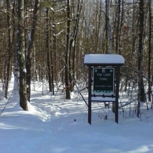
If you go, pick up a map first from the kiosk on Amherst Road, and then have fun.
Trails in winter are good for snowshoeing, cross-country skiing, and fat tire biking.
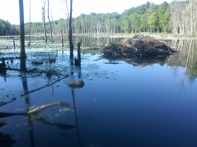
Lastowka Pond at Horse Hill Nature Preserve hosts a heron rookery and beaver lodge.