A bit of a challenge

I’m downright embarrassed. I haven’t been on any hilly hikes lately (save one, about which more below). I haven’t explored anyplace new. Nothing long, despite my good intentions about training for an autumn attempt at the Cross New Hampshire Adventure Trail. My recent challenges have been on the order of going up stairs without pulling the railing out of the wall.

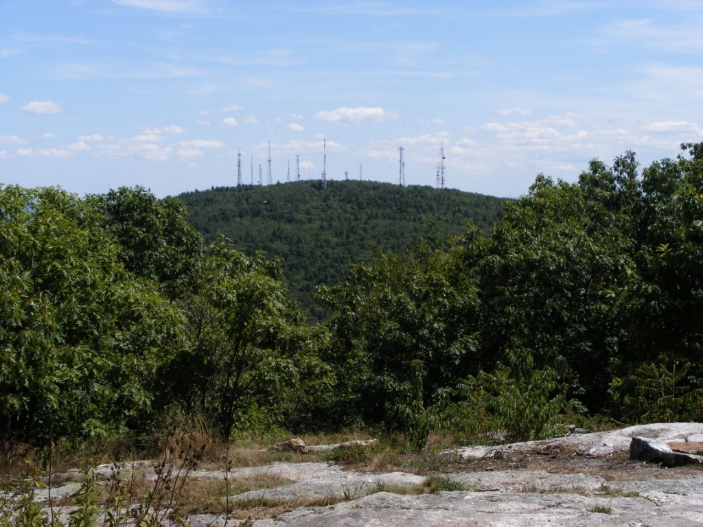
Shut up, knees. I’m trying to hike here. I’ve been muttering that a lot since a mid-May mishap in which I banged up both knees, one worse than the other. A few weeks ago I tried a hike up South Uncanoonuc in Goffstown, which with its twin to the north is the first place I go when I test how rehab from injury is going. Nice views, bad judgment. My knees and I have barely been on civil terms ever since. Flat is fine, stairs not so much.

But oh, a stop on a South Uncanoonuc ledge was refreshing. I had a view to the west-southwest, towards the Monadnocks, with Grand Monadnock itself peeking from behind the Wapack range.

photo of hills in distance, pine trees in foreground

I’ve since been walking on easy paths with their own attractions. One of my town’s conservation areas is home to a heron rookery that’s too far away from shore to be captured by my phone’s camera. I pressed my family’s “real” camera into service, to good effect. The juvenile herons are growing fast.

great blue herons in nests

The Nashua River Rail Trail can still surprise me, even after a hundred or more visits. I spotted a trailside blossom the other day that I’d never seen before. Goat’s rue, if my phone’s plant ID app is accurate; I welcome correction from any reader who knows better. In a year when poison ivy and knotweed threaten to overwhelm the trail’s usual flora, this was a treat to find.

goat's rue blossom amid grassy ground cover

Annoyed as I am to be on limited duty, I can see this will be a beautiful summer. May you find pleasant surprises on your own Granite State walks this season.

North Uncanoonuc, late fall

Kiosk at Mountain Road parking area near town waterworks gate. No take-along maps available; download one before you go. 

Western view towards the Monadnocks from North Uncanoonuc. The haze is typical.

My boots had cobwebs in them when I picked them up for this afternoon’s hike in Goffstown. It’s been too long since the last hike. The Uncanoonuc hills are close by, have easy trails, and offer fairly good views, so that’s where I went. Not a bad little local jaunt.

On this clear day in the 40s,  the little parking area on Mountain Road at the town waterworks was almost full. “Full” means about eight cars, so crowds were not a problem. I headed for North Uncanoonuc’s summit via the snowmobile trail marked as a class VI road. (Download the map at www.goffstowntrails.com.) The slippery leaves & loose rocks made made me watch my step, but this is an easy hike overall.  At a casual pace, I got to the summit in just over half an hour.

People brought their kids and dogs today. Most, like me, were taking it easy. A few ambitious souls ran a big loop beginning on the trail I took, then over the summit to the White Dot trail (not to be confused with the famous one on Monadnock) and back to Mountain Road. Must be nice to be fit.

Unlike the south peak, which boasts a decent view of Manchester, North Uncanoonuc offers views west  to the Wapack Range and north to Mt. Kearsarge.  (The Kearsarge vista is a few hundred yards down from the summit on the White Dot trail.) The ledgy summit pokes just far enough up from forest & shrubs to reward hikers with some pleasant sights. It’s a great picnic spot, too.

That spiky hill in Goffstown

The twin Uncanoonuc hills in Goffstown are my landmarks for knowing I’m nearly home whenever I come back from even a short trip out of my area. North Uncanoonuc looks forested and fresh, while South has 14 antennae and cell towers on its summit, making it look a bit like a geographic porcupine. I can’t complain too much about the towers, since I like having cell service & similar conveniences. Any map I consult calls these the Uncanoonuc Mountains, but when you read that, bear in mind that these “mountains” top out around 1300′.

North Uncanoonuc is always pleasant, with good views, no power lines, & no towers. Today, though, I wanted to check out the trails on South. Goffstown has produced a terrific map (www.GoffstownTrails.com) showing not just the old hiking trails, but also the snowmobile trails that snake over & around both peaks. Mountain Road between the hills has several parking areas for hikers, and the entrance to the Reservoir road off Mountain Road now has a parking area with a map kiosk.

I started up South Uncanoonuc from the kiosk for a short late-afternoon hike, carrying the map I had downloaded & printed. Conditions are typical for November. South’s trails are covered with slippery oak leaves, and a few of the boggy spots already have a thin skin of ice. Major trail intersections have either snowmobile signs or trail markers. Most minor trails as shown on the map are easy to spot, though they’re unsigned. A power line cut across the slope includes a well-defined trail, which today saw bike traffic along with a few hikers. It was a great day to enjoy the view of Manchester (see photo) from South’s summit ledges. I could almost forget that a cell tower was right behind me.

If I had had more time, I could have continued down the other side of South Uncanoonuc on either of two trails that end at Uncanoonuc Lake. A full morning or afternoon could easily be given to wandering these trails and visiting both summits. Bring water & snacks – the closest store & restrooms are on Mast Road, a couple of miles north of the trail kiosk on Mountain Road. There’s a paved road from South’s summit to Back Mountain Road, and if you want a good workout without going into the woods, you can drive to the summit (no good parking at the base)and walk down to the base & back. But why would I want to avoid the woods on a day like this?