Autumn road trip: clouds and no crowds on the Presidential Rail Trail

My husband and I drove to northern New Hampshire for a hastily-planned weekend trip for some hiking and biking, past the peak autumn foliage and the oppressive crowds driving to see it. The cloudy weather got cloudier. Traffic got lighter. When we stopped at a little inn on U.S. 2, we were exactly where we wanted to be.

You can call it “past peak.” I call it just fine.

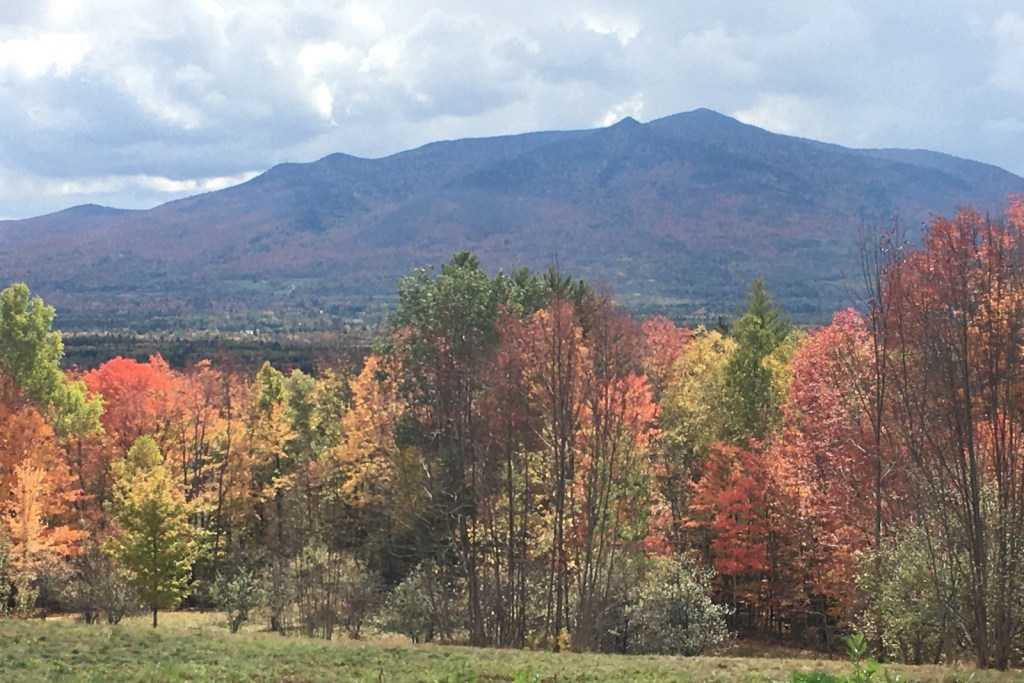
It was not a weekend for grand vistas or clear night skies. Low clouds were the rule. My favorite lookout spot on the Weeks State Park Auto Road, which usually features a showstopping view of the Presidential Range, featured nothing but a wall of fog.

So instead of looking at things miles away, I spent more time looking at things like the carpet of red maple leaves under my feet. I liked walking for miles in the cool conditions. Segments of the Presidential Rail Trail were ideal.

The only noisy mile of trail was one I shared with ATVs in Gorham when I wanted to get a look at the Androscoggin River from a trail bridge. Once I’d done that, I scooted back west to where the trail was closed to motorized traffic. Once I was on that stretch, I saw a grand total of three other people in five miles of walking.

Androscoggin River in Gorham New Hampshire
Androscoggin River, Gorham NH: low in October after a dry summer. Ellen Kolb photo.

At one point during the weekend, the clouds lifted enough to reveal nearby Cherry Mountain, which for once wasn’t just a visual foil to all the other peaks in the area. I was lucky enough to be walking on the Presidential Trail in the Pondicherry area (trailheads on Airport Road in Whitefield and NH Route 115-A in Jefferson) when the sun came out and the view opened up.

Cherry Mountain, Jefferson New Hampshire. Photo by Ellen Kolb
Cherry Mountain, Jefferson NH. Ellen Kolb photo.

Cool and Shady: Falls in the River, Cohos Trail

Another trip to northern New Hampshire for me meant another walk to one of my favorite spots on the Cohos Trail, the Falls in the River. No trip to Pittsburg on a 90-degree day would be complete without it. From the parking area by the Second Connecticut Lake Dam, a half-hour southbound walk through the woods on the blazed Cohos Trail brought me to the Falls. Soon I was refreshed in every way.

A few years ago, my husband and I were among the volunteers who put the finishing touches on this segment of the CT before it was officially dedicated. Others had done the hard work. It has since become one of the CT’s most popular dayhike areas.

Rushing water over boulders in a riverbed, with shrubs growing on the shore
Falls in the River, Pittsburg NH, June. Photos by Ellen Kolb.
small wildflowers growing from a crack in a boulder
Cracks in the granite give tiny blossoms a home.
Lake surrounded by evergreen forest
A peek at Second Connecticut Lake from the parking lot by the dam. 

The trail in this area manages to feel remote even when it’s squeezed between U.S. 3 and the Connecticut River. Trees conceal the highway and muffle the sound of vehicles.

I saw no moose. I figured the hot weather would keep them from being out on the roadside at midday, but I thought for sure I’d see one in the woods. I saw only their prints in the mud.

Learn more about the Cohos Trail at cohostrail.org and the Friends of the Cohos Trail Facebook group. Links updated, 2026.