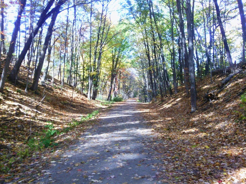
New Hampshire’s Piscataquog Rail Trail finally reaches across the Piscataquog River, connecting Manchester with Goffstown. I put off some workday tasks long enough to walk the trail from its east end all the way across the new bridge. With all due respect and gratitude to the many people who made the project happen, I didn’t stay for the ribbon-cutting and speechifyin’. Trails are for walking.
On the Manchester side, looking toward Goffstown, at long last. Ellen Kolb photos.
On the Goffstown side.
I call this right neighborly.
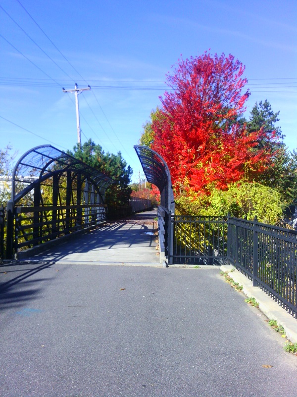
Second Street bridge, near east end of Piscataquog Rail Trail.
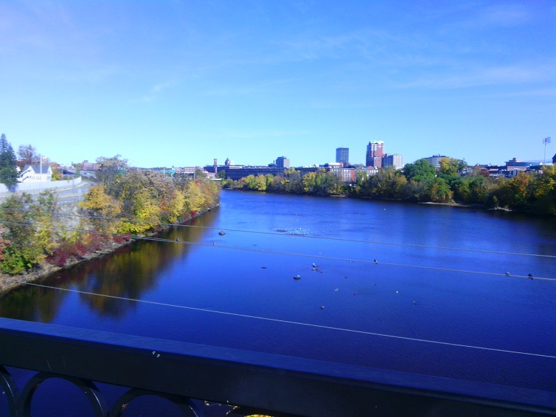
The Queen City: Manchester, New Hampshire, seen from the Hands Across the Merrimack bike/ped bridge.
The Singer family is behind many philanthropic efforts in the Manchester area. Their generosity helped to complete the bridge project.
August 2015: new span will soon link the Goffstown and Piscataquog (Manchester NH) rail trails. Ellen Kolb photo.
I take back every pessimistic word I ever wrote about the difficulties that would have to be overcome in order to link the rail trails in Goffstown and Manchester, New Hampshire.
A month ago, there was a great big empty spot where the old railroad trestle over the Piscataquog River used to be. Now, sooner than I thought possible, a new bridge for pedestrians and bicyclists is in place. It’s not yet open, but I checked out the area today and saw a serious construction effort underway on the approach to the Manchester end.
Kiosk at Mountain Road parking area near town waterworks gate. No take-along maps available; download one before you go.
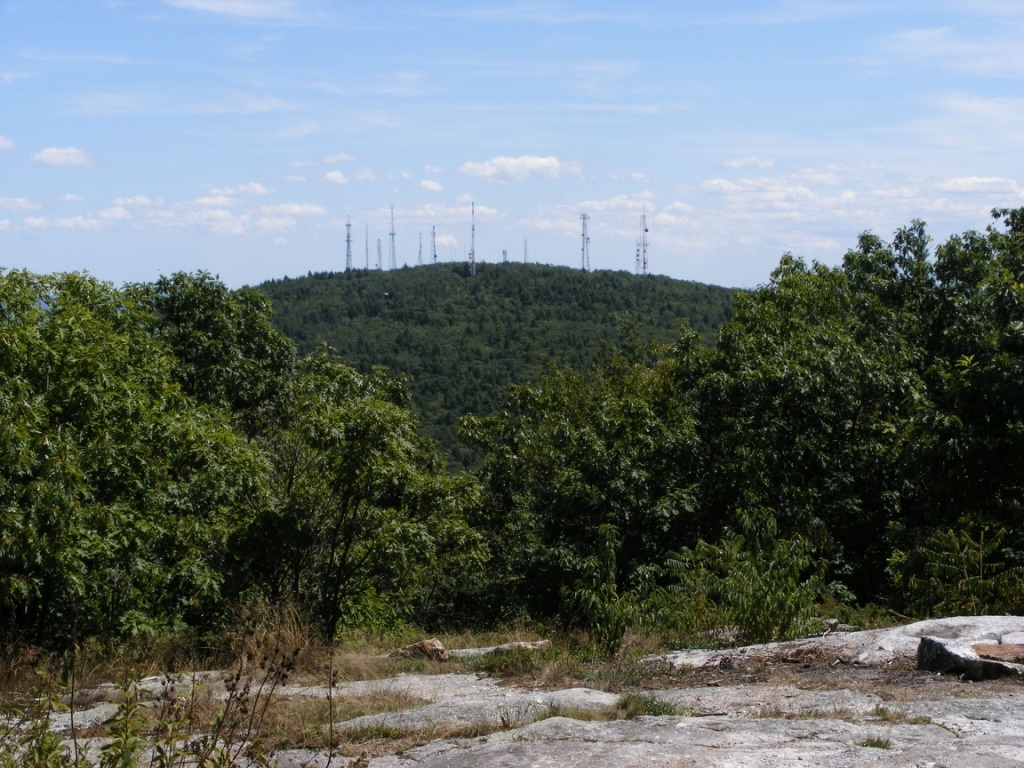
Western view towards the Monadnocks from North Uncanoonuc. The haze is typical.
My boots had cobwebs in them when I picked them up for this afternoon’s hike in Goffstown. It’s been too long since the last hike. The Uncanoonuc hills are close by, have easy trails, and offer fairly good views, so that’s where I went. Not a bad little local jaunt.
On this clear day with temperatures in the 40s, the little parking area on Mountain Road at the town waterworks was almost full. (“Full” means about eight cars.) I headed for North Uncanoonuc’s summit via the snowmobile trail marked as a class VI road. (Download the map here.) The slippery leaves & loose rocks made made me watch my step, but this is an easy hike overall. At a casual pace, I got to the summit in just over half an hour.
People brought their kids and dogs today. Most, like me, were taking it easy. A few ambitious souls ran a big loop beginning on the trail I took, then over the summit to the White Dot trail (not to be confused with the famous one on Monadnock) and back to Mountain Road. Must be nice to be so fit.
While the south peak boasts a decent view of Manchester, North Uncanoonuc offers views west to the Wapack Range and north to Mt. Kearsarge. (The Kearsarge vista is a few hundred yards down from the summit on the White Dot trail.) The ledgy summit pokes just far enough up from forest & shrubs to reward hikers with some pleasant sights. It’s a great picnic spot, too.
Update, 2026: If the goffstowntrails.com website isn’t available, look for information on the Uncanoonucs and other Goffstown, New Hampshire trails at goffstownlibrary.com.
The twin Uncanoonuc hills in Goffstown, New Hampshire are my landmarks for knowing I’m nearly home whenever I come back from even a short trip out of my area. North Uncanoonuc looks forested and fresh, while South has 14 antennae and cell towers on its summit, making it look a bit like a geographic porcupine. I can’t complain too much about the towers, since I like having cell service & similar conveniences. Any map I consult calls these the Uncanoonuc Mountains, but when you read that, bear in mind that these “mountains” top out around 1300′.
North Uncanoonuc is always pleasant, with good views, no power lines, & no towers. Today, though, I wanted to check out the trails on the South mountain. Goffstown has produced a terrific map available on the town library’s website showing the trails that snake over & around both peaks. Mountain Road between the hills has several parking areas for hikers, and the entrance to the Reservoir road off Mountain Road now has a parking area with a map kiosk.
South Uncanoonuc Mountain with all its communications towers, seen from nearby North Uncanoonuc. Ellen Kolb photo.
I started up South Uncanoonuc from the kiosk for a short late-afternoon hike, carrying the map I had downloaded & printed. Conditions are typical for November. South’s trails are covered with slippery oak leaves, and a few of the boggy spots already have a thin skin of ice. Major trail intersections have either snowmobile signs or trail markers. Most minor trails as shown on the map are easy to spot, though they’re unsigned. A power line cut across the slope includes a well-defined trail, which today saw bike traffic along with a few hikers. It was a great day to enjoy the view of the city of Manchester from South’s summit ledges. I could almost forget that a cell tower was right behind me.
If I had had more time, I could have continued down the other side of South Uncanoonuc on either of two trails that end at Uncanoonuc Lake. A full morning or afternoon could easily be given to wandering these trails and visiting both summits. Bring water & snacks – the closest store & restrooms are on Mast Road, a couple of miles north of the trail kiosk on Mountain Road. There’s a paved road from South’s summit to Back Mountain Road, and if you want a good workout without going into the woods, you can drive to the summit (no good parking at the base)and walk down to the base & back. But why would I want to avoid the woods on a day like this?