Silver maples bend over the trail at the Forest Society’s Merrimack River Education and Conservation Area, Concord NH. Ellen Kolb photo.
The Society for the Protection of New Hampshire Forests headquarters is in Concord, off of I-93’s exit 16. Follow signs for “conservation center”, and you’ll find the headquarters on Portsmouth Street.
The Forest Society trail network at this property runs along the Merrimack River and includes a pine plantation, a silver maple forest, floodplain, and a river cove with a canoe landing. The traffic sounds from nearby I-93 are easy to ignore. In this drought, the river is quiet, but the sharply-cut banks indicate how high the Merrimack can run in a rainy season.
I stayed here longer today than I had intended, stretching a quick lunchtime walk into an hour. The trail is flat & sandy; no boots required. The bugs are out, so bring your insect repellent. This is an undramatic, peaceful spot for a walk, and it’s open from dawn to dusk.
The Oak Hill trails in Concord, New Hampshire branch out from a parking area on Shaker Road, where ten cars (maybe a dozen, in a pinch) can fit comfortably. From NH Route 132 in the northeast part of town, turn onto Shaker Road and continue for about 2.4 miles. Watch for a sign on the right with a parking area.
The forested hill is laced with trails, with good vistas here and there. The fire tower at the summit, on the Concord-Loudon line, is a bonus, and you can get there by following Tower Trail, which is about two miles long and has signage along the way. Print out your map from the City of Concord’s website so you can find your way around the trail network.
My trail report from a visit on December 18, 2010:
Tower Trail is free of obstructions. The few bridges are intact. Oak Hill is still snowless, and the trail itself is ice-free except for a few small areas in the last few hundred yards leading to the tower. The frozen ground is covered with leaves that can be a bit slippery, and the surface is a bit uneven with rocks and roots. In other words, this is a typical woods walk.
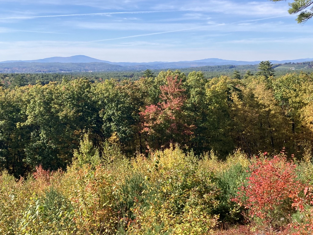
The last quarter-mile or so follows a power line straight to the fire tower, which is dwarfed by a pair of cell towers. The cab is unstaffed and locked this time of year. I was able to climb to the platform just below the cab, stopping at each landing to wonder just what the fire warden was supposed to survey. I had to get to the platform before the view and the breeze really opened up. Warner’s Mt. Kearsarge dominated the view to the west-northwest. There are hills in all directions, none of them snowcapped yet, though my view was limited by distant haze.
It’s about 500 feet of vertical rise from the trailhead to the tower, with a gentle grade. The hike took me 50 minutes each way, and a more fit walker could undoubtedly cut that time considerably. The full trail network on the hill covers about 7 miles, so a hiker could easily spend a day exploring the area. There are no toilet facilities at the trailhead.
The trailhead is less than 15 minutes’ drive from the State House, and the trail is in great shape. I’ll be back.
Looking west from the Oak Hill fire tower in Concord NH, the next active fire tower is on Mount Kearsarge (at left) in Warner.