Northern NH road trip: Stark to Third Connecticut Lake

Great North Woods, New Hampshire (NHDOT map)

Great North Woods, New Hampshire (NHDOT map)

With no formal vacation in sight, I can improvise. Just give me 24 hours and a car. Good hiking territory is essential, but so is a pleasant drive. Earlier this week, that meant heading up I-93 to Coos County.

Third Connecticut Lake area

Lone hiker, five miles from Canada

Lone hiker, five miles from Canada

Site 28 at Deer Mountain State Park

Site 28 at Deer Mountain State Park

This trip was actually inspired by a planned work project on the Cohos Trail, cutting a spur to the summit of Deer Mountain in the town of Pittsburg near the Canadian border. Unfavorable weather forced postponement of the trail work, leaving me free to wander familiar trails alone for a few hours. Very quiet overcast morning: no logging in the area this week, only two campsites occupied at Deer Mountain State Park, only one other hiker in sight. No hills on this trip, given my limited time in the area. U.S. Rt. 3 was nearly deserted. Snowmobile trail #5, on which the Cohos Trail piggybacks in this area, had a few mud puddles, but nothing dramatic. I enjoyed miles of walking the highway and the trail.

When I hiked through this area on a backpacking trip in ’09, the segment of trail now shared with the snowmobile trail was not yet on line. I was on pavement in 90 degree weather from Happy Corner to the Canadian border. I loved that trip, but I can tell you that cool drizzle is fine, too.

Stark

OK, I’m cheating here: I didn’t hike in Stark. I broke up the long drive to Pittsburg by stopping for a night at the Stark Village Inn, owned and operated by a member of the Cohos Trail Association board. The inn is homey and affordable, and I would recommend it to anyone heading up that way who wants a comfortable place to stay without breaking the bank. Nancy, the owner, is the soul of hospitality. She can tell you about trails in the area, and she’s been known to provide shuttle service to local trailheads.

View from Stark Village Inn

View from Stark Village Inn

If I did decide to hike here, I’d probably head up the Nash Stream Road from NH Rt. 110. Or maybe I’d head south of 110 toward the Kilkenney Ridge trail. Maybe I’d just walk along 110 and enjoy the sound and sight of the Upper Ammonoosuc River. I’d turn off my cell phone, too. North of Lancaster, cell service ranges from spotty to nonexistent. That sort of enforces a vacation state of mind.

Etc.

I like Colebrook. It’s bustling, but it’s a tiny town nonetheless. Here, U.S. 3 meets NH 26, which leads to Dixville Notch. Another day, I would have gone to the Notch for a short but lung-busting climb to Table Rock. No time on this trip, though. “Later,” I promised silently as I drove past NH 26, not weakening even when I drove past Le Rendez-Vous. That’s a bakery with amazing stuff, including a chocolate croissant that will fortify any hiker.

On NH 145 northeast of the center of town – a fun road, by the way – is Beaver Brook wayside area. Even if you’re driving past on your way to another trail, stop here. It’s a feast for the eyes. There are short trails near the falls, especially nice in the summer when the spray from the falls is soothing on hot days. Pack a picnic.

Beaver Brook wayside area

Beaver Brook wayside area

I stopped in Columbia on my way home, just south of Colebrook, at the Shrine of Our Lady of Grace. It doesn’t take long to walk the grounds. There are days when the shrine is thronged with pilgrims & tourists. I was there a few years ago during the Blessing of the Motorcycles (coming up this year on June 22), with hundreds of cheerful bilingual bikers. This week, I was alone. Different feeling altogether. For me, it was a place of prayer.

(Update: the Shrine closed in 2014. Part of the property has become the Tillotson Center, a community heritage, visual, and performing arts center.)

Shrine of Our Lady of Grace

Shrine of Our Lady of Grace

The ride back to southern New Hampshire on U.S. 3 goes past some of my favorite hiking spots, including Weeks State Park. There was that pesky clock ticking, though. I had some fun getting off U.S. 3 and I-93 in some areas to enjoy the back roads. I carry a DeLorme atlas (old school, I know, in these days of GPS) to give me inspiration when I’m all Interstated-out.

Of course, once I was halfway home, the sun came out and the temperature went up 15 degrees. If I couldn’t have that weather for hiking, it was at least nice to have it for driving. No complaints, though. Those were twenty-four pretty good hours.

Last Day on the Road

bee balm in bloom
Summertime bee balm along the Cohos Trail. Photo by Ellen Kolb.

Twelfth and last in a series about my Cohos Trail section hike in 2009. If you’ve enjoyed reading about this journey, I hope you’ll consider supporting the Granite State Walker blog. Thank you!

After seven hot hours, I made it from Pittsburg village to Sportman’s Lodge. It was much more comfortable, not to mention faster, to be walking without a tent or pad or several days’ worth of food.

I slept like a baby last night. No matter how I try, there’s just no way I feel as secure in a tent as I do in a place like a cabin with a lock on the door.

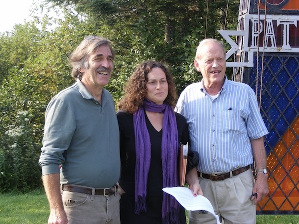
I decided to spend some of my fast-dwindling cash supply on a really, really good breakfast. I went to Dube’s Pittstop (yes, an extra T), where the lone waitress was cheerfully attending to a nearly-full house. I ordered my plateful of food along with coffee & OJ, and then heard a cheerful greeting from the next table. I looked over and there was Armand, sitting with 5 or 6 buddies over coffee. A small town, indeed.

When I finished up, I bought a couple of bottles of some kind of flavored non-carbonated water-type stuff (couldn’t they just carry Gatorade??). Armand called out “May it all be downhill.” Surely, there’s no finer farewell for a hiker! We were laughing as I stepped outside for the last leg of the trip.

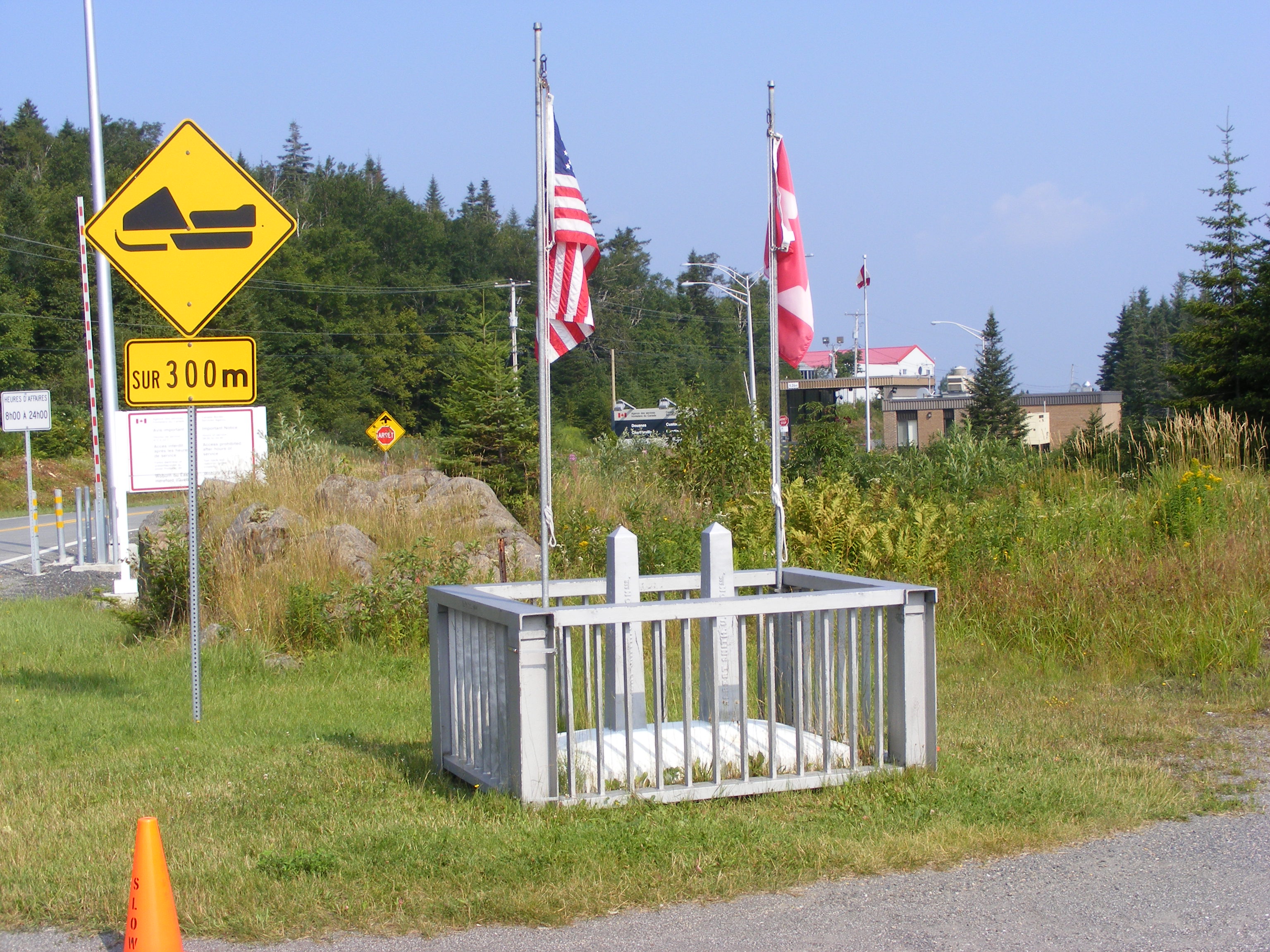
I took Rt. 145, & when I got to Clarksville Pond Rd., I took one look down Old County Road & decided to stay on 145 until Creampoke Road. When I got to the 45th Parallel marker, I hung my hat on its corner and propped my pack & trekking pole against the sign’s support pole & then took a picture. It occurred to me then that I should have been using that hat as a photographic prop throughout the trip.

145 climbs a bit leaving Pittsburg and heading through Clarksville. I cheered when I got to the little signs warning trucks to use low gear, knowing that meant a downhill stretch was coming up. On Creampoke Road’s long eastward run, a truck slowed down beside me & the driver said “Didn’t I see you in Pittsburg this morning?” Darned if it wasn’t one of Armand’s breakfast companions! We went our separate ways after a brief cheerful chat.

I packed 40 ounces of drinks & should have packed more. I packed 3 energy bars, & I could have done with one. Solid food seemed an unnecessary distraction.

After turning from Creampoke to Haines Hill Road which becomes McAllaster, I came to a fork that puzzled me. There was a logging cut on the left with a path through it, and a path like a snowmobile trail off to the right. I remembered going past a logged area when I came up here, but I hadn’t seen the fork from that direction. I used the 10-minute rule that has served me well on the trip, and I didn’t even need the full 10. About 3 minutes of walking into the log yard showed me a dead end on a little knoll.

Suddenly, I heard my phone buzzing. That little hill brought me into cell range, probably pinging off a Canadian tower. I was receiving a text my daughter had sent the night before. I texted her back with an update on my location.

Out of the logging yard, onto the other path, out of cell range: right back where I belonged. My compass confirmed I was heading SSW, close enough to south to be reassuring. The path gradually widened. I came around a curve and saw a massive tree down across the road. Suddenly, I remembered the tree from my northbound walk, and I knew where I was. The tree had been leaning over the road quite precariously when I last saw it. Once past the tree, I recognized the farm ahead, and soon I reached Bear Rock Road. The route was a piece of cake from there, with nothing ahead but signed town roads. By the time I got to Diamond Pond Road, I was dragging, but I knew I was almost done.

Coleman State Park at last! It was just a mile away from my goal, and I was more than ready for water when I got there. The park was deserted except for me and a lone motorcyclist. I dropped my pack & trekking pole on a picnic table & made a beeline for the nearest faucet. I filled my bottle & drank it straight down, savoring shade & water. A faint cell signal let me text my family that I was nearly done. My daughter sent a joyous message back a few moments later. In the patchy world of cell phone service in Coos County, there’s a faint signal at Coleman and no signal at all at the lodge a mile away.

Twenty minutes later, I was at the lodge. I let my host Roger know I was back, told him I needed no dinner service, and went straight upstairs for a shower, clean clothes, and some rest. I felt utterly exhilarated.

We’ve had a good evening here, watching the Sox game. Linda and Roger treated me like an honored guest. Corey, a neighbor whom I met at last year’s Cohos Trail gathering, greeted me like an old friend & wanted to hear about the hike. We all chatted, criticized our pitcher (Buchholz tonight), & put up with dogs & cats vying for attention. I called it a night after 5 or 6 innings, as did Corey.

My inventory of bodily damage from this escapade actually amounts to a short list.
Blisters: healing.
Toes: A few discolored toenails. Nothing I haven’t seen before.
Sunburn: during one stop along the way today, I was alarmed to see little blisters in patches on my shins. I’ve got sunburn over sunburn. I didn’t bother with sunscreen today because I figured I’d only sweat it off within the hour. I now have a painful reminder to USE it hourly, if necessary. I intend to lecture my kids about this. (They’ll ignore me. At their age, I didn’t want to hear it, either.)
Left knee: An arthritic joint, to be sure, now sore to the point where I need a pillow under it when I lie down. Nothing new. Naproxen & rest will help.

Tomorrow: laundry, reading, review my photos, and maybe do some kayaking (with lots of sunscreen) on Big Diamond Pond. The day after that, my husband will be here to pick me up and get his first look at the area.

Let’s see: 17 to 19 miles for today, depending on the relative accuracy of Google Maps & my own calculations. Actual one-way CT mileage from lodge to border, including spurs to lodging, & including 2 miles between Coleman SP & Tumble Dick Notch, comes to 51 miles. That excludes the work on the trails with Lainie, since it was road walking on US 3 that got me to the border. These calculations are for the benefit of all those people in my life who will only want to know how far – how many – how long. It all amounts to 85 miles altogether in 8 days of walking, if anyone asks.

It’s been three years from idea to fruition for this trip. From here, right now, it seems that it all went by in a flash.

Celebrating An International Trail

Representatives of three trail organizations celebrate the linking of trails in the U.S. and Canada.
l-r: Kim Nilsen of the Cohos Trail Association, Gloriane Blais of Sentiers Frontiers, and Richard Andersen of the International Appalachian Trail.

Eleventh in a series of posts about a 2009 hike on the northernmost section of the Cohos Trail.

I saw a magnificently starry night last evening through the mesh of my tent. Awesome, in the original sense. It occurred to me this is the first time on the trip I’ve seen such a clear night sky. I’ve fallen asleep too early most nights, & it’s been cloudy on some others. I’ll treasure the memory of last night’s view, with so many more stars than I can ever see at home. I started identifying constellations, but quickly decided to forget that. I just stared up at the sky like a kid, with a silly grin on my face. I couldn’t even articulate a prayer of thanks beyond “…this is soooooo cool.”

Pete & Lainie picked me up at 8:25 this morning, accompanied by Kim Nilsen, who first came up with the whole idea of a Cohos Trail. Today’s official celebration of the joining of the CT with a Canadian trail is something he’s wanted to see for a long time.

The press conference turned out to be quite an event, with a wonderfully festive tone. About 70 people were there. Half were hikers, there to begin a 6-day hike arranged & sponsored by Sentiers Frontaliers. Of course, every Canadian there was bilingual, while we few Americans were trapped in English. There were no NH or US VIPs, but our hosts welcomed a mayor & a prefect & provincial deputies. So now we have an international trail! It was a happy morning.

I have taken my trip during the year’s first official heat wave. Here at Robie’s Cabins, back in the land of satellite TV, channel 9 is reporting that Nashua hit 96 today. I know I had two mighty hot days on US 3 yesterday & the day before. Today, I’ve been driven everywhere, so the temperature hasn’t affected me much.

Here in Pittsburg village, I’m in a comfortable little unit here on Main Street.  I’m catching up on news & sports & weather. There’s a DVD player & a selection of discs, and I’ve picked one out for the evening. I’ll be able to call home tonight. I’ve hand-washed the bulk of my laundry, & pieces are draped here & there to dry. I shipped off the tent & assorted gear at the post office down the street. This has been a pretty productive afternoon.

Channel 9 forecasts storms tonight and maybe early tomorrow. That should break the heat for now. Unless we’re in for all-day rain, I plan to put in however many miles it takes to get all the way back to Sportsman’s. I’ll get a good breakfast at the diner up the street, and then I’ll be off. I’ve already called Roger at the lodge to tell him I’m coming in a day early. I’m eager to get going. As my husband would say, I can smell the barn.

Fourth Lake & A Glimpse of Quebec

U.S./Canada border marker at Pittsburg, NH

Tenth in a series of posts journaling a 2009 hike on the northernmost section of the Cohos Trail.

The day was indeed uncomplicated, & sleep was untroubled until the first logging truck roared onto the dirt road just across from my campsite at 5 a.m. I’ve changed sites for tonight.

I woke up to find everything in the tent damp from condensation. Very unpleasant, but not surprising. This muggy weather stays overnight, even though the heat takes a break for a few hours. Tonight, I’ll cram into a plastic garbage bag all items that will fit.

The heat really took a lot out of me today. I was such a sweaty mess when I got back from the border that I got cleaned up & changed as soon as I returned to camp, even though the day was far from over. T-shirt & shorts & the indispensable socks are hanging to dry after a good rinse in spring water.

I MADE IT!!! I’ve reached the northern end of the Cohos Trail. I crossed into Canada long enough to enjoy a snack on the hill overlooking Chartierville. I got here with NO northbound shuttles past Sportsman’s Lodge, on my own two blistered feet, through rain & heat & pavement & rocks & weeds. I did it, I did it, I did it. I’m 50 years old, and I’ve just had a dream come true that would never have occurred to me at 40. And I have had so much fun in the process that it’s just plain ridiculous.

Amid all this lofty prose, the tent ceiling is drooping AGAIN. That’ll keep me humble.

Conditions for today’s hike were the same as yesterday’s, & the moose are still avoiding US 3 in the heat of the day.

As I passed Third Lake, a coyote howled over & over from somewhere on the other side. I heard a loon somewhere out there as well. These were the only sounds – no traffic at those moments.

The border crossings were quick & uneventful. I stopped on the US side to confirm that I could get back in with my passport. I then walked to Canadian customs, stopping to photograph the boundary monument. I’m sorry no one was around to take a picture of me standing there. This was not a place to seek help from the border agents. Very serious men, every one. I can usually elicit a smile from people. Not these guys.

At the Canadian station, I discovered – oh, the letdown! The disappointment! – that they had no need to stamp my passport. The document therefore still looks unused. Stamp or not, though, I couldn’t have entered Canada or returned to the US without it. Glad I brought it. Upon seeing my lunch bag & my trekking pole, and probably getting a whiff of my unshowered body as well, the Canadian agent nodded at my request to cross over for a short walk. Looking at the posted list of prohibited items, I quickly added that I was carrying a jackknife. That almost drew a smile from the agent – a ghost of a smile was in there somewhere. He saw no need to inspect my little bag, and he sent me on my way.

I have been told that it’s amazing to cross into Quebec from NH because of the abrupt change from forest to farmland. Turns out that’s absolutely true. The view from the border is really quite striking: US 3 becomes Rt. 257, and it heads straight north to Chartierville, three miles away – downhill all the way in one gentle rolling drop after another. The day was too hazy for any good photo of this scene. Little town, lots of farmland, lots of signs in French: welcome to Quebec.

I decided after seeing that downhill road that I was not going to check out Chartierville. The trip back would have been time-consuming and, quite frankly, a drain on my legs, and I still had 4th Lake on the day’s agenda. Instead, I found a picnic area in a small meadow just past the border station, with three shaded picnic tables & a tourist kiosk & view to the north. I took out my water & my snack & enjoyed my 15 minutes of international travel right there.

The meadow was full of energetic cedar waxwings, flying from trees to meadow to picnic tables in search of worms or insects or whatever it is they live on. The heat wasn’t slowing them down a bit. They kept me quite entertained, though I was too slow to get good pictures. I never knew they could hover, but hover they did when examining a promising patch of ground.

Back to the USA. I told the agent I wanted to go on the 4th Connecticut Lake trail, and he waved me toward it. Within about 2 minutes, I was very glad I hadn’t gone to Chartierville & back. This little trail went up a few hundred feet in seven-tenths of a mile. One of the photos attached to this post shows the view down to the border station from about halfway up the trail. Wherever it wasn’t rocky, it was muddy. I needed the trekking pole, especially on the way down. But … I got there! Fourth Lake is a peaceful, unassuming little bog. It’s a marvel to think of the lakes I’ve seen on this trip all starting out here.

The walk back to camp in the afternoon was anticlimactic. I was hot & lethargic, & I went through my water much too fast. There’s a little unmarked pullout at 3rd Lake where small boats can put in. I stopped there to sit by the shore & cool off for awhile. I soaked my bandanna in the chilly water & then tied it around my neck. Heavenly. (That bandanna has been really good to have on this trip.) A couple from Florida sat nearby with their 3 dogs. The largest of the 3 was Mick, a boisterous creature who liked chasing his little Frisbee into the water. With the owners’ OK, I tossed the toy into the lake again & again, & Mick splashed right in to retrieve it & dog-paddle back to shore for another round. He would shake off cold water all over me after every retrieval. I loved it.

Back to US3, grinding it out one step at a time. I promised my kids I’d do no hitchhiking, and never was that promise more sorely tested than today. I behaved myself, though, and returned to Deer Mountain under my own power. I stopped at the spring at the park entrance to refill my water bottle, and I drank a third of it down in one long pull.

No rest for the weary just yet. I was determined to change my campsite to avoid another 5 a.m. logging-truck wakeup call.  I’m now just a stone’s throw away from the ranger’s office & house. I’ll bet logging trucks don’t wake HIM up at 5.

Relocated & freshened up by 3:30 in the afternoon, I dropped onto my sleeping pad & slept for an hour. A breeze blowing through the tent was a big help. When I woke up, I felt thoroughly refreshed, though really hungry. I put a good dent in the contents of the bear box, washing it all down with water. Delightful.

It’s 7:30 p.m. now, & I miss having a book, & I’m picturing my family watching Jeopardy. Today’s reading material has consisted of tourist brochures too bland to keep as souvenirs. If I can’t read, I can write, & this keeps me occupied in camp.

Ooohh, I can feel the air mucking up again. Tent fly off, mesh wide open: let’s hope that keeps the humidity at bay.

NH’s Northernmost Park

entrance sign at New Hampshire's Deer Mountain State Park
NH’s northernmost state park, Deer Mountain, five miles from the Canadian border.

Ninth in a series of posts journaling a 2009 hike on the northern section of the Cohos Trail.


I figured I’d be out for six hours today, & I was right. That included stops. I scurried out this morning without much breakfast, and I paid for that later, as five minutes’ thought would have warned me. No matter. I’m here, at Deer Mountain State Park, five miles from Canada.

It took half an hour to walk from the Bungalow down to US 3. I stopped at a store a little north of Happy Corner, Treats & Treasures,  to buy (& drink on the spot) a bottle of Gatorade. I knew I’d need the calories as well as the fluid. At 2nd Lake dam, about two-thirds of the way to Deer Mountain, I stopped for about 20 minutes because I was bonking. My no-breakfast decision caught up with me. I nibbled on a Powerbar & drank some water, then nibbled some more as a few minutes’ rest revived me. I lay on the grass in the shade, leaning against my backpack, feeling better by the minute. The spray from the dam was a treat.

Route 3 was hot and shadeless at midday. I saw no moose – not a one – though to be fair, any self-respecting moose spent today by a shady brook.

It’s the end of a summer weekend. I saw a fair number of out-of-state plates. Lots of day trippers came north with their kayaks, I presume for East Inlet. I saw so many motorcyclists that I worried they were all headed to Deer Mountain to camp, leaving me without a site. They weren’t, meaning they must have been Quebecois heading home.

I stopped at a spring on the roadside a bit north of 2nd Lake. While I was filling my bottles with that wonderful cold water, two people drove up to fill a pair of five-gallon jugs. They’re regulars here. They caught me up on the forecast for the next couple of days, and it sounds good, meaning no rain.

Humid, sticky day. I’ve been disappointed about not being able to hike up Magalloway, but that doesn’t bother me so much now. This may sound like sour grapes, but it’s been so muggy & hazy the past few days that visibility from the fire tower must be lousy.

It’s 5 p.m. now, there’s a soft breeze coming on, and the sun is becoming less harsh. Families are pulling into camp to claim their spaces. I saw the reservation sheet, and at least two sites have been rented for the week, starting today. It’s very peaceful here. I can see the attraction.

The attendant here, whose office is a little patio adjoining his cabin, recommended an out-of-the-way site for me. It’s right on Moose Flowage, as the Connecticut River is known in this stretch. I love the sound of the water, & while the site is buggy, I have DEET. Good enough. I actually have a couple of spots within the park that I can go to get away from the bugs. One is here, at the 2-table picnic area out front on US 3, beside the campground’s flagpole. The pole sports the most faded NH flag I have ever seen, and a somewhat less beaten-up American flag. Maybe a VIP coming to the Sentiers Frontaliers/Cohos Trail press conference Tuesday will be moved to spring for new ones.

ALMOST there. Third & Fourth Connecticut Lakes are just a few miles away. My goals tomorrow are to get to 4th Lake and thus reach the current northern terminus of the CT, and to get over the border long enough to get my passport stamped. Lainie pointed out that bringing my backpack through Canadian customs, as I had planned to do, would be a headache. She’s right. I’ll try for the border tomorrow while my heavy equipment stays here.

The park attendant says the spring water here is fine, and I guess I believe him. He looks hydrated enough. He also said my bear canister was OK but probably not necessary. He hasn’t had a bear pester anyone here for three years. Fine. Let’s make it four. I’m using the canister. It’ll foil the raccoons, at any rate.

I’m sponging down my aching feet with my bandanna soaked in cool spring water. Ahhhh. The daily routine has been to soak my feet in cold water after a long day, dry them off, and put fresh padding around the nearly-healed blisters. (Another lesson from this trip: do not ever hike in wet socks.) That’s working well. My left knee was the day’s chief troublemaker. After 13 miles, it’s entitled to protest – just not for long.

A pair of hummingbirds entertained me for awhile when I arrived. I can hear plenty of other birds with unfamiliar songs. Sunburn & all, it’s been a glorious Sunday. This really is a lovely little piece of God’s creation.

Snug and dry as this tent was at Lake Francis, I’m still annoyed that I am never able to pitch it tight enough to keep the already-low roof from drooping. Also, I’m on a platform, and I’m still figuring out the best way to pitch and guy out my nonfreestanding tent. This trip is a learning experience. I’ve rolled back the fly and hooked it to the low side of the tent to keep ventilation going on this muggy evening. If it starts raining, I can have the fly up in a minute.

I can hear voices from nearby sites only faintly. I’m far from other sites but actually close to US 3.

I’ve put the bear canister a short distance from the tent platform. No bear is going to come after me, but I am concerned about a bear wanting my food if the food is tucked in with me. Perhaps I need a tad more fortitude.

OK, so I have fortitude of a sort. I’ve walked a fair chunk of the Cohos Trail alone. No one can ever take this away from me. I’ve also had some wonderful encounters with other people, & no one can ever take that away from me, either. This relatively inexperienced hiker is on top of the world.

For all the concerns expressed by family & friends as I prepared to take this trip, the most dangerous part of my walk so far was probably today, walking along Rt. 3. Drivers were very friendly as they zipped past me in their fast little cars. But here I am, thank God, with no injuries but the ones I’ve inflicted on myself. My feet really do look like a podiatrist’s nightmare.

My husband wondered how I’d get by without reading material. He knows me well. I brought a magazine with me on the trip, and I decided to leave it at the Bungalow for the next occupants. I dropped every little thing I could spare to cut the pack’s weight, & I’m glad I did. But oh, I could go for something to read right now!

This trip is over the hump, & my husband & kids & home are coming in sight. It’ll be good to see them again. As soon as I get back home, it’ll be time to help my daughter pack for her departure to UNH. That seems awfully close now.

It’s nearly dark, and I’ve written enough. God grant me untroubled sleep & an uncomplicated day for tomorrow!

East Inlet

2013 update: I’m sorry that Armand, the wonderful guide who accompanied me on the East Inlet expedition, is no longer in the guide business. 

East Inlet, Pittsburg NH.

Seventh in a series of posts from the journal I kept on a 2009 hike on the northern part of the Cohos Trail.

My bungalow room is 85º, if the thermometer on the wall is to be believed. I’m sitting in what is more or less the living room, kitchen windows open, table fan blowing at top speed. I packed for cooler weather. We’re getting 90º days & mid-60º nights. Dew point? Hanged if I know. Sticky weather for sure, and the details are irrelevant. It looks like I have only two nights in my tent coming up. If rain holds off, conditions will be fine.

I am nursing sunburned legs after an unforgettable kayak trip. About me & kayaks: I don’t own one. I rent or borrow one on rare occasions, for use on some nice flat body of water. I avoid embarrassment only by traveling alone. Today, I put aside my reluctance to look like a fool, just because I wanted to see East Inlet from the water, not from a few glimpses off East Inlet Road.

At the East Inlet Road boat launch, my hosts and I put ourselves in Armand’s capable hands. An easygoing man with a dry wit, he knows this area well. He brought a kayak for each of us, so no one was subjected to tandem-kayaking with me. My last experience with a kayak was a few months back when my son and I rented a tandem kayak at Silver Lake state park. I never could manage to find a rhythm, and my poor son endured repeated whacks from my paddle.

I was candid with everyone about my relative inexperience. No matter how awkward or downright wrong my paddling style became, Armand never raised his voice except to call out something encouraging. I suppose that’s what guides are supposed to do, but since I never took a guided trip before, I was relieved not to be taken to task by a stern local with no patience for out-of-towners who can’t paddle a boat properly.

The area we were in has several names, each referring to a specific spot, and I’m not sure which ones we were in: Norton Pool, Moose Pasture, East Inlet. We went across a big pond and then into a narrow stream that wound in what to me seemed like a hopeless maze through the trees. All are beautiful, regardless of name. Eventually, this water all flows into 2nd Lake.

The blazingly sunny day was moderated by a breeze on the water. We paddled out with the wind but against the current, and came home with the current but against the wind. I found paddling upwind to get back across the big pond much easier than trying to push through an opening in a breached beaver dam, against the current. I believe that maneuver took me five minutes, compared to the 10 seconds or so achieved by each of my companions.

My companions had the best free show in town, watching me maneuver clumsily but persistently around the many curves. We had the maze to ourselves. When we first hit the pond on the way back, we saw one kayak after another heading out. Armand remarked that most of the people heading onto the pond would probably not continue into the stream – certainly not as far upstream as we went. Their loss.

I was able to paddle very close to a great blue heron too intent on fishing to pay any attention to me. I saw a bald eagle, huge in comparison to the tiny bird harrying it up in the sky, probably defending her young against the eagle’s depredations. I saw the eagle’s nest. There were many Canada geese that appeared to be unaccustomed to people, unlike the geese back home that have become suburban pests. Cedar waxwings and ducks were abundant.

Kim Nilsen has written in the official CT guidebook about the never-cut stand of black spruce we saw today. Spruce budworm damaged the stand some years ago, but the trees rebounded & this one little area has somehow never been logged.

Perhaps today didn’t count as hiking, but without my CT hike, I never would have found this place or the people who accompanied me. Much of this “hiking” trip, in fact, has been spent doing things other than hiking. I am loving almost all of it. I remain opposed to rainy hikes punctuated with insect stings.

The payment assessed by my hosts for use of the Bungalow is an unspecified monetary donation and/or some trail work. I am going to be donating more than I had originally budgeted. I tried to imagine the bill for everything if this were the “real” world: 5 nights’ lodging, shuttle service, one very important load of laundry. Nothing but the lodging was expected.

I walked to Young’s store today, and they had a pair of padded insoles, which my torn-up feet needed. I snatched them up. When I got back to the Bungalow, I dropped into the swing on the lawn to catch my breath. My hostess returned from errands a few minutes later, and she spied me on the swing. “I have something for you!” she sang out. From her shopping bag, she triumphantly produced a pair of insoles. I burst out laughing. She’s a far more experienced outdoorswoman than I, and she could tell that my blisters were getting the better of me. I accepted the insoles with thanks. Her pair is now in my boots, and I am cutting up the pair I bought to make little doughnut-shaped blister pads.

A fine day, despite my stinging legs. I’m draping my damp laundry over my legs to cool the burn. Sunburn seems a fair price to pay for a day like this.