I’ve been invited to do something joyful and fun, and it’ll be online so you can join from anywhere. #ReadOnCamera is a 24-hour fundraising event to benefit the Manchester City Library Foundation. Around the clock on Wednesday, April 7, 2021, an assortment of readers including yours truly will take turns reading aloud, with a different theme each hour. Viewers and listeners are invited to make donations to the library as the reading marathon goes on.
The event kicks off at midnight with an hour devoted to Nature, and that’s my topic! At about 12:20 a.m., I’ll read a short selection from The Cohos Trail guidebook. Author Kim Nilsen included some New Hampshire natural history in that wonderful guide, and that’s what I’ll share.
Not a night owl? Go online to the project anytime on April 7. Different readers, different themes.
Follow the Manchester City Library Foundation’s posts on Instagram, Facebook, and Twitter to get the log-in link and to learn more about the featured readers.
New Hampshire author Dan Szczesny will be the featured reader during the hour in which I’m participating. Readers of this blog, take note: Dan’s currently working on a book about New Hampshire’s fire towers. I’m looking forward to some serious hiking inspiration when that’s published.
Image by Manchester City Library Foundation
The Granite State Walker getting ready to #ReadOnCamera
It’s time to dig out my blaze orange gear. My favorite hiking season is at hand. I have no complaints about the season just ended, though. It was a beautiful summer in New Hampshire and beyond.
Mt. Kearsarge, Rollins State Park, Warner
The fire tower on Kearsarge was getting a serious makeover this summer, with heavy mats laid over the trail from Rollins State Park to accommodate construction vehicles. Hikers were still welcome, though. The broad ledgy summit offered its usual fine views.
view from Mt. Kearsarge summit, Warner NH. Photos by Ellen Kolb.
Mt. Kearsarge fire tower gets a makeover, summer 2019
While I was there in July, a group of kids from a Boys and Girls Club arrived on the summit with their chaperones, having hiked up from the state park on the other side of the mountain. One boy, maybe ten years old, bounded around like a puppy. “Dude! I’ve never been to the top of a mountain before!” I suspect he’ll go in search of more.
North Country trip
Four days of car camping in August brought me to trails in Pittsburg and Jefferson and a few places in between. Ramblewood Campground in Pittsburg and Percy Lodge and Campground in Stark served as homes-away-from-home.
It’s tough to pick my favorite part of the Cohos Trail. On this trip, though, Pondicherry Wildlife Refuge in Jefferson staked a pretty strong claim. I circled the refuge one sunny afternoon, stringing together several trail and road segments to make an 8-mile loop. Once out of the woods, the view was all about the surrounding peaks: Mt. Martha to my south, the Presidentials to the east, and the Pliny Range to the north. That just might be the most rewarding flat hiking route I’ve found so far in New Hampshire.
Cherry Pond, Jefferson NH. looking toward Pliny Range.
I didn’t limit this trip to Cohos Trail segments. I discovered Second College Grant, a Dartmouth College property the size of a town, where I enjoyed a serene walk alongside the Dead Diamond River. Another day, perhaps I’ll return for a hike up Diamond Ridge.
From Stark, I took a quick drive to Milan Hill State Park to check out late-afternoon views from the fire tower. Not a hike, but still a treat.
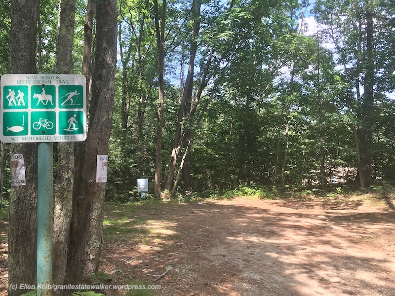
New Boston rail trail
What a difference since my last visit about five years ago. I found the shady New Boston rail trail south of Lang Station upgraded significantly since my last visit. Trail volunteers, take a bow.
New Boston rail trail, NH
I walked for the first time north of Lang Station on the trail to the Goffstown line. Very different up that way: a work in progress, or maybe just in the planning stage. I found blowdowns, mud, and at the Goffstown line, an overgrown swath separating the trail from Route 114.
Someday, if a whole lot of things work out just right, the New Boston trail will connect with the Goffstown rail trail, which already connects to the Piscataquog trail in Manchester.
Zion, Bryce Canyon, Grand Canyon: life-list material
My husband and I spent nine too-short days in Utah and Arizona in early September, where I got my first-and-maybe-last look at some of the gems of the national park system:
Zion, where temps in the low hundreds did nothing to dull the scenery…
Zion National Park, Utah
Bryce Canyon, land of the hoodoos, where even a half-moon can’t blot out the stars at night…
Bryce Canyon National Park
and Grand Canyon’s North Rim, far from South Rim’s crowds, where the sheer scale of the canyon left me speechless.
View of Grand Canyon from North Rim, Arizona
Along the way – it takes a lot of driving to see all three parks in only a few days – we found some beautiful lesser-known recreational areas: Cedar Breaks and Red Canyon in Utah, and portions of Dixie National Forest in Arizona.
As our return flight descended over the Monadnocks on the way into Manchester, I was happy to see our familiar green hills. This is home. Still, I treasure the awesome sights and beautiful places we saw out west.
Job responsibilities prevented a backpacking trip for me this season. I settled for four days of dayhikes in Pittsburg, way north in Coos County, New Hampshire. (CO-ahhs, if you please, in case you’re new here. Welcome.)
Conditions: upper 80s, high humidity, overcast, with a low cloud ceiling that cut off views of nearly every peak in the area. On the other hand, I was there on quiet weekdays, and I had the solitude I craved on every road and trail.
Mount Magalloway (in cloud) and First Connecticut Lake. All photos in this post by Ellen Kolb.
Cohos Trail Segments
Covell Mountain really does not want to yield a trail this summer. There were signs of storm damage and logging. The mud made me glad I had shoes with a moisture-resistant lining. Grasses were growing high despite obvious efforts by trail adopters to keep them in check. Blazes were clear and plentiful, though, and I know I can thank those same trail volunteers for that.
There was a newly-fallen spruce across the trail, not far from a junction with a path marked Cattail Trail. The spruce refused to give way to the little knife I carried. All I got for my pains was a sappy blade.
Perhaps on a clearer and cooler day, I’d have kept going past Covell to Prospect Mountain, where on another trip I enjoyed a spectacular vista. This was not a week for great views, I thought, so I contented myself with an up-and-back hike on Covell.
As I returned to my car parked at the Ramblewood campground, I caught sight of Mt. Magalloway and a sliver of First Connecticut Lake. The summit was obscured by cloud and the lake reflected the gray sky: a striking monochrome landscape offered up by Covell Mountain, as if to thank me for putting up with its messy trail.
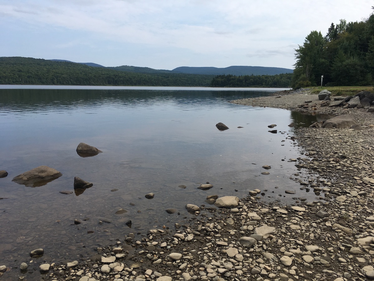
Second Connecticut Lake, at a low late-summer level.
Peaceful Second Connecticut Lake never disappoints, however short the visit. This time, I parked at the dam alongside U.S. 3 and followed the Cohos Trail north.
The trail soon intersected Idlewilde Road, and I turned for the five-minute detour to the Idlewilde boat ramp. On a hazy late-summer afternoon, I stood at the ramp on the lake’s shore all by myself, with a loon’s call the only sound I could hear.
Back on the trail, I took up the Chaput segment. It’s named for a couple I’ve never met who are famous to Cohos Trail veterans for their years of trail work. The segment is parallel to and very close to U.S. 3, but it gets hikers off the pavement. I’m a fan. I hiked the northern section of the Cohos Trail in 2009, and at that time the last ten miles of trail to the Canadian border were on the highway. Thanks to the efforts of many volunteers, that’s no longer the case.
“Lainie’s Lair,” on the Cohos Trail.
Along the Chaput segment, I found the little rocky overhang nicknamed Lainie’s Lair. That’s a fun tribute to another legendary Cohos Trail volunteer. Lainie brought me with her for a memorable day of trail work during my 2009 hike. I had a lot of enthusiasm for the task, but zero skill. Lainie patiently coached me on things like how to use tools without hurting anyone and how not to freak out at the sight of bear scat. She could have accomplished a lot more that day in 2009 without me, but she was happy to be my guide. Nine years later, I smiled at the whimsical salute to her at the “lair.”
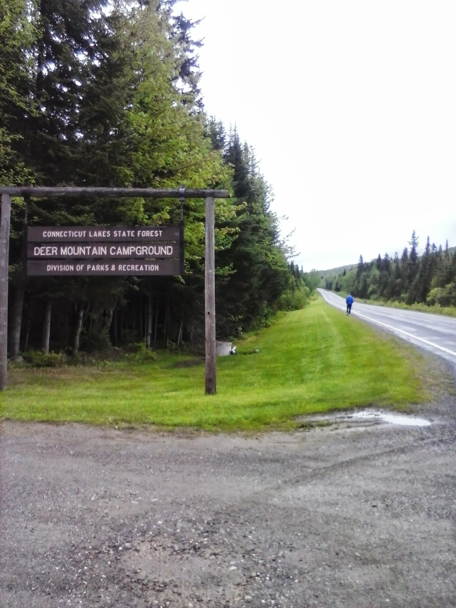
Sophie’s Lane is part of snowmobile corridor #5, and the Cohos Trail follows it beginning just south of Deer Mountain State Park. After being in the woods on a hot day, Sophie’s Lane was a relief. It was wide and open enough to catch a breeze that kept insects at bay. The lane leads to a spur to the site of an old fire tower on Deer Mountain (no cab or platform remains), which is a side trip I didn’t take.
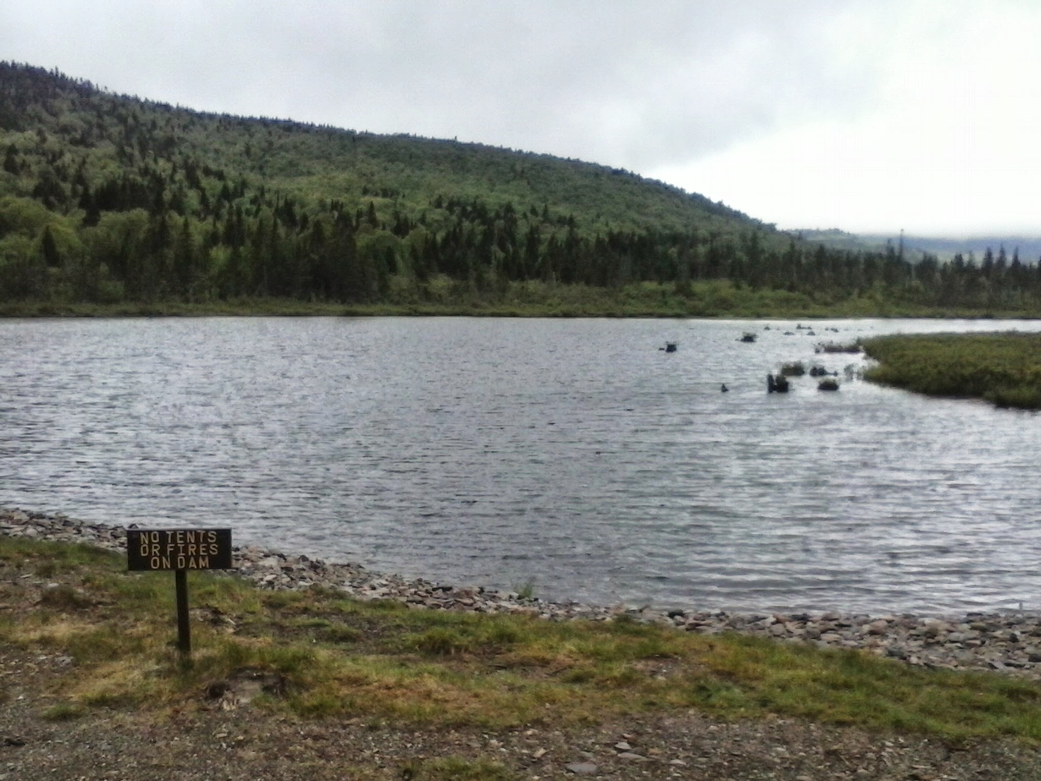
I liked the short spur to Moose Flowage, which is part of the Connecticut River south of Third Lake. It was a good spot for a break and a snack. It was a tempting place for a campsite as well, but signs sternly warned against any such notion. Deer Mountain state park’s campground, accessible from U.S. 3, is just across the Flowage.
Sophie’s Lane trail kiosk
The lane gradually narrowed the further north I walked. I stopped well short of the Canadian border, avoiding a walk through a long weedy stretch of trail. I passed a clearing with one boulder covered in street art. That jarred me. That painted rock somehow bothered me more than the relatively new cell tower at the north end of First Lake. It poked a big hole in the sense of isolation I expected in August on a snowmobile trail three miles from Quebec.
What I didn’t see along the way – not on Sophie’s Lane, and not anywhere else – was a moose. No bear or deer, either. I saw moose tracks in one muddy spot, but as for the beasts themselves, nada. Perhaps the heat kept them in hiding. Maybe I’m such a noisy hiker that I scare off everything larger than a mosquito. My presence didn’t bother the birds, though. It was a good week for seeing heron, hawks, and turkeys.
Pittsburg: the Village and Happy Corner
Broadband has come to Pittsburg, or at least parts of it. I stayed in the village – downtown Pittsburg, more or less – in a comfortable little cabin with WiFi and cell service.
The snowmobile crowds are a few months away, people are buttoning up their camps for the season, and the summertime ATV vacationers have mostly returned to work and school. The town roads were thus quiet and inviting during my recent visit. As always in Pittsburg, the people I encountered were friendly and hospitable, ready to answer my questions and point me to interesting places.
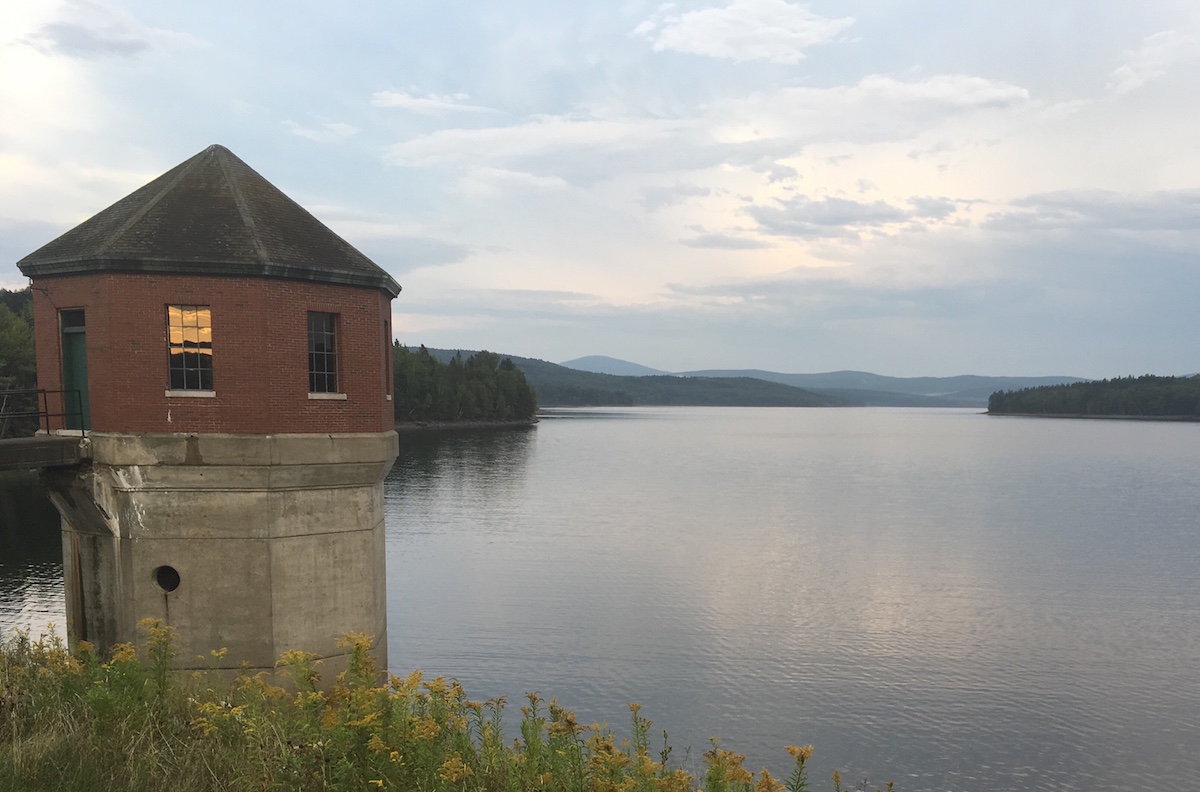
A three-mile loop walk from my cabin at day’s end took me to Murphy Dam, Lake Francis, and Cedar Stream Road. A tranquil route, from start to finish. Had I moved east on Cedar Stream Road rather than west towards town, I’d have picked up a Cohos Trail segment leading to the east side of Lake Francis.
Lake Francis seen from Murphy Dam
Six miles north of the village, the crossroads known as Happy Corner makes a good base for a few Cohos Trail dayhikes and for exploration of town roads. I loved rambling with no schedule and no fixed route.
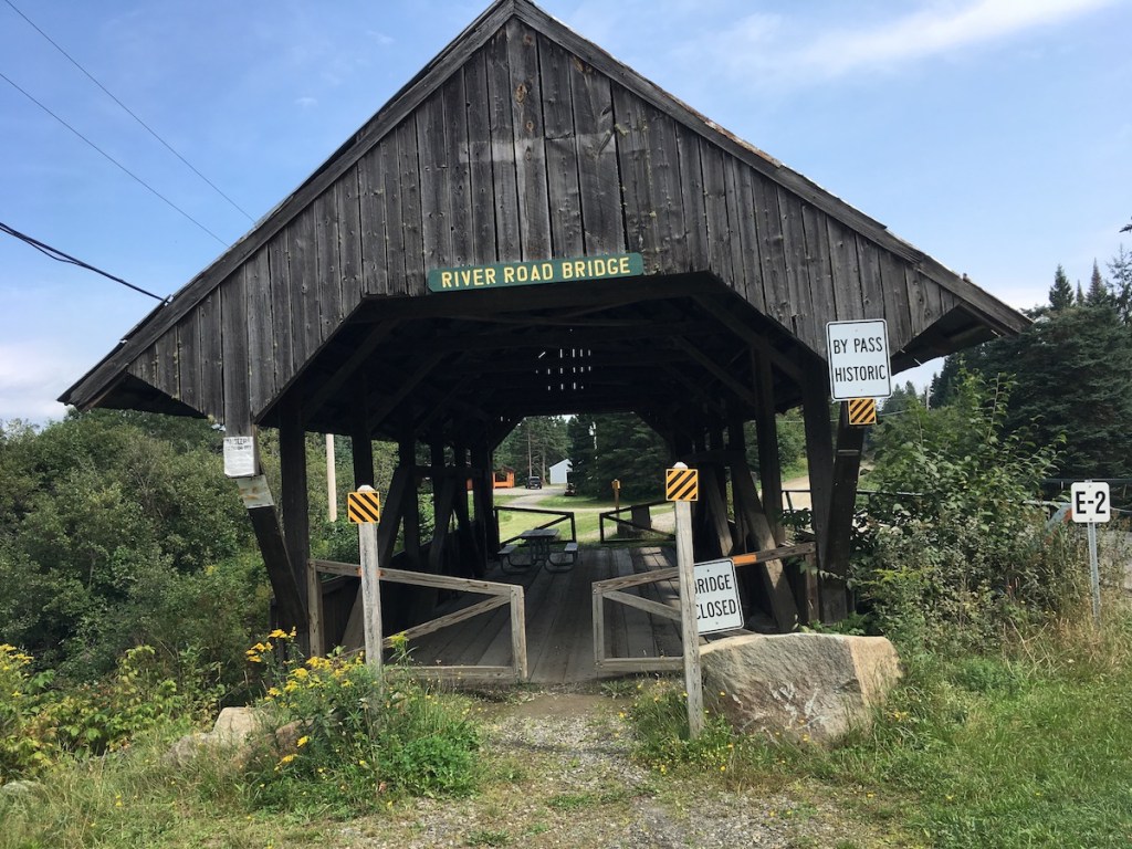
Perry Stream at the River Road bridge.The Happy Corner bridge is still open to automobiles, although none were in sight when I was there.The old covered bridge on River Road has been bypassed, but visitors are welcome to take a break at the picnic table inside.I found this along Hill-Danforth Road, and left it for the next person to enjoy.
Road Tripping
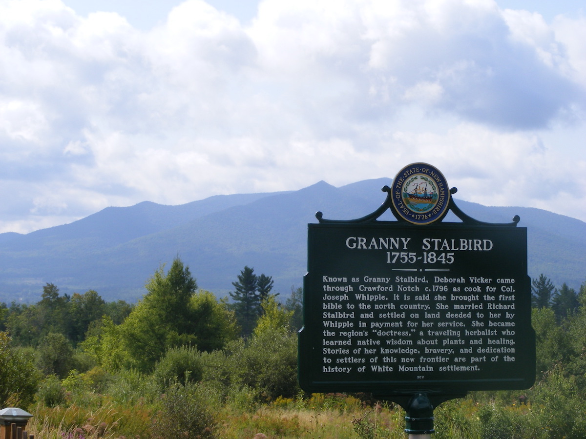
I only get up this way once a year or so, and I try to make the most of the long drive. I drove a circuitous route on the way north in order to photograph a slew of North Country historical markers. Interesting sites, interesting history!
On a cloudy morning, the Cog Railway track seemed to disappear into Mount Washington.That’s Cherry Mountain behind the Granny Stalbird marker in Jefferson.The city of Berlin on the Androscoggin River boasts four markers, each featuring a different aspect of the city’s heritage.
Another trip to northern New Hampshire for me meant another walk to one of my favorite spots on the Cohos Trail, the Falls in the River. No trip to Pittsburg on a 90-degree day would be complete without it. From the parking area by the Second Connecticut Lake Dam, a half-hour southbound walk through the woods on the blazed Cohos Trail brought me to the Falls. Soon I was refreshed in every way.
A few years ago, my husband and I were among the volunteers who put the finishing touches on this segment of the CT before it was officially dedicated. Others had done the hard work. It has since become one of the CT’s most popular dayhike areas.
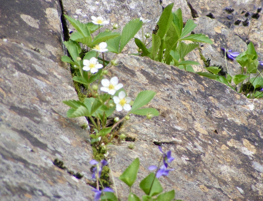
Falls in the River, Pittsburg NH, June. Photos by Ellen Kolb.
Cracks in the granite give tiny blossoms a home.
A peek at Second Connecticut Lake from the parking lot by the dam.
The trail in this area manages to feel remote even when it’s squeezed between U.S. 3 and the Connecticut River. Trees conceal the highway and muffle the sound of vehicles.
I saw no moose. I figured the hot weather would keep them from being out on the roadside at midday, but I thought for sure I’d see one in the woods. I saw only their prints in the mud.
A friend and I have been trying for several weekends to arrange a hike, with last-minute work commitments sabotaging every trip so far. Still, we keep planning. When I suggested Pondicherry Wildlife Refuge, she said “where’s that?” I was going to refer her to a blog post here, when I discovered to my embarrassment that I hadn’t yet written about this lovely place, despite my fondness for it. Oops. Making up for lost time here.
The refuge straddles the towns of Jefferson and Whitefield. To get there from southern New Hampshire, I take I-93 through Franconia Notch and then U.S. 3 through Twin Mountain into Whitefield. There’s a airport sign in Whitefield pointing me to a right turn off route 3. A drive around the south side of the one-runway airport brings me to a little biomass plant, across from which is a well-marked parking area for Pondicherry.
Cherry Pond, with Presidential range at left and Mount Martha at right. All photos by Ellen Kolb.
Pondicherry trailhead, on Airport Road in Whitefield.
From the parking area, one could be forgiven for thinking “is that all there is?” The Presidential Rail Trail extends north from there, looking like a long dirt boulevard. (In fact, it’s a busy snowmobile thoroughfare in the winter.) Cherry Pond is a mile and a half away via the trail. During my April visits, little spring flowers are usually peeking up on the sunny side of the trail when there’s still ice along the shaded side. I seldom have company here, and there is little noise except for the occasional small plane landing at the airport.
The walk into the refuge is tree-lined, making the sudden view of the Presidentials all the more startling when I arrive at Cherry Pond. I never get tired of that view.
Nearby are Little Cherry Pond and the adjacent wetlands. The Cohos Trail passes through, piggybacking on the Presidential Rail Trail for some distance. There’s an observation platform, affording excellent views for the birdwatcher who remembered to bring her binoculars. Critters of all sizes, from beaver to moose, find Pondicherry a congenial place.
An active (but not busy) rail line runs through the property as well. I sometimes see a few freight cars parked on a nearby siding. This quiet location still bears the old rail-line name Waumbek Junction.
Pliny Range, north of Cherry Pond
The Pondicherry refuge is a cooperative venture of state, federal, and private organizations. A good guide to the Pondicherry trails can be found in the Jefferson Dome chapter of Kim Nilsen’s book 50 Hikes North of the White Mountains.
Update, 2026: Since I wrote this entry, Pondicherry Wildlife Refuge has found its way into many of my posts. I describe a recent visit in “One way to celebrate, part II,” with summertime photos.
With no formal vacation in sight, I can improvise. Just give me 24 hours and a car. Good hiking territory is essential, but so is a pleasant drive. Earlier this week, that meant heading up I-93 to Coos County.
Third Connecticut Lake area
Lone hiker, five miles from Canada
Site 28 at Deer Mountain State Park
This trip was inspired by a planned work project on the Cohos Trail, cutting a spur to the summit of Deer Mountain in the town of Pittsburg near the Canadian border. Unfavorable weather forced postponement of the trail work, leaving me free to wander familiar trails alone for a few hours. Very quiet overcast morning: no logging in the area this week, only two campsites occupied at Deer Mountain State Park, only one other hiker in sight. No hills on this trip, given my limited time in the area. US route 3 was nearly deserted. Snowmobile trail #5, on which the Cohos Trail piggybacks in this area, had a few mud puddles, but nothing dramatic. I enjoyed miles of walking the highway and the trail.
When I hiked through this area on a backpacking trip in ’09, the segment of trail now shared with the snowmobile trail was not yet on line. I was on pavement in 90 degree weather from Happy Corner to the Canadian border. I loved that trip, but I can tell you that cool drizzle is fine, too.
Stark
OK, I’m cheating here: I didn’t hike in Stark. I broke up the long drive to Pittsburg by stopping for a night at the Stark Village Inn, owned and operated by a member of the Cohos Trail Association board. The inn was homey and affordable. Nancy, the owner, is the soul of hospitality. She knows the trails in the area, and she’s been known to provide limited shuttle service.
View from Stark Village Inn
If I did decide to hike in Stark, I’d probably head up the Nash Stream Road from NH Route 110. Or maybe I’d head south of 110 toward the Kilkenny Ridge trail. Maybe I’d just walk along 110 and enjoy the sound and sight of the Upper Ammonoosuc River.
Colebrook and Columbia
I like Colebrook. It’s bustling, but it’s a tiny town nonetheless. Here, US 3 meets NH Route 26, which leads to Dixville Notch. Another day, I would have gone to the Notch for a short but lung-busting climb to Table Rock. No time on this trip, though. “Later,” I promised silently as I drove past NH 26, not weakening even when I drove past Le Rendez-Vous. That’s a bakery with amazing stuff, including irresistible chocolate croissants. (Update: Alas, since the publication of this post, Le Rendez-Vous has closed down.)
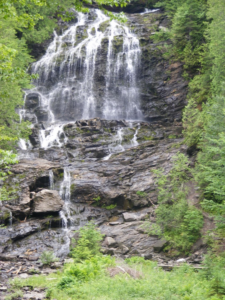
On NH 145 northeast of the center of town – a fun road, by the way – is Beaver Brook wayside area. It’s a feast for the eyes. There are short trails near the falls, especially nice in the summer when the spray from the falls is soothing on hot days. Pack a picnic.
Beaver Brook wayside area, Colebrook NH
I stopped in Columbia on my way home, just south of Colebrook, at the Shrine of Our Lady of Grace. It didn’t take long to walk the grounds. There are days when the shrine is thronged with pilgrims & tourists. I was there a few years ago during the annual Blessing of the Motorcycles, with hundreds of cheerful bilingual bikers. This week, I was alone. Different feeling altogether. For me, it was a place of prayer.
(Update: the Shrine closed in 2014. Part of the property has become the Tillotson Center, a community heritage, visual, and performing arts center.)
Shrine of Our Lady of Grace
The ride back to southern New Hampshire on US 3 went past some of my favorite hiking spots, including Weeks State Park. The pesky clock was ticking, though, and I kept driving. Once I was halfway home, the sun came out and the temperature went up 15 degrees. If I couldn’t have that weather for hiking, it was at least nice to have it for driving. No complaints, though. Those were twenty-four good hours.