Pondicherry is for the birds (and beavers and hikers)

A friend and I have been trying for several weekends to arrange a hike, with last-minute work commitments sabotaging every trip so far. Still, we keep planning. When I suggested Pondicherry Wildlife Refuge, she said “where’s that?” I was going to refer her to a blog post here, when I discovered to my embarrassment that I hadn’t yet written about this lovely place, despite my fondness for it. Oops. Making up for lost time here.

The refuge straddles the towns of Jefferson and Whitefield. To get there from southern New Hampshire, I take I-93 through Franconia Notch and then U.S. 3 through Twin Mountain into Whitefield. There’s a airport sign in Whitefield pointing me to a right turn off route 3. A drive around the south side of the one-runway airport brings me to a little biomass power plant, across from which is a well-marked parking area for Pondicherry.

Mount Martha, with Presidential range at left. All photos by Ellen Kolb.
Cherry Pond, with Presidential range at left and Mount Martha at right. All photos by Ellen Kolb.
trailhead, Airport Road

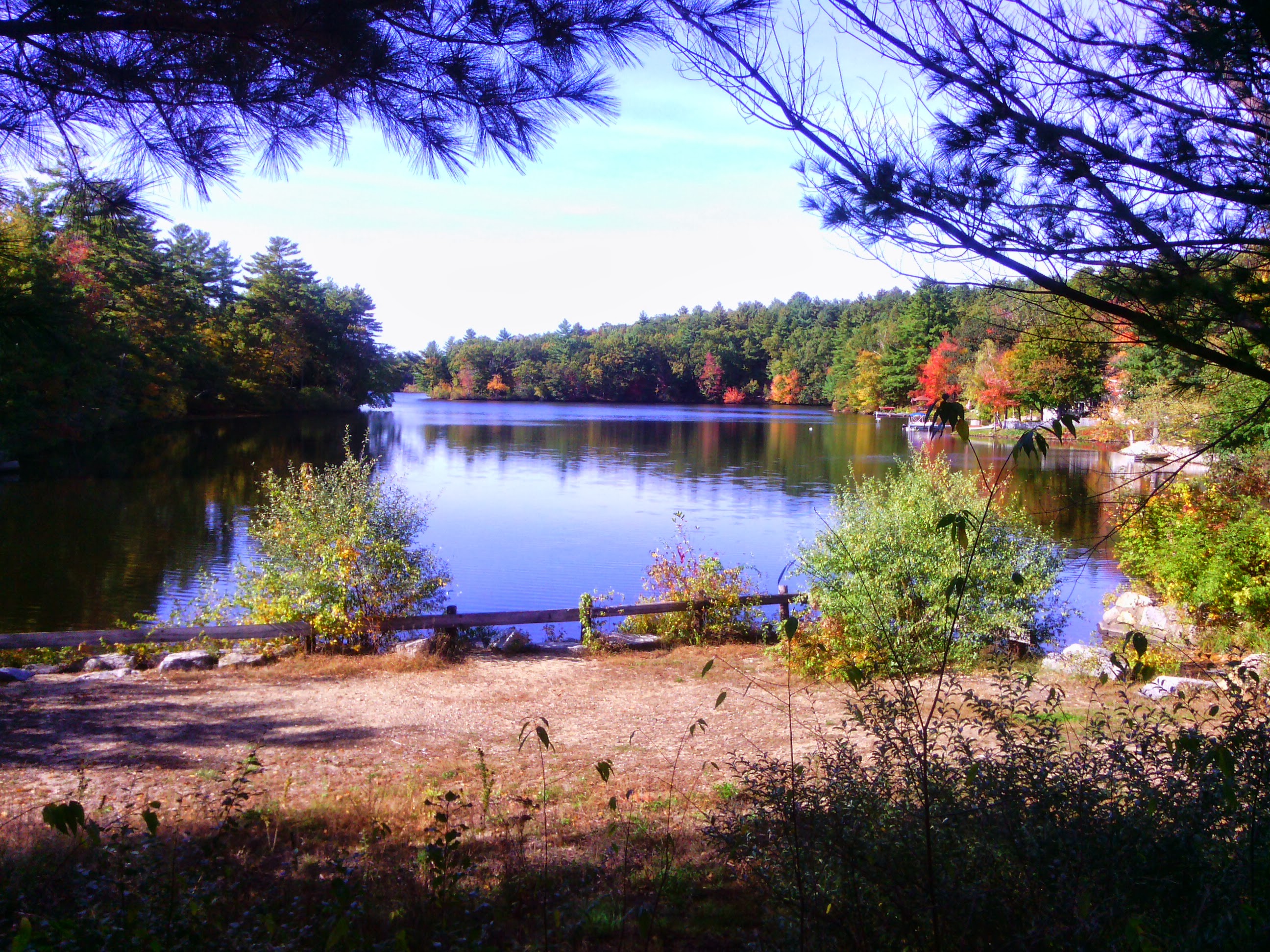
From the parking area, one could be forgiven for thinking “is that all there is?” The Presidential Rail Trail extends north from there, looking like a long dirt boulevard. (In fact, it’s a busy snowmobile thoroughfare in the winter.) Cherry Pond is a mile and a half away via the trail. During my April visits, little spring flowers are usually peeking up on the sunny side of the trail when there’s still ice along the shaded side. I seldom have company here, and there is little noise except for the occasional small plane landing at the airport.

The walk into the refuge is tree-lined, making the sudden view of the Presidentials all the more startling when I arrive at Cherry Pond. I never get tired of that view.

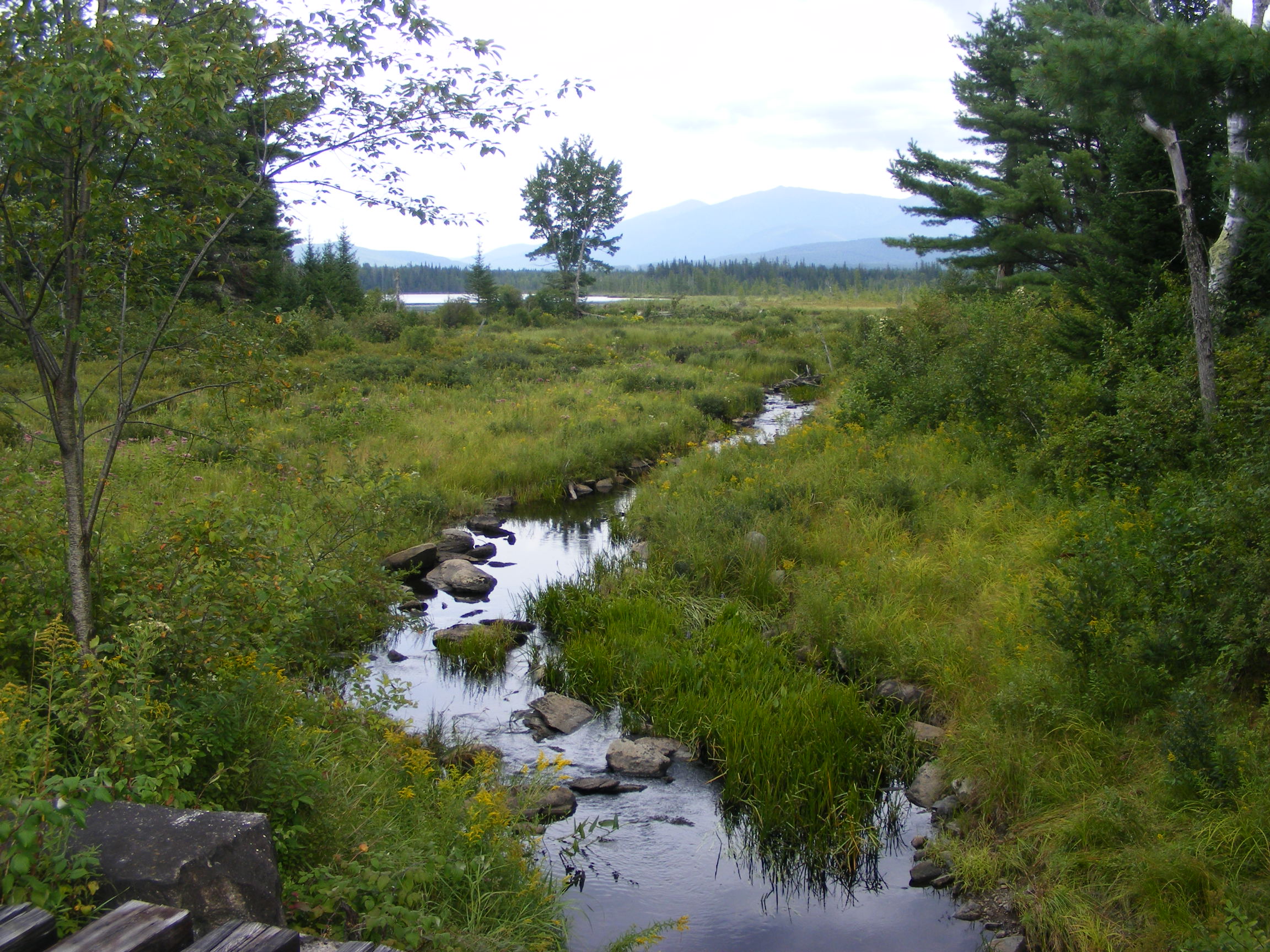
Nearby are Little Cherry Pond and the adjacent wetlands. The Cohos Trail passes through, piggybacking on the Presidential Rail Trail for some distance. There’s an observation platform, affording excellent views for the birdwatcher who remembered to bring her binoculars (which I ALWAYS forget). A rail line runs through the property as well. Signs sternly warn that the rail line is “active,” but that means “two trains a week” or thereabouts. I sometimes see a few freight cars parked on a nearby siding; this quiet location still bears the old name of Waumbek Junction.

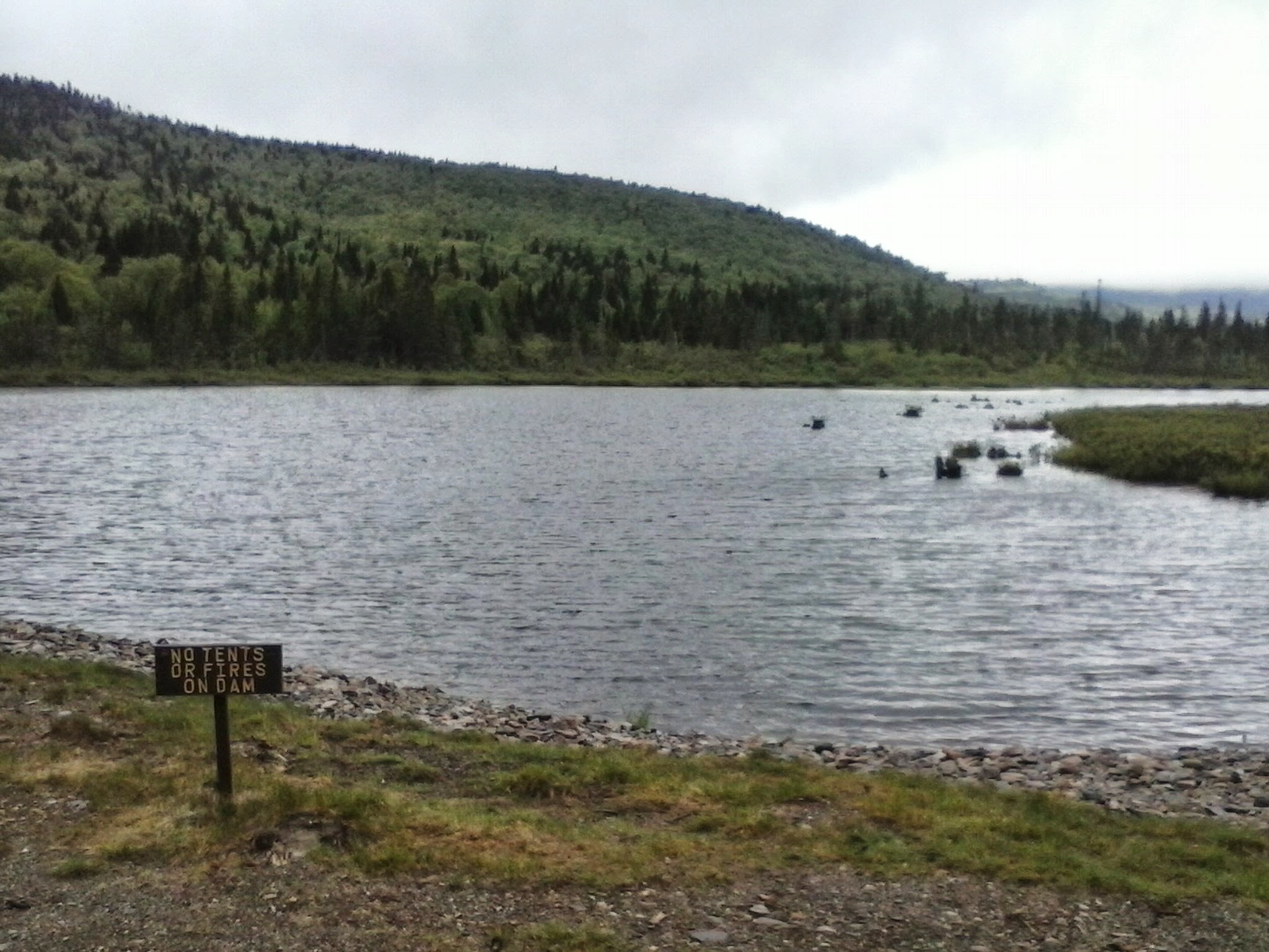
Beavers have waged undeclared war on hikers for years by causing flooding of a trail on the east side of Cherry Pond. Hikers currently have the upper hand with the recent rehabilitation of the Slide Brook Trail. The beavers don’t affect the southern access that I’ve described above. Critters of all sizes find Pondicherry a congenial place. I’ve seen moose tracks, but no moose.

Pliny Range, north of Cherry Pond
On the boardwalk to Little Cherry Pond

The Pondicherry refuge is a cooperative venture of state, federal, and private organizations. A good guide to the Pondicherry trails can be found in the Jefferson Dome chapter of Kim Nilsen’s book 50 Hikes North of the White Mountains.

A short Manchester stroll: no bridge, but plenty of sunshine

I reported last April on plans to build a pedestrian bridge over the Piscataquog River to link rail trails in Manchester and Goffstown. How’s that going? Alas, very slowly, it appears. The old trestle is still in place, still fenced off, with no new bridge next to it.  I know these things take time. Here’s hoping that all the factors come together soon.

I couldn’t visit Manchester’s side of the trail on a fall afternoon without spending a half hour on it. My last visit to this segment was three years ago. I took these photos today to show how the leaves aren’t at peak color yet in this area. I should have another couple of weekends for leaf-peeping.

This will be a pedestrian crossing, someday.

This will be a pedestrian crossing, someday.

Piscataquog River upstream of the old rail crossing

Piscataquog River upstream of the old rail crossing

Fences between the trail and private yards are softened by blossoms like this.

Fences between the trail and private yards are softened by blossoms like this. Note the lack of fall color. The best is yet to come.


Enter your email address to subscribe to this blog and receive notifications of new posts by email.

Pawtuckaway via Deerfield Fair

Given a complimentary pass to Deerfield Fair, I decided to enjoy not only the fair but also nearby Pawtuckaway State Park.  It’s early fall, cool but not yet cold. The leaves are just beginning to turn around here. It’s less than an hour’s walk from the quiet northwestern edge of the park to the fire tower on south Pawtuckaway peak.

First fall colors at the edge of wetlands on Tower Road.

First fall colors at the edge of wetlands on Tower Road.

I hiked in from the northwest corner of the park on Reservation Road, far from the busy main entrance.

I hiked in from the northwest corner of the park on Reservation Road, far from the busy main entrance. The little blue asters were the only blooms in sight.

Pawtuckaway fire tower. Barely visible on the underside of the cab are charts describing the landmarks in each direction.

Pawtuckaway fire tower. Barely visible on the underside of the cab are charts describing the landmarks in each direction.

View from fire tower east to Pawtuckaway Lake and the Seacoast.

View from fire tower east to Pawtuckaway Lake and the Seacoast.

View to northwest; Mt. Kearsarge in distance.

View to northwest; Mt. Kearsarge is barely visible in the distance at center.


Enter your email address to subscribe to this blog and receive notifications of new posts by email.

Celebrate Ten Years of Connecticut Lakes Headwaters Conservation in NH

East Inlet, Pittsburg NH.

East Inlet, Pittsburg NH. Photo by Ellen Kolb.

Some years back, the decline of New Hampshire’s North Country paper industry left up in the air the future use of over 100,000 acres in Coos County. Conservationists got busy in an effort to protect the land for recreation and forest management. A serious team effort resulted in the Connecticut Lakes Headwaters Working Forest in 2003. Time to celebrate the first decade!

Head to Lake Francis State Park in Pittsburg (get on U.S. 3 and just keep heading north) on October 5th for the big event. The Department of Resources and Economic Development – and has there ever been a worse acronym than DRED? – is hosting lunch and a few speakers at 11:30 a.m. At 1:30, the real fun begins. Attendees can choose from six tours, each in a different part of the CLHWF, lasting until 4:30. For more information, or to RSVP, email Eric Feldbaum at eric.feldbaum@dred.state.nh.us. With your RSVP, be sure to specify your choice of tours.

Want to hear about the Cohos Trail, and walk on a short segment? Yes, I know I write about the CT a lot. You can find out why if you join Lainie Castine after lunch on the 5th.

Maybe you like fire towers instead. If so, head to Mount Magalloway. Forty-five vigorous minutes on the trail will reward you with views that will knock your socks off.

Have you ever been to Boundary Pond? Here’s your chance to see it, if you’re ready for a drive; the boundary in question is with Canada. Other afternoon options include kayaking, a timber harvest forestry tour, and a local-history lesson. I wish I could head north for the event, although I’d have a hard time choosing just one afternoon activity. I encourage you to make the trip, if you are anywhere near northern New Hampshire. Again, let me mention that address for RSVPs, so the organizers know how many people to expect: eric.feldbaum@dred.state.nh.us

Yes, I love the Connecticut Lakes. My photography doesn’t do the place justice. I hope you can take your own photos there someday.

First Connecticut Lake and Mount Magalloway, from Prospect Mountain. Photo by Lainie Castine.

First Connecticut Lake and Mount Magalloway, from Prospect Mountain. Photo by Lainie Castine.

River Road covered bridge, on the way to Lake Francis SP. Ellen Kolb photo.

River Road covered bridge, on the way to Lake Francis SP. Ellen Kolb photo.

Sunset, Cedar Stream Road. Ellen Kolb photo.

Sunset, Cedar Stream Road. Ellen Kolb photo.


Enter your email address to subscribe to this blog and receive notifications of new posts by email.

“Site 28 for the week, please.”

Site 28, Deer Mountain State Park, NH.

Site 28, Deer Mountain State Park, NH.

I’m seldom at a loss for what to write. Just to be on the safe side, though, WordPress offers me daily prompts for when inspiration fails. Today’s prompt caught my fancy: “write a six-word story about what you think the future holds for you, and then expand on it.”

Too easy. “Site 28 for the week, please.” I’m making twenty-eight into one word since this is my blog with my rules.

Way upstate in New Hampshire, five miles from Quebec, is a little gem of a state park called Deer Mountain. It’s a simple campground with no utilities, no camp store, and only a spring for water. No one gets here by accident. You have to want to drive all day on U.S. 3 in order to get away from it all without having to bring a passport. You might also be hiking on the Cohos Trail, heading for the northernmost trailside place to pitch your tent.

There are a couple of dozen campsites tucked into the woods. There are a few out in the open. And then there’s the one that’s a quarter-mile away from a parking space. It’s listed as “hike-in” on the campground information web site, but really, is a quarter-mile all that much of a hike? Not to me, especially now that I usually hike solo with no one muttering are-we-there-yet while trudging along the path through the trees.

And here it is, site number 28, between the woods and Moose Flowage at the south end of Third Connecticut Lake. Packed earth, some gravel, a picnic table, a little firepit, and the shore: the property description doesn’t convey the sheer perfection of the spot. On a summer day, the slightest breeze across the water is heavenly. In the fall, the hardwoods fly their colors, valiantly trying to compete within the spruce forest. The night sky is unbelievable in such a remote area. The quiet is unearthly, broken now and again by a coyote or a loon. Loggers, route 3 traffic, and other campers are all muted by that quarter-mile buffer.

Life is full and busy and stressful. I take short hikes when I can, which is the stuff of this blog. I dream of a day, perhaps next year, when I can put work aside for seven whole days and walk up to the ranger’s cabin with cash in hand to place my order: “site 28 for the week, please.”

Enter your email address to subscribe to this blog and receive notifications of new posts by email.

A quick look at Bear Brook State Park

Catamount Pond, Bear Brook SP (Ellen Kolb photo)

Catamount Pond, Bear Brook SP (Ellen Kolb photo)

I had casual business in Concord this weekend and a couple of hours to kill afterward. I almost headed up to the fire tower at Oak Hill, but I decided instead to check out New Hampshire’s largest developed state park, Bear Brook in Allenstown. Yes, another spur-of-the-moment hike. Much less drama than my recent Monadnock trip.

This is a 10,000-acre park with many trails, and I had time for only a brief visit. I came in to the park via Deerfield Road off of NH Rt. 28. This through-road links Allenstown with Candia, and it’s possible to drive straight through without stopping at the park at all. I pulled over at the park kiosk, paid the $4 entry fee, and picked up a trail map. Catamount Hill was nearby, and so was Catamount Pond with a little beach. Those were destinations enough for today.

The hill is rated “difficult” on the park trail map (which is available as a PDF on the NH state park web site), but that’s a stretch. Uphill, yes, but no scrambling on the ledge. I had sneakers on, and no trekking pole, and the knee I hammered a couple of weeks ago on Monadnock was not stressed. The only wildlife I saw was of the six-legged variety.

One-Mile Trail, Bear Brook SP (Ellen Kolb photo)

One-Mile Trail, Bear Brook SP (Ellen Kolb photo)

This was a woods walk – even trail’s end on Catamount Hill is below tree line. I met three mountain bikers walking their bikes and their dogs uphill as I was heading down, and they were working a lot harder than I was. “Guess I’d better stay right,” I called. “No, we’re going down on another trail,” said one of the bikers reassuringly. They didn’t waste any time. We ran into each other again at the base of the hill, all smiles after what must have been a rip-roaring ride for them.

Catamount Pond and its facilities are across the road from the entrance kiosk. Deserted today, the beach looks like it could accommodate a crowd on a hot day. This looks like a great area for a family outing, with a playground and picnic pavilion nearby. On the lawn is a monument to the Civilian Conservation Corps workers who helped to develop this park among many others.

There is much more to Bear Brook than I could see today. I didn’t even get to the snowmobile museum, campground, or archery range. The park land is open year-round, but staffing for the year ends September 9, so some facilities may not be available through fall and winter. Check the web site.

CCC monument, Bear Brook SP (Ellen Kolb photo)

CCC monument, Bear Brook SP (Ellen Kolb photo)

I see on the web site that SCA-NH is having a historic-site cleanup day in Allenstown in three weeks, on 9/28/13. Projects will include buildings within the park. Interested? Show up at 8 a.m. on the 28th at the Bear Brook State Park warehouse at 159 Deerfield Road in Allenstown. Bring gloves, rakes, and clippers.