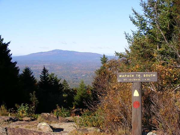
Columbus Day weekend is wrapping up for the leaf-peepers. Autumn colors are still muted in my area, except for a few specimen trees flashing scarlet. I figured the Monadnocks would be a little showier today. I stole a couple of hours from my schedule and headed to Miller State Park in time for a walk up the auto road before it opened to cars for the day. I actually spent time alone on the summit of Pack Monadnock! That’s a rare treat.
From the Pack Monadnock summit: Mt. Monadnock, about twelve miles away. Photos by Ellen Kolb.
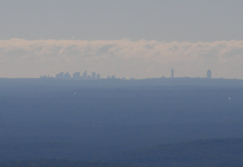
My guess is that the P on this granite marker along the auto road is for Peterborough, one of three towns that can lay claim to part of Pack Monadnock.There’s plenty of colorful foliage over on North Pack Monadnock.When I took my kids to Pack Monadnock when they were little, the first thing they wanted to check from the summit was whether it was “a Boston day,” clear enough to see Beantown’s skyline. This was a Boston day.
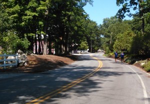
How many miles have I walked this year? A couple of hundred, if my journal is accurate, averaging a measly couple of dozen each month. Well, my knee hurt for awhile. The weather wasn’t always nice. I was busy. Blah, blah, blah … and just think, I fancy myself the Granite State Walker.
The last few yards of a 200+ mile walk.
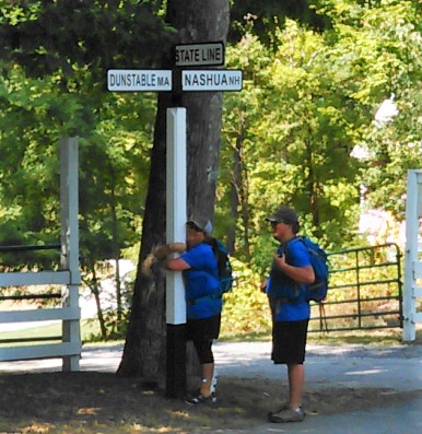
Today, I met a couple of real Granite State walkers. Wendy Thomas and Griffin Nozell, mother and son, just finished walking the length of New Hampshire, beginning at the Canadian border in Pittsburg and ending today in Nashua at the Massachusetts state line. They chose road walking rather than trail hiking, and in the process they built an online community that cheered them on all the way.
I joined Wendy and Griffin for the last couple of miles of their trip, just to meet them. I’d been following their travels via their Facebook group, Border-to-Border New Hampshire.
Wendy Thomas and Griffin Nozell, at the end of their border-to-border walk.
Thanks, Wendy and Griffin, for your fine company and conversation! I especially loved sharing impressions of Pittsburg, where they found the same warmth and hospitality that have made all my hikes up there so memorable.
They tell their own story better than I can. Link to Wendy’s blog, Lessons Learned From the Flock, for her introduction to their journey.
And you know what? It turns out that Wendy and I are neighbors. We live in the same town, about a mile apart. We didn’t meet until today.
Wendy plans to write up her travel notes for her blog, entitling the first post “Spoiler Alert.” She’ll have observations and insights different from those of someone hiking off-road. I urge you to head over to Lessons Learned From the Flock to read more about the border-to-border hike.
Griffin and Wendy have left me feeling inspired and encouraged to plod on, sore knees and all, always discovering more things to love about our Granite State.
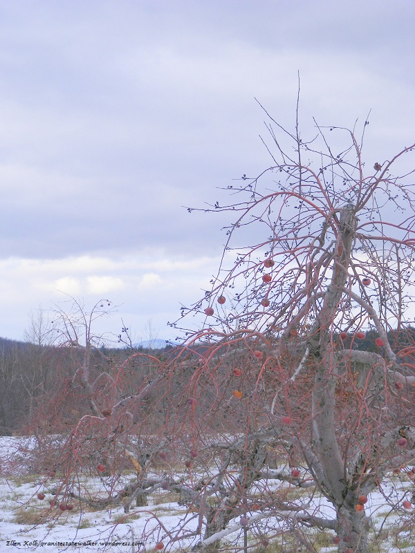
Woodmont Orchard, Hollis NH, New Year’s Day. Photos by Ellen Kolb.
The New Hampshire state parks people added Silver Lake State Park to the list of locations for guided First Day hikes, and I think this one’s a keeper. The state park abuts town conservation land with trails maintained by the local snowmobile club. With the area’s first measurable snowfall of the season having fallen just a few days ago, boots were all the equipment I needed to join the fun. I left in the car every accessory except my camera and a map, and spent an hour on trails I’d never before visited.
Multi-use trails in Hollis, NH
I didn’t mind the snowmobile that passed me at one point. People like the sled’s cheerful and careful driver maintain these trails.
Days like this remind me why I started this blog. Silver Lake State Park is where I used to take my kids swimming when they were little, and I thought the lake itself was all there was to it. Today, after living in the area for many years, I discovered new trails in what I thought was a familiar place.
New Hampshire is a tiny slice of the republic, and the southern tier is even tinier. Yet here in what looks like an insubstantial part of the map are parks and trails that most New Hampshire visitors and even some residents will never see. Every year, I find something new: a little trail connecting two urban parks, country roads with drivers who don’t mind sharing the pavement with pedestrians, a Hollis trail connecting Silver Lake with Woodmont Orchard. I want to drink it all in and come back for more.
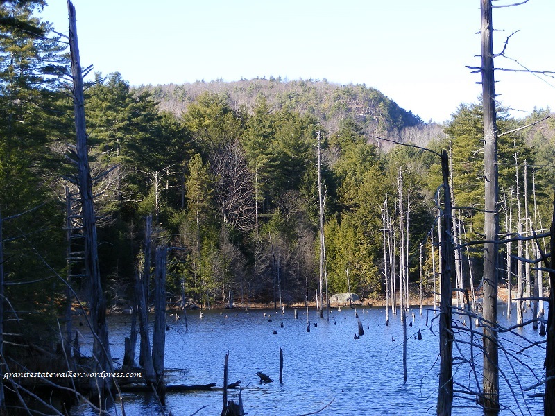
The snowless days are ending; I’ll be shoveling my driveway in just a few days, if the forecast holds. This was my last chance to visit some nearby trails before winter conditions set in. I had planned to walk up a hill with a pretty view, but decided at the last minute to stick to level paths. I went to Pawtuckaway State Park and explored the northwest corner of the park via Reservation Road and Round Pond Road.
North Mountain seen from Round Pond Road. This must be a wonderful birding spot at dawn and dusk. All photos by Ellen Kolb.Round Pond, harshly lit on a brilliant sunny day. The pond is about two and a half miles from where I parked on Reservation Road.A side trail from Round Pond Road leads to the Boulder Field, where the woods are full of large glacial erratics. I placed the backpack at the base of a boulder for scale.
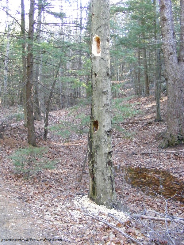
A pileated woodpecker had been hard at work on this tree.
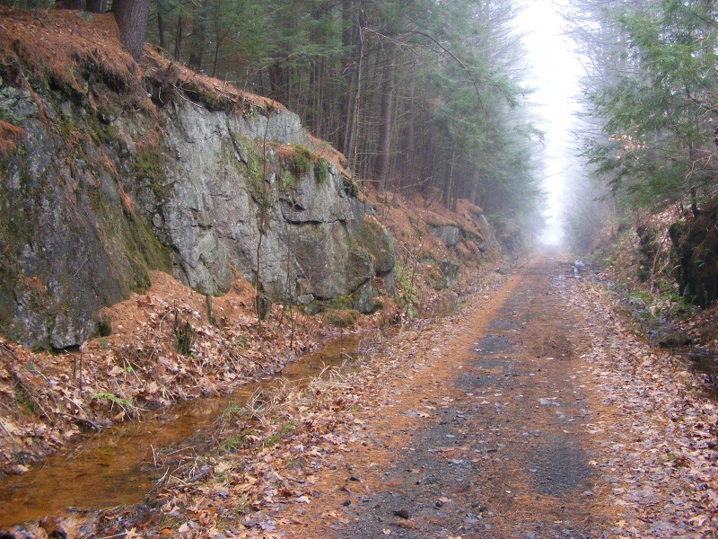
I spent a foggy and snowless December day driving from the Merrimack River to the Connecticut River and back through New Hampshire’s southern tier, stopping for walks now and then. Visibility was too limited to make a mountain hike worthwhile, but rail trails and roadside parks were ready for me.
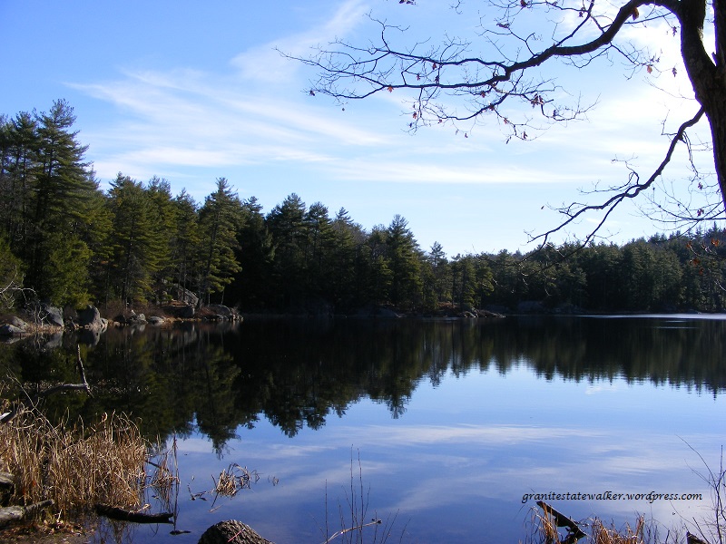
I chose a short segment between the nicely-restored depot in Troy and Rockwood Pond in Fitzwilliam. It was a round trip of just over four miles on a wide, straight trail. The only sounds were from birds and my own steps. No ice or snow, just a bit of mud on the southern half of the walk. On a clear day there’s a splendid view of Mount Monadnock from the shore of Rockwood Pond, though the fog obscured all the surrounding hills today.
Cheshire Rail Trail, Troy NH. All photos by Ellen Kolb
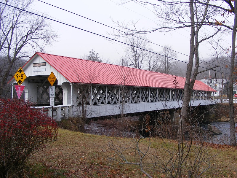
Swanzey was next, and I managed to work a pair of the town’s famed covered bridges into my route. The most exciting sight of the day was a bald eagle I spotted near the Ashuelot River, and it was too swift for me to snag a photo.
Thompson Bridge in Swanzey, complete with sidewalk.
The village of Ashuelot is in Winchester, with a covered bridge of its own.
Bridge in the village of Ashuelot, Winchester NH
After some business in Brattleboro, Vermont, I took the more-or-less direct route back east, along New Hampshire routes 9 and 101. I stopped for a half hour at Chesterfield Gorge, a small roadside state park on NH route 9.
Enjoy Chesterfield Gorge with a three-quarter-mile loop walk from the parking area.Wilde Brook, which cuts Chesterfield Gorge.
As the photos show, this is a very mild late autumn. In a fit of irrational exuberance, I almost tossed sandals in the car before I left home. Good thing I refrained; there was just enough mud and chill to make me glad I wore sensible shoes.
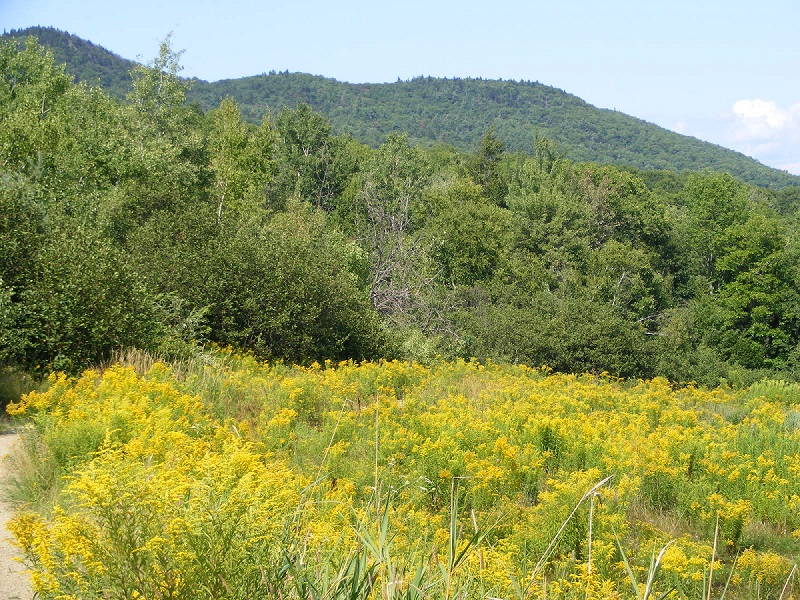
August was a low-mileage month. That’s fine. This has been as lovely a month as I’ve seen this year, and I know things will only get better as autumn approaches.
Crotched Mountain (Greenfield, NH) from Gregg Trail, August. Ellen Kolb photos.
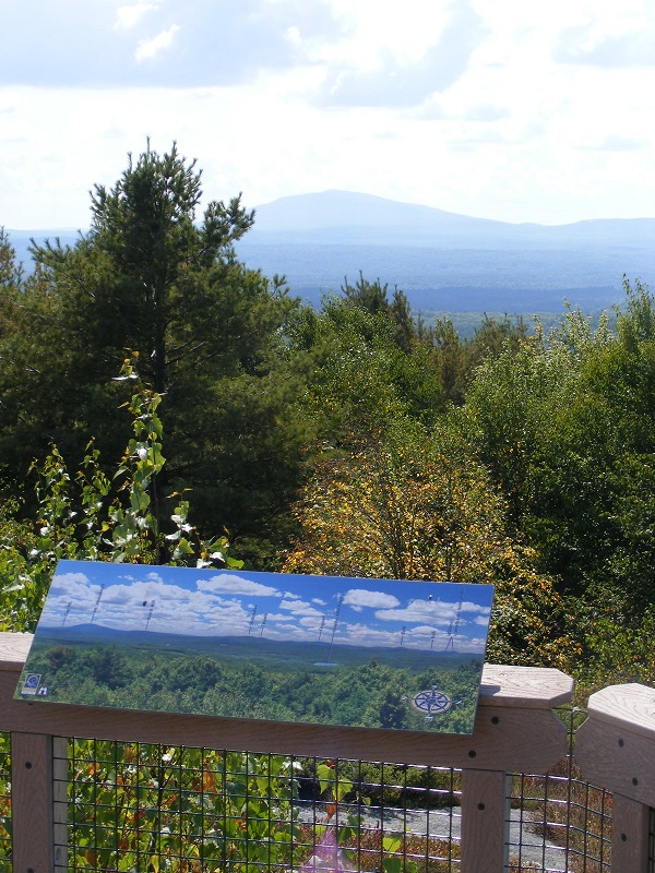
The Gregg Trail is accessible from the trailhead at Crotched Mountain school (take Crotched Mountain Road off of NH Route 31) in Greenfield. (You will not be looking for the Crotched Mountain ski area, which is on the other side of the mountain in Bennington). It’s a wheelchair-accessible path to a wonderful western overlook toward Monadnock. Even on a hazy day, it’s a pleasant walk. Past the overlook, trails continue to the summit ridge, though I didn’t go that far this time.
Mt. Monadnock from Gregg Trail overlook on Crotched Mountain, hazy August day
More short hikes on recent road trips
Rhode Island
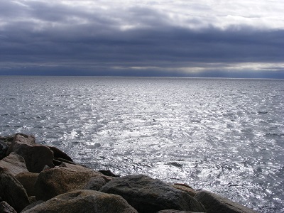
I joined my husband for a trip to Narragansett, Rhode Island. While he had a road race, I enjoyed a quiet walk along Ocean Road. Sunny inland, clouds building offshore.
Off the Rhode Island coast. Ellen Kolb photo.
Alton and Wolfeboro, New Hampshire
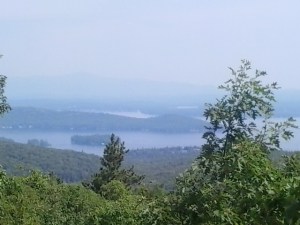
I may be the only person on record to hike Mt. Major in Alton without getting to the top. Despite being in good energetic company, I was out of breath as the last ledge came in sight. I sent my companions on as I found a comfortable place to sit: a breezy bit of ledge with a few blueberries nearby (how did earlier hikers miss them?!). Another hazy day, but even a murky view of Alton Bay and Lake Winnipesaukee is better than no view at all. Bonus: after the hike, we went to the Wright Museum in Wolfeboro. I’d never been there, and it was a treat. I recommend it to anyone interested in World War II history.
A view from not-quite-the-top of Mount Major in Alton, NHThe Wright Museum in Wolfeboro, NH is worth a visit.