The blueberries were gone along Crotched Mountain’s Gregg Trail on this July afternoon, but the Queen Anne’s Lace was in full bloom. A fair trade-off. Besides, there were still some raspberries left. If you’d like to search for them, head to NH Route 31 in Greenfield, New Hampshire, turn onto Crotched Mountain Road, and drive uphill to the trailhead across from Crotched Mountain School.
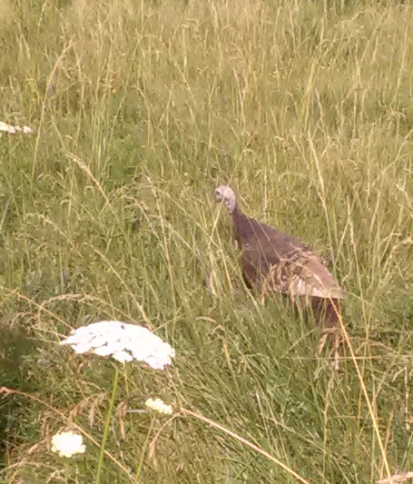
This hen turkey was just off the trail, cooing softly. I’d never heard such a gentle sound from a wild turkey. A moment later I caught a glimpse of her babies, mostly concealed by the tall grass.
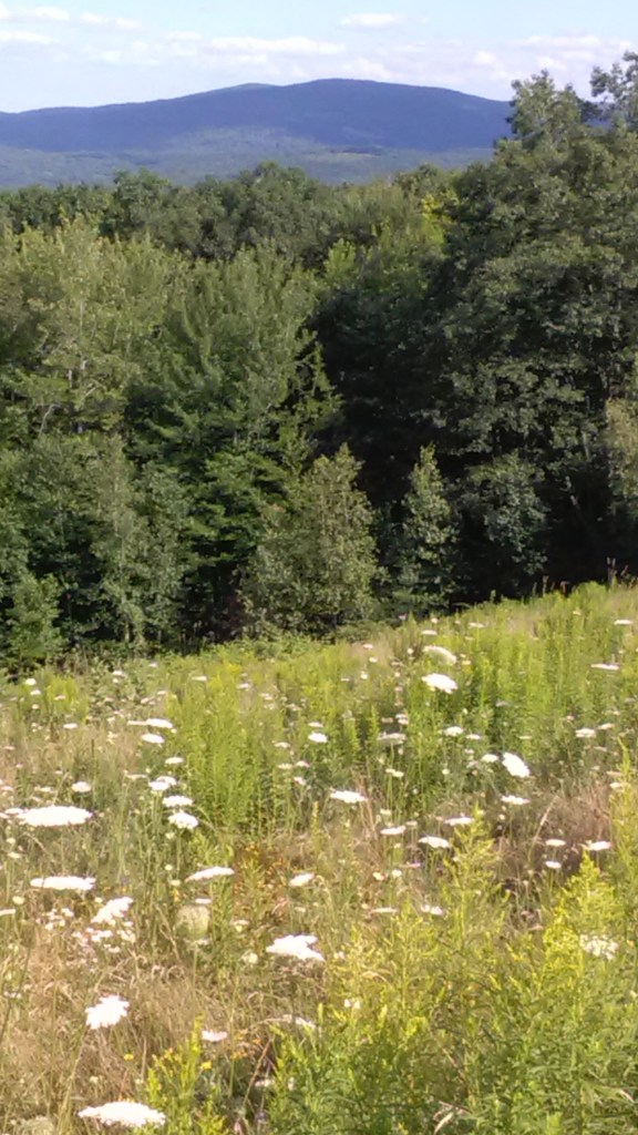
Lyndeborough hills (Rose and Pinnacle) seen from Gregg Trail.
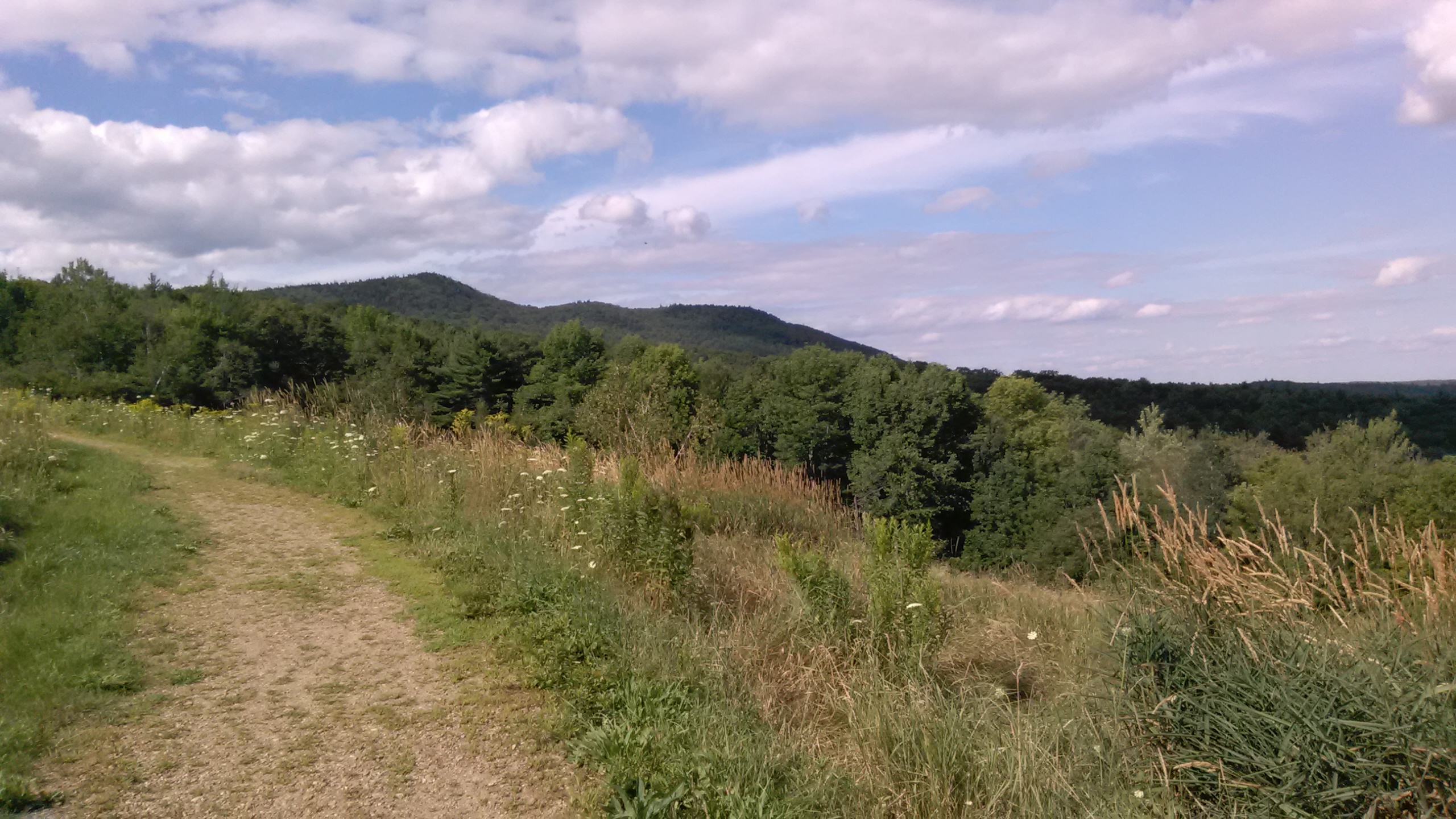
Gregg Trail is graded and switchbacked to accommodate wheelchairs. It ends at an open ledge well short of Crotched Mountain’s summits.
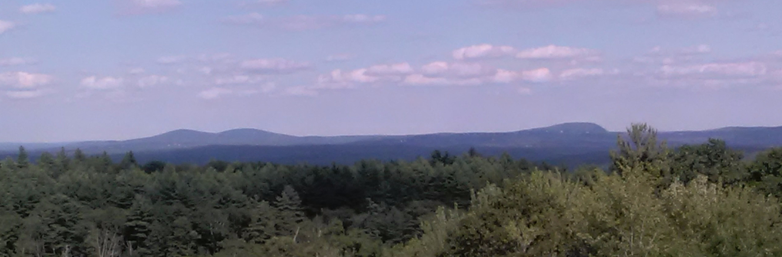
Seen from the Gregg Trail: Uncanoonucs in Goffstown (left) and and Joe English Hill in New Boston (right).
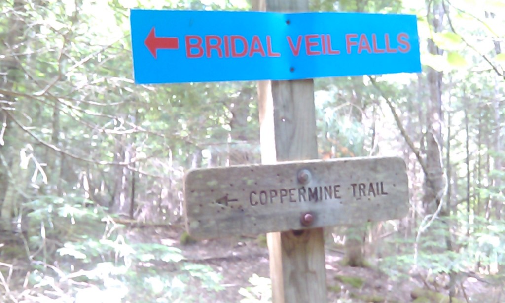
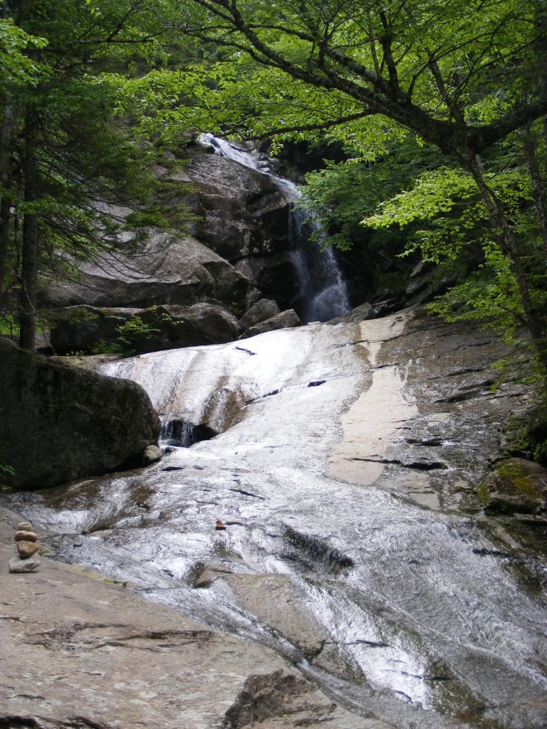
A waterfall, good company, and a Bette Davis plaque: welcome to Coppermine Brook and Bridal Veil Falls in Franconia, New Hampshire.
The plaque’s been documented elsewhere, but in brief: in the 1930s, actress Bette Davis was married to Arthur Farnsworth from nearby Sugar Hill, who died in a tragic accident. Someone, supposedly Davis herself, later mounted a memorial plaque on a boulder in Coppermine Brook, with an affectionate inscription to “the keeper of stray ladies.”
The Coppermine Brook trailhead is just off NH Route 116. I went there with a friend a few days after heavy rains and flash flooding had left significant road and property damage in the area. Between I-93 and 116, we passed two work crews repairing washed-out edges of roads. The trail itself, alongside the brook, was a bit gullied but otherwise intact.
The trail rises about 1100 feet in two and a half miles to its terminus at Bridal Veil Falls. If you want a shorter hike, the plaque is only a mile or so from the trailhead – but you have to want to find it. No directional signs will help you. It’s on a boulder in the brook, accessible via a clearing that you’ll see between the trail and the brook. The plaque faces downstream.
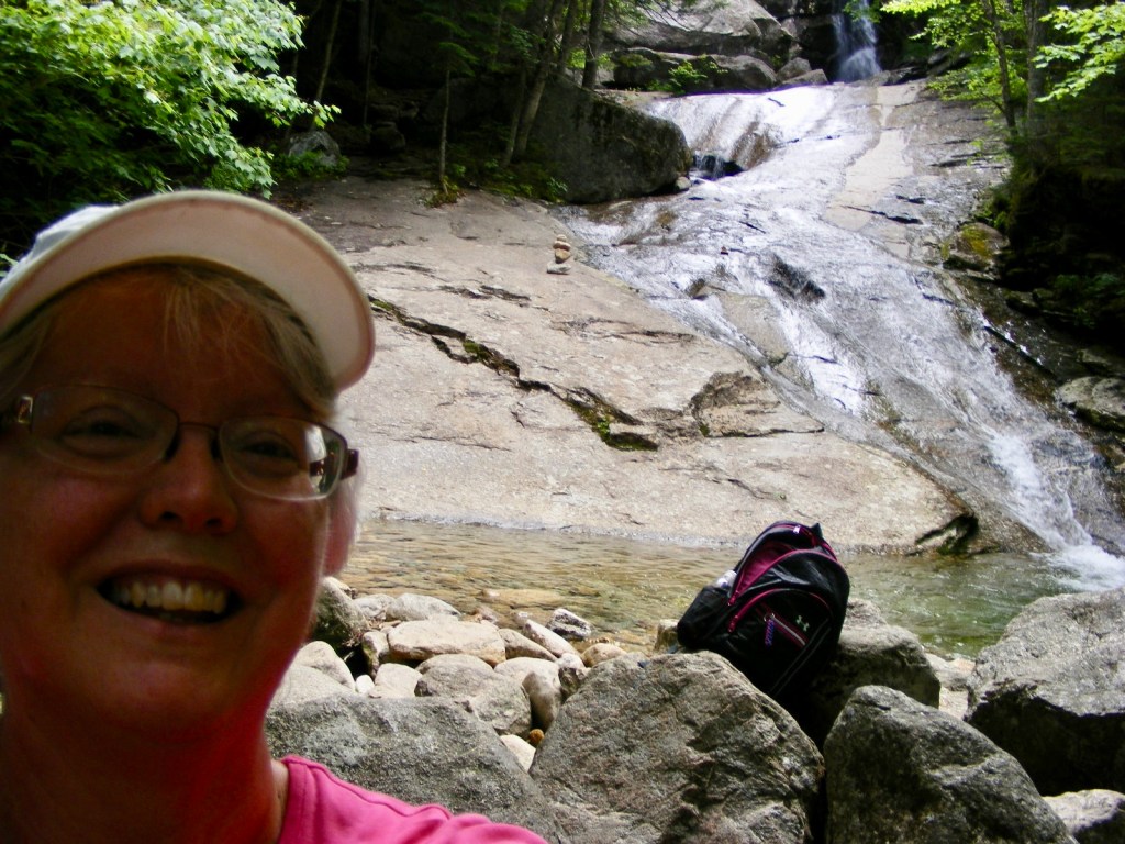
A week after a flash flood, the brook and falls had receded to tame levels. I remained at the lower falls. If you have more time and shoes that grip on slippery rock, help yourself to the upper falls.
This out-and-back hike has an average grade of about 8%, if my math is right. It doesn’t feel like an 1100′ climb, although it is. There are no scrambles along the way, and no mountain vistas, but there’s plenty of shade by a cool brook leading to a pretty waterfall. This was a perfect choice for a low-key hike with a friend.
This hike along Coppermine Brook goes partway up the west side of Cannon Mountain, which is more familiar from its other side facing I-93. So to stretch a point, I can say that I’ve hiked Cannon…never mind that I didn’t get anywhere near the summit!
Hot day, feeling sluggish, mulling over a list of places to go: I finally just got in the car and started driving.
Along the Haselton Farms trail in Benson Park
Zipping through NH Rt. 111 in Hudson enroute to yet another Forest Society property (I’ll get that patch if it kills me), I realized that I was near Benson Park. I hadn’t been on the property in years – since it was Benson’s Wild Animal Farm, in fact. I made a quick detour, found the park, and walked three good miles on its trails and paths. The trails I chose weren’t crowded, even with a couple of Pokémon Go groups intent on doing whatever it is they do.
Download a trail map before you go. I settled for taking a photo of the map at a kiosk on site. Kids, don’t try this at home; batteries are fickle friends.
The history of the property is available on the Town of Hudson website. Indulge me as I recount a grossly oversimplified version: once upon a time in the town of Hudson, New Hampshire, there was an amusement park called Benson’s Wild Animal Farm. The Finer Minds at the state capital decided that a Circumferential Highway would ease all of Nashua’s traffic problems. (I hear you tittering over there in the back.) The Benson’s property was bought up by the state to mitigate the expected loss of wetlands for the highway project. Years passed, and the Circumferential Highway project quietly expired, leaving only exit 2 off the Everett Turnpike to remember it by. Eventually, the Finer Minds released the Benson’s property to the town of Hudson.
More years passed, many people put enormous efforts into rehabilitating the property, and Benson’s Park is now a Hudson jewel with a playground, dog park, memorials, and a trail network. The longest single trail, Haselton Farm, is about two and a half miles long; many shorter ones allow for extended hikes.
On the Haselton Farm trail, some of the pavement remains from the Wild Animal Farm days, and the occasional sewer-access cover along the way serves as a reminder that this used to be a more developed area. On this 90-degree summer day, the trail was wonderfully shady, and a light breeze made bug repellent unnecessary.
This was the best spur-of-the-moment stop I’ve made in a long time. It’s great fun to find a place like this fairly close to home.
9/11 memorial at Benson Park, featuring a beam from the World Trade Center.