The calendar says winter is a few days away, and late fall has been happy to provide a preview. I visited the Nashua River Rail Trail on a quiet weekday morning to take advantage of a just-above-freezing day. I wanted to beat the messy forecast: rain, followed by plummeting temps and a resulting flash-freeze.
I strapped cleats onto my shoes just to be on the safe side, since icy patches can lurk in a path’s shaded areas. The powder snow that fell earlier in the month was packed down nicely in an informal lane for walkers. There were traces of ski tracks alongside, but I think those must have been made when the snow was fresher.
I was on the northernmost segment of the trail, in Nashua. I was pleased to see that the city has kept the Gilson Road parking lot plowed. Many tracks in the snow between parking area and trail attest to the NRRT’s continuing popularity.
Along the Nashua River Rail Trail: “The Shapes of Water” by Faith T., a student at Nashua High School South.Ellen Kolb photo.
The art displays along the way between Gilson Road and the Rt. 111-A crossing featured pieces by students at Nashua High School South. Some of the display stands were showing signs of wear, and I hope the city will maintain them. The artwork is a meaningful way for Nashua to put its stamp on its section of the NRRT.
A bird’s nest was in the middle of the trail, perched atop the snow. A gust of wind probably took it down from a nearby tree. I picked it up thinking that it was edged with snow, but I was mistaken – all the white fuzz was from downy feathers. I moved the nest the edge of the trail, not wanting to damage it even if its former occupants were done with it.
Feathers, not snow, adorn this nest. Ellen Kolb photo.
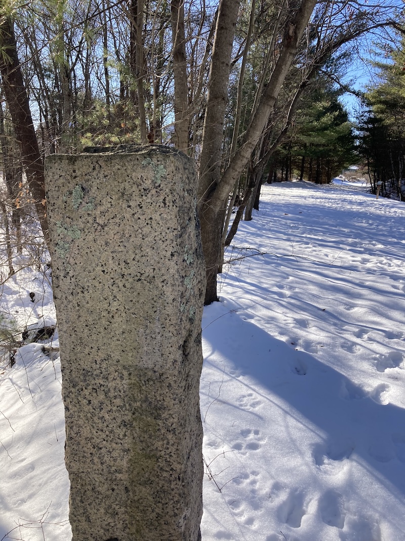
The painted markings on the old granite B&M railway mileage marker have weathered away. W 40, I thought to myself as I walked past it. Forty miles south to Worcester along the old rail line.
This granite post is a mileage marker, which once had “W 40” painted on it (40 miles to Worcester, Massachusetts). Ellen Kolb photo.
The twelve-mile long NRRT has several parking areas along the way. Trail users in Nashua can park by the trail on Gilson Road, NH Rt. 111-A, or Groton Road/Hollis Street (at the NH/MA state line).
You can help send the Granite State Walker to the next trailhead with a small donation at her Buy Me a Coffee page. Thank you!
When last we met, I described a stop in Franconia Notch as I headed north for a birthday hike. Ultimately, half of my trip’s miles were along the Presidential Rail Trail (PRT). No two hikes there are alike, even from one day to the next.
Was I hiking, or was I walking? I know there are trail lovers out there who would scorn my use of the word “hike” to describe travel on any path that’s flat. I humbly ask their (your?) indulgence. If I’m on a paved surface, or an unpaved well-maintained town road, I’m walking. Anyplace else, I’m hiking.
Just go with it. Let’s get back to the PRT.
A cloudy day in Pondicherry Wildlife Refuge
Two days and half of my miles were on the PRT, my favorite rail trail. The first day was cloudy, the second brilliantly sunny, and each was splendid.
I began with the PRT’s path through Pondicherry Wildlife Refuge. My first stop was the viewing platform at Cherry Pond, an easy mile and a half from the Airport Road trailhead in Whitefield. The pond was covered with waterlilies. The only sounds were crickets, bees, some shy songbirds, and one distant jet way overhead.
Cherry Mountain and the Pliny Range were out the open, but the Presidentials to the east refused to come out from behind clouds. I gave them a chance, as I spent several hours between the trailheads at Airport Road and NH 115-A, but they simply weren’t going to show off for anyone not climbing them.
Cherry Mountain and Joe-Pye weed along the Presidential Rail Trail. Ellen Kolb photo.
Wild blossoms lined my way. I was pleased to see that Joe-Pye weed, while fading a bit, was still plentiful. I like its bold height and pink blooms. I was to see much more of it in the coming days.
Coming back at dusk to chase some sunset photos, I was surprised by a snowshoe hare popping out of the dense brush along the trail. Accustomed as I am to the pesky Eastern cottontails that abound in my southern New Hampshire neighborhood, I wasn’t used to seeing a larger, darker rabbit. But there it was!
A late afternoon view from the PRT: Mount Waumbek and the Pliny Range. Ellen Kolb photo.
The Cross New Hampshire Adventure Trail
The next day, there wasn’t a cloud in the sky. I was doomed to get sunburned.
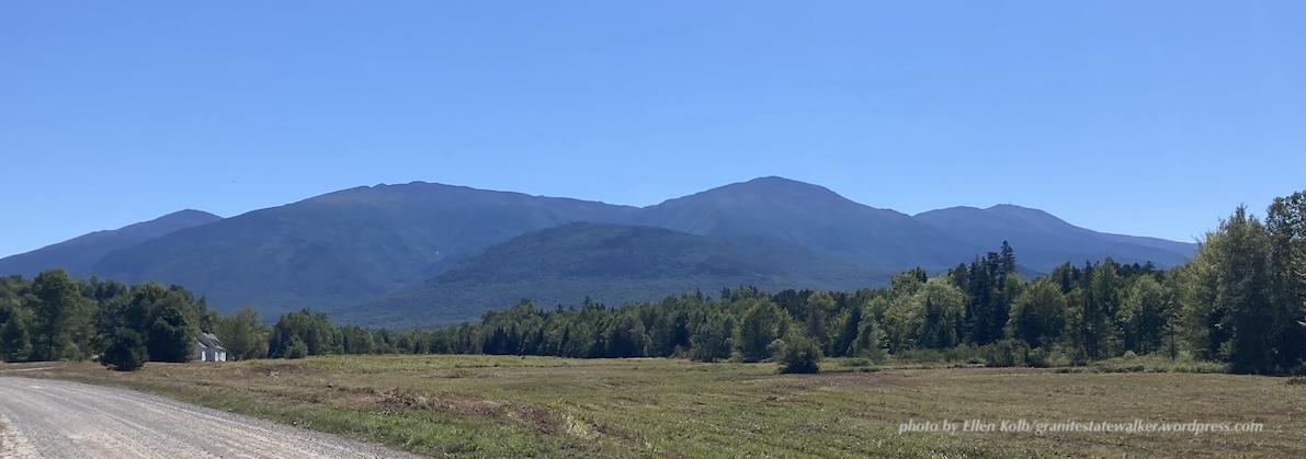
The xNHAT – I’ll use the abbreviation favored by the trail’s founder, about whom more in part III – includes much of the PRT, but also a quiet residential unpaved Jefferson road called Valley Way. That’s where I got my sunburn. It’s also where I had all the views of the Presidential Range that were missing the day before.
The Presidential Range seen from Valley Way in Jefferson NH. L-R: Mts. Madison, Adams, Jefferson, and Washington. Mt. Washington is the tallest, but seems shorter due to the angle from which I took the photo.
(I’ve written before about the xNHAT, which extends all the way across the state from Woodsville past Shelburne, ending in Bethel, Maine. My trip included only a couple of segments. Take a look at xnhat.org to learn about the whole trail.)
I started from Bowman, a trailhead off U.S. 2 in Randolph. From there I hiked west to NH Route 115, and then reversed direction as far as the Appalachia parking area. Having the car in the middle of my route gave me a place to eat lunch with my feet propped up. (My celebration, my rules.)
I started on the shady PRT, and when I got to Jefferson Notch Road I cut over to Valley Way. After all the clouds the day before, I was going to take the scenic route and enjoy the view of the Presidential range in all its summer glory.
Thumbs up to the friend of the trail who has established Paradise Meadow on Valley Way! This generous supporter has set up a little oasis on his own property for the benefit of xNHAT travelers. There’s room for a couple of tents, for the convenience of bikepackers or backpackers. More important for me as a day hiker were his other amenities, including a picnic table, a cooler full of bottled water, and a tidy discreetly-located pit toilet. I left him a thank-you note and a small donation in the little lockbox nearby.
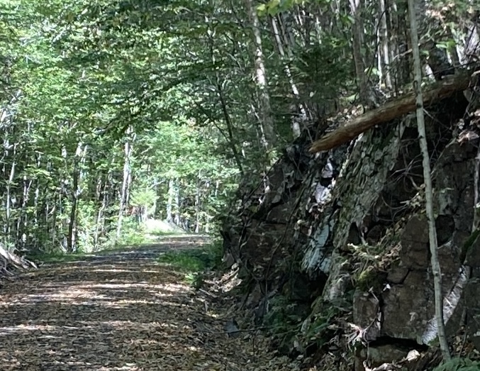
Valley Way was superb, but I eventually switched back to the PRT for its soothing shade. While the PRT is parallel to and close by U.S. 2, the highway’s traffic is muted by the trees between trail and highway. A soft surface to walk on, shade above me, and wild black raspberries here and there made for a fine afternoon.
Shade along the PRT, and a rock cut dating back to rail days. Ellen Kolb photo.
In part III, I’ll take you to Hogan Road on the xNHAT, which might be Mr. Hyde to Valley Road’s Dr. Jekyll – though after several visits, Hogan and I have come to terms. It has beauty of its own. If you missed part I, you can find it here.
If you’re so inclined, you can Buy Me a Coffee – with my thanks!
This spring’s weather in southern New Hampshire has been somewhat uneven, which means “normal,” which means rainy days and 80-degree days and near-freezing nights. (Not all at once.) Most weekends this season have had inclement weather of one sort or another.
When the forecast last weekend mentioned a sunny Sunday, I knew what I’d be doing after church. Off with the dress shoes, on with the hiking gear. I headed just over the county line for eight good miles on the Rockingham Recreational Trail.
One thing I like about this trail linking Manchester and the Seacoast region is the choice of trailhead parking areas. This time I parked in East Candia, where the trail crosses Depot Road. (Here’s a tip: anytime you see a Depot Road in a New Hampshire town, keep your eyes open for a rail trail.) There’s a parking area there that’s unpaved but well-maintained, with room for a dozen cars or so.
Another thing I like is the trail’s shade. Mixed hardwoods have leafed out, and along with hemlocks and pines they create a kind of canopy along the trail.
I headed east for a few miles and stopped for a snack at a trailside picnic table by Onway Lake. Not too far away was the day’s prime photo op: ladyslippers in profusion! These were a deeper pink shade than the ones I’ve seen closer to home. Always beautiful, whatever the color. Within a couple of weeks they’ll disappear, to return next spring or perhaps the spring after that. I happened to catch them at the perfect time. No picking them or digging them up! They’re highly site-dependent and don’t take kindly to changes of venue.
Pink ladyslippers, making their brief appearance. Ellen Kolb photo.
I retraced my steps to my car, dropped off my fleece pullover, and then headed west. That section of trail had a different look from the section I’d been on earlier: wider, a bit smoother, more residential buildings nearby. I like the modest rock cut in that western section, blasted into shape when the old rail line was laid. Such cuts testify to the effort it took to lay rails in the aptly-named Granite State.
Everyone I encountered on the trail was in good spirits, and why not? It was a rare sunny weekend day, and a holiday weekend to boot. I greeted a few runners and walkers, who were far outnumbered by cheerful courteous cyclists. I like a good hearty “passing left!” when I’m approached from behind by someone on wheels.
A few notes on the Rockingham Recreational Trail section I visited, centered in East Candia: as I mentioned, the parking area on Depot Road is unpaved but in good shape. No toilet facilities are available. Carry snacks and water; the closest place along the trail with coffee and fast food is further east in a commercial area of Raymond. The trail is unpaved, and it’s full of the stones and roots typical of this area. If your mobility is impaired to any degree, you might enjoy the relatively smooth and wide two-mile section of trail extending west from Depot Road. No ATVs or class III e-bikes are allowed.
When you’re ready to explore this or any other trail in New Hampshire, remember to defend yourself against ticks and mosquitoes. I use permethrin on my hiking clothes and DEET on exposed skin. Lyme disease and its nasty cousins are illnesses I want to avoid.
There are two Rockingham Rec Trails in New Hampshire, which can be confusing. It’s a heritage from the route names in railroad days. For this walk, I was on what’s called the Portsmouth branch, which goes between Manchester and Newfields but not quite all the way to Portsmouth. There’s a separate Fremont branch that extends from Windham Junction to Epping, where it meets the Portsmouth branch. If you decide to explore the Fremont branch, be aware that you’ll sharing the path with ATVs between Windham and Fremont.
The more I hike around the Granite State, the more I become aware of the pieces of history visible along the way. There are stories everywhere, told in many ways: markers, signs, cellar holes, even concrete footings from long-gone towers and cabins. The recent dedication of a historical marker not far from my home sparked this post, which I wrote for nhrtc.org, the website of the New Hampshire Rail Trails Coalition.
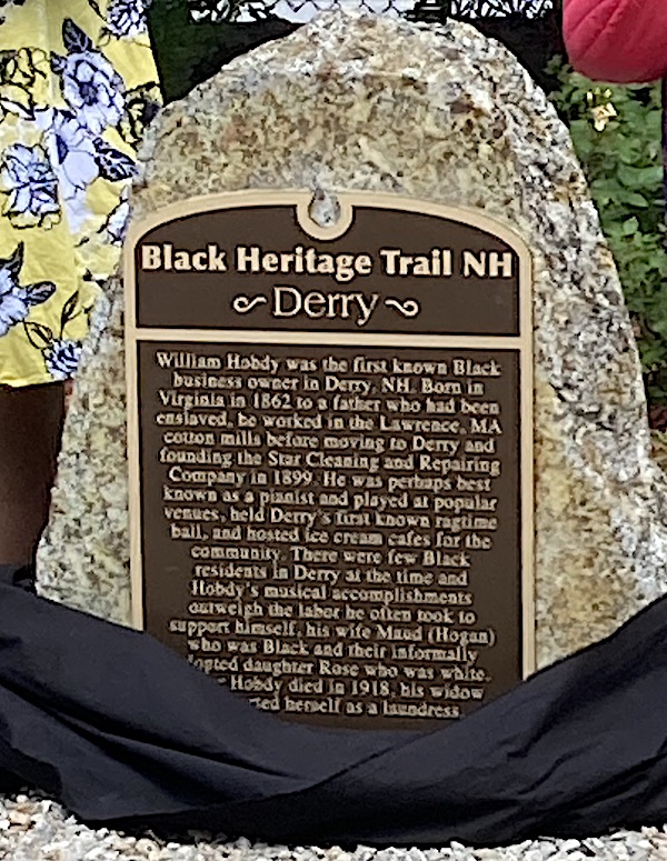
You’ll be well rewarded as you travel along New Hampshire’s rail trails if you keep your eyes open for reminders of Granite State history and heritage. You’ll find informative markers, plaques, and signs celebrating people and events. Among the newest is the Black Heritage Trail marker honoring William Hobdy, mounted on the Derry Rail Trail just south of Broadway (NH Route 102).
On the Black Heritage Trail in New Hampshire: a tribute to William Hobdy, businessman and entertainer. Photo by Ellen Kolb
The dedication of the Hobdy marker was a community-wide event drawing a crowd to central Derry. William Hobdy lived in town in the early 20th century and became owner of a small business. His music brought him his greatest renown, as his ragtime piano skills graced local venues. Now, the marker relating his story is a prominent feature on the Derry Rail Trail in the town center.
On the same trail, keep an eye out for artwork framing a poem by Robert Frost, who once taught at nearby Pinkerton Academy before earning worldwide fame for his poetry.
Another Black Heritage Trail marker is at Potter Place in Andover, where a restored depot is a scenic highlight along the popular Northern Rail Trail. Andover resident Richard Potter was a 19th-century entertainer who gained nationwide fame as a ventriloquist, magician, and humorist, but his story didn’t end there. The marker honoring Potter can inspire you to learn more about him and his time.
Canobie Lake Station marker along the Salem NH bike-pad trail. Ellen Kolb photo.
Thanks to the enthusiasm of rail trail fans in conjunction with local historical societies, some trails celebrate a heritage of passenger rail to popular parks and bygone resorts. Kiosks in the towns of Troy and New Boston display reproductions of train schedules from the days when Boston residents would come to New Hampshire via train for vacations and day trips. In Salem on the Bike-Ped trail, a marker recalls train service to Canobie Lake and Rockingham Park.
Sometimes, a sign will spotlight a feature of the trail itself. Watch for an informational sign along the Sugar River Trail in Newport about the unusual Pier covered bridge, built tall enough to accommodate the trains that used to ply the route. Motorists on nearby roads can’t see the bridge, but trail users get to travel right through it.
These clues to local history add something special to an excursion on rail trails. Every trip can reveal something new.
There’s a colorful new piece in my trail-memento shadow box: the patch noting completion of the New Hampshire Rail Trails Challenge. Over the past few years I’ve walked, and occasionally biked, on every rail trail in the state. That’s hundreds of miles, especially considering that I usually hike alone and don’t have a shuttle to get me back to my starting point. I’ve seen everything coming and going.
I loved this project. It’s open to anyone, with details available at nhrtc.org. Check it out, and you’re bound to discover trails you never knew about. Even a single region’s trails could keep a walker busy all year.
This is the project that got me involved with the New Hampshire Rail Trail Coalition. I had the privilege of serving on the NHRTC board for three years. In that time, I met some fine people and got an education in trail development and maintenance. It all started with a list of trails and the dangerous thought “hmmm…I could do that.”
Favorites
Presidential Rail Trail, Gorham-Whitefield. I love this one for its views in Pondicherry Wildlife Refuge, not to mention the views of the Presidential Range and Cherry Mountain. This is far from local for me, but I’ve found ways to get up there every year. Maybe I’d get bored with it if I saw it more often. Hmmmm…no. I’d love it anyway.
Nashua River Rail Trail. This is my home trail, so to speak. I know every bit of it from its mile in Nashua, New Hampshire all the way to its southern end in Ayer, Massachusetts. I first rode it the week of its dedication as a rail trail a couple of decades ago. I must have been there upwards of 200 times since then, observing every season’s changes. It’s justifiably popular. The pavement has its figurative ups and downs, but the recent reconstruction on some Massachusetts segments will keep this trail going for many years to come. And hooray for the city of Nashua, which now keeps the big parking lot at the north end of the trail on Gilson Road plowed in winter.
Rockingham Recreational Trail, Manchester-Newfields. The section heading east from Lake Massabesic at the Manchester/Auburn line is a favorite of mine for a quick two or three midday miles after appointments in Manchester. I avoid it during mud season, but the rest of the year makes up for that. The trail is well-traveled near the lake and becomes much quieter the further east I go. It’s close to Route 101, but the trees lining the trail muffle much of the traffic noise.
Cherry Mountain from the Presidential Rail Trail, Jefferson NHGranite marker at New Hampshire/Massachusetts border, Nashua River Rail TrailLake Massabesic along Rockingham Recreational Trail, Manchester/Auburn NH
One-offs
These are a few of the trails I visited only once. Perhaps I’ll be able to return to them another time.
Lilac City Greenway, Rochester. A business trip to Rochester a couple of years ago gave me a chance to walk along this greenway alongside busy Route 125. In town, it looks like a sidewalk rather than an abandoned rail line. Its landscaping and public art make it a cheery feature.
Sugar River Rail Trail, Newport. This one’s up in Sullivan County, another out-of-the-way place for me. I treasure the memory of the day I spent walking nine-plus miles on this little gem. It’s open to OHRVs, which sometimes creates issues for slow trail users like me, but there were no problems during my midweek visit. It’s a shady trail with several interesting bridges along the way. I benefited from a very reasonably-priced shuttle ride on a Southwestern Community Services bus between Newport and Claremont.
Cotton Valley Rail Trail, Wolfeboro-Wakefield. I visited this one the day a local rail car club had an open house. The unique trail has rails in place for little rail motor cars – interesting in themselves – with the hardpack walking/biking path between the rails.
Lilac City Greenway, Rochester NH. Photo by Ellen Kolb.
I found hiker-friendly towns that I never would have visited if I hadn’t been on a mission to explore every trail. When echoes of Covid restrictions were still in the air, I stopped in Lisbon on the Ammonoosuc trail and found cheerful hospitality. While heading for the Warren rail trail, a driver from a hostel catering to Appalachian Trail hikers agreed to give me a shuttle ride that saved me two hours of walking. (Best five bucks I spent all that week.) The folks at the general store in Danbury along the Northern Rail Trail took one look at my sweaty face, halfway through a 15-mile day, and showed me first to the restroom and then to the cold drinks. I came across such kindnesses all over the state.
You can search this blog for many rail trail posts I made during the Challenge. I hope you’ll take the Challenge yourself. If that’s too big a project to tackle, explore one or two of the trails near you. May your adventures be as rewarding as mine.
If the Danbury Country Store were a human being, it would be my new best friend. This and other treats awaited me as I set out on a long walk on central New Hampshire’s Northern Rail Trail.
Fifteen miles is a big stretch for me, especially after losing fitness and energy to post-Covid problems earlier this year. I had to crawl, figuratively, before I could walk far again. I’ve added a few more miles each week. This week, I decided to go big. I walked on the trail from Potter Place in Andover to the Danbury Country Store and back. I figured that was one way to evaluate how I’m doing.
I’m doing fine. Sore, yes, but fine.
Sights
I’d seen Potter Place before, but its charm catches me by surprise every time. The restored depot in Andover close to the US 4/NH 11 junction is a tribute to the people who care about the rail trail and the railroad’s history. The Northern Rail Trail is in fact well-loved and well-maintained throughout its fifty-plus miles. A big park-and-ride lot just down Depot Street from Potter Place is an ideal spot from which to launch a walk or ride along the trail.
Potter Place: restored depot and an old Central Vermont Railway car.All photos by Ellen Kolb.
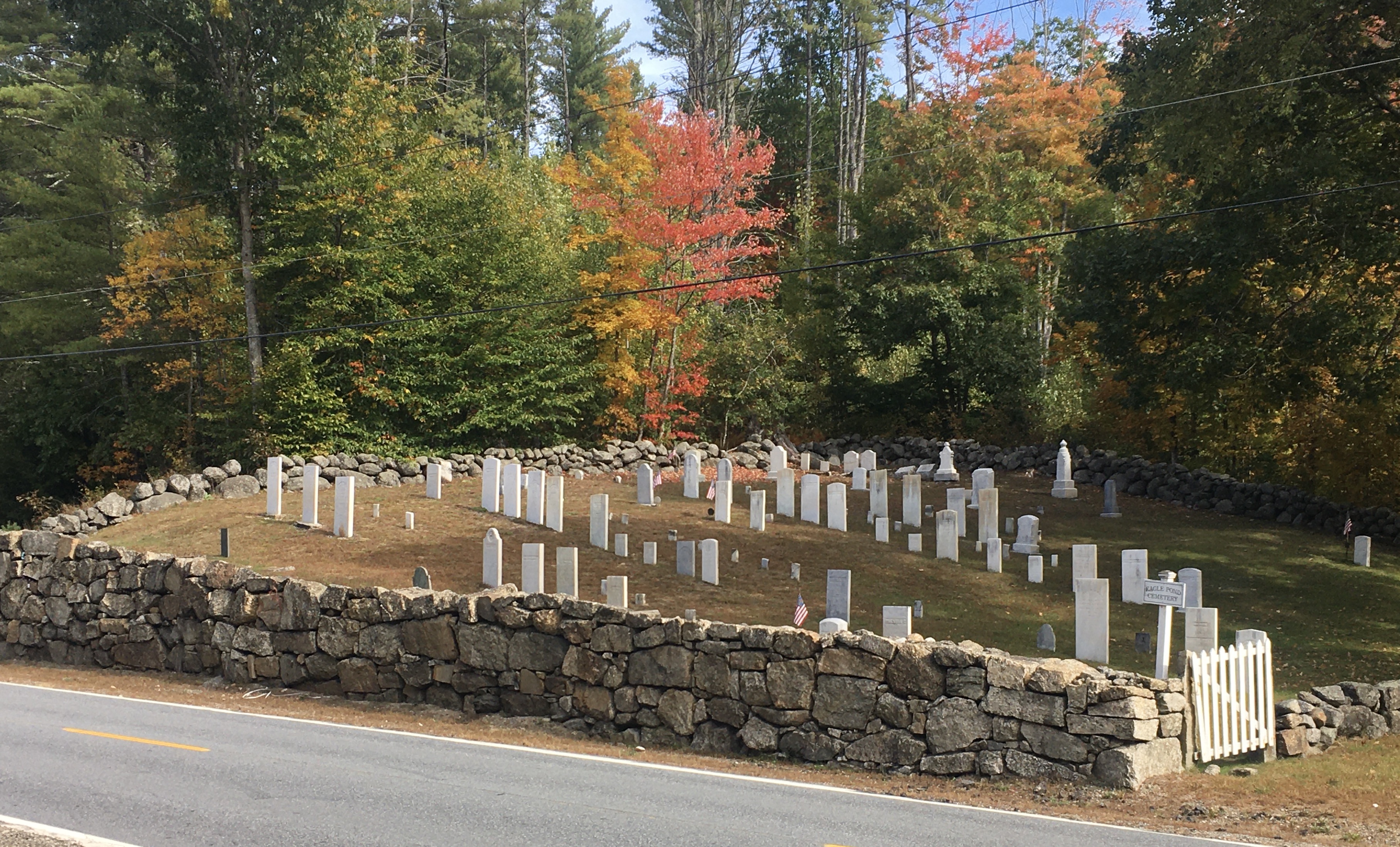
Coming upon an old cemetery is no surprise on any of my walks. In Wilmot, I came upon one that looks beautifully tended. From a distance the markers looks unweathered. They’re all upright. The stone wall around the cemetery is a work of art, albeit with some interesting items (read: “trash”) tucked between some of the stones.
Eagle Pond Cemetery, Wilmot
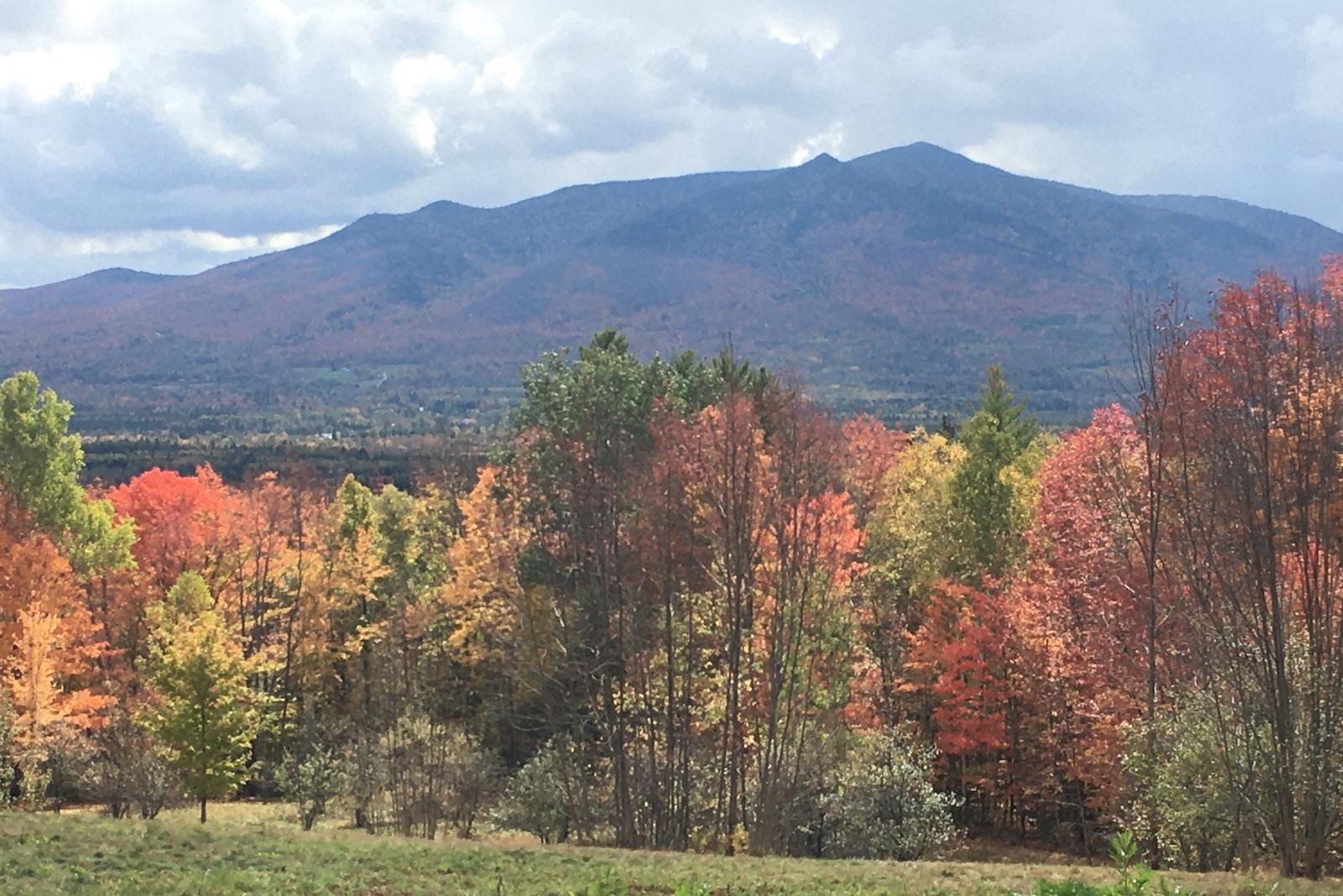
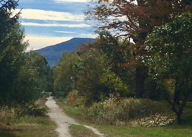
I even got a glimpse of Mt. Kearsarge. I took a photo that came out fuzzy, but even so one can barely discern the cell tower on the summit, with the fire tower just to its right.
Mt. Kearsarge seen from Northern Rail Trail
Foliage
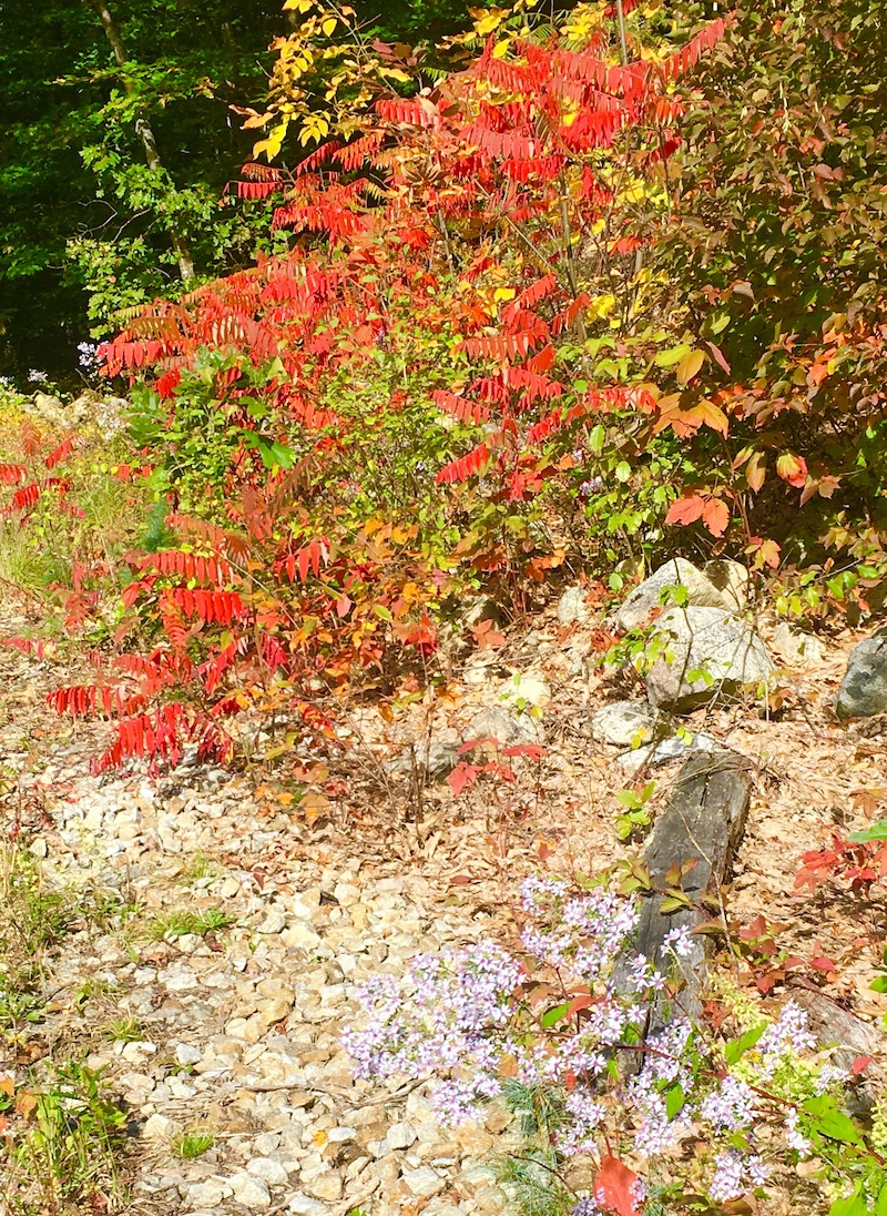
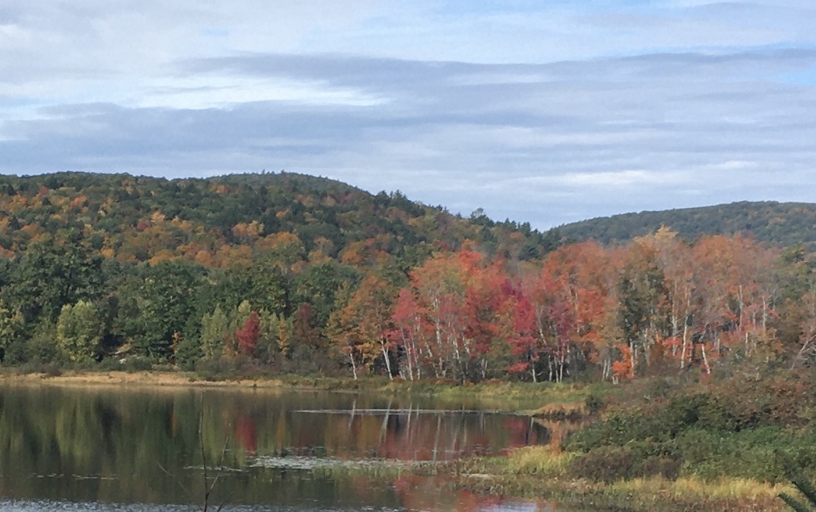
Fall is my favorite time to take walks, and even the weeks before peak foliage can be splendid. I found plenty of leaves underfoot this week. Remaining foliage in the central New Hampshire area I visited is still a week or two away from full color. Icy blue asters, a last reminder of summer, persist all along the trail, contrasting nicely with the changing leaves.
Tiny blue flowers in the foreground contrast nicely with the changing leaves.
Eagle Pond in Wilmot
Lunchtime
My turnaround spot was the Danbury Country Store. It’s a must for anyone traveling along the NRT. I figured I’d sit on one of the porch seats there and nibble on a Clif bar from my pack. That was before the store’s deli crew set out two fresh hot pizzas. Game, set, match, and the Clif bar retreated to its pocket.
Also at the store: an air pump for cyclists, a huge assortment of beverages, the usual country-store inventory, and a deli where you can have any sandwich made to order. Enjoy. I sure did.
As I write this the day after my walk, I’m nursing a few aches, but they’re good aches. The kind that don’t herald injuries; the kind that whisper please don’t try this two days in a row. Best fifteen miles of the year, and that’s good to write three months after I needed my husband’s help to get around the block.
Fall isn’t winter’s knock on the door. Instead, winter is the price I pay for fall hiking. Fair exchange, in my view.