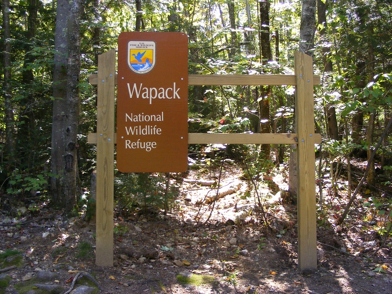
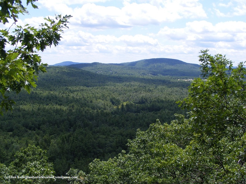
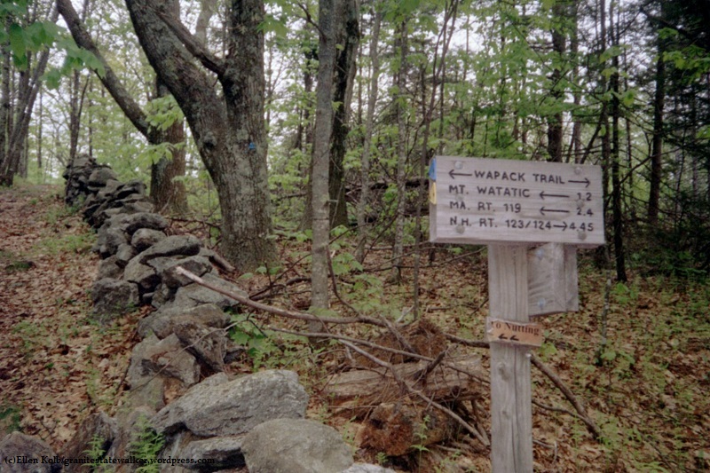
From Ashburnham, Massachusetts to Greenfield, New Hampshire, the Wapack range extends over a series of peaks that can be seen clearly from the eastern slopes of Mount Monadnock. The 21-mile Wapack Trail spans the range, with segments that make great dayhikes.
My copy of the the Wapack Trail guide is well-thumbed, and the map that comes with it has held up pretty well for me through the years. Map and guidebook, along with recent trail notes, are available at the Friends of the Wapack web site.
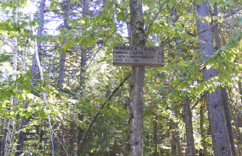
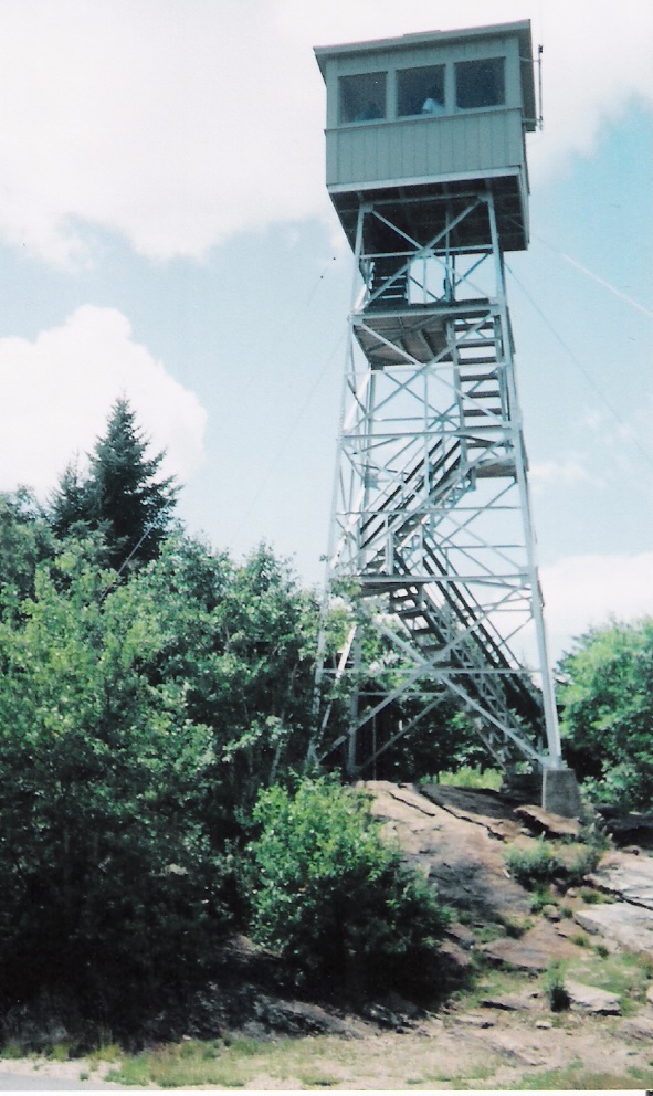
Pack Monadnock is the most popular part of the trail, with Miller State Park and the summit’s fire tower apt to draw crowds. North Pack is close enough to add for an out-and-back hike.
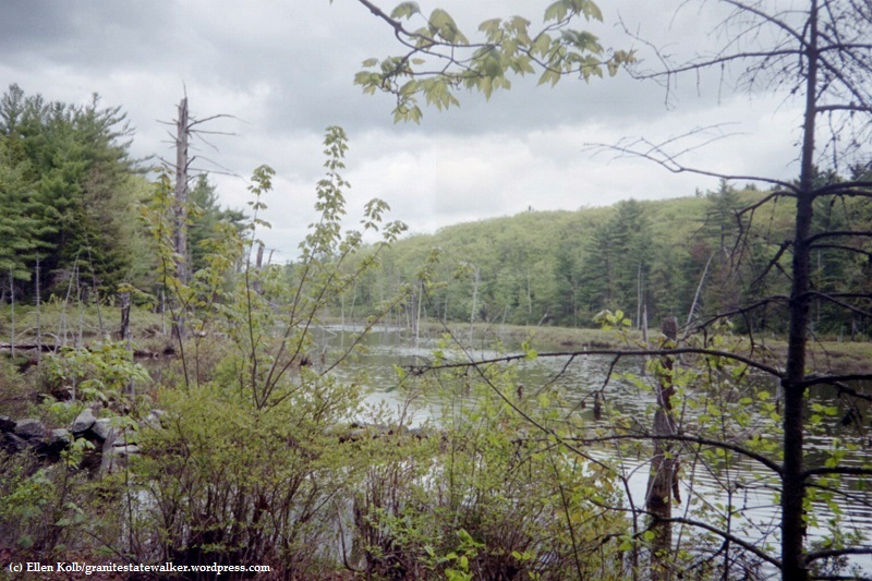
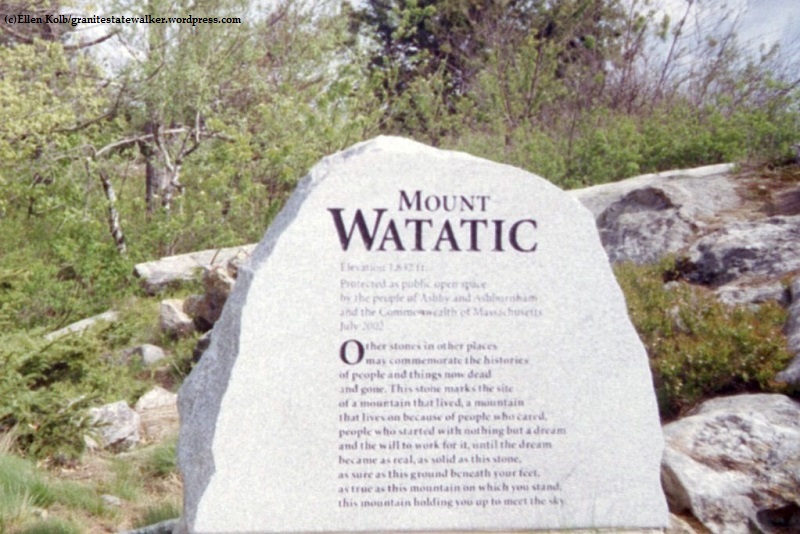
I like the Temple Mountain ridge in July, when I can make a lunch out of blueberries. Watatic, at the southern end of the trail, has a wonderful open summit. The variety of birds in the Binney Pond area make the mosquitoes worth tolerating.
Endurance racers have been known to run the entire trail in a day. I take the Wapack in segments, at a gentle pace. Either way, the Wapack Range is memorable.
North Pack Monadnock – Pack Monadnock
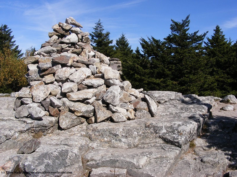
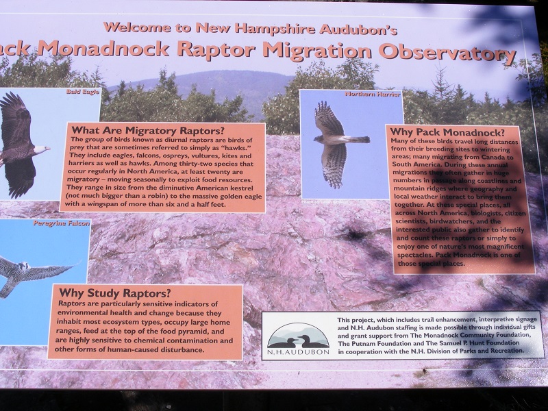
Northern trailhead, Greenfield NHmileage from northern terminusNorth Pack Monadnock summit cairneast from North Pack: the Uncanoonucs and Joe English HillEvery fall, New Hampshire Audubon volunteers staff a raptor migration observatory on Pack Monadnockfire tower at summit of Pack Monadnock
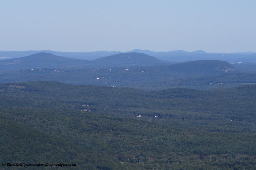
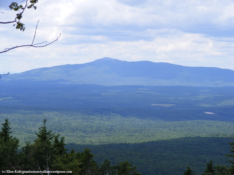
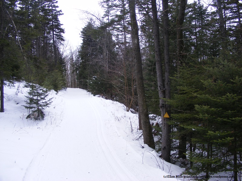
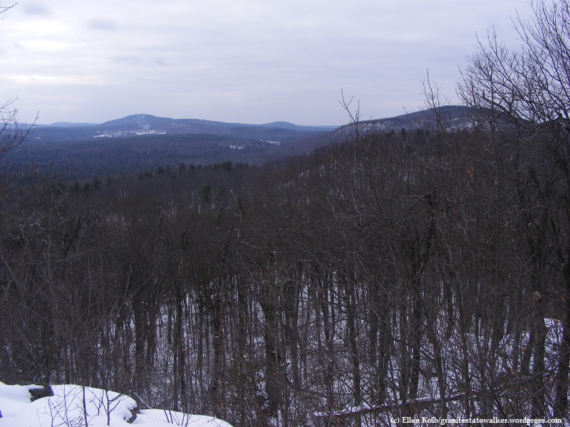
Mt. Monadnock seen from Temple Mountainparking area on Temple Road in Temple, leading to Sharon Ledges on Temple Mtn.view to south from Myrick Overlook on Temple Mountain: Wapack RangeThe Wapack’s yellow blazes guide snowshoers along the trail.Winter view from the Wapack Trail.
Southern section of the trail
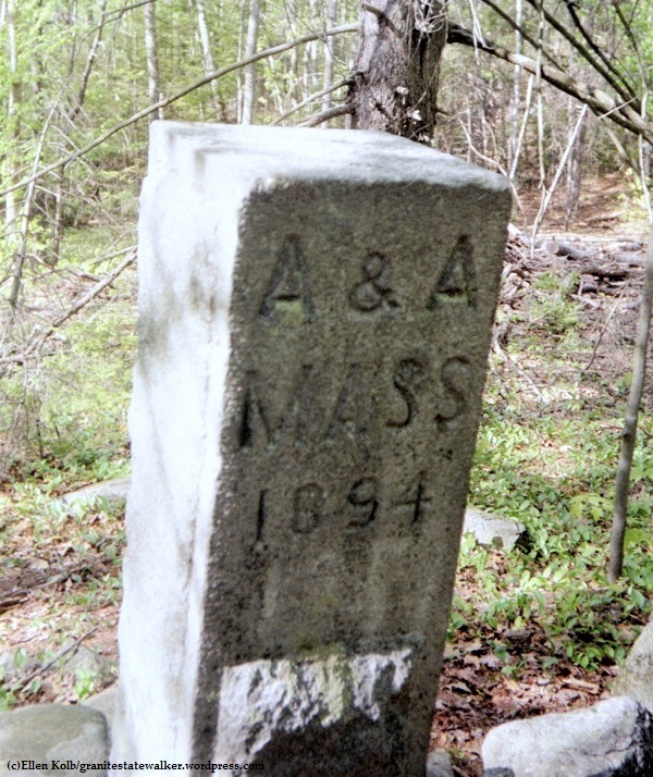
Binney Pond, a fine birding area along the Wapack Trail in New Ipswich, NHThis monument sits atop Mt. Watatic in Ashburnham, MassachusettsThe NH/MA state line.A state line monument. A&A means Ashby and Ashburnham MA. The other side of the monument has “NI” for New Ipswich NH.
The December 2008 ice storm in southern New Hampshire, now four months past, has become a reference point for all my observations of southern NH trails this spring. I recently visited Miller State Park and Pack Monadnock to see how recovery is going.
I can’t begin to speculate on how many people it has taken to return trails around here to usable condition. The auto road, still gated to keep cars out, is clear all the way to the summit. The road sports a new edging of wood chips and sawdust from all the overhangs and broken limbs cleared from ice-damaged trees.
Auto road at Miller State Park, Peterborough, NH, showing tree damage from ice storm.
The lower end of the auto road is now clear, with deadfall and snapped tree limbs piled at the road’s edges. Hardwoods predominate at the base of the mountain, and they took the brunt of the storm damage. The destruction must have seemed overwhelming to the first people who came by to check it out just after the storm. The cleared road testifies to a lot of effort since then. Even so, I was stunned for a few minutes when I got out of my car and had my first look around.
The few other cars in the lot when I arrived belonged to members of a trail-clearing party of Friends of the Wapack. The group’s web site says that there will be a work party somewhere along the trail every weekend this season, and this must have been Pack Monadnock’s turn. I heard a chainsaw being used in the woods off to my left as I descended from the summit later in the morning.
I decided to walk up the auto road, wondering just how blocked the Wapack and Marion Davis trails must be. I brought my camera in the hope of seeing some wildflowers growing low to the ground, but there has been way too much cleanup activity along the road to allow anything to sprout along the edges. I don’t doubt that there are plenty of flowers farther from the road and along the trails. I did see lots of buds on trees and shrubs, reminders that the forest will recover as it always does after one of Nature’s big events. One tree had lost its two main limbs and looked pretty sorry, but that didn’t stop a bird from working on a good-sized nest in one of the branches that was left.
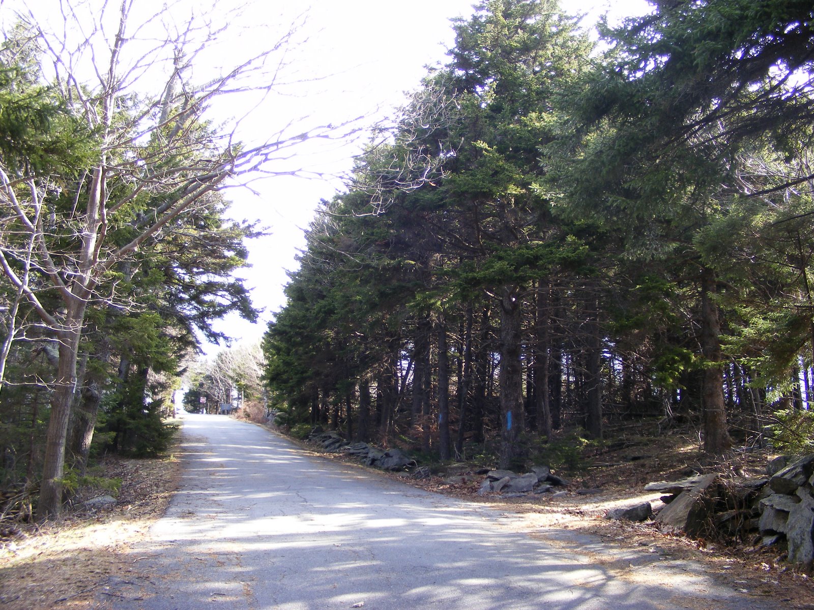
The road’s a mile & a quarter long, and it rises 700 feet. Towards the summit, where evergreens take over from the oaks & maples & birches, there is much less tree damage. The evergreens seem to have shrugged off the ice and bounced right back. The last few hundred yards of the road have blue blazes on nearby trees, and that made me wonder if the Marion Davis trail has been re-routed for a distance.
Miller State Park auto road: evergreens near the summit weathered the ice storm much better than the hardwoods at Pack Monadnock’s base.
The summit, without summer crowds, was a fine place to be. The view of Monadnock always pleases me, even on a hazy day. The cool morning was giving way to an 80+ degree afternoon, with a brisk breeze up on the landing of the fire tower. I later perched on a picnic table with my water bottle, looking over towards North Pack in its shades of green & grey. Close up, the woods show damage. From a distance, they look like they’ll be around long after I’m gone, which of course is exactly the case.
When I was here last fall, New Hampshire Audubon had volunteers at its raptor observatory near the summit, identifying birds in the fall migration. I was lucky enough to catch sight of a golden eagle that day. This weekend was different, with migration season long past. There wasn’t so much as a turkey vulture soaring overhead. I settled for chickadees in the woods.
One Subaru – or more precisely, one Subaru’s driver – drove around the closed gate to the auto road, surprising me on my way up. Aside from that, I had very little company: a half dozen dog walkers, one intrepid bicyclist, a lone runner. I was therefore unprepared for the sight in the parking lot when I finally got back down a little past 11 a.m.: more than 40 cars, with more coming in by the minute. That suggested to me that the Wapack Trail up the mountain must be in fine shape, since all the people from those cars had to be somewhere, and they weren’t on the auto road.
The ice storm left scars on the land, but recovery is underway. I’m grateful to all the volunteers whose work is bringing the trails back to life.