The Piscataquog Trail, Manchester NH

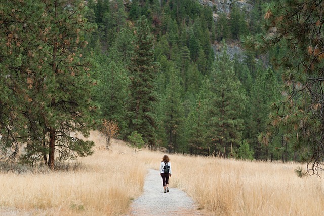
Judging from this year’s traffic on Granite State Walker, there’s been a surge of interest in the Piscataquog trail in Manchester. That’s fitting for a trail that’s conveniently located in New Hampshire’s largest city. The two-mile-long path crosses the city’s West Side, with interesting features along the way.

What do you need to know to appreciate this urban trail?

It’s a rail trail

The Piscataquog trail was built on an old rail line, one of many in New Hampshire converted to recreational use thanks to the vision and commitment of community members. As you travel along the path, watch for markers honoring some of the people who were instrumental in the trail’s development.

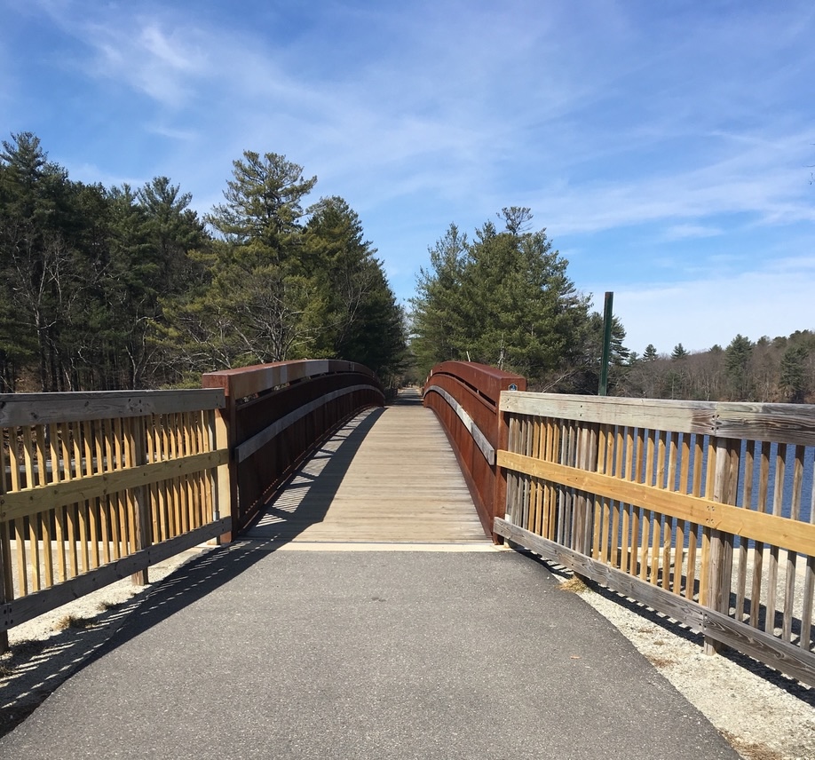
It features a pair of notable bridges

The trail is only a couple of miles long, but it features a pair of bridges that would be standouts on any longer path. At the east end near Delta Dental stadium where the New Hampshire Fisher Cats play baseball, the Hands Across the Merrimack bridge spans the Merrimack River, offering a fine view of Manchester’s mills and downtown towers. A bridge at the western end, near the West Side ice arena, crosses the Piscataquog River.

"Hands Across the Merrimack pedestrian bridge over Merrimack River in Manchester New Hampshire
The Hands Across the Merrimack bridge, where the Piscataquog Trail crosses the Merrimack River in Manchester NH. Photos by Ellen Kolb.

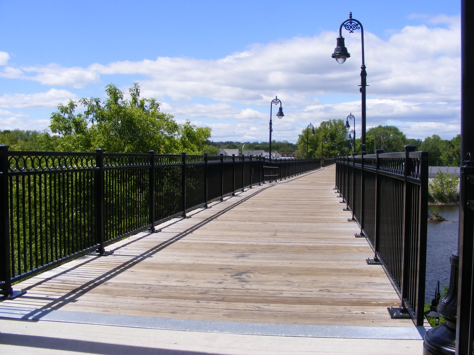
Both bridges are closed to motorized vehicles apart from e-bikes, providing cyclists and pedestrians a safer alternative to busy nearby streets.

Stay right

This is an urban trail, and it’s a busy one. Good trail etiquette promotes safety for everyone. Stay to the right side of the trail. Cyclists, yield to walkers and runners. That goes double for people on e-bikes, where speed and power can quickly lead to dangerous conflicts with other trail users.

If you’d like to learn more about peaceful coexistence on trails and roads, check out the Bike-Walk Alliance of New Hampshire.

Approach Main Street with caution

Manchester NH skyline with Merrimack River in foreground

Most of the Piscataquog trail’s road crossings are in quiet neighborhoods. Main Street on the West Side is in a class by itself, busy at all hours. Fortunately, there’s a pedestrian crossing beacon there that can be activated with the push of a button, triggering flashing lights to warn drivers of activity in the crosswalk.

Cross the city limit and you’re still on a trail

If you’d like to add miles or time to your outing, you’re in luck if you’re headed west. Just west of the Piscataquog River bridge, the trail changes from pavement to a neatly-maintained unpaved surface as it crosses the town line into Goffstown. Same old rail line, different town! The Goffstown Rail Trail extends west for five miles, all the way to the town center.

pedestrian bridge with wooden railings, on an urban trail
The Piscataquog trail bridge over the Piscataquog River…with the Goffstown Rail Trail just ahead.

Birdwatchers, bring your binoculars

The trail’s proximity to rivers and wooded neighborhoods mean it’s a fine route for spotting waterfowl and songbirds. If you’re lucky while you’re on the Hands Across the Merrimack bridge, you might even see a bald eagle! Eagles have nested not far downstream, and they like to feast on the river’s bounty.

Other connections: maybe someday

Perhaps in a few years the South Manchester trail will connect with the Piscataquog. For now, there’s a gap between the Delta Dental Stadium and South Willow Street near where the South Manchester trail begins. It’s hidden behind the shopping centers, and it continues south to Perimeter Road near the Manchester airport. That trail features a beautiful trestle bridge crossing Little Cohas Brook near the Perimeter Road end.

On the east side of the city, about two and a half miles from the stadium, the Rockingham Recreational Trail begins at Mammoth Road and continues east for more than 25 miles to the town of Newfields.

A note on trail safety

Whether you’re on an urban trail or miles away from the nearest town, the best practices for safety are the same: maintain situational awareness, and always let someone know where you’re going before you launch your adventure. Avoid anything that would prevent you from listening to (and watching for) what’s going on around you.

If you’re a Manchester resident and you enjoy using the Piscataquog trail, be sure to tell your representative on the Board of Aldermen. When local officials know that their neighbors support recreational trails, those trails are more likely to be maintained – with help from volunteers, of course.

The Granite State Walker blog will celebrate its 20th anniversary in 2026 – and more people have visited the blog in the past 12 months than ever before! With your support, GSW will keep highlighting some of the best non-motorized recreational opportunities in the Granite State, with an emphasis on southern New Hampshire.

“Open eyes and sturdy shoes”

“Today, you hike… I go because I want to and also because I can. I go because life doesn’t end once you’ve done enough. It keeps unfolding. And I intend to meet it with open eyes and sturdy shoes.”

That’s from the Blissful Hiker podcast by Alison Young. After my recent journeys recounted on this blog, her message resonates with me. I heartily recommend this nine-minute episode called “Aliveness”, for inspiration and encouragement.

Open eyes and sturdy shoes: I’ve been working on that here at Granite State Walker for nearly two decades now. It’s always good to meet fellow hikers similarly equipped. Walk on!

From blissful hiker ❤︎ inspiring you to hike your own hike: Aliveness, Jul 3, 2025
https://podcasts.apple.com/us/podcast/blissful-hiker-inspiring-you-to-hike-your-own-hike/id1515744759?i=1000715549476&r=269
This material may be protected by copyright.

Header photo by Ellen Kolb. Mount Kearsarge (south), NH.

Hike Safe card: not just for mountain hikers

For my New Hampshire readers, here’s a plea from me: if you haven’t purchased a Hike Safe card, please do so now. Even if you’re sure you’ll never need to be rescued, buy one anyway. It will be a small way of supporting the state’s Search and Rescue fund. Sadly, demands on the fund never let up.

Take out a credit card, go online to the New Hampshire Fish and Game’s Hike Safe page, and plunk down $25 for a virtual card covering an individual, $35 for a family. If a Hike Safe cardholder needs to be rescued in the course of an outdoor activity, she or he will not in most cases be assessed for the cost of the rescue. Just get the card. Don’t wait.


I write this as I hear news about a hiker who perished upstate while attempting a solo hike on a mountain ridge in winter weather. A few weeks ago, another hiker lost her life in the same area. Rescue attempts, which became recovery missions, involved professional conservation officers from New Hampshire Fish and Game plus many volunteers.

Those same volunteers and first responders would come out even if the trail were less challenging. They don’t write off any of us. Missing hikers, once reported overdue by family or friends, spark a search-and-rescue mission.

I know from experience that hikes can go awry even in good weather on heavily-traveled trails. (A particularly embarrassing day on Monadnock comes to mind.) While I haven’t yet inspired any rescue missions, I’m uncomfortably aware that this could change anytime. I carry simple essentials even for short hikes, but even so, bad stuff happens now and then.

Ninety percent of my trail miles are on flat trails within an hour of my home. I buy a Hike Safe card every year anyway. It’s cheap insurance against being assessed some hefty costs arising from my own negligence. More importantly, the card lets me as a hiker contribute to the readiness of search-and-rescue teams.

Hunters, anglers, and anyone registering a boat, OHRV, or snowmobile already contribute to the Search and Rescue fund as part of their license and registration fees. Hikers don’t need a license. We can pull our weight, so to speak, by purchasing the Hike Safe card.

Image by yinet gomez from Pixabay

Finding something new on the familiar Nashua River Rail Trail

How did I not see this before? It’s a granite marker along a trail crossing the New Hampshire-Massachusetts border, plain as day. Somehow, I had never seen this, even though I have walked this trail maybe a hundred times.

I saw that there was a knocked-over lightweight fence nearby; had that concealed the marker all these years? Or have I just not been paying attention?

Years ago, I first saw markers like these along the Wapack Trail. I noticed that the letters referred to the town I was in as I looked at the marker, not the town I was about to enter. Having spent more time on interstate highways than on trails, this surprised me, but I’ve since gotten used to it. It’s remarkable to see these markers in such good shape after more than a century.

Anyone looking at my walking history can see that there are a few paths and parks to which I return again and again. There’s a sort of comfort and ease in being someplace familiar. This marker reminds me that it’s good to stay as alert on such trails as I am on new ones. Little delights abound, if I pay attention.

Spring on Cheshire County NH roads and trails

Cheshire County, New Hampshire is best known to outdoors enthusiasts for its most dramatic geological feature, Mount Monadnock. I have nothing against the mountain, except that I can’t seem to get to the summit and back without an injury of one sort or another. That’s not a problem. The Monadnock region offers plenty of options that have nothing to do with hiking uphill.

Rockwood Pond in Fitzwilliam , New Hampshire, with Mount Monadnock in the background.
Seen from the Cheshire Rail Trail in Fitzwilliam: Rockwood Pond with Mount Monadnock nearby. Photos by Ellen Kolb.

As part of the New Hampshire Rail Trails Challenge, I’ve been exploring rail trails all over the state – but I’ve barely touched southwestern New Hampshire, aside from a few miles in the town of Troy. This is the year I’ll get busy out in that direction. I got off to a modest start recently on a short segment of the Cheshire Rail Trail in Fitzwilliam.

What a day! Weather was pleasant. The flying insects were not yet out in force (but alas, the same couldn’t be said for ticks; I came prepared with permethrin-treated clothing). Deciduous trees hadn’t yet leafed out. That left the hemlocks and pines to shade me, and as a bonus, the breeze through their boughs was like music.

Parking along long trails like the Cheshire can be a problem. Not every road crossing has room nearby for cars to pull over. I decided to begin my walk at Rhododendron State Park, a mile away from the trail. No trouble parking there. The park’s signature rhododendrons won’t be in bloom until July, but spring wildflowers abounded in the park’s grove and along its trails.

daffodils and violets, flowers

Spring flowers at Rhododendron State Park

From there – pull out your maps app now – it’s a mile along unpaved Rockwood Road to the the intersection with rail trail along Rockwood Pond. Rhododendron Road provides a shorter but less interesting link.

The scenic highlight of the day was the view of Monadnock seen from the shores of Rockwood Pond. Pine trees tried to obscure the view, but I found my way through them.

From the pond, I headed south. The trail was unpaved, wide, and shaded. It’s a snowmobile trail when there’s snow cover, but motorized vehicles are supposed to stay off the rest of the year. Wide ruts in some soft sections of the trail told me that an ATV driver or two had ignored the restriction. Aside from that, the trail was in good condition between the pond and state road 119. South of there, the trail was full of roots and rocks, looking like a typical New Hampshire woods walk. I got as far as Royalston Road before turning around.

Get a grip this winter: traction aids for walkers

Southern New Hampshire – and northern, for that matter – serves up a varied weather menu each winter. As I write this, the weather forecast is for up to a foot of snow from a coming storm. Maybe I’ll finally need snowshoes for a local hike. So far this season, all I’ve needed is a set of traction aids to strap on my sneakers or boots.

Investing in a traction device like YakTrax or a set of Stabil cleats (both of which I’ve used) can make the difference between taking a walk at the nearest park and staying home for fear of falling on the ice. Cleats aren’t just for hill hikers.

I was recently at Horse Hill nature preserve in Merrimack. Conditions on those trails are less than ideal: bumpy ice topped by a dusting of snow, with some pine needles sandwiched in between just to make sure things stay slippery. I found the same conditions around Lake Massabesic a day earlier. Without cleats, I wouldn’t have lasted five minutes at either place. I’m simply not as surefooted as some of my neighbors. (I’ve even been known to strap on cleats just to walk to the mailbox.)

I found my cleats at a local outlet store specializing in outdoor equipment. You can shop for them online as well.


I had the chance to head north to Waterville Valley’s Nordic ski center not long ago, with beautiful trails extending into the White Mountain National Forest. That was a glorious snowshoe hike in spite of bitter cold temps. I seldom hike where a trail pass must be purchased, but this was definitely a worthwhile trip.

If you decide to explore a Nordic center, be sure to check the facility’s website or Facebook page in advance for trail conditions and Covid adaptations.

Cross-country ski trail in White Mountain National Forest, New Hampshire
At Waterville Valley, groomed Nordic trails extend into the White Mountain National Forest. Ellen Kolb photo.