I headed to Hancock hoping to find some autumn color, but foliage season is only skimming the Monadnocks so far. The brilliant colors are a couple of weeks away. I had a beautiful drive nonetheless, followed by a good walk up Mt. Skatutakee on the property of the Harris Center for Conservation Education. (Check the “Trails” tab on that site for maps to local trails.) Great early fall conditions: sunny, cooling down, no bugs.
With or without fall color, Skatutakee’s summit is a good spot for lunch, just as I recalled. I was last there about thirteen years ago on a spring day when the blackflies were ferocious and ladyslippers were everywhere. Views from the summit were obscured by vegetation that hasn’t been trimmed back in awhile.
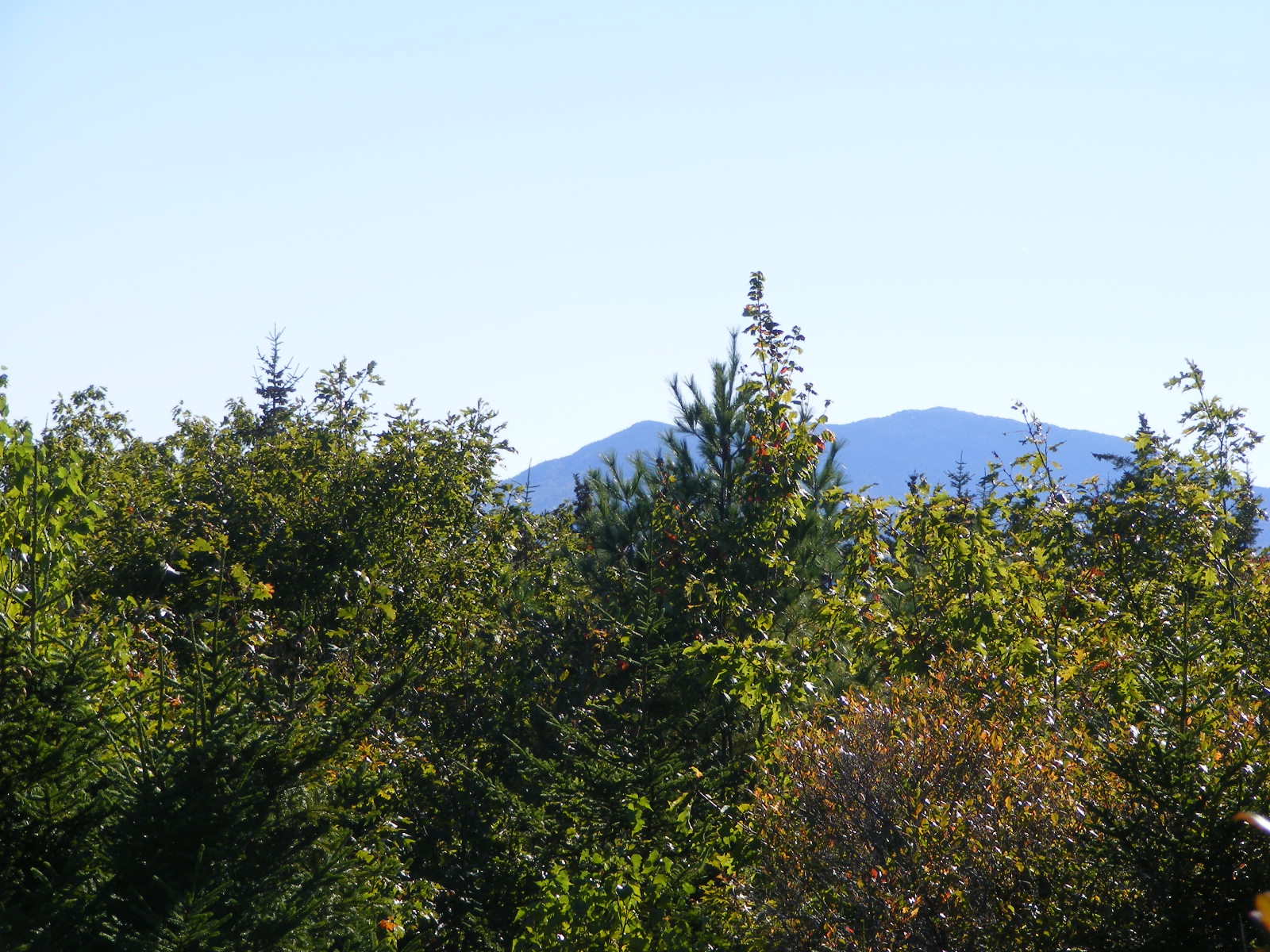
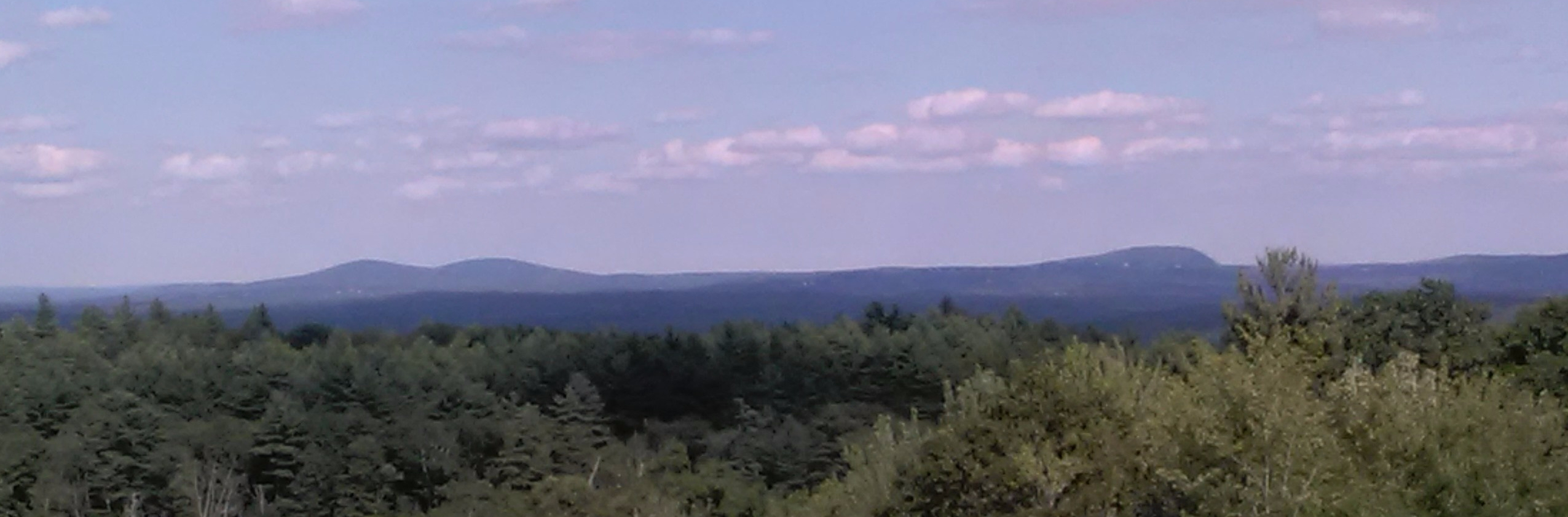
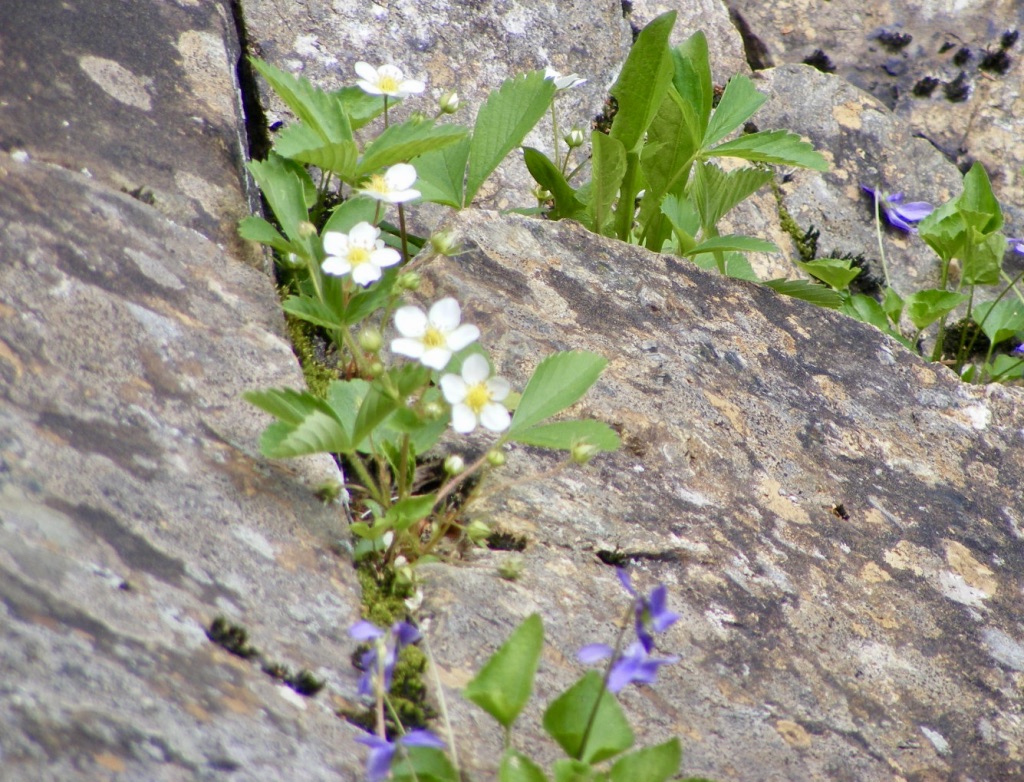
The view from the Skatutakee summit south to Mount Monadnock was limited by the leafed-out trees. North Pack Monadnock (at left) and Pack Monadnock, seen from Skatutakee’s summit.
The blueberries were gone along Crotched Mountain’s Gregg Trail on this July afternoon, but the Queen Anne’s Lace was in full bloom. A fair trade-off. Besides, there were still some raspberries left. If you’d like to search for them, head to NH Route 31 in Greenfield, New Hampshire, turn onto Crotched Mountain Road, and drive uphill to the trailhead across from Crotched Mountain School.
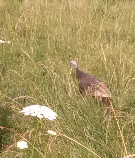
This hen turkey was just off the trail, cooing softly. I’d never heard such a gentle sound from a wild turkey. A moment later I caught a glimpse of her babies, mostly concealed by the tall grass.
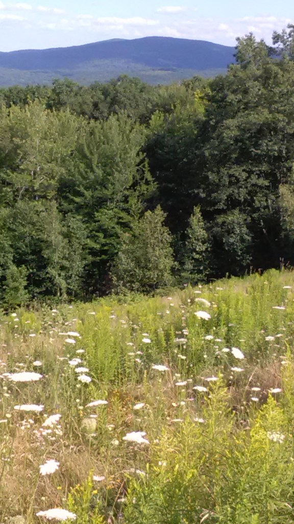
Lyndeborough hills (Rose and Pinnacle) seen from Gregg Trail.
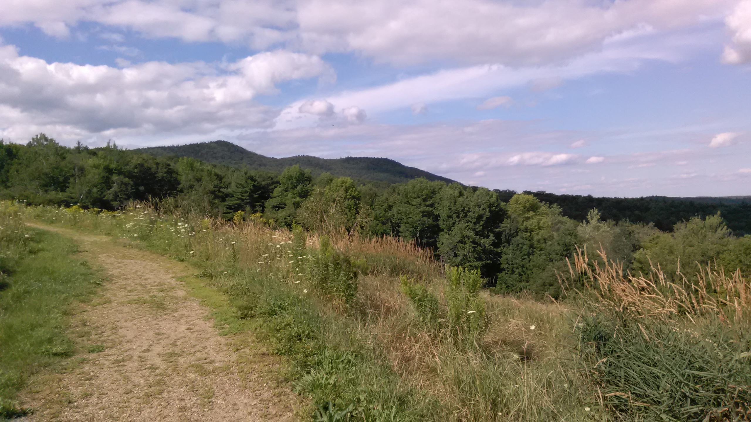
Gregg Trail is graded and switchbacked to accommodate wheelchairs. It ends at an open ledge well short of Crotched Mountain’s summits.
Seen from the Gregg Trail: Uncanoonucs in Goffstown (left) and and Joe English Hill in New Boston (right).
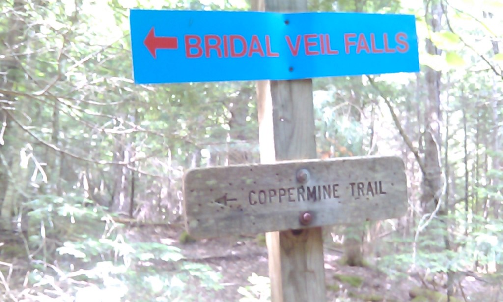
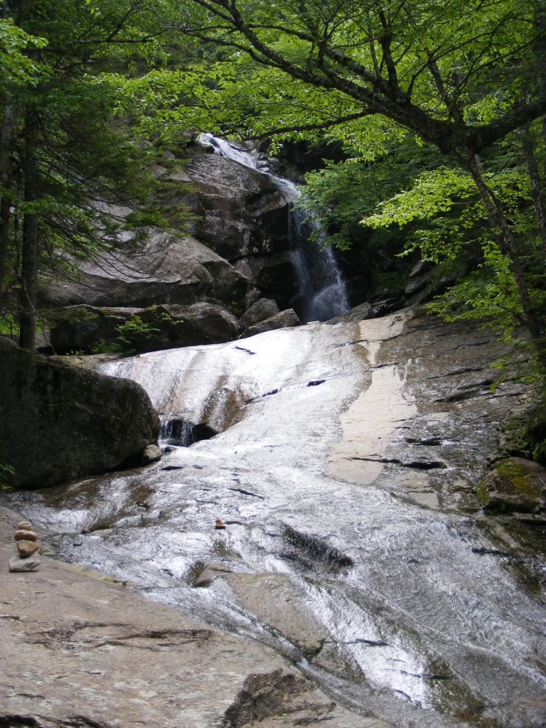
A waterfall, good company, and a Bette Davis plaque: welcome to Coppermine Brook and Bridal Veil Falls in Franconia, New Hampshire.
The plaque’s been documented elsewhere, but in brief: in the 1930s, actress Bette Davis was married to Arthur Farnsworth from nearby Sugar Hill, who died in a tragic accident. Someone, supposedly Davis herself, later mounted a memorial plaque on a boulder in Coppermine Brook, with an affectionate inscription to “the keeper of stray ladies.”
The Coppermine Brook trailhead is just off NH Route 116. I went there with a friend a few days after heavy rains and flash flooding had left significant road and property damage in the area. Between I-93 and 116, we passed two work crews repairing washed-out edges of roads. The trail itself, alongside the brook, was a bit gullied but otherwise intact.
The trail rises about 1100 feet in two and a half miles to its terminus at Bridal Veil Falls. If you want a shorter hike, the plaque is only a mile or so from the trailhead – but you have to want to find it. No directional signs will help you. It’s on a boulder in the brook, accessible via a clearing that you’ll see between the trail and the brook. The plaque faces downstream.
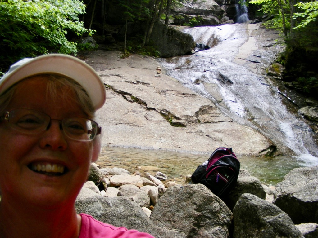
I remained at the lower falls. If you have more time and shoes that grip on slippery rock, help yourself to the upper falls.A week after a flash flood, the brook and falls had receded to tame levels.
This out-and-back hike has an average grade of about 8%, if my math is right. It doesn’t feel like an 1100′ climb, although it is. There are no scrambles along the way, and no mountain vistas, but there’s plenty of shade by a cool brook leading to a pretty waterfall. This was a perfect choice for a low-key hike with a friend.
This hike along Coppermine Brook goes partway up the west side of Cannon Mountain, which is more familiar from its other side facing I-93. So to stretch a point, I can say that I’ve hiked Cannon…never mind that I didn’t get anywhere near the summit!
Another trip to northern New Hampshire for me meant another walk to one of my favorite spots on the Cohos Trail, the Falls in the River. No trip to Pittsburg on a 90-degree day would be complete without it. From the parking area by the Second Connecticut Lake Dam, a half-hour southbound walk through the woods on the blazed Cohos Trail brought me to the Falls. Soon I was refreshed in every way.
A few years ago, my husband and I were among the volunteers who put the finishing touches on this segment of the CT before it was officially dedicated. Others had done the hard work. It has since become one of the CT’s most popular dayhike areas.
Falls in the River, Pittsburg NH, June. Photos by Ellen Kolb.
Cracks in the granite give tiny blossoms a home.
A peek at Second Connecticut Lake from the parking lot by the dam.
The trail in this area manages to feel remote even when it’s squeezed between U.S. 3 and the Connecticut River. Trees conceal the highway and muffle the sound of vehicles.
I saw no moose. I figured the hot weather would keep them from being out on the roadside at midday, but I thought for sure I’d see one in the woods. I saw only their prints in the mud.
Over the years I’ve maintained this blog, there’s one unassuming little post that keeps getting hits every single month: my walk to the Oak Hill fire tower where Concord meets Loudon. Is it the “fire tower” phrase that keeps the search engines happy, or does New Hampshire’s capital city have a lot of enthusiastic local walkers?
Either way, the Oak Hill trails deserve the attention. They’re pleasant, easy, varied, and only a few minutes away from downtown Concord. I headed there after some work at the State House recently, knowing that I could only spare a half hour or so.
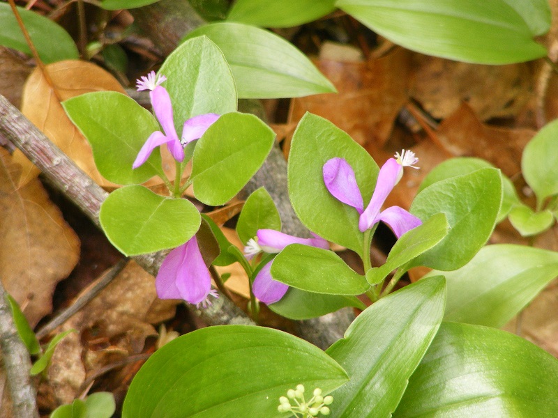
The only blossoms in sight on a spring day were on the ground cover at the edge of the trail. Shown here: fringed polygala. Photos by Ellen Kolb.Junctions are well-marked, but this little “new vista” sign helped keep me on the right path.
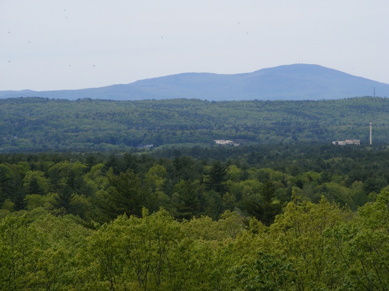
I followed the signs to “vista,” only about a 12-minute walk from the parking area, and was treated to a good view of Mt. Kearsarge. That was ample reward for my quick visit.
Mt. Kearsarge to the west. Trees conceal the Merrimack River, flowing south past the industrial building at right.
When the Forest Society announced its challenge last year, offering a patch for anyone visiting 33 specified Forest Society properties, I jumped on board immediately. Since then, I’ve had fun discovering some new trails. Others, like those on Mount Monadnock, are already familiar. The Forest Society has a reservation on the mountain that blends seamlessly with Monadnock State Park.
On my most recent visit to Monadnock, my indifferent level of fitness ruled out a summit hike. I settled for an easy walk to the Halfway House clearing via the Old Toll Road, featuring a wonderful view to the south with Gap Mountain foremost.
The view south from Mt. Monadnock’s Halfway House clearing. Photos by Ellen Kolb.
The Old Toll Road begins at the well-marked state park parking lot on NH Route 124 on the south side of the mountain. (Post-Covid update: the state park now charges a $15 parking fee, which covers a driver and up to five passengers. Reservations can be made online. See the Monadnock State Park web page for current information.)
The Old Toll Road has a packed crushed-gravel surface, well-drained, and wide as a boulevard. It’s an uphill path for sure, but easy going until it ends at the White Arrow Trail. I walked up the Road, picked up White Arrow for a short distance, and soon I reached my destination: the Halfway House clearing, named for an inn that once stood there.
Old Toll Road on Mount Monadnock, mid-spring
I looked up to the summit and saw no hikers. That’s unusual. Normally, the summit seen from that distance looks like an anthill.
A peek at Monadnock’s summit from the Halfway House clearing
A cool breeze kept the bugs away on the overcast day. I knew I was likely to be rained on any minute. I didn’t care. A midday midweek visit to New Hampshire’s most-climbed mountain rewarded me with solitude, and solitude on Monadnock is meant to be savored.